
St Minver (Cornwall): parish, settlements and coastal landscape
St Minver is a civil and ecclesiastical parish in north Cornwall, England, known for its coastal setting beside the River Camel estuary, divided into Highlands and Lowlands and including Rock, Polzeath and Trebetherick.
St Minver is a parish and village on the north coast of Cornwall in south‑west England. Its Cornish name is often given as Sen Menvra. Administratively the area exists as an ecclesiastical parish, a civil parish and a small village settlement. Locally the civil parish is commonly treated as two sections: St Minver Highlands to the north and east, and St Minver Lowlands to the west.
Image gallery
3 Images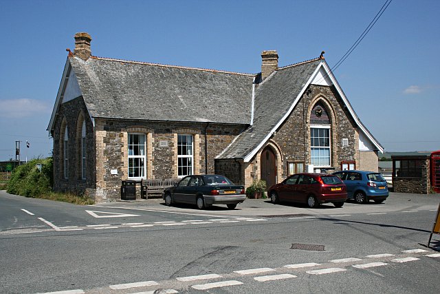


Location and landscape
The combined parish lies between the Atlantic shore to the north and the broad estuary of the River Camel to the south and west. The eastern boundary meets neighbouring parishes such as St Endellion and Wadebridge lies a few miles inland to the south. The mixture of coastal cliffs, sandy bays and estuarine creeks defines much of the local character and has shaped settlement, recreation and land use for centuries.
Settlements and communities
The civil parish encompasses several distinct villages and coastal hamlets. Principal settlements include the small churchtown of St Minver itself and the estuary village of Rock. On the seaward side are well‑known coastal communities such as Trebetherick and Polzeath, each linked by roads and footpaths to the surrounding farmland and shoreline. The village of St Minver sits close to the B3314 road leading north from Wadebridge.
Population and administration
Historically the parish has been split for civil governance into St Minver Highlands and St Minver Lowlands. At the turn of the 21st century the combined population recorded in the census reflected a small rural community with residents distributed between the two wards. Local matters are handled through parish councils and by Cornwall unitary authorities for wider services.
History and cultural notes
Like many Cornish parishes, St Minver has ecclesiastical origins and takes its name from a local saint or chapel dedication. Over time its economy and society have been tied to the sea, the estuary and to agriculture. In more recent decades tourism, watersports and second‑home ownership have become important influences on the local economy and housing market.
Recreation, nature and visitor interest
The parish appeals to walkers, birdwatchers, sailors and surfers. The exposed north coast provides sandy beaches and surf at places such as Polzeath, while the sheltered waters of the River Camel estuary support boating and mudflat wildlife. The South West Coast Path runs along nearby stretches of coastline and attracts many visitors during the warmer months. For regional context, St Minver lies within the United Kingdom and is part of the larger district commonly referred to as north Cornwall.
- Principal villages: St Minver, Rock, Trebetherick, Polzeath.
- Natural features: Atlantic coast, River Camel estuary.
- Access: near Wadebridge and connected by local roads to the rest of Cornwall.
Questions and answers
Q: Where is St Minver located?
A: St Minver is located in north Cornwall, United Kingdom.
Q: What are the different divisions of the civil parish of St Minver?
A: The civil parish of St Minver is nominally divided into St Minver Highlands (to the north and east) and St Minver Lowlands (to the west).
Q: What are the borders of the combined parish of St Minver?
A: The combined parish of St Minver is bounded on the south and west by the estuary of the River Camel, on the north by the Atlantic coast, and on the east by the parishes of St Endellion and St Kew.
Q: What was the population of the parish in the 2001 census?
A: The population of the parish in the 2001 census was 2,474 (St Minver Highlands 1025; St Minver Lowlands 1449).
Q: What are some of the main villages in the whole parish?
A: The main villages in the whole parish are the churchtown of St Minver, Rock, Trebetherick and Polzeath.
Q: How far is St Minver village from Wadebridge?
A: St Minver village is 3 miles (5 kilometres) north of Wadebridge.
Q: What is the B3314 road?
A: The B3314 is a road that goes from Wadebridge to Delabole in Cornwall.
Related articles
Author
AlegsaOnline.com St Minver (Cornwall): parish, settlements and coastal landscape Leandro Alegsa
URL: https://en.alegsaonline.com/art/93186