
Spencer Gulf: geography, history, ecology and human use
Overview of Spencer Gulf in South Australia: its geography, physical features, human history, ports and industries, ecological value, and conservation issues.
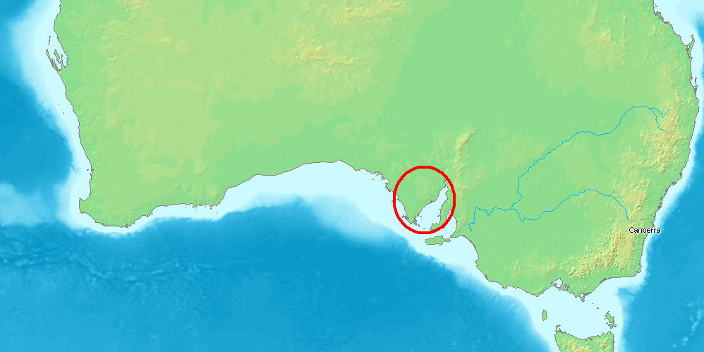
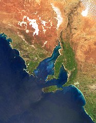
The Spencer Gulf is the larger, western inlet on the southern coast of Australia, projecting northward into the state of South Australia. It is bounded to the west by the Eyre Peninsula and to the east by the Yorke Peninsula, which separates it from the smaller Gulf St Vincent. The gulf opens onto the Great Australian Bight and extends inland for several hundred kilometres; its entrance was described by explorer Matthew Flinders as a line between Cape Catastrophe and Cape Spencer. Modern descriptions emphasise the gulf's long, relatively narrow shape, its role as a sheltered maritime corridor and its mix of industrial and natural values. Regional geography

Image gallery
9 Images




Physical characteristics
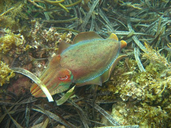
Spencer Gulf is notable for its length and the contrast between a wide mouth and narrowing waters inland. The shoreline includes sandy beaches, tidal flats, and rocky headlands, while the sea floor varies from shallow coastal shelves to deeper central channels. Currents and water temperature are influenced by exchanges with the Great Australian Bight and by seasonal winds. The gulf supports a range of marine habitats — seagrass meadows, mangrove patches in sheltered bays, and deeper habitats that provide feeding and breeding areas for fish, birds and other marine life. For general mapping and more detail, see state resources.
History and naming
European charting of the gulf began in the early 19th century during the voyages of Matthew Flinders, who named several coastal features and set the formal entrance line. Indigenous peoples had occupied and used the coastline and island systems for thousands of years before European arrival; archaeological and cultural studies describe long-standing links to coastal resources. Over the 19th and 20th centuries the gulf became important for settlement, shipping and industry, with ports and towns established along both peninsulas and on the inner shores. Further historical context and timelines are available from maritime histories and local authorities: exploration records.
The coastal settlements around Spencer Gulf developed ports for bulk commodities, fishing and ship facilities. Major regional centres serve as hubs for mineral exports, shipping services and fisheries. The gulf's sheltered bays have supported aquaculture ventures, recreational boating and tourism, while its beaches and jetties remain popular local attractions. For maps and transport information, consult regional planners and port authorities: transport and shipping and local economy.

Ecology, uses and conservation
Spencer Gulf supports commercially important fish species and a diversity of seabirds and marine mammals. Its coastal habitats are valued for biodiversity and for traditional and commercial uses. At the same time, the area faces pressures from industrial development, shipping, aquaculture and climate-related change. Conservation efforts include protected areas, monitoring programs and planning processes that aim to balance economic activity with habitat protection and cultural values. Information on conservation programs and how to get involved is provided by regional environmental agencies and local organisations: conservation links.
Today the gulf remains a focus for scientific study, recreational use and regional industry. Its long shoreline, strategic ports and ecological importance make it a notable feature of South Australia's coast, combining natural attraction with practical value for the communities that depend on it.
Questions and answers
Q: Where is the Spencer Gulf located?
A: The Spencer Gulf is located on the southern coast of Australia in the state of South Australia.
Q: How long and wide is the Spencer Gulf?
A: The Spencer Gulf is 322 km (200 mi) long and 129 km (80 mi) wide at its mouth.
Q: What are the two peninsulas that border the Spencer Gulf?
A: The western shore of the gulf is bordered by Eyre Peninsula, while its eastern side is bordered by Yorke Peninsula.
Q: Who defined the entrance to the Spencer Gulf?
A: Matthew Flinders defined the entrance to be a line from Cape Catastrophe on Eyre Peninsula to Cape Spencer on Yorke Peninsula.
Q: What harbor lies on the Eastern shore of Spencer Gulf?
A: Port Broughton lies on Eastern shore of Spencer Gulf.
Q: What type of view can you get from NASA's satellites looking at Spencer Gulf?
A: From NASA's satellites, you can get a bird's eye view looking down at Spencer Gulf.
Q: Is there any notable jetty near Moonta Bay in East Shore of Spenser Gulp? A: Yes, there is a notable jetty near Moonta Bay in East Shore of Spenser Gulp.
Related articles
Author
AlegsaOnline.com Spencer Gulf: geography, history, ecology and human use Leandro Alegsa
URL: https://en.alegsaonline.com/art/92615
Sources
- commons.wikimedia.org : Spencer Gulf
- gutenberg.org : A Voyage to Terra Australis : undertaken for the purpose of completing the discovery of that vast country, and prosecuted in the years 1801, 1802, and 1803 in His Majesty's ship the Investigator, and subsequently in the armed vessel Porpoise and Cumberland Schooner; with an account of the shipwreck of the Porpoise, arrival of the Cumberland at Mauritius, and imprisonment of the commander during six years and a half in that island
- tools.wmflabs.org : 34°25′S 136°45′E / 34.417°S 136.750°E / -34.417; 136.750