
South Hampton Roads (Virginia)
South Hampton Roads, often called the Southside, is the southern half of the Hampton Roads metropolitan area in southeastern Virginia, noted for its coastal geography, naval presence, ports and urban centers.
Overview
South Hampton Roads refers to the southern portion of the greater Hampton Roads metropolitan region in the United States. It lies in the southeastern corner of the state of Virginia and forms one half of the metropolitan area commonly known as Hampton Roads. The region is frequently called the "Southside" by residents and is included in the Virginia Beach–Norfolk–Newport News, VA–NC metropolitan statistical area. The metro area has roughly 1.7 million residents and serves as a major population center between Washington, D.C. and the Southeastern United States.
Image gallery
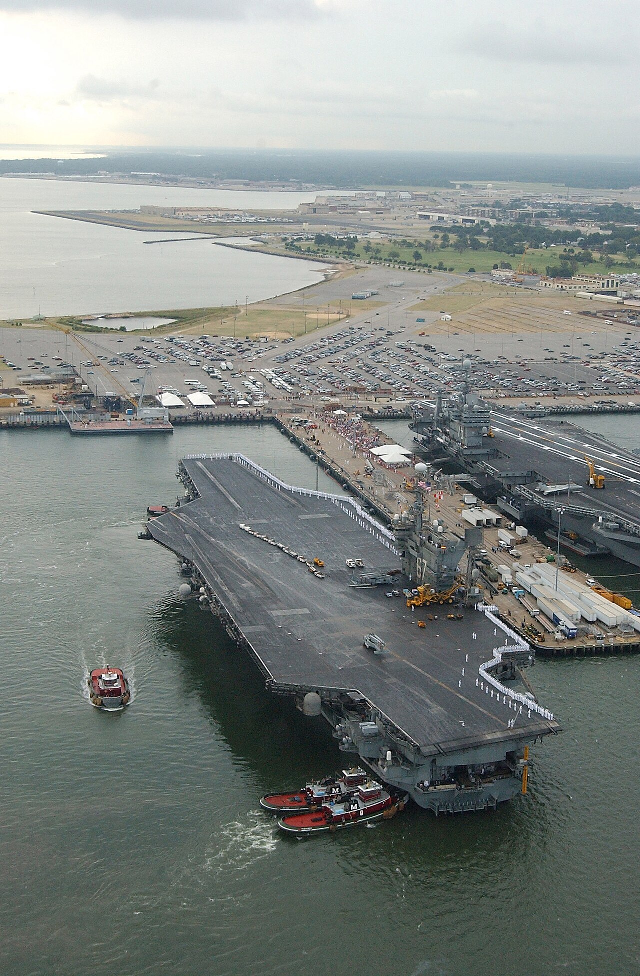
3 Images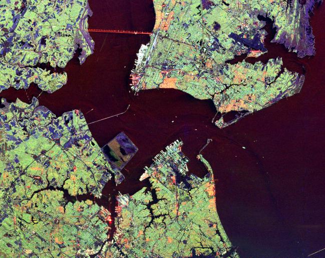

Geography and principal communities
South Hampton Roads occupies low-lying coastal lands around estuaries, harbors and the mouth of the Chesapeake Bay. Its shoreline, rivers and tidal waterways shape much of the land use and transportation. Major independent cities and jurisdictions commonly identified with South Hampton Roads include:
- Norfolk
- Virginia Beach
- Chesapeake
- Portsmouth
- Suffolk
These cities sit opposite the Virginia Peninsula, the northern half of the Hampton Roads area, and together they surround the natural harbor historically called Hampton Roads.
History and name
The term "Hampton Roads" originally describes the roadstead — a broad, sheltered body of water formed where several tidal rivers meet the Chesapeake Bay. Historically the larger land region was often called "Tidewater," a name still used in cultural and historical contexts. Over time the metropolitan label "Hampton Roads" gained official and popular currency; in some cases this adoption involved local political and marketing choices, reflecting how communities brand themselves and coordinate regional planning. Local examples of naming shifts include changes in sports team names and civic promotions, where references to "Tidewater" gave way to the Hampton Roads identity.
Economy, military and maritime importance
South Hampton Roads has an economy oriented around the water: deepwater ports, shipbuilding and repair, commercial fishing, and logistics make the waterfront vital. The region is also home to significant military installations and facilities that support fleet operations and defense readiness. Naval installations and related industries are among the largest employers, while commercial port activity supports international trade and regional commerce.
Transportation and infrastructure
Because the area is divided by waterways, key transportation elements include bridges, tunnels and bridge-tunnel complexes that connect the Southside to the Peninsula and to outlying regions. Major crossings and corridors facilitate commuter and freight movement and are central to planning and congestion management. Rail, interstate highways and port terminals complement the marine network and serve both civilian and military needs.
Culture, identity and notable facts
Local identity often hinges on the simple distinction between the Southside and the Peninsula, and residents may use older terms like "Tidewater" in historical contexts. Census labels such as the 2010 Census are used to measure the metropolitan area's size and composition. Naming and branding choices have been influenced by municipal leaders and marketing efforts — at times described as political decisions — and have affected public perception and civic development. Examples from popular culture and sports include references to regional teams and their changing names; for instance, baseball clubs that once used the "Tidewater" name later emphasized city identification to attract fans and local support. The area also hosts numerous festivals, maritime museums and shoreline parks that reflect its coastal character and maritime heritage, and occasional references in media and tourism highlight the region's strategic location within the broader Mid-Atlantic corridor and its accessibility to points by land and sea, including routes toward baseball-friendly venues and family attractions.
For further regional context and planning resources consult local metropolitan authorities and tourism information maintained by civic organizations and state agencies.
Questions and answers
Q: What is South Hampton Roads?
A: South Hampton Roads is a region of the U.S. state of Virginia located in the most southeastern part of the state.
Q: How many people live in South Hampton Roads?
A: Approximately 1.7 million people live in South Hampton Roads.
Q: What is the common name for the metropolitan area around the body of water called?
A: The common name for the metropolitan area around the body of water is called "Hampton Roads".
Q: How is Hampton Roads divided into two regions?
A: Hampton Roads is divided into two regions; South Hampton Roads on the south side and Virginia Peninsula on the north side.
Q: What do people who live there commonly call South Hampton roads?
A: People who live there commonly call South Hampton roads "the Southside".
Q: How does it rank among other metropolitan areas in terms of size in southeastern United States?
A: As of 2010 Census, it ranks as fifth largest metropolitan area by size in southeastern United States, second-largest between Washington D.C and Atlanta, Georgia.
Q: Why was this region named "Hampton Roads"?
A: The decision to call this region "Hampton Roads" was a political one; although it had been referred to as "Tidewater" by locals for many years prior to that.
Related articles
Author
AlegsaOnline.com South Hampton Roads (Virginia) Leandro Alegsa
URL: https://en.alegsaonline.com/art/92159