Senegal: West African Republic — geography, history, culture, and economy
Overview of Senegal, a West African country with capital Dakar: geography, climate, population, languages, history from precolonial states to independence, economy, culture, and notable sites.
Senegal, officially the Republic of Senegal (République du Sénégal), is a country on the Atlantic coast of West Africa. Its Atlantic shoreline, the Cape Verde peninsula and the port city of Dakar give it a strategic maritime position. Senegal shares land borders with Mauritania, Mali, Guinea, and Guinea-Bissau and largely surrounds the independent Gambia along the Gambia River. The country covers roughly 197,000 square kilometres and has a population of over 15 million people in contemporary estimates.
Image gallery
10 Images


Geography and climate
Senegal's landscape ranges from the sandy Atlantic coast and offshore islands to inland plains and the Senegal River valley on the northern border. The southern region of Casamance is separated from the rest of the country by Gambia and has a more humid, forested environment. The climate is broadly tropical with a distinct rainy season (generally mid-year) and a dry season influenced by the harmattan wind. For maps and regional overview see geographic resources.
History and politics
Long before European contact, the territory was home to powerful precolonial states and trading systems, including the Jolof and Tekrur polities. From the 17th century onward it became increasingly integrated into Atlantic trade networks. Senegal spent much of the 19th and 20th centuries under French colonial administration and achieved independence in 1960 from France. Léopold Sédar Senghor became the first president and later led a reputation for cultural and literary influence. Modern Senegal is a republic with a history of mostly peaceful transfers of power; since 2012 the presidency has been held by Macky Sall.
Economy and resources
Senegal's economy combines agriculture, fisheries, mining and services. Groundnuts (peanuts) historically drove export earnings and remain important, alongside horticulture (mangoes, tomatoes, melons), rice cultivation, and cotton. The fishing sector is a major source of protein and export revenue. Mining—phosphate in particular—and domestic processing industries such as fertilizer production, food processing and ship repair are notable. In recent decades the country has pursued diversification, port development, and regional trade integration.
Society, language and culture
French is the official language of government and education, while several national languages are widely spoken, especially Wolof, Pulaar, Serer and Jola. The majority of Senegal's population is Muslim, and Sufi brotherhoods like the Mouride and Tijaniyya play influential social and cultural roles. Senegalese cultural life is internationally known for music—most famously the mbalax genre—and for literature, cinema and visual arts. Traditional crafts, festivals and a strong urban music scene give the country a prominent cultural profile in West Africa.
Notable places and contemporary issues
Tourist and historical sites include Gorée Island, a UNESCO-listed site known for its role in the transatlantic slave trade, the vivid coastal city of Dakar, and the striking saline Lake Retba (the "Pink Lake"). The southern Casamance region has experienced a long-running, low-intensity separatist conflict at times, which remains a focus for national reconciliation and regional development efforts. Senegal continues to play a prominent diplomatic and economic role in West Africa and in regional organizations.
- Major industries: fishing, agriculture, phosphate mining, food processing, ship repair.
- Main languages: French (official), Wolof and other national languages.
- Key historical notes: precolonial states, French colonial rule, independence 1960.
Geography
Senegal is a coastal state on the Atlantic coast around Cap Vert in the far west of Africa. In the north and northeast, Senegal borders Mauritania with the Senegal River and in the east, the left Senegal tributary Falémé forms the border with the neighboring country Mali. In the south, a land border with the neighboring states of Guinea and Guinea-Bissau, running pretty much in an east-west direction, leads back to the Atlantic Ocean. Excluded from this border, which is circumscribed in this way, is a strip of land to the south from the Atlantic Ocean on both sides of the mouth and navigable lower reaches of the Gambia River. This 300 kilometer deep cut forms the national territory of Gambia. The border between The Gambia and Senegal makes it difficult to connect the Senegalese southwestern region of Casamance with the rest of the country.
Due to regional differences in the yield of rainfall, Senegal lies in the transition from the sparse vegetation of the Sahel in the north to the more fertile tropics in the south.
Landscape
The highest elevation in the country (12° 22′ N, 12° 33′ W12.3735-12.5435555556645), at 645 metres, is the summit of the Nepen-Diakha Mountains. These lie in the Kédougou region on the border with Guinea, 126 km west of the tri-border area with Mali and Guinea. The coastline is 531 kilometres long. The landscape consists of plains that slowly rise to the mountain foothills in the southeast. In the south of the country - near Vélingara - lies the Vélingara crater.
Waters
The Senegal River is the most important river in the country. It rises as the Bafing in the mountainous region of Fouta Djallon in Guinea. After the confluence with the Bakoyé in Mali, it takes on the Falémé as the border river between Mali and Senegal. From then on, it forms Senegal's northern border with Mauritania for a length of about 500 km. Other important rivers of the country are Casamance, Gambia and its tributary Koulountou, Sine and Saloum. All these water bodies have in common that they have a very low gradient due to the very flat surface profile of the country. All the main streams discharge into the Atlantic Ocean in extensive deltas. The water supply is subject to pronounced seasonal fluctuations. In the dry season, on the one hand, seawater can penetrate several hundred kilometres upstream with the tide (on the Senegal River, a limit was set to this tidal current by the construction of the Diama Dam); during the rainy season, on the other hand, floods and inundations are frequent.
The largest lake in the country is the shallow Lac de Guiers with a north-south extension of 80 km and an east-west extension of up to 12 km. During the rainy season, the lake can expand considerably southwards into the Ferlo. Lac de Guiers is of great importance for the drinking water supply of the region as well as Dakar. Lac Retba, a salt lake not far from Dakar, is famous for its pink colour due to the activity of organisms in the water. It is important for salt production and tourism; UNESCO has declared it a World Heritage Site.
The approximately 500 km long Atlantic coast of Senegal is characterized by the meeting of the cool Canary Current, the warm Equatorial Current and cold upwelling water. The Canary Current dominates during the dry season between December and April. The water temperature of the Canary Current, which is below 20 °C, and the cold upwelling water make the Senegalese coast a cold-water coast during the winter months. In contrast, during the rainy season between June and November, the equatorial current dominates with water temperatures of 27-28 °C. The combination of nutrient-rich deep water and the high production of phytoplankton in the surface water results in very large fish populations; the seasonal change in water temperature leads to widespread migration of fish species, such as tuna.
Climate
The climate of Senegal is characterized by a pronounced alternation between dry north-east trade winds and the humid air masses of the West African monsoon and the associated distinctive alternation between dry and rainy seasons.
During the summer months from April to October, the country lies in the zone of influence of the West African monsoon, which advances towards the north. This brings abundant rainfall to the south of Senegal, while it leads to showers in the north. In the winter months between October and April, dry, continental air from the northeast penetrates towards the south; the Harmattan blows, a dry, partly dust-laden wind. At the same time, cool, humid passat air masses prevail on the coast.
The annual rainfall varies from 1500 millimeters in the south to less than 350 millimeters in the north and northeast. Crucial for the country, however, is the variability of precipitation. For example, a drop in average annual precipitation between 1968 and 1973 led to a long-term drought. Short periods of drought within a rainy season are also a significant risk for agriculture and can cause serious crop failures.
Temperatures range between 22 and 27 °C in winter on the coast and over 40 °C inland at the end of the dry season. Sultriness occurs only briefly in March and April.
Alternations between wet and dry phases have been normal over the last 20,000 years; thus, it was unclear for a long time whether the decline in precipitation recorded over the last 50 years was caused by humans or not. However, the slow aridisation of the land has had a devastating impact on nature, people and the economy.
National Parks
- Basse-Casamance National Park (established in 1970)
- Delta du Saloum National Park (founded in 1976): with swamps and mangrove forests; birds and also mammals
- Djoudj National Park (founded in 1971): Unesco World Heritage Site; one of the largest bird reserves in West Africa with around 330 bird species; from November to April, a staging post for European migratory birds.
- Îles de la Madeleine National Park (established 1976)
- Langue de Barbarie National Park (founded in 1976): about 20 square kilometres; located at the mouth of the Senegal; waterfowl and European migratory birds
- Niokolo-Koba National Park (founded in 1954): Unesco World Heritage Site; 9500 square kilometres; 80 mammal species including the last elephants in Senegal and 300 bird species.
History
→ Main article: History of Senegal
Previous story
Archaeological finds on the Cape Verde Peninsula and from the upper Senegal Valley prove that present-day Senegal was already settled in the Acheuléen. Numerous remains of the country's earliest inhabitants are thought to have been found throughout the country, but overall the prehistory of Senegal is poorly understood. Neolithic and Iron Age megaliths, burial mounds, and shell islands survive on the coasts. The oral history of the Wolof and Serer people attributes this to a people called Soose, who are said to have inhabited the region at that time. What is certain is that the population at that time lived in villages, practiced agriculture and cattle breeding as well as fishing.
The West African Kingdoms
The introduction of ironworking also brought social upheaval. As a result, states emerged; the first historically documented state on the territory of present-day Senegal was Takrur. It emerged at about the same time as Gao and Ghana to the east; the latter developed in the 9th century into an empire that extended to the Senegal River. Takrur, however, in all probability remained independent. Around 1050, the Almoravids began religiously motivated campaigns in what is now Mauritania. They created an empire that stretched from Spain to the southern edge of the Sahara. Whether Takrur became part of this empire is not clear. However, the influence of the Almoravids strengthened ties to Islam; the first king of Takrur to profess Islam was War Jaabi.
In the 13th century, the state of Jolof emerged in the lower Senegal delta. This state was much more centralized than Takrur and expanded rapidly towards the south. However, dominance of the region was lost to the Mali Empire shortly thereafter. Takrur and Jolof became tributary to Mali, and Casamance and present-day Gambia became directly part of the Mali Empire as provinces. They allowed the empire coastal trade and perhaps even ocean exploration. The Mali Empire experienced the height of its power in the 14th century; thereafter, the western parts of the Mandinka Empire formed into the state of Gabu, while Jolof held its own north of the Gambia River.
In 1444, the first Portuguese ship reached the coast off what is now Senegal. The Portuguese were mainly interested in trading African gold, bypassing the Arabs. In the following centuries, the trade was carried on by lançados, descendants of Portuguese sailors and African women. Communities of Lançados existed in numerous places along the African coast; however, these were not initially colonies. Towards the end of the 15th century, a strong northern migration of Tukulor took place, which finally destroyed the state of Takrur and caused Jolof to break up into several kingdoms, namely Waalo, Cayor, Baol, Sine and Saloum. These states were all unstable; nobles, kings and members of the warrior caste of the old Mali Empire fought for influence.
To the middle of the 15th century also goes back the first sure proof of the name Senega both for the river and for the country lying beside it, which is possibly identical with the name of the Berber tribal group of the Sanhādscha.
Colonial Times
The instability of the states of what is now Senegal was exacerbated by the slave trade. From the 17th century onwards, the Portuguese trader network was replaced by fortified French, Dutch and British colonies, mostly on islands off the mainland. Warlike conflicts between states now increasingly involved the acquisition of captives. Although slavery was a feature of traditional societies, the number of people carried off to the Americas had a devastating effect on the demography of the region. When the slave trade came to a halt, native rulers in turn struggled to compensate for the loss of revenue. The result was a series of Islamic revolutions from 1673 to 1888 that overthrew kings and attempted to establish Islamic states. Most of these revolutions failed because the monarchs were supported by the French with firearms.
The French had established colonies, especially in Saint Louis and Gorée, which were formally subordinate to governors of the trading companies. However, circumstances prevented administrative structures from being established. Actual power in these centres was thus slowly taken over by the Métis (French: "mongrels") ethnic group, who controlled trade with the hinterland. For example, the Métis refused to implement the ban on slavery enacted in the wake of the French Revolution; this did not officially happen until 1848. The Métis also developed new trading activities, such as first the export of rubber and later massive exports of peanuts.
By 1891, the entire territory of present-day Senegal came under French control. The kingdoms were replaced by cantons, which were headed by nobles according to the traditional system, but who could exert little influence. The French exploited the significantly stronger influence of the emerging Sufi orders for the purpose of spreading peanut cultivation to their liking. The quatre communes of Saint Louis, Gorée, Rufisque, and Dakar were communes with full French citizenship from 1848. Here, society developed along French lines: newspapers, political parties and trade unions emerged; elections were held and in 1914 Blaise Diagne was elected the first African representative of the quatre communes in the French parliament. In 1902 Dakar became the capital of the Confederation Afrique Occidentale Française (AOF), founded in 1895.
The emerging emancipation movements were further strengthened by the two world wars in which Senegalese troops were deployed on the French side. On 19 February 1945, under the French colonial administration, a decree was issued stating that there was no difference between Senegalese and French women in active and passive female suffrage; they were voters and eligible under the same conditions. In 1956, still under French colonial rule, the loi-cadre Defferre was introduced, which guaranteed universal adult suffrage. When the country was independent in 1960, this right was confirmed.
The politician who was best able to unite the opposites of the people in the European-oriented cities and the religiously conservative rural population was Léopold Sédar Senghor. He managed to form a coalition that united socialists from Lamine Guèye to the caliph of the Murid order, Falilou Mbacké. When the AOF was dissolved in 1960, many leaders rejected the breakup of West Africa into small nation-states. Consequently, the country achieved independence along with present-day Mali as the Mali Federation on June 20, 1960. Just 2 months later, however, Senghor and Modibo Keita fell out and the two states went their separate ways. Senghor was elected the country's first president on September 5, 1960.
Since independence
After independence, a model of government was introduced in the Republic of Senegal that was very much based on France: to this day, Senegal is a highly centralized presidential republic. The three personalities who dominated the first years of independence were President Léopold Sédar Senghor, Parliamentary Speaker Lamine Guèye and Prime Minister Mamadou Dia. The latter began an ambitious reform program in economic and political matters; however, he was accused of planning a coup as early as 1962 and arrested.
After this political crisis, a new constitution was adopted in 1963, which strengthened the rights of the president; at the same time, Senegal effectively became a one-party state, so that in 1965 only the Union progressiste sénégalaise of the president was allowed. Senghor primarily pursued a visionary cultural policy in which the state financed festivals, studios, and museums. During the same period, however, the price of the country's main export, peanuts, began to fall, and a series of droughts brought a further decline in production. The resulting drop in government revenue led to serious social tensions. In the face of the crisis, the political system was liberalized again, the opposition party Parti Démocratique Sénégalais was admitted in 1974, and in 1980 Senghor became the first African head of state to abdicate, handing over office to Abdou Diouf.
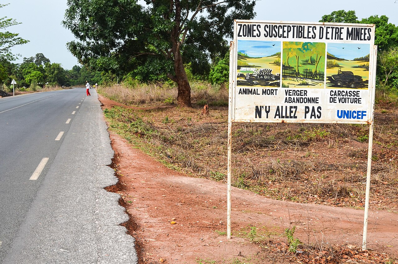
Diouf's tenure was marked above all by armed conflicts, both internal and external, and a steady economic decline. The implementation of reforms demanded by Senegal's creditors brought privatization and the end of subsidies, which sharply increased the cost of living for the people. In 1981/82, Senegal sent its army to The Gambia to assist President Dawda Jawara in a military coup. However, the Senegambia Confederation that was subsequently formed did not have a long life. Further, the Casamance conflict erupted in 1982, with the separatist movement Mouvement des forces démocratiques de la Casamance at its head. Disputes over grazing and water use rights on the Senegal River eventually led to a border war with Mauritania in 1989 that claimed 400 lives and forced numerous people on both sides of the border to return to their homeland. Following a military coup in neighboring Guinea-Bissau, Senegal and Guinea deployed troops in June 1998.
After all rounds of elections in the 1980s and 1990s had led to strong domestic tensions, the year 2000 saw the first peaceful transfer of power south of the Sahara: Abdoulaye Wade won the presidential elections and, a year later, his party also won the parliamentary elections. In January 2001, the constitution was amended by referendum. The presidential term was limited to a maximum of two 5-year terms. Wade's policies were aimed at liberalization, investment friendliness, and promotion of telecommunications and tourism, but success has been elusive. At the same time, Wade was increasingly accused of clientelism and wastefulness; the purchasing power of Senegalese continued to decline and young people in particular turned away from his policies.
In Senegal's 2012 presidential election, challenger Macky Sall defeated incumbent Wade in a runoff.


Questions and answers
Q: What is Senegal?
A: Senegal is a country in West Africa.
Q: What is the capital of Senegal?
A: The capital of Senegal is Dakar.
Q: What is the land area of Senegal?
A: Senegal covers a land area of almost 197,000 square kilometres.
Q: What is the population of Senegal?
A: Senegal has a population of about 13 million.
Q: What are the major industries in Senegal?
A: Major industries in Senegal include fish processing, phosphate mining, fertilizer production, petroleum refining, construction materials, ship construction and repair.
Q: What are the important cash crops in Senegal?
A: Important cash crops in Senegal include peanuts, sugarcane, cotton, green beans, industrial tomato, cherry tomato, melon, and mango.
Q: Who is the current president of Senegal?
A: Since April 2012, Senegal's president has been Macky Sall.
Related articles
Author
AlegsaOnline.com Senegal: West African Republic — geography, history, culture, and economy Leandro Alegsa
URL: https://en.alegsaonline.com/art/88830
Sources
- imf.org : "Senegal"
- data.worldbank.org : "Gini Index"
- hdr.undp.org : "2014 Human Development Report Summary"
- gouv.sn : Official website of the Senegalese government
- commons.wikimedia.org : Senegal