Seamounts: Submerged Volcanoes, Ecosystems, and Hazards
Seamounts are underwater mountains formed mainly by volcanic activity. This entry covers their formation, structure, ecology, mapping, human impacts, hazards and conservation challenges.
Overview
A seamount is a topographic high rising from the ocean floor that does not reach the water's surface. In other words, it is a submerged mountain on the ocean bottom that remains below sea level and therefore is not an island. Most seamounts originate as volcanic structures formed by submarine volcanoes, and they occur in all ocean basins. Typical heights vary widely: many rise a thousand metres or more above the surrounding seafloor, and some exceed several thousand metres.
Image gallery
10 Images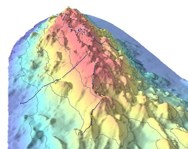


Structure and life cycle
Seamounts follow a characteristic pattern of growth, dormancy and erosion. During their active phase they are built up by successive lava flows. As activity wanes, erosion and subsidence reshape the flanks and summit. The largest volcanic peaks may emerge above the sea surface and be planed flat by waves; after subsidence the submerged, flat-topped remnants are known as guyots or tablemounts. Over geological time the sides of seamounts may weaken and collapse, producing large landslides.
Ecology and biological importance
Seamounts are recognized as important marine ecosystems. Their relief perturbs ocean currents and creates upwelling and localized retention of nutrients, which attracts plankton and higher animals. Plankton blooms around seamounts provide food hotspots for filter feeders and predators; common inhabitants include cold-water plankton, sessile suspension feeders such as corals, dense aggregations of fish, and marine mammals including various cetacea. Many seamounts support biologically rich communities with species that are unique or slow to recover from disturbance.
Human uses and impacts
Because they concentrate fish and other resources, seamounts have long attracted commercial activity. The commercial fishing industry relies on seamount-associated aggregations for valuable catches. However, some fishing methods—most notably bottom trawling—can severely damage fragile seamount habitats by scraping away slow-growing corals and sponges. Scientific surveys and fisheries records have documented declines in some seamount populations following intensive exploitation.
Mapping, research and technology
Despite their importance, the majority of seamounts remain poorly mapped and little studied. Modern surveys combine shipborne bathymetry (multibeam sonar) with satellite gravity measurements and other remote-sensing techniques to detect and characterise seafloor features. Researchers also deploy remotely operated vehicles (ROVs), submersibles and long-term observatories to collect biological and geological data from seamount summits and slopes. Notable well-studied examples include active seamounts such as Loihi within the Hawaiian–Emperor seamount chain, which illustrate submarine volcanism and hydrothermal processes.
Hazards and notable incidents
Seamounts can pose risks to navigation and coastal communities. Uncharted or poorly surveyed peaks have caused collisions and groundings; the Muirfield incident gave its name to a seamount struck by a ship in the 1970s. More broadly, flank collapses of large volcanic edifices can produce massive submarine landslides that displace water and generate tsunamis; such events represent one of the most serious geological hazards associated with aging seamounts and have been linked in the geological record to far-reaching tsunamis.
Conservation and management
Conservation responses include designating marine protected areas, restricting damaging fishing practices, and incorporating seamounts into spatial planning for seabed mining and cable routes. Because many seamount species have slow growth and limited ranges, precautionary frameworks are often recommended. Continued improvement in mapping, international cooperation and targeted research remain essential to balance sustainable use with protection of these remote yet ecologically valuable undersea features.
- Typical formation: submarine volcanism
- Biological drivers: upwelling supports plankton and corals
- Human concerns: fishing impacts and mapping by bathymetry
- Research tools: remote sensing and in situ data collection
- Examples and chains: Hawaiian–Emperor chain and named seamounts
For further reading and databases on seamount locations, biology and management, consult specialized marine science resources and global seafloor maps prepared by oceanographic institutions and multilateral organizations.
mountain | ocean | sea level | island | submarine volcanoes | Hawaiian–Emperor chain | guyots | ecosystems | plankton | corals | fish | cetacea | commercial | fishing | bathymetry | data | tsunamis
Questions and answers
Q: What is a seamount?
A: A seamount is a mountain rising from the ocean sea floor. It does not reach to the water's surface (sea level), and so is not an island. These are usually formed from submarine volcanoes, and are typically 1,000–4,000 metres (3,000–13,000 ft) in height from the sea floor.
Q: How many seamounts are estimated to exist around the world?
A: There are an estimated 100,000 seamounts around the globe.
Q: What type of organisms can be found on or near seamounts?
A: Interactions between seamounts and underwater currents attract plankton, corals, fish, and cetacea alike.
Q: How have commercial fishing industries been impacted by seamounts?
A: Their effect has been noted by the commercial fishing industry, and many seamounts support extensive fisheries. However there are concerns about the effect of fishing on these ecosystems due to stock decline caused by bottom trawling which scrapes whole ecosystems off of them.
Q: What technologies can be used to collect data about unexplored or unmapped seamounts?
A: Bathymetry and satellite altimetry are two technologies used to collect data about unexplored or unmapped seamounts.
Q: Are there any dangers associated with uncharted or unknown seamounts?
A: Yes - naval vessels have collided with uncharted seamounts in some cases; however the greatest danger from these features may come from flank collapses as they get older which could cause massive tsunamis if they occur near populated areas.
Related articles
Author
AlegsaOnline.com Seamounts: Submerged Volcanoes, Ecosystems, and Hazards Leandro Alegsa
URL: https://en.alegsaonline.com/art/88323
Sources
- bbc.co.uk : bbc.co.uk/news/science-environment-18040658
- ices.dk : "Seamounts – hotspots of marine life"
- un.org : The Impacts of fishing on vulnerable marine ecosystems