Scafell Pike — England's highest mountain
Scafell Pike, 978 m, is England's highest peak in the Lake District National Park, Cumbria. Known for its rocky summit, wartime memorial gift to the National Trust, varied ascent routes and sensitive upland habitats.
Overview
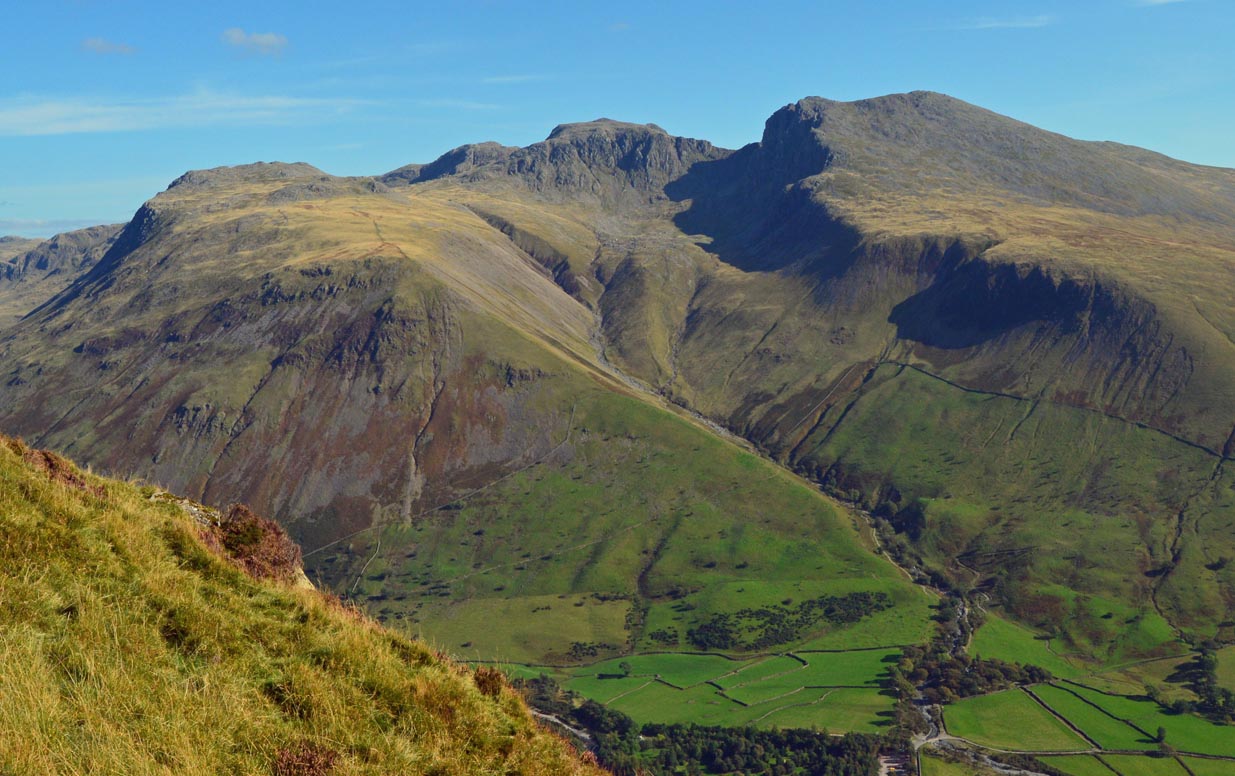
Scafell Pike is the highest mountain in England, rising to 978 metres (3,209 ft). It lies within the Lake District National Park and is one of the most prominent upland landmarks in England. The fell forms a compact, rocky summit area that is a popular objective for walkers, fell-runners and those attempting national peak-bagging challenges; it is commonly included in the English round of the National Three Peaks. For official peak information and mapping references see peak details.
Image gallery
10 Images


Geography and routes
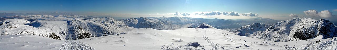
The massif includes steep ridges and corries formed and shaped by past glaciation. Main approaches begin from Wasdale Head (the shortest but steepest route), Borrowdale (via Seathwaite and the Corridor Route) and Eskdale. The summit is defined by a stony cairn and a low, rocky plateau that affords wide views in clear weather across the Lake District. Popular walks vary in difficulty; paths can be rocky and path erosion is an ongoing management concern.
Name and mapping
Scafell Pike is frequently confused with the neighbouring peak Scafell. Historically the phrase "Pikes of Sca Fell" described several tops in the group, including Ill Crag and Broad Crag. The present form "Scafell Pike" is said to have become established after a contraction and a mapping entry by the Ordnance Survey, and the usage is now standard on maps and guidebooks; see also discussion under Scafell Pike.
History and ownership
In 1919 the summit and surrounding land were presented to the National Trust by Lord Leconfield as a memorial gift. The donation commemorated local men who served and died in the First World War; the dedication referenced those who fell "for God and King, for freedom, peace and right in the Great War." The National Trust continues to manage paths, access and conservation on the fell.
Ecology and conservation
The high ground supports hardy upland vegetation such as heather, acid-tolerant grasses, mosses and specialised alpine plants. These habitats are sensitive to heavy foot traffic and grazing. Conservation work aims to reduce erosion, maintain access routes and protect rare plants and nesting sites.
Recreation and safety
Weather on Scafell Pike can change rapidly; mist, strong winds and low temperatures are common at height even in summer. Walkers are advised to carry a map and compass, suitable clothing and emergency equipment. Local mountain rescue teams respond to incidents and emphasise preparation, navigation skills and group safety.
Notable facts
- Height: 978 m (3,209 ft).
- Location: Lake District National Park, Cumbria.
- Nearby summits: Scafell, Ill Crag, Broad Crag.
- Mapping and name: historical name contraction and Ordnance Survey usage are linked to the current form; see Ordnance Survey and commentary at Scafell Pike.
- Ownership: summit land held by the National Trust since 1919 as a war memorial; further information at Lake District resources.
Questions and answers
Q: What is Scafell Pike?
A: Scafell Pike is the highest mountain in England.
Q: How tall is Scafell Pike?
A: Scafell Pike is 978 metres (3,209 ft) tall.
Q: Where is Scafell Pike located?
A: Scafell Pike is located in Lake District National Park in Cumbria.
Q: Why is Scafell Pike sometimes confused with Scafell?
A: Scafell Pike is sometimes confused with Scafell because of their similar names and close proximity to each other.
Q: How did the name Scafell Pike come about?
A: The name Pikes of Sca Fell was first used to refer to the peaks now known as Scafell Pike, Ill Crag, and Broad Crag. The contraction Scafell Pike started as an error on an Ordnance Survey map.
Q: When was the summit of Scafell Pike given to the National Trust?
A: The summit of Scafell Pike was given to the National Trust in 1919 by Lord Leconfield.
Q: Why did Lord Leconfield give the summit of Scafell Pike to the National Trust?
A: Lord Leconfield gave the summit of Scafell Pike to the National Trust in memory of the men of the Lake District "who fell for God and King, for freedom, peace and right in the Great War".
Related articles
Author
AlegsaOnline.com Scafell Pike — England's highest mountain Leandro Alegsa
URL: https://en.alegsaonline.com/art/87736
Sources
- ukniwm.org.uk : Scafell Pike on UKNIWM