Sauer (Sûre) — river of Belgium, Luxembourg and Germany
The Sauer (German: Sauer; French: Sûre) rises in Belgium, crosses Luxembourg and partly forms the border with Germany before joining the Moselle; notable for the Upper Sûre reservoir and riverside towns.
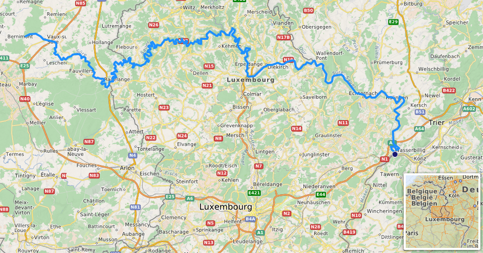
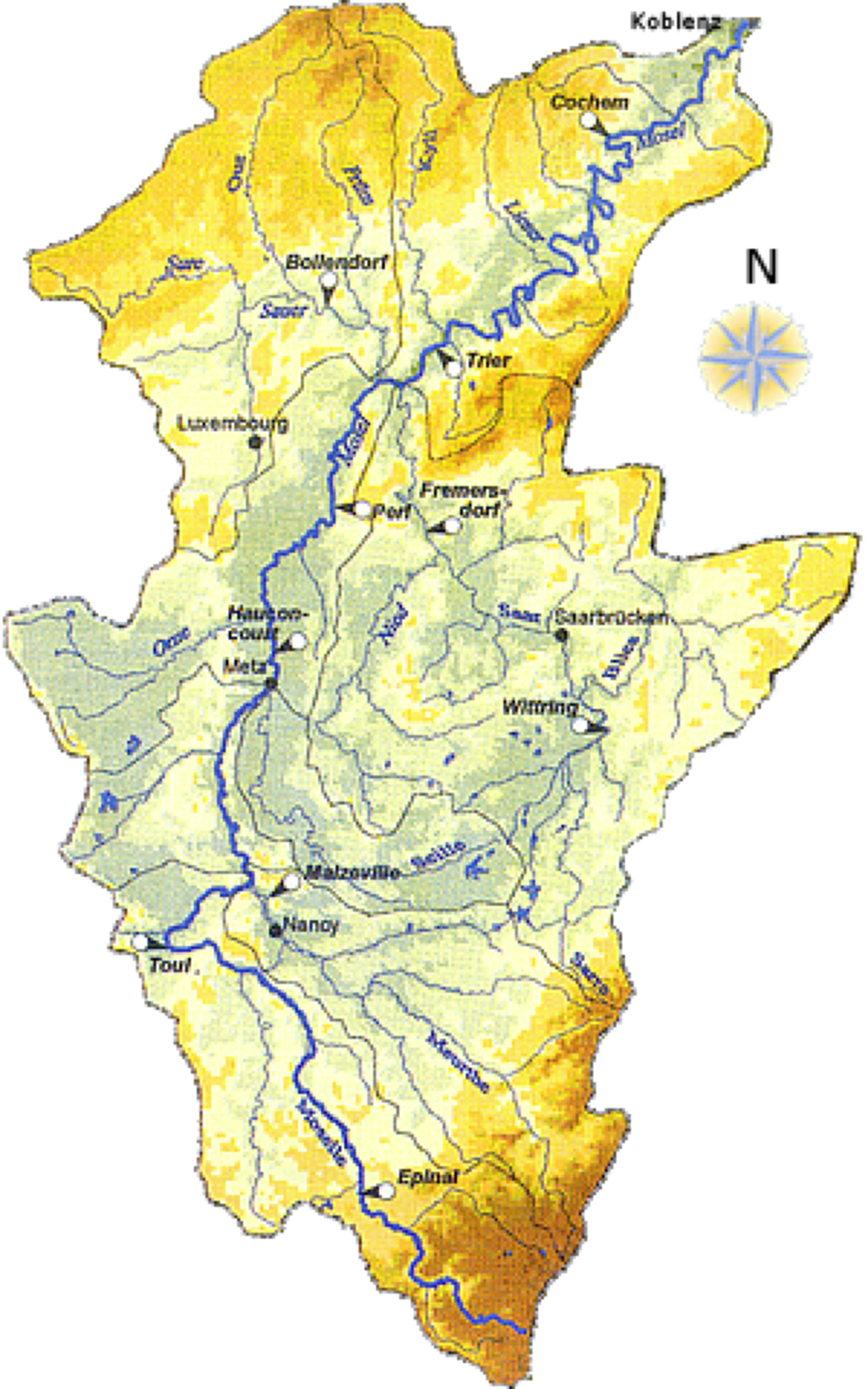
The Sauer (German: Sauer, Luxembourgish: name, French: Sûre) is a central European river that rises in eastern Belgium and flows eastward through Belgium, across Luxembourg and along parts of the border with Germany before joining the Moselle. Its mouth, confluence coordinates and general location are commonly referenced near these coordinates. The Sauer is a left-bank tributary of the Moselle and therefore belongs to the larger drainage basin that ultimately drains into the Rhine; it is often described as a left tributary in maps and regional descriptions.
Image gallery
8 Images


Course and towns
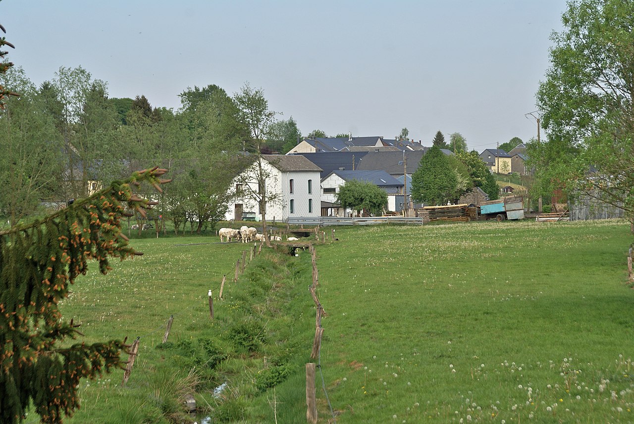
The river begins in the upland country of the Ardennes/High Fens region and moves generally east and southeast. Along its course it passes through or near several historic settlements, including the fortified village of Echternach and the scenic Esch-sur-Sûre. At its lower reaches the Sauer flows into the Moselle close to the town of Wasserbillig, an area that has long been a transport and trade junction between Luxembourg and Germany.
Characteristics and human uses
The Sauer's valley combines steep wooded slopes and narrower cultivated floodplains; this mix supports small-scale agriculture, forestry and riverside villages. Human use of the river includes municipal water supply, flood regulation and recreation. The Upper Sûre Reservoir (Lac de la Haute-Sûre) is an important artificial lake created by a dam upstream of Esch-sur-Sûre; it supplies drinking water, supports leisure activities and helped to shape modern land use in the basin.
History, culture and economy
Rivers like the Sauer have influenced settlement patterns and local economies for centuries: castles, mills and abbeys were established along its banks and many towns retain medieval cores. Echternach, for example, is noted for its historical abbey and annual cultural events. The Sauer corridor also served as a frontier and transport route in different historical periods, which is reflected in fortifications and cross-border ties visible today.
Ecology and protection
The Sauer valley supports varied habitats—riparian woodlands, riverine wetlands and upland heath—and is important for freshwater fish, birds and invertebrates. Parts of the watershed are included in protected areas and regional nature parks that aim to balance biodiversity conservation with tourism and local livelihoods. Management efforts focus on water quality, habitat connectivity and sustainable recreation.
Notable facts and distinctions
- The river is known by different names in the three main languages of its basin, reflecting the multilingual region through which it flows.
- It functions both as an inland water resource for Luxembourg and as a cross-border natural feature linking three countries.
- Its confluence with the Moselle makes it part of the greater Rhine watershed, an important European river system.
For mapping and geographic reference see the commonly cited coordinates and regional river databases; for national and local information consult resources provided by Belgium, Luxembourg and Germany focusing on river management, tourism and conservation (Belgium, Luxembourg, Germany).
Questions and answers
Q: What are the coordinates of the Sauer River?
A: The coordinates of the Sauer River are 49°42′48″N 6°30′24″E / 49.71333°N 6.50667°E.
Q: In which countries does the Sauer River flow?
A: The Sauer River flows through Belgium, Luxembourg, and Germany.
Q: Is the Sauer River a left tributary of the Moselle River?
A: Yes, the Sauer River is a left tributary of the Moselle River.
Q: Is the Sauer River part of the drainage basin of the Rhine River?
A: Yes, the Sauer River is part of the drainage basin of the Rhine River.
Q: What is the name of the Sauer River in German?
A: The Sauer River is called "Sauer" in German.
Q: What is the name of the Sauer River in French?
A: The Sauer River is called "Sûre" in French.
Q: Which direction does the Sauer River flow with respect to the Moselle River?
A: The Sauer River flows towards the left of the Moselle River as it is a left tributary.
Related articles
Author
AlegsaOnline.com Sauer (Sûre) — river of Belgium, Luxembourg and Germany Leandro Alegsa
URL: https://en.alegsaonline.com/art/87531
Sources
- 213.139.159.46 : "Messdaten: Pegel Bollendorf / Gewässer: Sauer"
- britannica.com : "Sûre River"