Satellite navigation (satnav) and global navigation satellite systems
Satellite navigation uses networks of orbiting satellites and receivers to determine precise position and time. GNSS includes systems such as GPS, GLONASS, Galileo and BeiDou and supports mapping, transport, surveying and timing.
A satellite navigation system—often called satnav—provides a receiver with its precise geographic position and an accurate time reference by using signals from orbiting satellites. When a receiver processes time-stamped radio signals sent by several satellites, it can determine its latitude, longitude and height above the Earth. Modern satellite navigation systems that offer worldwide coverage are known as global navigation satellite systems (GNSS).
Image gallery
4 Images


How it works
Satnav receivers calculate position mainly by measuring the travel time of signals sent by satellites in known orbits. Each satellite continuously broadcasts messages that include the satellite’s location and a time stamp. A receiver compares the received time with its internal clock to estimate distance from that satellite; using distances to at least four satellites, the receiver solves for three spatial coordinates and clock offset. Signals must travel in a straight line (line of sight) and are carried by radio waves, which means reception can be blocked by buildings, terrain or dense foliage.
Characteristics and technical factors
Key elements of a satellite navigation service include the constellation of satellites in orbit, the ground control segment that tracks and maintains them, and the user segment—portable or embedded receivers. Accuracy depends on factors such as satellite geometry, atmospheric delays, multipath reflections from surfaces, and intentional or unintentional signal interference. Receivers typically provide position to within a few metres in ordinary consumer use and can achieve much higher precision with augmentation techniques such as differential corrections and carrier-phase processing.
Major systems and components
- Space segment: networks of satellites that broadcast timing and orbital data; see satellites and satellites in orbit.
- Control segment: ground stations that monitor health, update parameters and synchronise clocks.
- User segment: the hardware and software in phones, dedicated receivers and integrated devices that compute position and time.
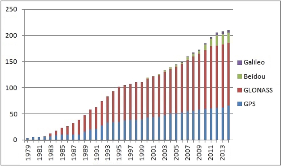
Well-known GNSS examples include the United States' GPS, Russia's GLONASS, China’s BeiDou system, and the European Union’s Galileo. Several countries operate regional services as well. Receivers report longitude, latitude and altitude (or elevation) and also recover precise time by using the same signals.
History, uses and importance
Satellite navigation originated in the late 20th century with military research into ranging and timing from spaceborne transmitters. Over time, governments and commercial organisations expanded capabilities so that civilian navigation and timing services became broadly available. Today GNSS underpins everyday activities such as road navigation, aviation and maritime navigation, land surveying, precision agriculture, telecommunications timing, emergency response and scientific research.
Limitations, augmentation and future trends
Receivers can be affected by signal blockage, reflected signals (multipath), ionospheric and tropospheric delays, and deliberate jamming. To mitigate these issues, systems use augmentation services, additional geostationary satellites, ground-based reference stations and combined sensor solutions (for example inertial navigation). Ongoing developments include more signals and frequencies, stronger civilian services, and tighter integration with other sensors and mapping data to improve resilience and accuracy.
For further technical background and system details see related resources: signal transmission, radio propagation and operational descriptions of specific systems such as GPS and GLONASS.
Questions and answers
Q: What is a satellite navigation system?
A: A satellite navigation or satnav system is a way of pinpointing position very exactly.
Q: How does a satnav system work?
A: Satnav uses a system of satellites. The system gives exact positioning by using time signals transmitted along a straight line (line of sight) by radio from satellites.
Q: What kind of receivers are required for using a satnav system?
A: Small electronic receivers are required for using a satnav system.
Q: What information can be obtained from a satnav system?
A: The position (longitude, latitude, and altitude/elevation) and current local time to high precision can be obtained from a satnav system.
Q: What is a global navigation satellite system (GNSS)?
A: A satellite navigation system with global coverage may be called a global navigation satellite system (GNSS).
Q: Which is the biggest and most used GNSS?
A: The Global Positioning System or GPS is the biggest and most used GNSS.
Q: Which countries or regions are working on similar systems of their own?
A: China, India, and the European Union are working on similar systems of their own.
Related articles
Author
AlegsaOnline.com Satellite navigation (satnav) and global navigation satellite systems Leandro Alegsa
URL: https://en.alegsaonline.com/art/87446