Saskatchewan
Canadian prairie province known for vast skies, agriculture, potash and uranium resources, boreal forests and the North and South Saskatchewan rivers. Capital Regina; largest city Saskatoon; population just over one million.
Overview
Saskatchewan is a landlocked province in central Canada, characterized by wide horizons, a strong agricultural base and significant mineral resources. Home to just over one million people, most residents live in the southern half of the province. The two largest urban centres are Saskatoon, the largest city and cultural hub, and Regina, the capital and seat of provincial government. Saskatchewan often markets itself by the nickname Land of Living Skies, a reference to dramatic cloudscapes and long, open vistas.
Image gallery
10 Images


Geography and environment
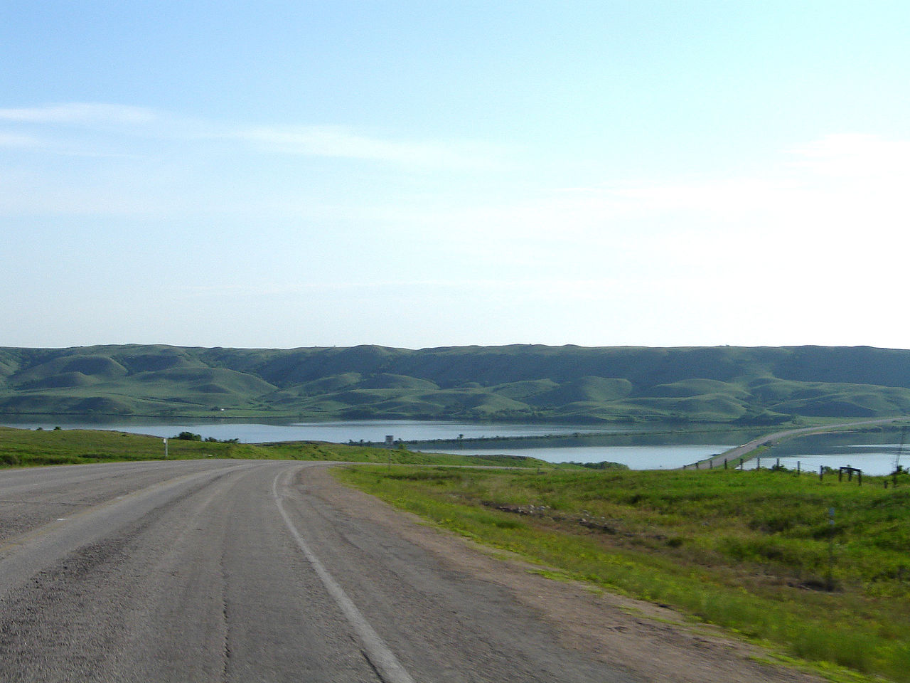
The province stretches from the prairie grasslands in the south to the boreal forest and lake-studded terrain in the centre and north. It is crossed by the North and South Saskatchewan rivers, which converge and drain eastward. Southern Saskatchewan is part of the Great Plains: mostly flat to gently rolling farmland and native prairie. Moving north, the landscape becomes parkland, then dense boreal forest, and finally Canadian Shield outcrops in the far northeast. These zones support diverse wildlife and a range of outdoor activities.
Climate and natural features
Saskatchewan experiences a continental climate with cold winters and warm summers. Precipitation is highest in the south during the growing season and lower across the interior and north. The province contains numerous provincial parks, lakes and river systems that are important for recreation, fishing and conservation. Residents and visitors value the open skies and seasonal variations—long daylight in summer and clear, crisp winter nights.
History and peoples
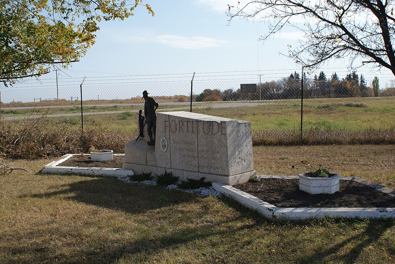
Long before European contact, the area was home to diverse Indigenous peoples, including Cree, Dene, Saulteaux, Dakota and Nakota communities, along with the Métis. European settlement expanded in the 19th and early 20th centuries with fur trade routes, missionary activity and the arrival of settlers drawn by agricultural opportunities. Saskatchewan entered Confederation as a province in 1905. Indigenous communities, settlers and immigrants have shaped its cultural and political history.
Economy and resources
Agriculture remains central to Saskatchewan’s economy: grain, oilseed and livestock production dominate much of the southern landscape. The province is also a major producer of potash and uranium, minerals that play a key role in global fertilizer and energy markets. Forestry, mining, and a growing services sector centered on the cities complement farm incomes. Transportation networks, including rail and highways, support export of commodities to domestic and international markets.
Culture, cities and recreation
Saskatchewan’s cultural life combines Indigenous traditions, settler heritage and contemporary arts. Festivals, museums and university centres in Saskatoon and Regina contribute to music, theatre and research. Popular recreational activities include hunting, fishing, canoeing, and snowmobiling. Important practical distinctions within the province include:
- Major cities: Saskatoon and Regina anchor economic and cultural activity.
- Natural regions: prairie, parkland, boreal forest and the Canadian Shield.
- Key rivers: the North and South Saskatchewan rivers give the province its name.
For official information and further reading, provincial resources and travel guides are available online: see the provincial site as an entry point (provincial pages) and general Canadian resources (national overview). For landscapes and photography that capture the province’s characteristic skies and vistas, consult regional tourism materials (prairie landscapes) and park guides (parklands and lakes).
Geography
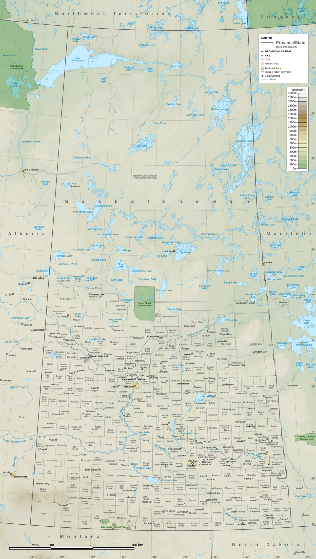
Saskatchewan is located in central southern Canada. The province borders Alberta to the west, the Northwest Territories to the north and Manitoba to the east. The US states of Montana and North Dakota border Saskatchewan to the south. Together with Alberta, it forms the country's only landlocked province. In addition, it is one of Canada's three prairie provinces, along with Manitoba and Alberta. The longest border is the one with Alberta in the west with 1225 km. The border in the north reaches a length of about 445 km; the length of the border with the United States, located in the south, is 630 km. All four borders run approximately straight vertically (in the east and west) and horizontally (in the north and south). The Alberta-Saskatchewan border is at 110 degrees longitude west; the border with the Northern Territories is at 60 degrees latitude north.
At 651,900 km² (251,500 square miles), Saskatchewan is the seventh largest province by area of the country's thirteen provinces. Approximately 59,366 km² (22,900 square miles) consist of inland waters. A large number of lakes are located mainly in the north. Lake Athabasca is the largest inland lake in the province, covering an area of about 7849 km². Other large lakes include Reindeer Lake and Wollaston Lake in the northeast.
Some of the rivers flowing through Saskatchewan (e.g., the Saskatchewan River and the Churchill River) are part of the Hudson Bay drainage basin in northeastern Canada. Only a few belong to the catchment area of other rivers that drain into the Arctic Ocean and the Gulf of Mexico.
Most of the geographic relief of Saskatchewan consists of the Canadian Shield and Interior Plains to the south. A large number of Precambrian, igneous and metamorphic rocks occurring here are found only exclusively in the more southern area. The highest point is at an elevation of 1,392 m in the Cypress Hills on the Alberta border; the lowest point, however, is at 213 m on the shore of Lake Athabasca.
Saskatchewan consists of two main biomes. The boreal or taiga forest covers the entire Canadian Shield and part of the Interior Plains of the province, while the grasslands occupy the southern portion of the province. These two major regions are separated by the Aspen Parkland. This is a secondary biome in the transition between tall grassland and boreal coniferous forest that mainly follows the North Saskatchewan River.
Climate
The climate in Saskatchewan is predominantly cold temperate. The province lies between the maritime and continental climate zones. The humid continental climate sometimes causes very cold winters, especially in the central and eastern parts of the province, whereas summers can be very warm. In the Cypress Hills in the southwest, the climate is steppe-like throughout the year. As the province is located in the northern latitudes of the North American continent, the regions around La Ronge in the north have a subarctic climate.
The average annual rainfall is 300-450 mm. The least precipitation falls during the winter months, while the majority falls in the summer months from June to August. Snow falls in the months from November to March, and in summer there are six to eight rainy days per month.
Summertime in Saskatchewan usually lasts from June to August. During these months, temperatures can rise to over 30°C, with readings of up to 44°C recorded. At night, temperatures can sometimes drop to freezing. On average, the summer months are characterized by high temperature differences during the day and at night. In July and August, winds blow warm air from the lower plains and the midwestern United States across the area. In the south around Regina (Saskatchewan) and Moose Jaw, it is mostly dry, and precipitation rarely falls in these regions. Arctic cold air blasts can result in light frost during the summer months, but also heat waves with high temperatures. The highest temperature recorded in Saskatchewan was 45 °C in Midale and Yellow Grass.
Autumn usually begins in September, and in November the night temperature drops to -11 °C.
Winter lasts from December to February. The average day and night temperatures are between -15° and -21 °C, occasionally also -8° to -11 °C, but the differences can rise up to 60 °C. However, the temperature differences between the south and the north are less pronounced. Lows of -40 °C have only occurred in the months from November to March and found their lowest point at -49 °C. Highs in the winter months average 9 °C in January, usually rising to 15 °C in December and February. The average temperature here is -10° to -12 °C, but sometimes this can drop to -17 °C. In the southern latitudes, so-called "Chinook winds" from the west, comparable to the Alpine foehn in Europe, ensure a mild climate.
Saskatchewan is considered one of the most tornado active regions in Canada. The subarctic climate in the northern latitudes and the submaritime climate in the south favour the formation of tornadoes. About 18 to 20 such tornadoes occur per year; some have already exceeded the F3 mark. In 2012, about 33 tornadoes were reported in the province. There is also a strong occurrence of thunderstorms, mainly in June and July, with accompanying hailstorms. The devastating Regina cyclone in 1912 killed about 28 people.

Related articles
Author
AlegsaOnline.com Saskatchewan Leandro Alegsa
URL: https://en.alegsaonline.com/art/87417