Santa Ana River
Major river in Southern California that runs from the San Bernardino Mountains to the Pacific Ocean, shaping water supply, flood control, and habitat across the Inland Empire and Orange County.
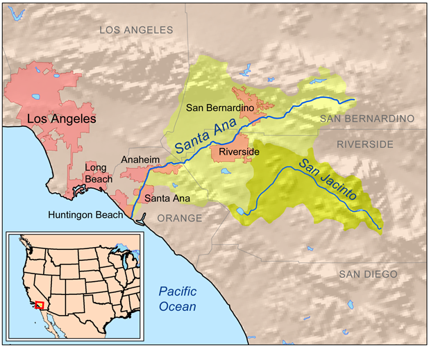
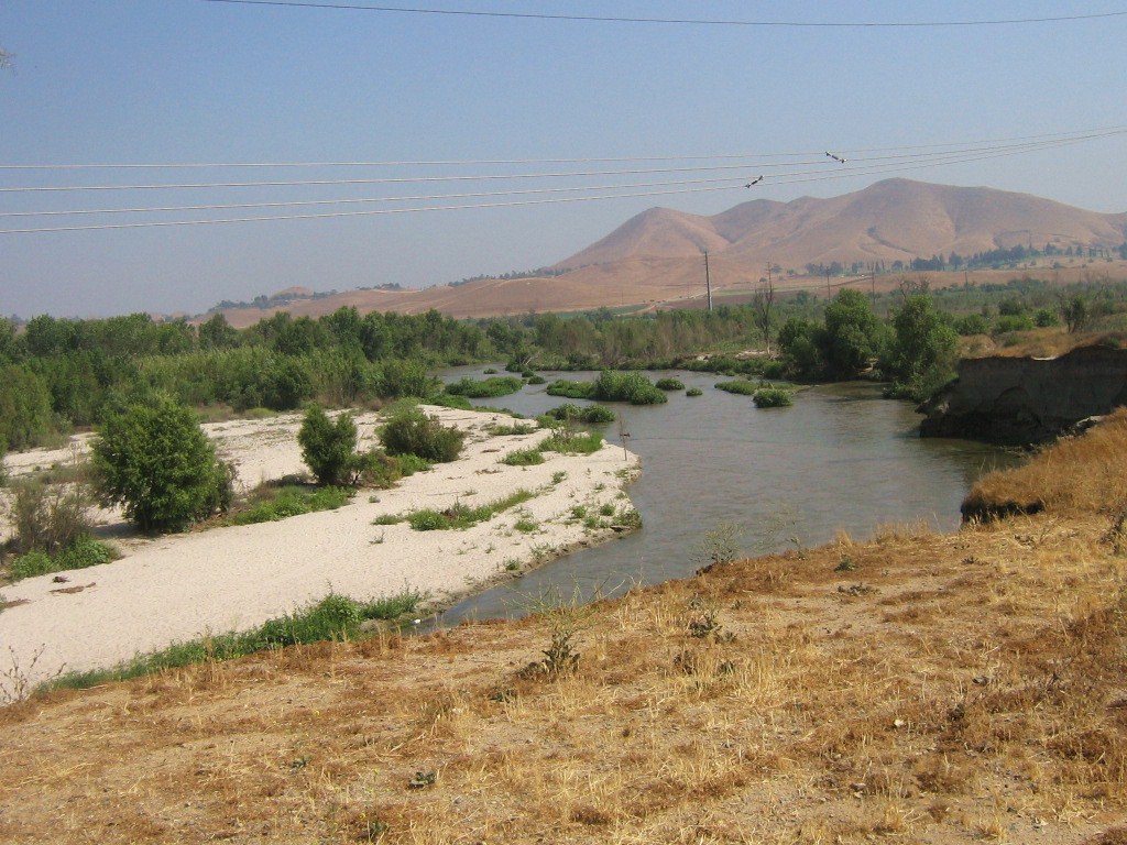
The Santa Ana River is the largest river system in the Santa Ana River watershed of southern California in the United States. Rising in the mountains of the upper basin, it flows west for about 100 miles (160 km) and has long been one of the region’s most important waterways, even though much of its lower course has been heavily altered by engineering.
Image gallery
10 Images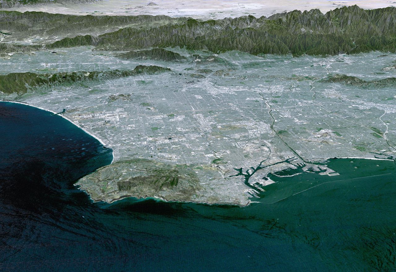


Course and watershed
The river begins in San Bernardino County and crosses a wide and varied landscape as it moves through Riverside County and Orange County before emptying into the Pacific Ocean. Its watershed covers about 2,650 square miles (6,863 square kilometers), gathering runoff from mountain slopes, foothills, and urbanized valleys. Major tributaries include Lytle Creek, Temescal Creek, and Santiago Creek.
- Length: roughly 100 miles (160 km)
- Drainage area: about 2,650 square miles
- Major tributaries: Lytle Creek, Temescal Creek, Santiago Creek
Flood control and engineering
Like the Los Angeles and San Gabriel rivers to the north, the Santa Ana River has been channelized in many places and lined with concrete to reduce flood risk in densely populated areas. This kind of modification reflects the river’s history of sudden high flows, which can be dangerous after heavy rain or mountain runoff. One of the best-known structures in the basin is Seven Oaks Dam, a major flood-control dam on the upper river. At 632 feet (193 m) tall, it is the sixth tallest dam in the United States.
Importance today
Even in a heavily managed form, the Santa Ana River remains important for groundwater recharge, flood protection, recreation, and habitat. In some stretches, the river corridor supports trails and open space, including the well-known Santa Ana River Trail. The river’s mix of natural flow, engineered channels, and reservoir-and-dam management makes it a useful example of how water systems in arid and crowded regions must serve both environmental and urban needs.
Questions and answers
Q: Where is the Santa Ana River located?
A: The Santa Ana River is located in southern California, in the United States.
Q: Where does the Santa Ana River begin?
A: The Santa Ana River begins in San Bernardino County.
Q: How far does the Santa Ana River flow before it reaches the Pacific Ocean?
A: The Santa Ana River flows west about 100 miles (160 km) before it reaches the Pacific Ocean.
Q: Which counties does the Santa Ana River flow through?
A: The Santa Ana River flows through Riverside and Orange counties.
Q: What is the size of the watershed of the Santa Ana River?
A: The Santa Ana River has a watershed of 2,650 square miles (6,863 square kilometers).
Q: What are some of the tributaries of the Santa Ana River?
A: Some of the tributaries of the Santa Ana River include Lytle, Temescal, and Santiago Creeks.
Q: What is a notable feature on the Santa Ana River?
A: A notable feature on the Santa Ana River is the Seven Oaks Dam, which is the 6th tallest dam in the United States and stands at 632 feet (193 m) tall.
Related articles
Author
AlegsaOnline.com Santa Ana River Leandro Alegsa
URL: https://en.alegsaonline.com/art/87089
Sources
- sawpa.org : Santa Ana River Watershed
- ocwatersheds.com : OC Watershed