
San Francisco–Oakland Bay Bridge
Overview, design, history and significance of the San Francisco–Oakland Bay Bridge, the multi-span highway link across San Francisco Bay that carries Interstate 80 between San Francisco and Oakland.
Overview
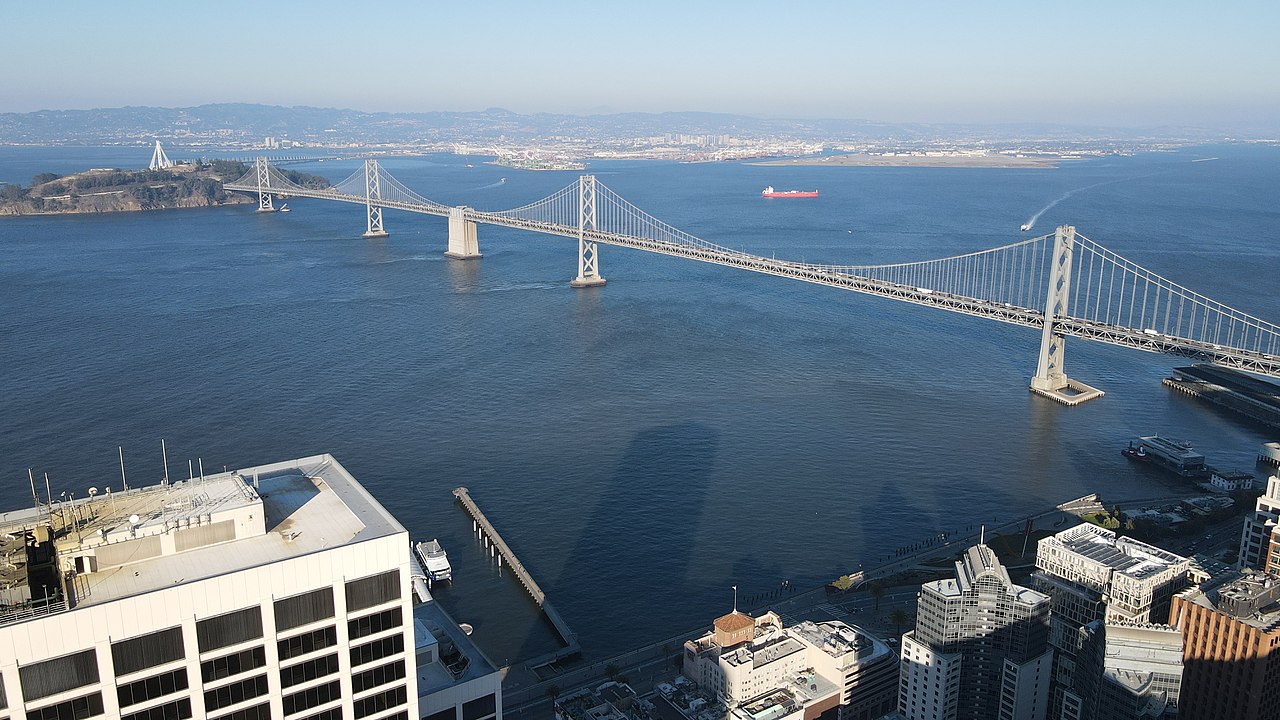
The San Francisco–Oakland Bay Bridge is a connected sequence of bridges and roadways that span San Francisco Bay, linking the cities of San Francisco and Oakland. Often called the Bay Bridge, it forms a critical section of Interstate 80 in the state of California. The crossing is not a single uniform structure but a pair of major spans separated by Yerba Buena Island, together forming a continuous traffic route for commuters, freight, and regional travel. For basic orientation see a general description as a series of bridges across San Francisco Bay.
Image gallery
10 Images


Structure and design
The crossing consists of two principal water spans with distinct forms and engineering approaches. The western span is a traditional suspension bridge with tall towers and long main cables; it carries traffic on two decks, with motorists using separate levels for opposite directions. A short tunnel bored through Yerba Buena Island connects the western span to the island's roadway network.
- The eastern span connects Yerba Buena Island to the eastern shore near Oakland and was rebuilt in the early 21st century as a self-anchored suspension bridge, a form that anchors the cables to the bridge deck itself rather than to distant anchorages.
- The older eastern crossing had been a large steel cantilever bridge, but that structure was taken out of service and later replaced for seismic safety reasons.
History and development
The original Bay Bridge opened in the 1930s as part of an era of major bridge construction on the U.S. West Coast. Over the decades it underwent maintenance, retrofitting and improvements to accommodate growing traffic and modern safety standards. A major turning point occurred after the 1989 Loma Prieta earthquake, which damaged the eastern cantilever span and highlighted the vulnerability of older bridge designs in strong seismic events. In response, engineers, public agencies and elected officials pursued a lengthy program of study, design changes and construction that ultimately led to the new eastern span and extensive seismic upgrades to other sections of the crossing.
Uses and significance
The Bay Bridge carries thousands of vehicles daily and serves as a primary arterial between the East Bay and San Francisco. It supports commuter flows, commercial transport, and links to regional transit systems. Tolling on the bridge helps fund maintenance and seismic work; the crossing is also a familiar landmark used in regional planning, emergency response routing, and public discussions about transportation resilience.
Notable features and distinctions
Several attributes make the Bay Bridge notable. The western suspension span's double-deck arrangement is a defining visual element seen from San Francisco waterfronts. The replacement eastern span was designed specifically to meet stringent seismic performance goals and includes a roadway deck arranged differently from the older cantilever; advocates described it as among the widest bridge decks when it opened. The crossing also illustrates the challenges of maintaining and upgrading aging infrastructure in densely populated urban regions.
Further reading and resources
Readers looking for technical history, construction timelines, or current traffic and toll information can consult government and engineering sources. For introductory material and summaries of the bridge's role in the Bay Area transportation network, see resources on the bridge as a series of bridges, materials about San Francisco Bay, regional information from California transportation pages, the interstate designation at Interstate 80, and explanations of suspension and cantilever bridge types via links about suspension bridges and cantilever bridges. These will help place the Bay Bridge in both local and engineering context.
Questions and answers
Q: What is the San Francisco–Oakland Bay Bridge?
A: The San Francisco–Oakland Bay Bridge is a series of bridges across San Francisco Bay in the U.S. state of California, and is part of Interstate 80.
Q: How many spans does the Bay Bridge have and what are they?
A: The Bay Bridge has two spans over water. The western span is a suspension bridge, while the eastern span is a self-anchored suspension bridge.
Q: What type of bridge was the eastern span before it was replaced?
A: The eastern span used to be a cantilever bridge, but it was removed once the new bridge opened.
Q: Why was the old eastern span destroyed?
A: The cantilever span was destroyed in the 1989 Loma Prieta Earthquake.
Q: What is one reason for the replacement of the eastern span?
A: The destruction of the old eastern span in the 1989 Loma Prieta Earthquake is one reason why the eastern span was replaced.
Q: What is the configuration of the western span of the Bay Bridge?
A: The western span is a double suspension bridge with two decks. Westbound traffic is carried on the upper deck and eastbound on the lower deck.
Q: What is the configuration of the new eastern span of the Bay Bridge?
A: The new east span is a single deck with the eastbound and westbound lanes on each side, and is the world's widest bridge.
Related articles
Author
AlegsaOnline.com San Francisco–Oakland Bay Bridge Leandro Alegsa
URL: https://en.alegsaonline.com/art/86825
Sources
- npgallery.nps.gov : "National Register of Historic Places Registration Form"
- dot.ca.gov : San Francisco-Oakland Bay Bridge
- dot.ca.gov : "Traffic Census Program"
- mtc.ca.gov : "San Francisco-Oakland Bay Bridge"
- nrhp.focus.nps.gov : "National Register Information System"
- dot.ca.gov : dot.ca.gov