Salzburg: Austria’s Baroque City, birthplace of Mozart and UNESCO old town
Salzburg is a historic Austrian city on the Salzach River, famed for its Baroque old town (UNESCO), music heritage (Mozart), hilltop fortress and cultural festivals.
Salzburg is the capital and a district of the Austrian federal state of Salzburg, situated on the Salzach River. The city — home to roughly 150,000 residents — combines dramatic Alpine surroundings with a well‑preserved Baroque centre. Its name literally means "Salt Fortress," a reminder of the salt trade that shaped the region for centuries. For basic administrative and demographic context see Salzburgerland and local population references at city statistics.
Image gallery
10 Images


Geography and urban layout
Salzburg sits at the northern edge of the Alps. The Salzach River divides the modern and historic parts of the city, with steep hills and fortified sites providing distinctive views. The compact old town (Altstadt) is clustered on the east bank while residential and commercial neighbourhoods spread across both banks and into surrounding valleys. The topography influences transport, walking routes and the concentration of historic monuments around the river and hillside.
History and development
The city developed around a medieval market and the administration of salt rights — hence the name. From the Middle Ages until the early 19th century Salzburg was the seat of powerful prince-archbishops whose wealth financed churches, palaces and the extensive fortifications such as the Hohensalzburg Fortress. The city's architecture reflects successive phases: Romanesque origins, an extensive Baroque remodelling after the 17th century, and modern infrastructure added in the 19th and 20th centuries.
Culture, music and notable figures
Salzburg is internationally associated with Wolfgang Amadeus Mozart, born here in 1756. His life and works are a central theme of the city's museums, concerts and tourism; see more about Mozart at Mozart resources. The physicist Christian Doppler, known for the Doppler effect, also came from Salzburg; biographical and scientific material can be found via Doppler references. The city hosts a lively calendar of cultural events, the best known being the annual Salzburg Festival, which attracts opera, theatre and classical music audiences from around the world.
Old Town and UNESCO designation
Salzburg's historic core is noted for its harmonious Baroque ensemble, narrow lanes, domes and spires. In 1996 the old town was inscribed by UNESCO as a World Heritage Site in recognition of its outstanding architecture and preserved urban fabric; see the UNESCO entry at UNESCO and the formal World Heritage listing at World Heritage. The designation covers both monuments and the overall townscape, protecting key buildings and sightlines.
Major attractions and visitor information
Visitors typically explore a mix of musical history, religious architecture and hilltop fortresses. Important sites include:
- Hohensalzburg Fortress — commanding hilltop stronghold with panoramas;
- Mozart's Birthplace and Residence — museums dedicated to the composer;
- Salzburg Cathedral and numerous Baroque churches;
- Mirabell Palace and Gardens — a formal palace with sculpted grounds;
- Walking routes along the Salzach and historic market squares.
Beyond sightseeing, Salzburg functions as a regional economic and academic centre with seasonal tourism supporting hotels, festivals and cultural industries. The city also appears in popular culture as a principal setting for the film and stage musical "The Sound of Music," which has increased international interest in its landscapes and historic sites.
Practical notes and distinctions
Salzburg is compact and walkable, with efficient public transport linking suburbs and the airport. Its combination of natural setting, music history and well‑preserved Baroque architecture distinguishes it from larger Austrian cities: it is often described as a city-museum with active cultural life rather than a sprawling metropolis. For further reading and official resources, use the links above to access regional, musical and heritage information.


Geography
→ Main article: Geography and climate of the city of Salzburg
Location
The city of Salzburg is located on the northern edge of the Alps, in the middle of the Salzburg basin. The historic old town centre is located on the Salzach and is bordered by the fortress and Mönchsberg as well as its western spur, the Rainberg.
To the east of the old town centre, the Kapuzinerberg and the small Bürglstein rise on the right bank of the Salzach, to the south of the town the Hellbrunner Berg and the Morzger Hügel, to the west of the Altliefering district the small Grafenhügel. In the southwest the 1973 m high Untersberg, which is accessible by a cable car, borders the city. Dominating the landscape in the west are the Hohe Stauffen and in the south the Salzburger Kalkhochalpen with Göll, Hagengebirge and Tennengebirge. In the east the 1288 m high city mountain Gaisberg and the Osterhorngruppe form the border of the Salzburg basin. North of the city, the foot of the Plainberg with the pilgrimage basilica Maria Plain reaches the city area. To the northeast, the hilly landscape of the Flachgau region joins the Alpine foothills, with the Haunsberg as the last Alpine foothill. A closed alluvial forest belt along the Salzach and Saalach rivers reaches into the city area in the north.
The alluvial forest to the west of the Saalach and the hilly area behind it, the Högl, already belong to the Berchtesgadener Land district in Bavaria. To the northwest, the Bavarian town of Freilassing, separated only by the Saalach, borders the Salzburg district of Liefering-Rott.
The old town in the Salzburg basin lies 420 to 426 m high. The highest point of the urban area is the Gaisbergspitze with 1288 m, the Saalach mouth at the foot of the embankment is the lowest point with 404 m. The municipal area covers 65.65 km², of which 2238 hectares are building land (34.0 %), 503 hectares are traffic areas (7.7 %), 1080 hectares are forest (16.5 %) and 342 hectares are water bodies (5.2 %).
Districts
→ Main article: List of districts of Salzburg
The city is divided into 24 districts and three adjoining landscape areas, independently of the historical cadastral municipalities. The historic core of the city is formed by the old town to the left and right of the Salzach (Salzburg Old Town district), which is adjoined by the old suburbs of "Mülln" and "Nonntal" dating back to the Middle Ages.
Around 1900, the district "Riedenburg" was created west of the old town. On the area of the demolished bastions and barracks on the right bank, the Andräviertel (New Town) was formed. West of the main station the district "Elisabeth-Vorstadt" developed. In the northern part of Mülln the district "Lehen" developed.
The districts of Aigen, Parsch, Itzling and Gneis were essentially built after 1900. The once independent villages, later suburbs Maxglan in the west, Liefering in the northwest, Gnigl in the east and Morzg in the south became city districts in the interwar period. During this time, the continuously built-up settlement strip along Moosstraße in Leopoldskron-Moos gradually formed.
After 1950, Salzburg-Süd with the parts Josefiau, Herrnau and Alpensiedlung emerged as the youngest settlement core. The districts of Langwied, Kasern, Taxham and Schallmoos, as extensions of old suburban villages, also date from the middle of the 20th century, as does the district of Itzling Nord in the north as a young settlement splinter that seamlessly connects to the settlement area of the municipality of Bergheim. South of Gneis are the likewise young small settlements Eichethofsiedlung and Birkensiedlung. They are grouped together under the name Gneis Süd. South of the airport is the district Maxglan West, which includes the Kendlersiedlung and the small former hamlets Pointing and Loig. The Kendlersiedlung continues with the houses of the Glansiedlung, which already belong to the municipality of Wals-Siezenheim. The Pointing and Loig groups of houses adjoin the Walser Himmelreich. Outside the settlement areas, the enclosed landscape areas Hellbrunn, as well as Gaisberg and Heuberg at the foot of the city mountain Gaisberg are located in the urban area of Salzburg.
Cadastral communities
Salzburg is divided into 14 cadastral municipalities (area as of 31 December 2019):
- Salzburg (878.46 ha)
- Aigen I (834.65 ha)
- Gnigl (282.85 ha)
- Itzling (276.86 ha)
- Leopoldskron (869.35 ha)
- Liefering I (664.67 ha)
- Maxglan (621.59 ha)
- Morzg (983.22 ha)
On the outskirts of town are:
- Bergheim II (149.65 ha)
- Gaisberg I (427.86 ha)
- Hallwang II (294.08 ha)
- Heuberg I (28.75 ha)
- Siezenheim II (203.05 ha)
- Wals II (50,16 ha)
The names of the districts as functional units largely correspond to the cadastral municipalities of the same name, whose boundaries were largely defined in the early 19th century (before 1830). The designation Aigen I indicates that the former municipality of Aigen was by far the largest part incorporated into the city of Salzburg in 1939. The remaining very small part was assigned to the neighbouring municipality of Elsbethen under the designation Aigen II as a very small cadastral municipality of its own.


History
→ Main article: History of the city of Salzburg
Early history and Bavarian times
The area of the town has been continuously settled since the Neolithic Age until today. In the La Tène period it was an administrative centre of the Celtic alums in the Kingdom of Noricum. The population on the city hills was moved to the area of the old town after the Roman invasion in 15 BC, in accordance with Roman town planning. The new city was one of the most important cities of the now Roman province of Noricum since Emperor Claudius as Municipium Claudium Iuvavum. After the abandonment of the province of Noricum in 488 at the beginning of the Migration Period, part of the Romano-Celtic population remained in the country. In the 6th century, the land was taken over by the Bavarians. Bishop Rupert received the remains of the Roman city as a gift from Duke Theodo II of Bavaria around 696 AD in order to missionize the country in the east and southeast. He renewed the monastery of St. Peter and founded the Benedictine nunnery of Nonnberg. The province of Salzburg and its counties soon gained more and more influence and power within Bavaria due to the flourishing salt mining and the extensive missionary activities.
In 996, Emperor Otto III granted Salzburg the right to hold markets, mint coins and tolls, and in 1120/30 a town judge was already mentioned in a document. The oldest known town charter dates back to 1287.
Prince-Archbishop's residential town
Since the Battle of Mühldorf in 1322, the archbishopric was at enmity with the motherland Bavaria. As a result, Salzburg became an independent archdiocese within the Roman-German Empire. The economic prosperity of the city in the 15th century led to a self-confident middle class with increasing rights and duties. Archbishop Leonhard von Keutschach, who was economically very successful, ended this autonomy by force. A few years after Martin Luther's posting of the theses, the majority of the city's population was close to Protestantism, and the unbending Protestants were then all expelled from the country by 1590. Criticism of the archbishop's authoritarian power continued to grow under Keutschach. In 1525, rebellious squires and peasants laid siege to the fortress of Hohensalzburg, where Archbishop Matthäus Lang von Wellenburg had entrenched himself. Only with the help of troops bought from the Swabian League were the rebels forced to retreat. Around 1600, the archbishopric was one of the richest principalities in the Roman-German Empire due to salt and gold mining. At that time Archbishop Wolf Dietrich von Raitenau redesigned the old town centre. The large late Romanesque cathedral was demolished and rebuilt by Markus Sittikus in early Baroque style.
Paris von Lodron succeeded in keeping Salzburg out of the Thirty Years' War (1618-1648) through a clever policy of neutrality. The city was developed into one of the best fortified cities in Europe. (See also article Fortifications of the City of Salzburg).
Salzburg soon became a centre of the Counter-Reformation, where monasteries, a seminary and numerous baroque churches were built, and a large part of the inhabitants were united in lay brotherhoods. In the years between 1675 and 1690, the Zauberbuben trials took place in Salzburg, as a result of which over 150 people were executed for alleged witchcraft. The majority of them were boys and youths.
In 1732, under Archbishop Leopold Anton von Firmian, the majority of the Protestants remaining in the country were forced to emigrate (Salzburg exiles).
Under Archbishop Hieronymus Franz Josef Colloredo of Wallsee and Mels, Salzburg became a centre of the late Enlightenment between 1772 and 1800, where science and the arts flourished.
part of Austria
In 1803, by order of Napoleon Bonaparte, Salzburg became a secularized electorate, and in 1805, together with Berchtesgaden, it was annexed to the new Empire of Austria, and in 1810 it was again annexed to the Kingdom of Bavaria. In 1800, 1805 and again in 1809 Salzburg was occupied and plundered by Napoleonic troops.
In 1816, with the Treaty of Munich, most of the province of Salzburg again fell to the Empire of Austria and thus under Habsburg rule. At first Salzburg was a district town of little importance in the crown land of Upper Austria, to which, apart from a few spa guests, only a few painters and literary figures strayed. These, however, were enchanted by the beauty of the city and their reports made Salzburg more and more a tourist destination. On April 30, 1818, a fire broke out that raged through the city for four days. Around a hundred houses were destroyed. In 1860 the demolition of the city fortifications began, they were mainly used as building material for the new Salzach slaughter. In the same year the people of Salzburg celebrated the opening of the railway lines Vienna - Salzburg and Salzburg - Munich. This ensured strong growth of the city and allowed trade and commerce to flourish.
The end of the First World War also brought a period of hunger to Salzburg, and the economy recovered only gradually.
In the period between 1935 and 1939 various neighbouring villages were incorporated. During the Nazi regime, arrests and deportations of political opponents as well as Jews and other minorities took place from 1938 onwards. Prisoners of war kept the economic life going. In 1944/45 aerial bombs from the USA damaged large parts of the town. Colonel Hans Lepperdinger saved the city in 1945 by refusing to obey orders and handing it over to the US without a fight. Salzburg was the seat of the US High Command after the end of the war. In the first post-war years the city was marked by the misery of the refugees. Only gradually were the barrack dwellings replaced by the construction of new districts. In 1962 the university, which had been dissolved in 1810, was re-established. In the following period Salzburg became an economically successful trade, fair and tourism city.
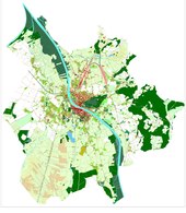
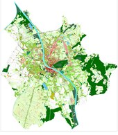
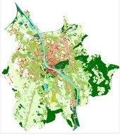
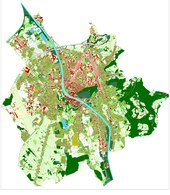
The development of the city of Salzburg, shown as a time series of 30 years each
· Detailed historical plans of the city
· 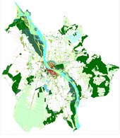
Late 1800s
· 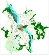
End 1830
· 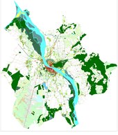
End 1860
· 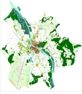
End 1890
· 
End 1920
· 
End 1950
· 
end of 1980
· 
end of 2010
The graph on the right shows the increasing decoupling of built-up area and the respective number of inhabitants after about 1970. Despite a hardly increasing number of inhabitants, the demand for space for new buildings continues to grow strongly (also) in the city of Salzburg. (Data: respective sum of built-up areas and adoption of the respective number of inhabitants)


Questions and answers
Q: What is Salzburg?
A: Salzburg is the capital and district of the Austrian state of Salzburg or Salzburgerland.
Q: What is the population of Salzburg?
A: The population of Salzburg is about 150,000, making it the 4th largest city in Austria.
Q: Who was Wolfgang Amadeus Mozart?
A: Wolfgang Amadeus Mozart was a famous citizen of Salzburg.
Q: Who was Christian Doppler?
A: Christian Doppler was a physicist who found the Doppler effect, which was named after him. He was also a famous inhabitant of Salzburg.
Q: What river crosses Salzburg?
A: The Salzach river crosses Salzburg.
Q: When was the old town of Salzburg adopted by UNESCO as a World Heritage Site?
A: The old town of Salzburg was adopted by UNESCO as a World Heritage Site in 1996.
Q: What is Salzburg known for?
A: Salzburg is known for being one of the settings for the movie "The Sound of Music", which is based on the musical by Richard Rodgers and Oscar Hammerstein.
Related articles
Author
AlegsaOnline.com Salzburg: Austria’s Baroque City, birthplace of Mozart and UNESCO old town Leandro Alegsa
URL: https://en.alegsaonline.com/art/86602