
Salah ad-Din Governorate (Saladin Province)
Salah ad-Din Governorate is a province in north-central Iraq centered on Tikrit. Named for Saladin, it contains important archaeological sites, oil infrastructure, a Sunni-majority population and a complex modern history.
The Salah ad-Din Governorate, often called Saladin Province, lies in north-central Iraq and takes its name from the 12th-century Kurdish Muslim leader Saladin (Salah ad‑Din). In Arabic the name is written صلاح الدين. The governorate occupies a strategic corridor along the Tigris River and has been a crossroads of agricultural, religious and military activity for centuries.
Image gallery
5 Images


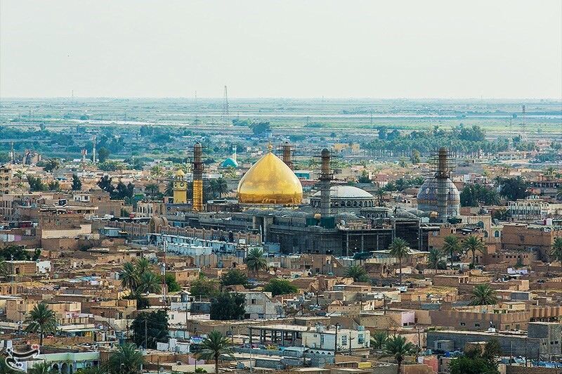

Geography and population
Salah ad-Din covers a large area in the north of the country; it is administered as a province of Iraq. The provincial capital is Tikrit, the largest city and birthplace of Saddam Hussein, often identified with the province in recent decades. Official figures and estimates have placed the provincial population at roughly one to one and a quarter million people; demographic composition is mixed but the majority identify as Sunni Arabs, with Shia Arabs, Kurds and other minorities present in parts of the governorate.
Administration, districts and economy
The governorate is divided into several districts that center on key towns and facilities. Important districts include:
- Tikrit (Tikrit)
- Samarra
- Baiji
- Balad and Al-Diwaniyah
- Diyala-adjacent northern districts
Economically it combines irrigated agriculture along the Tigris with oil-related industry. The Baiji area is notable for a major refinery and associated infrastructure, while local markets and farming remain important livelihoods for many residents.
History and recent events
The province contains significant archaeological and religious sites, most famously the historic city of Samarra with its Abbasid-era remains. In modern times the governorate experienced heavy conflict: it was affected by the 2003–2011 Iraq War and later by the rise of ISIL in parts of northern and central Iraq during the 2010s. Some local authorities reportedly made autonomy-related declarations in 2011 during a period of political turmoil and shifting control; such moves were controversial and part of wider national debates over governance and security (see source reports).
Notable features
- Historic sites: Samarra's archaeological complex and religious shrines attract scholarly and pilgrim interest.
- Strategic location: control of roads and river crossings in Salah ad-Din has long had military and economic significance.
- Cultural mix: while Sunni Arabs form a majority, the governorate includes diverse communities and religious sites important to different groups.
As a governorate, Salah ad-Din remains important to Iraq's cultural heritage and its contemporary politics, balancing agricultural life, energy infrastructure and contested modern history within its borders.
Questions and answers
Q: What is the name of the governorate in north of Iraq?
A: The name of the governorate in north of Iraq is Salah ad Din.
Q: What is the area of the province?
A: The area of the province is 24,751 km².
Q: What is the capital of Salah ad Din Province?
A: The capital of Salah ad Din Province is Tikrit.
Q: Who was born in Tikrit and became a leader of Iraq?
A: Saddam Hussein was born in Tikrit and became a leader of Iraq.
Q: How many people live in Salah ad Din Province?
A: 1,147,000 people live in Salah ad Din Province.
Q: What is the religion of the majority population in Salah ad Din Province?
A: The majority population in Salah ad Din Province is Sunni.
Q: When did the province declare autonomy?
A: The province declared autonomy in 2011.
Related articles
Author
AlegsaOnline.com Salah ad-Din Governorate (Saladin Province) Leandro Alegsa
URL: https://en.alegsaonline.com/art/86391
Sources
- hdi.globaldatalab.org : "Sub-national HDI - Area Database - Global Data Lab"
- mcclatchydc.com : "Saddam's home province declares regional autonomy in Iraq" · web.archive.org