
Sahara Desert: overview, geography, climate, history and significance
The Sahara is the world's largest hot desert in North Africa. This article explains its extent, landscapes, climate cycles, human history, ecology and notable facts.
Overview
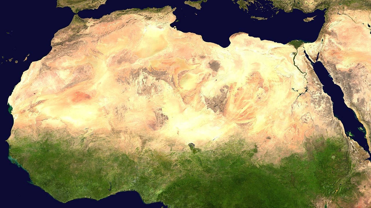
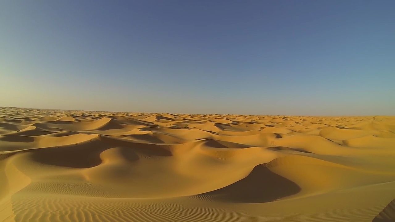
The Sahara is the vast desert region occupying much of North Africa. It is the world's largest hot desert and, apart from polar ice sheets, one of the largest deserts overall — often compared with Antarctica when deserts are ranked by area. Its surface is commonly given as about 9,000,000 square kilometres (roughly 3.5 million square miles), though its extent has shifted over millennia. The Sahara includes a mix of sand seas, rocky plateaus, gravel plains and mountain ranges rather than a single continuous sand sheet.
Image gallery
10 Images


Boundaries and countries
The desert is bounded by distinct physical regions and waters: the Atlantic Ocean to the west, the Atlas Mountains to the northwest, the Mediterranean Sea to the north, the Red Sea to the northeast and the semi-arid Sahel to the south. It spans or touches many modern states, including:
Landscape and climate
The Sahara's terrain is varied: broad ergs (sand seas), hamadas (rocky plateaus), regs (gravel plains), salt flats and isolated mountain massifs occur across the region. Average daytime temperatures in summer can be extremely high, and the region experiences large diurnal temperature swings. Although very dry overall, the Sahara is not uniformly the driest place on Earth — that distinction belongs to deserts such as the Atacama Desert in South America. Precipitation is sparse and highly variable, concentrated in a few seasonal showers or rare storms.
History and changing climate
The Sahara's climate has oscillated between wetter and drier phases over geological time. After the last glacial period, parts of the region experienced a period of greater rainfall and supported lakes, grasslands and human communities; subsequently, progressive aridification produced the modern desert landscape. These shifts in climate have been documented by palaeoclimate records and archaeological evidence. The desert's size and boundaries have expanded and contracted, so statements about its area — often cited as about 9 million km² — reflect a general average rather than a fixed limit.
People, ecology and uses
Human presence in the Sahara ranges from nomadic and pastoral communities to towns clustered around oases and river valleys. People have adapted through pastoralism, irrigated agriculture where water permits, and trade routes that historically crossed the desert. Plant and animal life is adapted to extreme conditions: date palms, acacias and drought-tolerant shrubs occur near water sources, while reptiles, insects and specialized mammals occupy niche habitats. Fossil and archaeological finds show long-standing human occupation during wetter intervals and significant cultural exchange across the region.
Notable facts and comparisons
The Sahara is frequently described as roughly the same size as the contiguous United States and is classed as the planet's largest hot desert and one of its most iconic landscapes. It is distinct from polar deserts such as Antarctica, which are colder but larger when ice-covered areas are counted. Studies of the Sahara contribute to understanding climate dynamics, desertification processes and human adaptation to aridity. For readability and further context on desert classification and the region's borders, see general reference material on the largest deserts and paleoclimate summaries related to the last ice age.
Further reading and regional overviews are available for North Africa and individual countries linked above.
Questions and answers
Q: What is the Sahara?
A: The Sahara is the largest desert in the world except for Antarctica, located in North Africa.
Q: What kind of desert is the Sahara?
A: The Sahara is the largest hot desert in the world.
Q: What are the boundaries of the Sahara?
A: The Sahara is bounded by the Atlantic Ocean, the Atlas Mountains, the Mediterranean Sea, the Red Sea, and the Sahel region.
Q: In which countries does the Sahara run through?
A: The Sahara desert runs through many countries including Morocco, Algeria, Tunisia, Libya, Egypt, Mauritania, Mali, Niger, Chad, and The Sudan.
Q: Is the Sahara uninhabited?
A: Most parts of the Sahara are uninhabited, but some people manage to survive in places where there is water.
Q: How big is the Sahara?
A: The Sahara Desert is about 9,000,000 square kilometers (3.5 million square miles) in size.
Q: Is the Sahara the hottest and driest place on Earth?
A: The Sahara is the hottest place on Earth, but not the driest. The driest is the Atacama Desert in South America.
Related articles
Author
AlegsaOnline.com Sahara Desert: overview, geography, climate, history and significance Leandro Alegsa
URL: https://en.alegsaonline.com/art/85269
Sources
- britannica.com : "Sahara (desert, Africa) -- Britannica Online Encyclopedia"
- desertusa.com : "The Sahara Desert: Location, Landscape, Water and Climate - DesertUSA"
- looklex.com : "Sahara - LookLex Encyclopaedia"
- algeria.com : "Snow in the Sahara"