Saarland: Germany’s Small Border State with a Unique History
Overview of Saarland, a small German state on the French border: geography, history, economy, culture, administration and notable sites including the Völklingen Ironworks.
Overview
Saarland is one of Germany’s 16 federal states (Bundesländer). It lies in the country’s southwest and is notable for its compact size, cross-border ties with France and Luxembourg, and a distinctive regional identity. The state capital is Saarbrücken, and the population is about one million, making Saarland one of Germany’s smaller states by both area and inhabitants. For pronunciation and language forms see Saarland (pronunciation) and the French name Sarre.
Image gallery
4 Images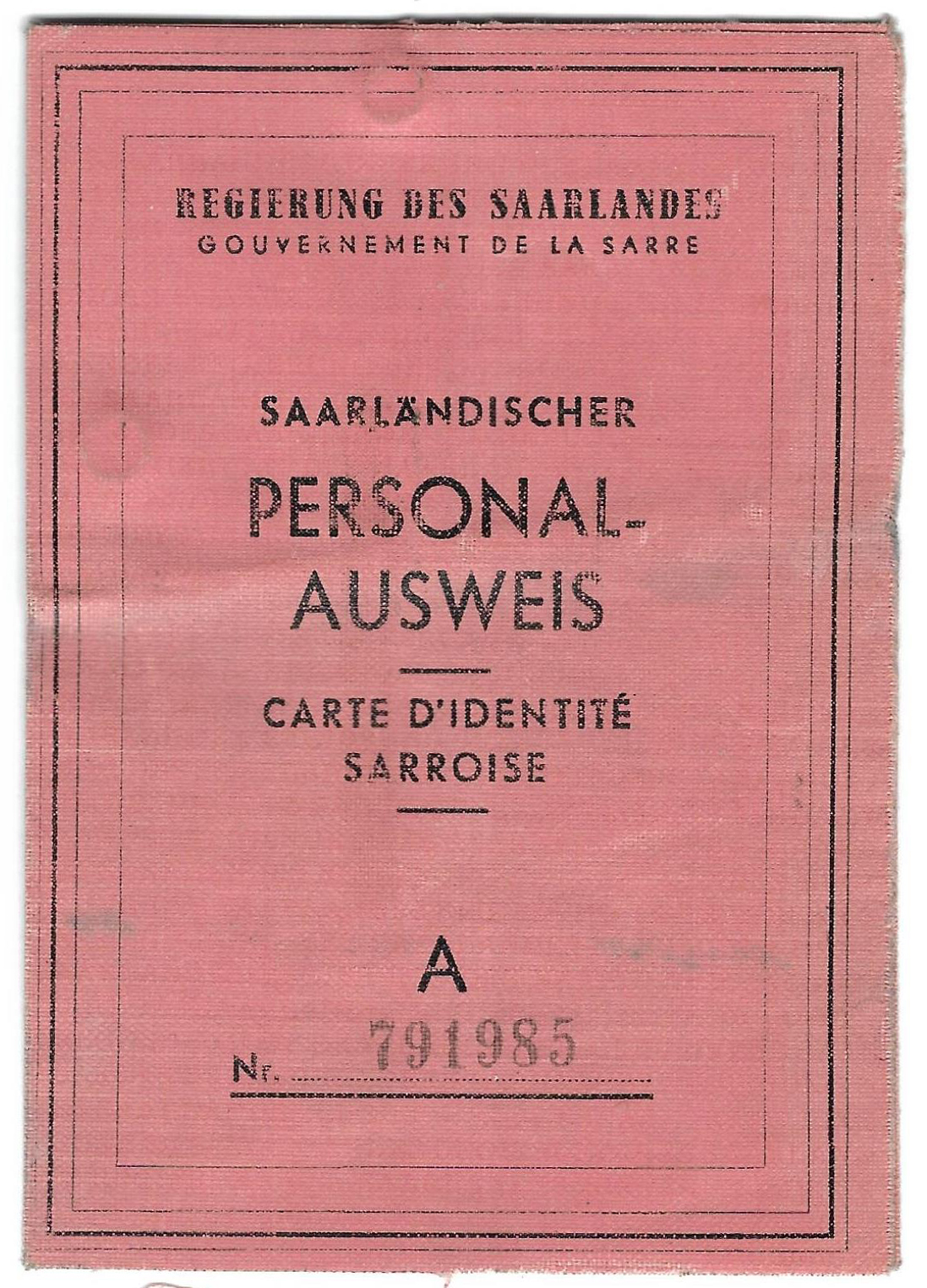


Geography and administrative structure
Saarland covers roughly 2,500–2,600 km² and is dominated by river valleys and low hills, with the Saar River as a central feature. It borders the German states of Rhineland-Palatinate and direct international neighbours France and Luxembourg. The state is administratively divided into several districts and the regional centre around Saarbrücken. Official status as a Bundesland places it within the federal system of Germany.
History and political development
Saarland’s location at the Franco‑German frontier has shaped its modern history. After both world wars its sovereignty was contested and it experienced periods of economic administration by France and international bodies. The political reunification with the Federal Republic of Germany was settled in the mid‑20th century following a referendum; since then Saarland has been integrated into the German federal and economic system. For historical context and timelines consult sources linked at regional history and post-war period.
Economy, culture and language
Historically driven by coal and steel industries, Saarland has diversified into automotive supply, precision engineering and services. Local culture bears French influences in cuisine, bilingual place names, and dialects (e.g., Saarländisch). Saarbrücken is the cultural and economic hub, with universities, theatres and cross-border commerce. More on contemporary economy is available at economic profile.
Notable places and distinctions
- Saarbrücken — capital and largest city.
- Völklingen Ironworks — a UNESCO World Heritage industrial site and a symbol of the region’s steel past.
- Other towns: Neunkirchen, Homburg, Merzig — centers for industry and regional services.
Saarland remains strategically significant as a bridge between German and French culture and economies. For official information and visitor guidance see regional resources.
Geography
Location
The Saarland is located in the extreme southwest of Germany. It covers parts of the Hunsrück with the Black Forest, the Lorraine strata and the Saar-Nahe mountain region. With an area of 2,569.69 square kilometres, it has established itself in the German-speaking world as a benchmark for medium-sized disaster events, such as forest fires or floods. Other important areas are the Saar and Bliesgau with their fertile limestone soils.
Geology
The Saarland shows a high heterogeneity both geologically and geomorphologically. The Saarbrücker Sattel, which is bedded from northeast to southwest and in which Carboniferous rocks come to the surface, adjoins sedimentary and magmatic rocks of the Permian to the north and northeast. Bordering these Permian rocks to the north is the Hunsrück, which forms the southern margin of the Rhenish Slate Mountains. To the northeast, the Permian rocks border the Mainz Basin, a lateral extension of the tectonically formed Upper Rhine Plain. The Saarbrücken Saddle is bordered in the south, southeast and west by Triassic rocks that are unevenly bedded to each other. Deposits from the Triassic fill the Saargemünd-Zweibrück trough in the southeast of the Saarland. To the southeast they merge into the red sandstone mountains of the Vosges and to the east into the Palatinate Forest. In the west and southwest of the Triassic areas of the Saarland are deposits of the Paris Basin from the younger Mesozoic.
Surveys
The highest elevation is the Dollberg (695.4 m) north of Nonnweiler, the second highest is the Schimmelkopf (694.8 m) north of Weiskirchen. The most important elevation, however, is the Schaumberg in Tholey with its lookout tower, which is considered the local mountain of the Saarland, probably due to its tradition as the highest mountain of the former Saar region. It is relatively low at 569 metres, but stands alone in a rather flat environment.
Vegetation
One third of the area of Saarland is covered with deciduous mixed forest. This means that Saarland, together with Hesse and Rhineland-Palatinate, has the largest forest area in Germany in percentage terms. In addition, deciduous forest takes up the largest share of the total forest area here compared to all other federal states.
Waters
The longest river in Saarland is the Blies, of whose 99.5 km of course lie in the state, whereas only 68 km of the course of the eponymous Saar lie in the state. The Blies rises in the northern Saarland near Selbach and flows into the Saar in the south as a border river near Saargemünd (France). Other important rivers are the Moselle, Prims, Nied, Nahe and Rossel. In the north there are also the Bostalsee and the Losheimer Stausee.
Almost 95 % of the area of Saarland belongs to the catchment area of the Saar-Moselle river system. The remaining 5 % of the state's territory in the northeast belonged to the Glan-Nahe drainage area.
See also: List of lakes in Saarland
Climate and precipitation
The climate is temperate oceanic. The average annual precipitation is 800 millimeters. The Saarland is one of the warmest regions in Germany.
![]()
Commons: Precipitation graphs - Collection of images, videos and audio files
Landscapes
In addition to the political division into municipalities and into the Saarland districts, the following landscapes and areas can be described. They are characterized by a relatively uniform appearance in demarcation to neighboring landscapes and areas, which often arose from common political-historical or economic contexts (especially agriculture, industrialization):
- Bliesgau
- Köllertal
- Eastern Valley
- Saargau
- Saar Coal Forest
- Black Forest
- Sankt Ingbert-Kirkel forest area
- St. Ingbert Valley
- Saint Wendel region
- Warndt
See also: List of natural units in Saarland

History
→ Main article: History of the Saarland
→ Main article: Duchy of Saarland
→ Main article: Province de la Sarre
→ Main article: Département de la Sarre
→ Main article: Saar region
→ Main article: Saarland 1947 to 1956
Today's Saarland was formed as a political entity on January 10, 1920, after administrative and constitutional predecessors in the early Middle Ages and early modern times, from areas that had belonged to the Prussian or Bavarian territories since the Congress of Vienna.
After the Second World War and even before the founding of the state of Rhineland-Palatinate on August 30, 1946, 142 municipalities with just under 900 square kilometers and around 100,000 inhabitants were separated from the administrative district of Trier and annexed to the Saarland on August 1, 1946, extending the Saarland's territory to the Hunsrück and the Moselle. Less than a year later, however, on June 8, 1947, the French government had to take into account the opposition of the governments of the United States and Great Britain to this unilateral territorial change and return 61 municipalities of the Saarburg and Trier districts. However, areas of the expansion of August 1, 1946 in the northeast that had been part of the Grand Duchy of Oldenburg (exclave of the Principality of Birkenfeld) and the Duchy of Saxe-Coburg and Gotha (Principality of Lichtenberg) in the 19th century, as well as the border area to the Grand Duchy of Luxembourg in the northwest, remained with the Saarland. In addition, on June 8, 1947, the Saarland territory was expanded in the northeast to include 13 Rhineland-Palatinate municipalities. In the east of the Saarland, small territorial parts of Rhineland-Palatinate were added on 23 April 1949.
In the time before the French Revolution, the four most important dominions in the area of today's Saarland were the Electorate of Trier, the Duchy of Lorraine, the Wittelsbach Duchy of Palatinate-Zweibrücken and the County of Saarbrücken. These four dominions are also reflected in today's coat of arms.
The independent territories in the area of today's Saarland before the French Revolution had always been German-speaking since the early Middle Ages, but were always temporarily under French influence, especially in the late 17th century during the French Reunions and in the period between the Coalition Wars and the Second Peace of Paris.
Even after the First World War and the Second World War, the country was under French influence. From 1920 to 1935, the "Saargebiet" (as it was then called) was under the administration of the League of Nations, but belonged to the French economic area. On 1 March 1935, following a referendum, the Saar region became part of the German Reich again, initially under the name Saarland.
After the Second World War, the Saarland initially belonged to the French occupation zone before being removed from the jurisdiction of the Allied Control Council in January 1946. In 1947, its own constitution and citizenship were created. The Saarland was briefly given its own currency, the Saar-Mark, on 16 June 1947 for monetary reasons. It was replaced by the French franc on 20 November 1947. It also minted its own coins with German inscriptions and Saarland-related motifs, but these were denominated in French francs (see illustration). Once again, the Saarlanders held a special position for over a decade. This time they also participated with their own teams in the 1952 Summer Olympics as well as in the qualification for the 1954 World Cup.
On October 23, 1955, a referendum was held on the Europeanization of the Saarland, in which 67.7 percent of the voting Saarlanders said "no", thus opposing the (second) Saar Statute negotiated by the Adenauer government with the French government. The result of the vote was interpreted as the will of the Saarland population to join the Federal Republic of Germany. The French government relented, and on 27 October 1956 the Saar Treaty was concluded in Luxembourg, whereupon the Saarland became the tenth federal state of the Federal Republic of Germany on 1 January 1957. The economic annexation, including the adoption of the Deutschmark, was completed on 6 July 1959, the so-called "Day X".
In 2012, Saarland applied for its own top level domain .saarland as part of the application process for new generic top level domains (gTLD), which was awarded to dotSaarland GmbH in September 2014. The project is supported by the government of Saarland, which was able to reserve domain names for free. In addition, the non-profit association dotSaarland e.V. supports the TLD. Besides Saarland, the federal states of Bavaria, Berlin, Hamburg and NRW have their own TLDs.


Questions and answers
Q: What is Saarland?
A: Saarland is a state (Bundesland) of Germany.
Q: How big is Saarland?
A: Saarland has an area of 2,568.45 km2 (991.7 sq mi).
Q: How many people live in Saarland?
A: As of 2011, there were 1,014,000 people living in Saarland.
Q: Where is Saarland located?
A: Saarland is located in the south-west of Germany and is near the French border and Metz.
Q: What is the capital of Saarland?
A: The capital of Saarland is Saarbrücken.
Q: How do you pronounce Saarland?
A: Saarland is pronounced as /ˈsɑːrlænd/ or /ˈzɑːr-/ in the US, [ˈzaːɐ̯lant] in German (listen), Sarre [saʁ] in French, and Saarlond in Rhine Franconian.
Q: What language is spoken in Saarland?
A: German is the official language of Saarland, but some people may speak French or Rhine Franconian dialects.
Related articles
Author
AlegsaOnline.com Saarland: Germany’s Small Border State with a Unique History Leandro Alegsa
URL: https://en.alegsaonline.com/art/85074