
Rügen: Germany's Largest Island — geography, history, and tourism
Rügen is Germany's largest island in Mecklenburg-Western Pomerania, famed for chalk cliffs, Baltic beaches, seaside resorts like Binz, mixed coastal landscapes and a long history from Slavic roots to modern tourism.
Overview
Rügen is the largest island in Germany, lying off the country's northeastern coast in the Baltic Sea. Covering about 926 square kilometres, the island combines sandy seaside resorts, lagoons, beech woods and chalk cliffs. Its permanent population is modest compared with the many visitors who come for seasonal holidays; a past census counted roughly 77,000 residents.
Image gallery
10 Images


Geography and natural features
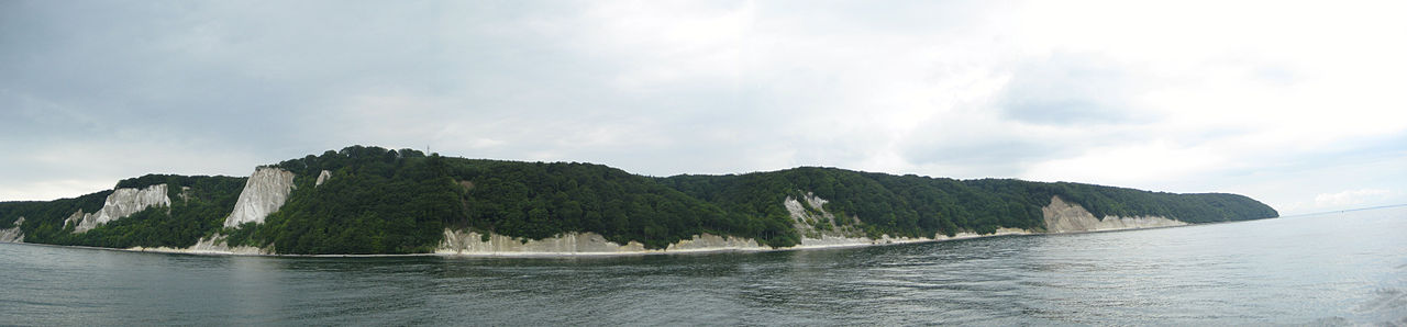
The island's shape is irregular, with several long peninsulas and bays that create a fragmented coastline of open beaches and sheltered shallow waters known locally as Bodden. Notable landscapes include the white chalk cliffs of the Jasmund peninsula, extensive beech forests, reed beds and dune systems. Jasmund National Park protects some of the best-known coastal scenery and its geological exposures.
History and origins
Human settlement on Rügen goes back many centuries. In the early Middle Ages the area was inhabited by West Slavic tribes often referred to as the Rani or Rugians. Over time the island came under the influence of Danish, Pomeranian and later German principalities, and it became integrated into modern state structures. Traces of this layered past survive in place names, ruins and local traditions.
Towns, architecture and culture
Several towns and villages serve as administrative, cultural and tourist centres. Bergen auf Rügen is the island's administrative hub, while other well-known places include:
- Binz — a classic seaside resort with nineteenth-century resort architecture (Bäderarchitektur)
- Sassnitz — a harbour town and ferry point
- Sellin, Göhren, Putbus and Garz — smaller resorts and historic towns
Rügen has a strong tradition of coastal tourism reflected in promenades, piers and historic villas, alongside local crafts and fishing culture.
Tourism, economy and uses
Tourism is the island's dominant industry: beaches, wellness spas, hiking trails and natural parks attract domestic and international visitors. Agriculture, small-scale fishing and services support the local economy. The island is also used for outdoor recreation such as cycling, birdwatching and sailing.
Transport, conservation and notable facts
Rügen is connected to the mainland by road and rail links near Stralsund, making it accessible for day trips and longer stays. Conservation efforts balance visitor pressure with habitat protection, especially in national parks and nature reserves. The combination of geological features, coastal ecosystems and resort culture makes Rügen one of the Baltic coast's most distinctive destinations.
Geology
Together with the Danish island of Møn on the opposite side of the Baltic Sea to Rügen, Rügen was once part of a larger plateau of chalk limestone that had been pushed to the earth's surface by tectonic movements. By far the largest part of this land mass has disappeared again through erosion and faulting, leaving the two islands with their characteristic chalk cliffs.
Geography
The northern part of the Greifswald Bodden, the Rügischer Bodden, is a large bay in the south of Rügen. The island of Vilm is located off the coast here. At the western end of the bay stretches the peninsula Zudar with the southernmost point of Rügen (Palmer Ort); at the eastern end the peninsula Mönchgut, again strongly indented, rises into the sea. This peninsula ends in the east at Cape Nordperd near Göhren and in the south at Cape Südperd near Thiessow. In the west of the Mönchgut peninsula, a five-kilometre-long narrow headland, the Reddevitzer Höft, divides the two bays Having and Hagensche Wiek.
The northeast of the island of Rügen is formed by the Jasmund peninsula, which is connected to the core island "Muttland" by the spit Schmale Heide between Binz-Prora and Sassnitz-Mukran and a railway and road embankment near Lietzow. The Schmale Heide separates the outer bay of the Prorer Wiek from the Kleiner Jasmunder Bodden. On the peninsula Jasmund are with the Piekberg (161 m above sea level) the highest elevation and with the Königsstuhl, a 118-meter-high chalk cliff of the Stubbenkammer, the most prominent landmark of the island of Rügen. Another spit, the Schaabe, connects Jasmund with the peninsula Wittow in the north of Rügen. The Schaabe in turn separates the outer bay of the Tromper Wiek from the Great Jasmund Bodden. The Wittow peninsula and the long and narrow Bug peninsula to the west are separated from the main part of Rügen by the Rassower Strom, the Breetzer Bodden and the Breeger Bodden. The peninsula Wittow closes to the north with Cape Arkona. Barely one kilometre to the northwest at 54° 41' n. Br. is the northernmost point of Mecklenburg-Vorpommern. In front of this cliff (Gellort), the Siebenschneiderstein - the fourth largest erratic boulder in Rügen - lies on the shore.
The northwest and west side of the island of Rügen is also strongly indented, but somewhat flatter. The islands of Hiddensee and Ummanz as well as the smaller islands of Öhe, Liebitz and Heuwiese are offshore. Due to sand erosion and sand accumulation in the Baltic Sea, the shipping channels north and south of the island of Hiddensee must be constantly dredged, otherwise Hiddensee would "grow together" with Rügen within a few years.
The middle of Rügen is only slightly hilly, the area is mainly characterized by agriculture. East of the city of Bergen on Rügen, 90 m above sea level are reached (Rugard with observation tower) and in the southeastern hill country of Granitz 107 m above sea level. The soil on Rügen is very fertile and productive, especially on Wittow, the granary of the island. In addition, there are large cabbage growing areas. Rügen is littered with many erratic blocks, of which the 22 largest are legally protected geotopes (see also: erratic blocks around and on Rügen).

enlarge and show information about the picture

Panoramic view over Rügen from the Granitz hunting lodge
Locations
The central place and middle centre of Rügen is the town of Bergen. Basic centres are the towns of Binz, Garz, Putbus, Sagard, Samtens, Sassnitz and Sellin / Baabe. Other municipalities with over one thousand inhabitants (as of December 2013) are Altefähr near Stralsund, Dranske, Gingst, Poseritz and Wiek. The city of Stralsund acts as the main centre for the island of Rügen.
Many places on Rügen are of tourist importance, especially near attractions such as Cape Arkona (Putgarten), castles, cultural events (Ralswiek) and near water. Traditional houses with thatched roofs as well as plaster, fieldstone and brick facades are often typical for rural places, while sophisticated spa architecture prevails in the time-honoured seaside resorts.
· 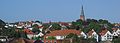
Bergen on the island of Rügen
· 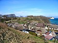
Vitt on Cape Arkona
· 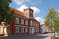
Primary school Garz
· 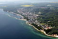
Sassnitz
· 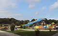
Rügenpark in Gingst
· 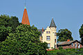
Altefähr near Stralsund


Related articles
Author
AlegsaOnline.com Rügen: Germany's Largest Island — geography, history, and tourism Leandro Alegsa
URL: https://en.alegsaonline.com/art/84664