
Rovaniemi — regional capital of Finnish Lapland
Rovaniemi is the administrative centre of Lapland in northern Finland on the Arctic Circle, known for Arctic research, winter tourism, Santa Claus attractions, and post‑war reconstruction.
Overview
Rovaniemi is the administrative and commercial centre of Lapland in northern Finland. The town lies close to the Arctic Circle and functions as a hub for public services, higher education and nature‑based tourism. It has a small urban population by international standards but covers a very large municipal area following a merger with surrounding rural territory.
Image gallery
10 Images


Characteristics and environment
Rovaniemi experiences a subarctic climate with long, cold winters and short, bright summers. The high latitude produces prolonged winter darkness and the midnight sun in midsummer; fair, clear nights often bring displays of the northern lights. The surrounding landscape combines river valleys, pine forests and marshland that support reindeer herding and outdoor recreation.
History and urban development
The modern town grew from a market and river crossing into a regional capital. Much of the city centre was destroyed during the Second World War; the post‑war rebuilding followed a plan by notable Finnish architects and gave Rovaniemi a compact, planned core. In 2006 the former rural municipality of Rovaniemi was merged into a single municipality, greatly expanding its administrative boundaries.
Economy, education and culture
Services, public administration and tourism are the main economic drivers. The University of Lapland and research institutions give the town an academic profile. Cultural attractions include museums and centres that interpret Arctic nature, Sámi culture and regional history. Visitors often combine sightseeing with outdoor activities such as skiing, snowmobiling and guided aurora tours.
Tourism and notable sites
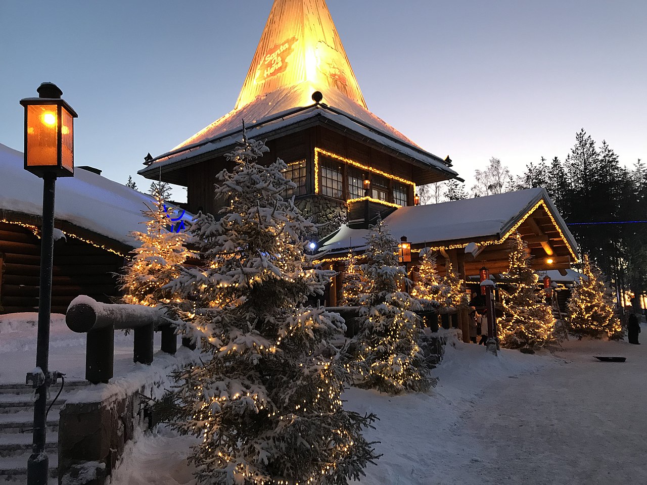
- Santa Claus Village and other Arctic tourist attractions that market the city's proximity to the Arctic Circle.
- Regional museums and science centres interpreting northern nature and human settlement.
- Outdoor opportunities: hiking, cross‑country skiing, reindeer and husky experiences.
Location and neighbours
The modern municipality is large on a European scale and borders several neighbouring municipalities and districts. Nearby municipal neighbours include Kittilä, Sodankylä, Kolari, Pello, Ylitornio, Tervola, Ranua, Posio, Kemijärvi and Pelkosenniemi. This position makes Rovaniemi a crossroads for travel and logistics within northern Finland.
For practical information on transport, research institutions and visitor services consult regional guides and official municipal sources. Many visitors reach Rovaniemi by air or rail and use the town as a base for exploring Lapland's natural and cultural attractions.
Geography
Location and extent
Rovaniemi is centrally located in the Lapland landscape in the far north of Finland. The city centre lies at the confluence of the Ounasjoki and Kemijoki rivers just a few kilometres south of the Arctic Circle.
Besides the actual core city, where more than 80 % of the inhabitants live, the administrative urban area of Rovaniemi covers a very wide area of 8017 km² (more than three times the area of Luxembourg) since the incorporation of the rural municipality of Rovaniemi. This makes Rovaniemi the largest city in Europe in terms of area. However, most of this area is very sparsely populated. This results in a low population density of 7.2 inhabitants per square kilometre for the whole of Rovaniemi.
Rovaniemi's neighbouring municipalities are Ranua to the south, Tervola to the southwest, Ylitornio and Pello to the west, Kolari to the northwest, Kittilä and Sodankylä to the north, Kemijärvi to the east and Posio to the southeast. Rovaniemi has merged with the municipality of Ranua to form the administrative community of Rovaniemi. The nearest major city is Oulu 207 km to the south, and the distance to the capital Helsinki is 815 km.
| Rovaniemi | ||||||||||||||||||||||||||||||||||||||||||||||||
| Climate diagram | ||||||||||||||||||||||||||||||||||||||||||||||||
| ||||||||||||||||||||||||||||||||||||||||||||||||
| Monthly average temperatures and precipitation for Rovaniemi
Source: WMO | ||||||||||||||||||||||||||||||||||||||||||||||||||||||||||||||||||||||||||||||||||||||||||||||||||||||||||||||||||||||||||||||||||||||||||||||||||||||||||||||||||||||||||||||||||||||||||||||||
Landscape and nature
In terms of landscape, the urban area of Rovaniemi belongs to the transition area of the Peräpohjola region to Lapland proper. The landscape is characterised by forests and bogs. The predominant tree species are pine (62 %) and spruce (22 %), with deciduous trees accounting for 16 %. About 5 % of the city area consists of inland waters. Unlike most of Finland, the Rovaniemi area is poor in large lakes. On the other hand, the two mighty rivers Kemijoki and Ounasjoki, some of which have widened into lakes, dominate the landscape. At the time of the snowmelt in spring there are regular floods.
Rovaniemi belongs to the area of the Finnish Hills (Vaara-Suomi). Accordingly, the hills in the city area are rather flat and forested, in contrast to the fells in more northern Lapland. The highest elevation is the 358 meter high Kaihuanvaara. Far better known is the 204 m high Ounasvaara. Rovaniemi's local mountain rises directly opposite the city centre and is a popular recreational destination for the inhabitants. Another well-known natural monument is the 16-metre-high Auttiköngäs waterfall in southeast Rovaniemi.
City breakdown
The urban area of Rovaniemi is divided into the urban centre and the rural hinterland. For statistical purposes, Rovaniemi is divided into six municipalities (suuralue), which are further subdivided into small statistical areas. The population is distributed among the municipalities and statistical areas as follows:
|
|


History
Previous story
The first human settlement spread in the Rovaniemi area after the retreat of the glaciers towards the end of the last ice age between 7000 and 5800 BC. A wooden moose head found in Lehtojärvi near Rovaniemi, which probably served as a bow ornament for a boat, is dated to around 5800 BC. The indigenous people lived by hunting and fishing on Lake Ancylus, which was formed by glacial meltwater and covered parts of the present-day town area.
The Sami (Lappish) population of Lapland was formed by mixing the Stone Age indigenous population and the Finno-Ugrians who migrated from the 3rd millennium BC onwards, and this population remained predominant in Rovaniemi for a long time. From the early Middle Ages, sedentary farming Finns settled in the Kemijoki river valley. Finnish settlement advanced to the heights of Rovaniemi in the 11th century. The place names in the Rovaniemi area indicate that these new settlers came mainly from Häme and Satakunta counties. With Finnish immigration and the adoption of arable culture, the semi-nomadic Sámi were gradually pushed back or assimilated. However, parts of Rovaniemi remained Sami populated until the 18th century.
Swedish and Russian times
In the High Middle Ages, the influence of the Swedish Empire in Lapland increased. Although the area was nominally part of Novgorod's sphere of power under the terms of the Treaty of Gothenburg of 1323, the Kemijoki valley was incorporated into the ecclesiastical administration of the Swedish diocese of Turku as the parish of Kemi in the early 15th century. The name Rovaniemi is first recorded in a land purchase deed from 1453. The name is often derived from the Sami word roavve for a wooded ridge or swidden area. From Peräpohjola dialects of Finnish, rova is also known as an accumulation of stones or rocks, especially near rapids. Niemi is Finnish for "peninsula" or "headland".
At the beginning of the 17th century Rovaniemi became a chapel parish of Kemi parish. A first church was built in 1605-11 but burnt down shortly after during a Karelian raid. The church was rebuilt by 1622 and replaced by a new successor building as early as 1688. In 1785 the chapel parish of Rovaniemi was elevated to an independent parish.
Independence
In 1929, the centre of Rovaniemi gained municipal independence as a market town (kauppala). The surrounding area was transformed into the rural municipality of Rovaniemi (Rovaniemen maalaiskunta). In 1938 the province of Lapland was formed from the northern areas of Oulu province. While the largest city, Kemi, had hopes of becoming the capital of the province, Rovaniemi was chosen because of its more central location.
During the Winter War, the Soviet Union attacked Finland in 1939. The Soviet air force bombed Rovaniemi several times, but the ground forces could only penetrate from the east to the village of Joutsijärvi in Kemijärvi and Pelkosenniemi (about 100 km east of Rovaniemi).
In the ensuing Continuation War from 1941 to 1944, Rovaniemi was a centre of German command and logistics in Lapland. Around 15,000 German soldiers were stationed in the city at this time. After Finland changed sides, the Wehrmacht left using scorched earth tactics. In the city of Rovaniemi, which consisted of wooden houses, the Wehrmacht systematically destroyed public and military buildings. A train loaded with ammunition also exploded in the railway station of burning Rovaniemi. From October 11 to 14, 1944, this destroyed about 90% of the city's building fabric. The approximately 25,000 civilians in the city had been evacuated the day before, along with their livestock. The 2,500 or so German soldiers who fell in what is now northern Finland are now buried in the Norvajärvi military cemetery, a peninsula about 19 kilometres north of the centre of Rovaniemi.
The town was rebuilt in 1952. The market town was not granted municipal status until 1960. At the beginning of 2006, the town and the rural municipality of Rovaniemi reunited to form the town.

Related articles
Author
AlegsaOnline.com Rovaniemi — regional capital of Finnish Lapland Leandro Alegsa
URL: https://en.alegsaonline.com/art/84375