
Roseland Peninsula, Cornwall
A rural peninsula in south Cornwall, England, known for its sheltered harbours, fishing villages such as St Mawes and St Just in Roseland, coastal walks, mild climate and disputed inland boundary near Tregony.
Overview
The Roseland Peninsula is a small, largely rural headland in the southern part of Cornwall in the Cornwall region of the United Kingdom. It sits at approximately 50°10′N 5°00′W and projects into the English Channel. The area is prized for its sheltered coves, shallow estuaries and relatively mild coastal microclimate, which supports a mixture of maritime flora and cultivated gardens.
Image gallery
5 Images



Settlements and landscape
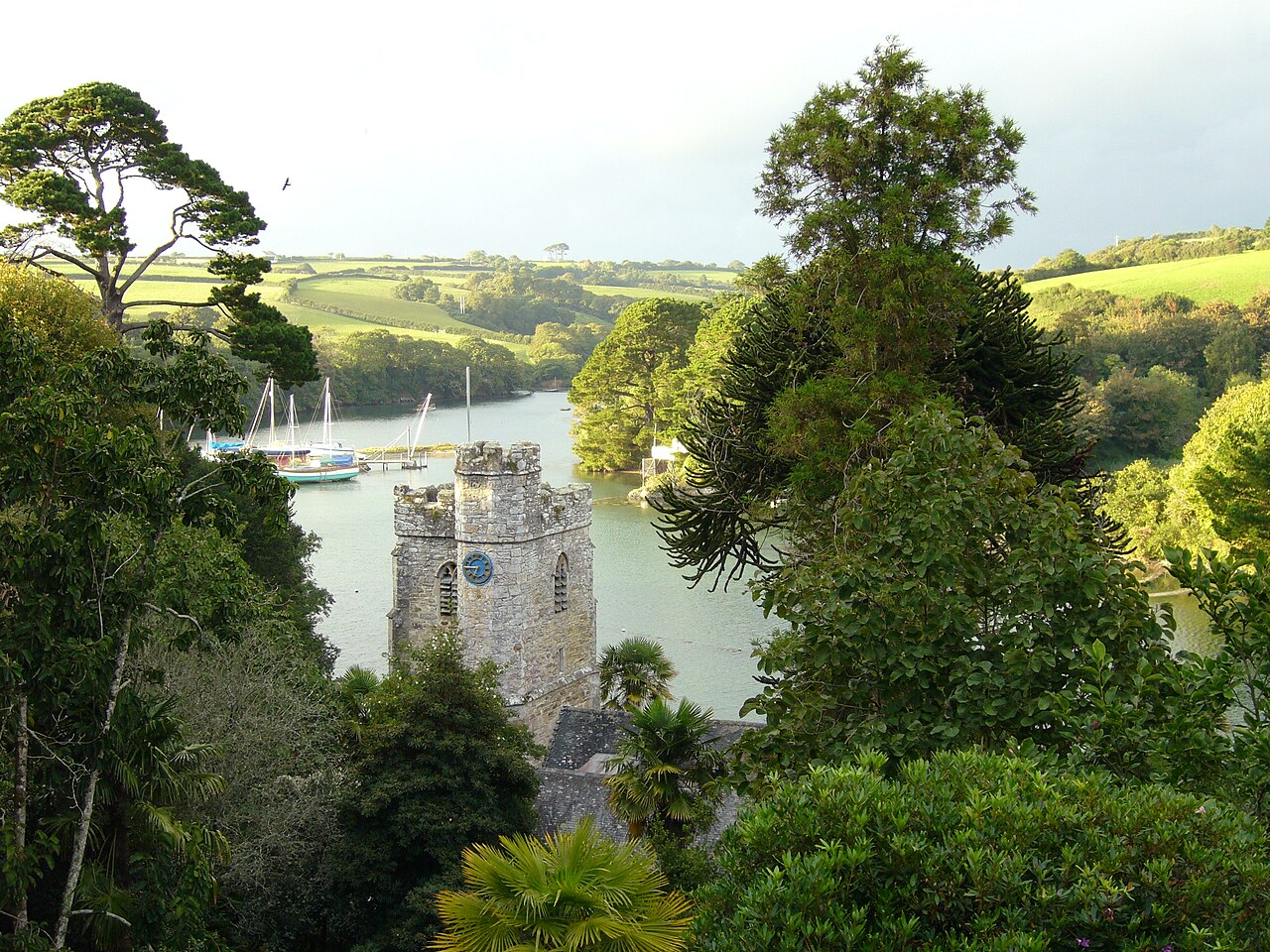
Roseland contains several small towns and villages, the best known being St Mawes, a harbour settlement popular with sailors and tourists. Other communities often associated with the peninsula include St Just in Roseland, Gerrans and Portscatho. The exact inland limit of the peninsula is debated locally: some definitions extend north to include the village of Tregony, while others draw the boundary closer to the coast.
The peninsula is bounded by tidal waterways, most notably the estuary of the River Fal, and is fringed by farmland, heath and rocky shoreline. The South West Coast Path follows the coastline, offering views of cliffs, coves and historical sites.
History and notable features
The name Roseland is thought to derive from the Cornish word "ros", often used for headlands or promontories. The peninsula preserves a range of historic features, including coastal fortifications and small medieval churches. St Mawes Castle, a well‑known Tudor artillery fort, guards one side of the mouth of the Fal and is a frequent destination for visitors.
Uses and visitor information
Today the Roseland Peninsula is valued for tourism, sailing and horticulture. Its mild climate has encouraged a number of notable gardens and early subtropical plantings, alongside farms producing dairy and mixed crops. Conservation organisations and local authorities manage several reserves and footpaths to balance public access with habitat protection.
Practical notes and distinctions
- Access: ferries, minor roads and coastal paths link the peninsula to other parts of Cornwall.
- Character: quiet villages, working harbours and scenic rural coastline rather than large urban development.
- Boundary issues: whether places such as Tregony belong to Roseland varies by map and local usage.
For maps and route details consult local guides and conservation organisations; the South West Coast Path and local heritage sites provide good introductions to the peninsula's landscape and history.
Questions and answers
Q: What are the coordinates of the Roseland Peninsula?
A: The coordinates of the Roseland Peninsula are 50°10′N 5°00′W.
Q: Where is the Roseland Peninsula located?
A: The Roseland Peninsula is located in west Cornwall in the United Kingdom.
Q: What towns and villages are located in the Roseland Peninsula?
A: The Roseland Peninsula contains the town of St Mawes and villages such as St Just in Roseland and Gerrans.
Q: Is the Roseland Peninsula connected to the rest of Cornwall?
A: No, the Roseland Peninsula is separated from the rest of Cornwall by the River Fal.
Q: What is the body of water located to the east of the Roseland Peninsula?
A: The body of water located to the east of the Roseland Peninsula is the English Channel.
Q: Is there disagreement about where the peninsula begins?
A: Yes, there is some disagreement about where the peninsula begins, with some including the village of Tregony in Roseland and others not including it.
Q: What is Roseland?
A: Roseland is a district of west Cornwall.
Related articles
Author
AlegsaOnline.com Roseland Peninsula, Cornwall Leandro Alegsa
URL: https://en.alegsaonline.com/art/84169