Romney Marsh — coastal lowland of Kent and East Sussex
Romney Marsh is a low-lying coastal wetland in southeastern England known for reclaimed farmland, salt-making history, military defences and distinctive wildlife and towns.
Overview
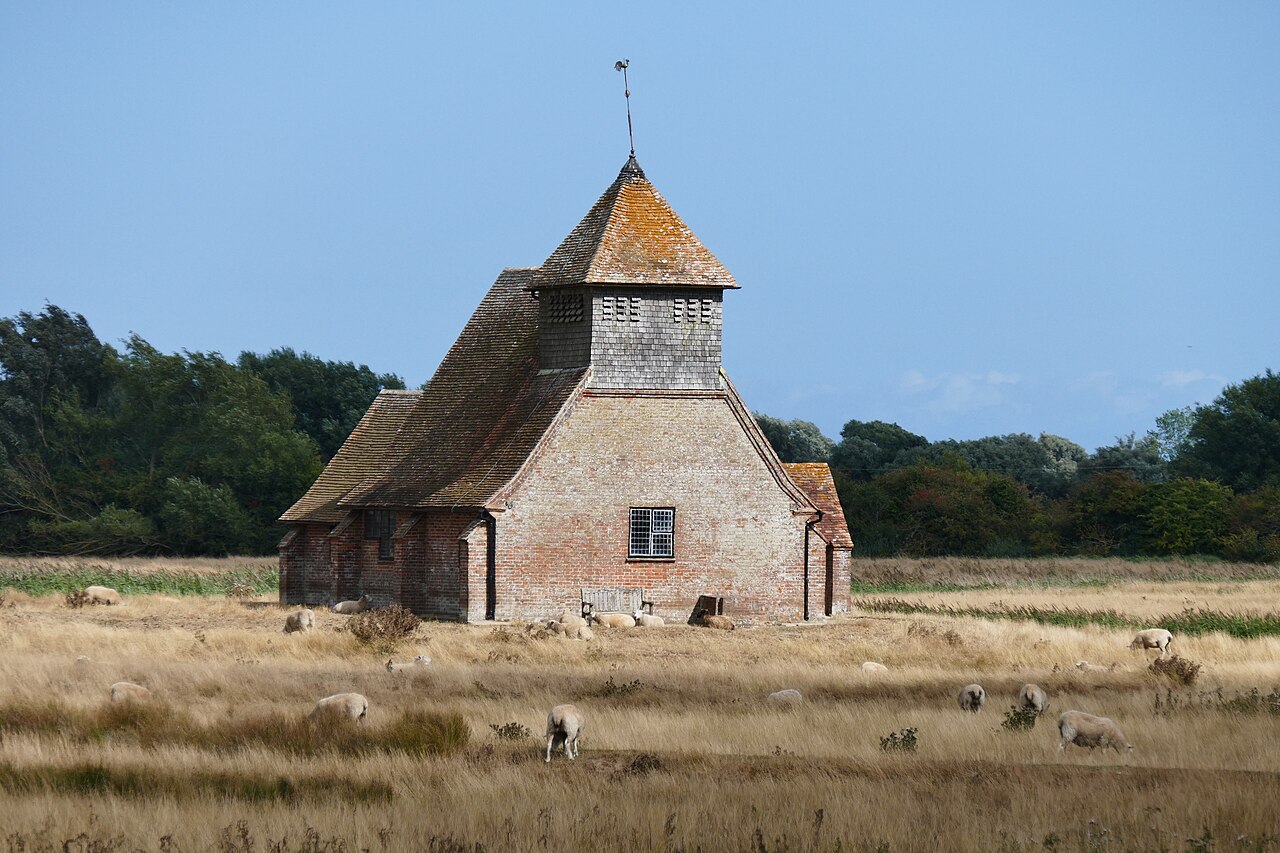
Romney Marsh is a broad, low-lying coastal plain that stretches across the counties of Kent and East Sussex in southern England. The area combines salt marshes, grazing marsh, ditches and drained farmland and has been shaped by centuries of interaction between sea and land. Although much of the marsh is now agricultural, it retains characteristic wetland features and a long human history of settlement, industry and coastal defence. Visitors today find a landscape of open sky, networked drainage channels and scattered villages.
Image gallery
10 Images


Geography and landscape
The marsh runs roughly from Hythe in Kent to Rye in East Sussex and covers an area of around 100 square miles (roughly 260 km²). As a coastal plain it functions as a classic marshland zone in southern England. Historically it was bordered by a lagoon protected behind a shingle bank at places such as Dymchurch, and the marsh remains closely linked to local tidal and freshwater systems, including the River Rother and man-made waterworks. Because the English Channel is at its narrowest in this sector, the coastline here is among the closest points to France.
Characteristics and human modification
Over many centuries the marsh has been extensively reclaimed and drained into productive arable and pasture land. The conversion involved building sea defences, straightening channels, digging drainage ditches and creating ridges for settlement. A prominent engineered feature is the Royal Military Canal, begun in the early 19th century and completed in 1809 as a defensive and drainage measure. The flat land and rich soils have supported mixed farming, while traditional grazing maintained the open character of the marsh. The area gave its name to the well-known Romney breed of sheep, valued for its hardiness on coastal pasture.
History and economy
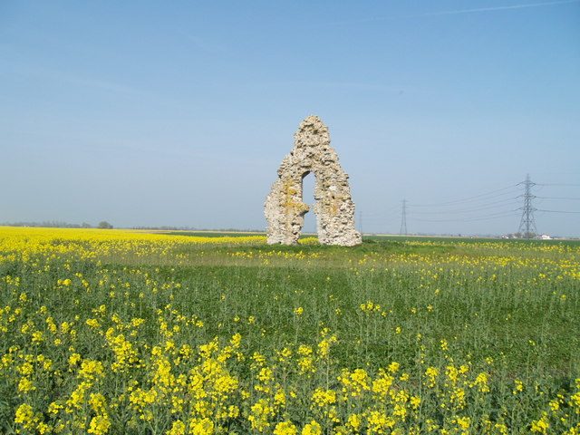
The marsh has a long human story. In Roman times the coastal flats were used for salt-making: seawater or brackish lagoon water was evaporated in pans so the salt could be collected for food and trade. Later medieval communities built ports and fishing settlements; several places here were among the historic Cinque Ports. Because the coastline moved and silted up, some former ports are now set well inland — for example New Romney was once on the sea but now lies some way from the shore. The marsh’s position made it vulnerable to maritime raiding and occasional invasion: historical sources record incursions by Danish fleets in the early medieval period.
Ecology and public interest
Although reclamation reduced the area of wet habitat, Romney Marsh still supports specialist plants, salt-tolerant communities and important bird populations, especially on remaining reedbeds, grazing marsh and shingle areas. Conservation groups and local authorities manage fragments of habitat and maintain traditional grazing to preserve biodiversity. The marsh, alongside other English wetlands such as the Fens and the Somerset Levels, illustrates how water, land use and human engineering interact in lowland Britain.
Towns, flood defences and notable facts
- Historic towns and ports in or beside the marsh include Winchelsea, Rye, Hythe and New Romney.
- Key waterworks and defences: the Royal Military Canal (completed 1809), sea walls, shingle ridges and a network of drainage ditches and sluices.
- Public health and environment: before modern drainage and sanitation the marshy conditions contributed to fevers in the past; historic accounts link marshes to outbreaks such as malaria in some low-lying parts of Europe.
- Cultural and economic notes: the area hosted salt production in Roman and medieval times — seawater or shallow lagoon water would be left to evaporate in pans to recover salt — and much land today is flat farmland.
The marsh remains a distinctive and often-visited part of the English coast, notable for its open horizons, wildlife interest and the way its character records the long history of coastal management — from natural lagoons and shingle banks to Roman salt-pans and Napoleonic defences. For readers seeking more detailed topography, history and conservation advice, local archives and conservation organisations provide further material and maps that show how the marsh evolved from a natural lagoon and wetlands to the managed landscape seen today.
Further reading and local guides often cover topics such as drainage schemes, settlement patterns and the marsh’s changing relationship with the sea; they describe how communities adapted to waterlogged soils, occasional flood risk, and the ongoing balance between agriculture, heritage and nature conservation — issues still relevant to low-lying coastal regions worldwide.
Related local links and references: coastal areas, marshland ecology, southern England geography, The Fens, public health history, Roman Britain, Dymchurch shingle, brackish water, evaporation techniques, cross-Channel proximity.
Questions and answers
Q: What is Romney Marsh?
A: Romney Marsh is a coastal marshland of southern England that runs from Hythe in Kent to Rye in East Sussex and covers about 100 miles2 (260 km2).
Q: What are the other two English wetlands?
A: The other two English wetlands are The Fens of East Anglia and the Somerset Levels.
Q: How was Romney Marsh used by the Romans?
A: The Romans used the Romney area for a salt industry, leaving pans of brackish water to evaporate so that they could collect the salt for use in food.
Q: What happened to Romney Marsh before it was drained?
A: Before it was drained, Romney Marsh caused malaria among its inhabitants.
Q: How many ships were part of the Danish fleet that invaded in AD 892?
A: The Danish fleet that invaded in AD 892 consisted of 250 ships.
Q: What protected much of the area around Romney Marsh?
A: Much of the area around Romney Marsh was protected by a shingle beach at Dymchurch.
Q: Which town on the marsh is now considered to be its main centre of population?
A: New Romney is now considered to be the main centre of population on the marsh.
Related articles
Author
AlegsaOnline.com Romney Marsh — coastal lowland of Kent and East Sussex Leandro Alegsa
URL: https://en.alegsaonline.com/art/83939