Romania: geography, history, government and culture
Romania is a Southeastern European country on the Lower Danube and Black Sea, with Carpathian mountains, a Latin-based language, circa 19 million people, EU and NATO membership, and rich natural and cultural heritage.
Overview
Romania is a country in southeastern Europe located where the Lower Danube reaches the Black Sea. It shares land borders with Hungary, Serbia, Ukraine, the Republic of Moldova and Bulgaria, and its territory includes large plains, mountain ranges and a long coastline. The capital and largest city is Bucharest , an administrative, economic and cultural centre with about 1.6 million residents. The country's population is around 19 million, making it one of the larger states within the European Union by both area and inhabitants.
Image gallery
10 Images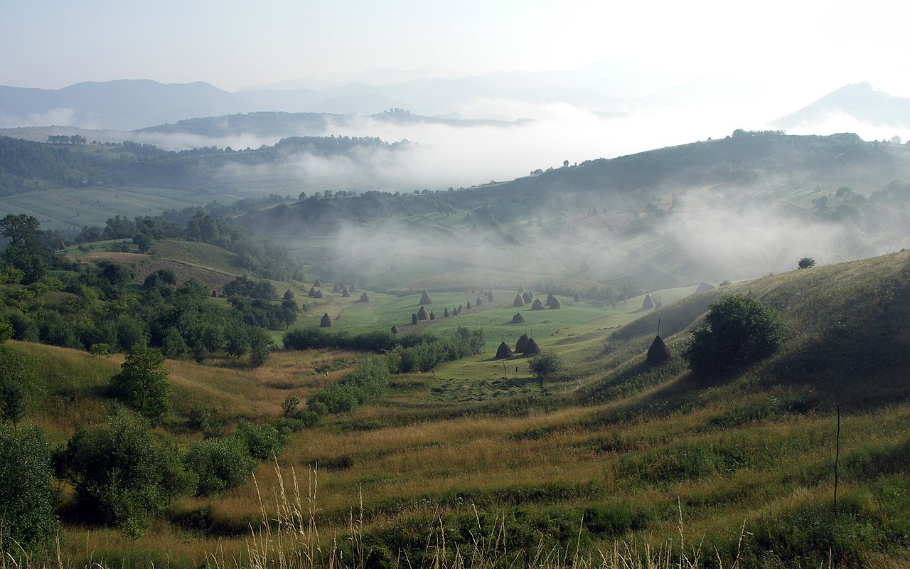


Geography and environment
Romania's relief is diverse: the Carpathian Mountains arc through the centre and northwest, creating alpine and subalpine environments, while broad lowlands and fertile plains lie to the south and east. The Danube River flows along parts of the southern border and forms the Danube Delta where it meets the Black Sea; the delta is notable for its extensive wetlands, birdlife and protected areas. Major historical and geographic regions include Transylvania, Moldavia, Wallachia, Banat and Dobruja. Climate varies from continental inland to milder maritime influences on the coast.
History and development
Romania's modern state has roots in the 19th century. The principalities of Moldavia and Wallachia united in 1859, laying the basis for a Romanian nation-state; formal international recognition of independence followed in 1878. The 20th century brought periods of territorial change, two world wars and, after World War II, decades under a communist regime. A popular uprising in 1989 ended communist rule and opened the country to democratic and economic reforms. Romania joined the North Atlantic Treaty Organization in 2004 and became a member of the European Union in 2007.
Government, economy and society
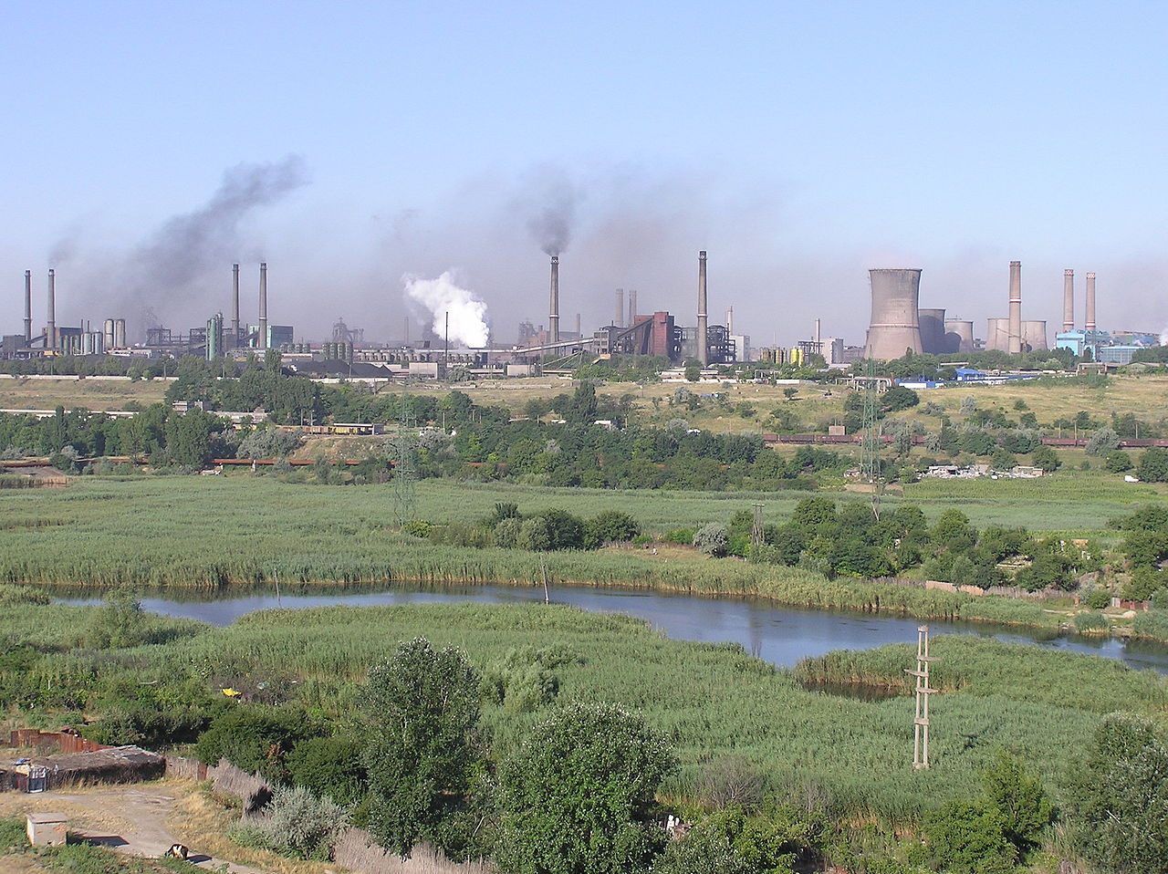
Romania is a unitary state that operates a semi-presidential system: executive authority is shared between a directly elected president and a prime minister accountable to parliament. Since the transition away from centrally planned economy, Romania has developed a mixed, market-oriented economy with important sectors including services, manufacturing, information technology and agriculture. EU membership has influenced reforms in governance, the legal system and human rights; Romania is an active participant in regional and international organisations.
Culture, language and notable features
The Romanian language is a Romance language descended from Latin and written in the Latin alphabet. The majority of the population belongs to the Eastern Orthodox Church, and religious traditions are reflected in festivals, church architecture and folk customs. Romania is known for medieval towns and castles—such as Bran and Peleș—fortified churches, and a rich folklore tradition. Natural attractions include the Carpathian forests, wildlife corridors and the biodiversity of the Danube Delta. Cities such as Sibiu have been recognized for cultural significance, including designation as a European Capital of Culture.
Further reading and external links
- Romanian language
- Country profile
- Southeastern Europe overview
- The Danube River
- Carpathian Mountains
- Black Sea coast
- Danube Delta
- Hungary
- Serbia
- Ukraine
- Bulgaria
- Semi-presidential systems
- Unitary state
- Principality of Moldavia
- Principality of Wallachia
- Independence
- Treaty of Berlin (1878)
- World War II
- Moldova and Bessarabia
- The Iron Curtain
- Democratic reform
- Human rights developments
- Freedom of speech
- Economic reform
- Legal reforms
- European Union membership and statistics
- Bucharest city information
- Bucharest (local names)
- Population figures
- Sibiu
- European Capitals of Culture
- NATO membership
Etymology
→ Main article: Etymology of the terms "Romania" and "Romanian".
The Romanian term România (Romania) comes from român (Romanian), which in turn is a derivative of the Latin romanus (Roman, Roman).
In the 16th century, Italian travellers reported that the inhabitants on the territory of present-day Romania called themselves Romans. In a letter written by the merchant Neacșu in 1521, the principality of Wallachia is referred to as "Romanian Land" (Romanian: Țara românească). The modern equivalent România has been in use since the early 19th century.
Historical documents show the spellings rumân and român to designate the Romanians, which were originally used synonymously. In the 17th century, the predominant form of speech, rumân, took on the meaning serf, while român retained its meaning as the designation of Romanians.
After the abolition of serfdom in the mid-18th century, the form rumân was gradually lost from the language, but in German it is still the root word for Romania.
Geography
Topography
Romania is located in the transition zone between Central, Southern and Eastern Europe.
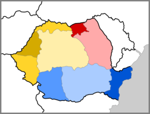
| Historical regions of Romania |
|
(Great W.)
Banat Screech Area Maramuresh |
The state border is 3150 km long. Of these, 1817 km are rivers, mainly the Danube, which demarcates Romania to the south from Bulgaria and to the southwest from Serbia. The Romanian coastline on the Black Sea is 225 km long. The border between Romania and Ukraine to the north and east is interrupted by Moldova. Another external border exists to the west with Hungary.
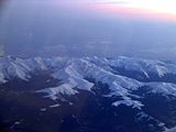
Romania's landscape is made up of about one third each of mountains, highlands and plains. The country's defining mountain range is the Carpathian Mountains, which separate the three historical regions of Moldavia, Transylvania and Wallachia. The geographical centre of Romania is the Transylvanian Highlands, enclosed by the Apuseni Mountains in the west and the Carpathian Arc elsewhere. The Eastern Carpathians form the border with the Moldavian Highlands, which lie in the northeast of Romania.
The Southern Carpathians, the Getian Precarpathians and the Getian Plateau separate Transylvania from the Wallachian Plain. This region can be divided into the Small Wallachia (Oltenia) in the west and the Great Wallachia (Muntenia), which includes the central and eastern parts. Wallachia is bordered to the west by the Banat Mountains. This, together with the Apuseni Mountains and Poiana Ruscă Mountains, forms the so-called Romanian Western Carpathians. These demarcate the central regions of Romania from the Pannonian Plain. Here are located the historical regions of Banat (southwest), Cretaceous (west) and Maramureș (northwest). In the north of Romania lies Bukovina. In the east of the country, Dobruja borders the Black Sea.
Geology
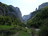
Almost the entire southern half of the Carpathians is located on Romanian territory. The mountains were formed during the Alpidic orogeny in the Triassic and are part of a mountain system that stretches from the Alps to the Himalayas.
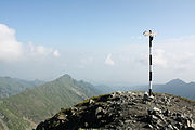
Ten peaks of the Carpathians reach heights of over 2500 m. The highest point of the Southern Carpathians and all of Romania is Moldoveanu at 2544 m. The Eastern Carpathians reach 2303 m at Pietros, and the Romanian Western Carpathians reach 1848 m at Curcubăta Mare peak. The Southern Carpathians are the most massive, while Eastern and Western Carpathians are interspersed with depressions and passes. Parts of the Eastern Carpathians are volcanic, the rest of the Romanian Carpathians are composed of shale and limestone.
The Transylvanian Highlands are between 300 m and 700 m high, the Moldavian Highlands between 300 m and 500 m high. The small Dobruja Highlands reach 467 m at their highest point. The Pannonian and Wallachian lowlands (Campia Romana) remain below the 200 m limit.
· 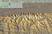
Panoramic map of the Făgăraș Mountains
· 
Aerial view in the Făgăraș Mountains
· 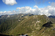
The Făgăraș Mountains are the highest region in Romania, with five mountains over 2500 m (including Moldoveanu).
· 
View of the Moldeveanu mountain panorama
· 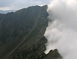
The summit of Negoiu
· 
View from the summit of Viștea Mare
· ![]()
The Transfogaras High Road at the Bâlea Pass - also called Road into the Clouds due to its routing
· 
View of the road from Poenari Castle
Hydrology
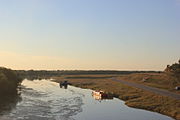
The most important river in Romania is the Danube (Romanian Dunărea), which flows through or along Romania for more than a thousand kilometres. It is one of the most important transport routes in the country. The Danube forms most of Romania's southern border between the Romanian part of the Banat and Serbia or Wallachia and Bulgaria. In the large Danube delta the river flows into the Black Sea.
The other important rivers of Romania belong directly or indirectly to the Danube catchment area and drain the Eastern Carpathians. The Tisza partially borders Romania to the north with Ukraine, the Pruth borders the Romanian region of Moldova to the northeast with the Republic of Moldova. The Sereth flows through Moldova, the Olt through Wallachia, the Mureș (tributary of the Tisza) through Transylvania.
Romania's lakes make up 1.1% of the country's surface. In total there are over 3400 lakes. The largest are the lagoons Razim with 41,500 ha and Sinoie with 17,100 ha.
See also: List of rivers in Romania
· 
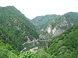
The Cheile Turzii gorge, about two kilometres long, is crossed by the Hășdate stream, which has dug into the limestone.
· 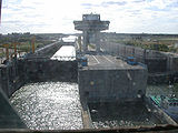
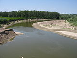
The Danube-Black Sea Canal near Constanța
· 
Pruth as Romanian-Moldovan border river
· 
The Sereth near Mircești
· 
Olt reservoir with the Southern Carpathians in the background (near the town of Avrig)
Climate
· 
Sibiu in the Carpathian foothills
· 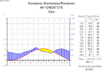
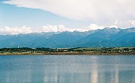
Constanța on the Black Sea coast
· 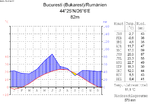
Bucharest in the Wallachian Plain
Romania belongs to the temperate climate zone in the area of the west wind zone. Due to the natural barrier of the Carpathians, however, the individual parts of the country differ from each other climatically. Transylvania (west of the Carpathian arc) is still characterized by the maritimeclimate of the Atlantic winds. However, the Carpathians prevent these air masses from reaching the east and south of the country. In Moldavia (east of the Carpathians) a continental climate prevails. This region is exposed to cold air currents from Ukraine. In Wallachia (south of the Carpathians), Mediterranean influences exist; to an even greater extent, this applies to Dobrudja.
The annual average temperatures vary within Romania between 11 °C in the south and 8 °C in the north. The coldest month is usually January and the warmest month is July. In winter, average temperatures are 0 °C on the Black Sea coast and -15 °C in the high mountains. In summer, average temperatures rise to more than 25 °C in the lower regions of the country. The lowest temperature ever recorded was -38.5 °C on 25 January 1942 in Bod, and the highest was 44.5 °C on 10 August 1951 near Brăila.
Precipitation tends to be heaviest in the northwest of Romania and weakest in the southeast. The highest annual precipitation rates occur in the high mountains, with 1000 mm, and the lowest on the Black Sea coast, with 300-400 mm. The latter has 2286 hours of sunshine per year compared to only 1500 in the mountainous regions of Romania.
· 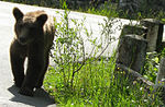
A brown bear in the Southern Carpathians
· 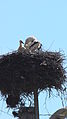
Storks can be seen almost everywhere in the rural areas of Romania.
Nature
Romania is 27% covered by forest. The forest zone ends at 1800 meters, above which there are mountain pastures. Within the coniferous forest zone (1400-1800 m) grow spruces, firs, pines, yews and larches. The beech forest (400-1400 m) is dominated by beech, but hornbeam, elm, ash and birch also occur. The lowest forest zone is the oak forest (150-400 m), where maples, plane trees, willows, poplars and lime trees can be found in addition to oaks.
In the Bărăgan (part of the Wallachian Plain) and in the Dobrudja there are steppe landscapes, large parts of which are used for agriculture. Otherwise, roses, prunus and hawthorns occur here in addition to isolated deciduous trees. In the Danube delta there is a swamp landscape characterised by reeds, cattails, water hemlock and water lilies.
Romania's fauna includes 3600 species, some of which are widespread in Europe, but others are found only here. In the Carpathians, these include chamois, bearded vulture, brown bear (about 6600 specimens), wolf (about 3100), lynx (about 1500) and otter. In addition, animals that are more common in the rest of Europe, such as golden eagle, black vulture, red deer and red fox, can be found in the higher forest regions of Romania, and badger, roe deer and wild boar in lower deciduous forests. In 2012, the bison was reintroduced after being extirpated in Romania in the 1800s. The 50 or so animals (as of 2017) now live there in complete freedom and are slowly reproducing.
Small populations of the Great Bustard can be found in the Wallachian Plain. The Danube Delta is home to numerous species of fish, amphibians and migratory birds. These include the pink pelican, which is found only here in Europe. In addition, the purple heron and the sturgeon, known for its caviar, live here.
The Black Sea (Dobruja) is home to the common dolphin.
Nature Conservation
As a member of the EU, Romania is also obliged to implement the NATURA 2000 network of protected areas. Numerous national parks already existed or were established after the country's accession to the EU.
Romania currently has 148 bird protection areas and 383 Habitats Directive sites classified as Special Protection Areas under NATURA 2000. This corresponds to 23.4 % of the Romanian land area. In comparison, Germany has designated 22.6 % (as of 12/2013) of its land area according to this criterion.
The Danube Delta is part of the UNESCO World Heritage Site and is home to the largest area of reed beds in the world. Romania has more biogeographical regions than any other EU country, but the landscapes are increasingly influenced by booming and modernised agriculture and urban growth.
The national budget in the sector of biodiversity conservation is very low and there is a lack of awareness of the meaning and purpose of EU nature conservation directives. In October 2007, the government in Bucharest received a written warning from the European Commission because the country had not complied with its laws on biodiversity conservation. Specifically, the warning concerned certain protection zones for migratory birds.
Masterless dogs are a problem because they also attack people when they are hungry. In Bucharest alone, their number is estimated at 60,000.
Illegal logging that is not followed by reforestation is increasingly threatening the forest stand. The reasons are the international demand for cheap wood, large foreign wood processing companies, especially from Austria, which determine the timber industry, and a pyramid-shaped system in which all parties involved, from foresters to processors to politicians, profit from the illegal revenues. NGOs such as Plantam Fapte Bune are trying to counter this development.


Questions and answers
Q: What is Romania?
A: Romania is a country in southeastern Europe, located north of the Balkan Peninsula on the Lower Danube River and bordered by Hungary, Serbia, Ukraine, Moldova and Bulgaria.
Q: When did Romania become an independent state?
A: Romania became an independent state in 1878 with the signing of the Treaty of Berlin.
Q: How many people live in Romania?
A: There are approximately 19 million people living in Romania.
Q: What is the capital city of Romania?
A: The capital city of Romania is Bucharest, with a population of 1.6 million.
Q: What changes did Romania make during the 2000s?
A: During the 2000s, Romania made changes to its democratic system, human rights acts, freedom of speech acts, economy and law.
Q: When did Romania join NATO?
A: Romania joined NATO on March 29th 2004.
Q:What European city was named a Capital of Culture ?
A:Sibiu , one of cities in Transylvania was named a European Capital Of Culture .
Related articles
Author
AlegsaOnline.com Romania: geography, history, government and culture Leandro Alegsa
URL: https://en.alegsaonline.com/art/83893
Sources
- edrc.ro : "Romanian 2002 census (in Romanian)[[Category:Articles with Romanian-language sources (ro)]]"
- recensamantromania.ro : recensamantromania.ro
- imf.org : World Economic Outlook Database, September 2011
- imf.org : Nominal GDP list of countries
- cia.gov : "CIA – The World Factbook – Field Listing :: Distribution of family income – Gini index"
- hdr.undp.org : "Human Development Report 2010"
- cia.gov : "1"
- nato.int : "North Atlantic Treaty Organization (NATO), Official Raport"
- ec.europa.eu : "Report on the Nominations from Luxembourg and Romania for the European Capital of Culture 2007"
- friesian.com : "Decadence, Rome and Romania, the Emperors Who Weren't, and Other Reflections on Roman History"
- friesian.com : Friesian School
- jstor.org : "Romania: The Latin Empire of Constantinople"