
River Thames
The River Thames is England’s longest navigable river, flowing from the Cotswolds through Oxford and London into the North Sea estuary; it has shaped commerce, settlement, ecology and culture for millennia.
Overview
The River Thames is a major river in England that flows through the city of London, the capital city of the United Kingdom. It is one of the best-known rivers in Britain and remains an important artery for navigation, recreation and urban life. The river’s length is commonly quoted as about 346 kilometres, though measurements vary with the precise start and tidal reach used.
Image gallery
7 Images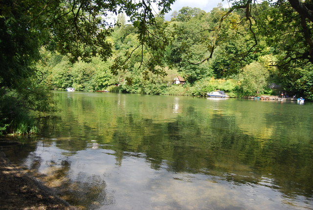


Course and characteristics
The Thames rises near the village of Kemble in the Cotswolds and travels eastward through a sequence of towns and cities. Upstream sections near Oxford are sometimes known locally as the Isis. Downstream the river passes through or beside towns such as Maidenhead and Eton, and skirts the outer limits of Greater London. Along its course the Thames flows past historic houses and parks including Hampton Court Palace and through stretches noted for picturesque views, for example Richmond Hill.
Lower reaches, estuary and tide
As the river approaches the capital it becomes tidal; the point at which tidal influence becomes noticeable lies some distance above central London and is tied to the slope of the river and sea levels. Within the urban area the Thames flows by districts such as Greenwich and industrial zones near Dartford before forming a broad estuary that opens into the North Sea at stretches historically referenced as The Nore. The land to the west of the city is often described as the Thames Valley, while development east of Tower Bridge has been promoted as part of a larger riverside regeneration area. The tide in the lower river is driven by the North Sea and is detectable many kilometres inland as a regular rise and fall of water level (tide), which can make the river slightly brackish in places where seawater mixes with freshwater (sea salt).
History and cultural importance
The Thames has been central to the settlement and economy of southern Britain since prehistoric and Roman times. The Romans established a major port and town, often linked in accounts to the reach of the tide and the navigable channel (Roman Britain). Throughout the medieval and early modern periods the river was a conduit for trade and communication, and many towns grew along its banks. In the industrial era the Thames became increasingly engineered, with locks, embankments and docks transforming both the flow and the shoreline.
Uses, wildlife and management
Today the Thames supports a mix of commercial navigation, passenger services, leisure boating and riverside industry. It is also a habitat for fish, birds and aquatic plants; concerted pollution controls and sewage treatment programmes in the late 20th century greatly improved water quality, allowing wildlife to recover and urban riverfronts to be redeveloped. Flood risk is managed through a combination of local defences and larger projects such as the movable flood barrier across the lower river, built in the late 20th century to protect central London from storm surges.
Notable facts and crossings
The Thames is crossed by many historic and modern bridges, tunnels and ferries, and several of its islands and backwaters are valued for recreation and conservation. Navigation is controlled by a system of locks and by river authorities that balance shipping, flood control and ecological concerns. The river’s identity varies along its length: from rural chalk streams in the upper reaches, through university and market towns, to the dense urban corridor of London and the wide tidal estuary that leads to the sea.
- Upper course: rural, chalk-fed streams and mill history.
- Middle course: towns, rowing and university associations.
- Lower course: tidal channel, major bridges, ports and flood defences.
For further reading about river geography, history and current management see sources linked from local authorities and river organisations: general river information, town pages such as Oxford and Maidenhead, heritage sites like Hampton Court, and regional planning pages for areas including the Thames Valley and Thames Gateway.
Other notable references include navigational and tidal guidance (tide), historical summaries of Roman Britain and London’s riverside development, and environmental overviews addressing salinity and ecology (sea salt).
Questions and answers
Q: Where does the River Thames start?
A: The River Thames starts near the village of Kemble in the Cotswolds.
Q: How long is the River Thames?
A: The River Thames is 346 kilometres (235 statute miles) long.
Q: What is the Latin name for The Isis?
A: The Latin name for The Isis, which flows through Oxford, is a shortening of its Latin name.
Q: What are some places that the river passes through on its way to London?
A: On its way to London, the river passes through Maidenhead, Eton and Windsor, Syon House, Hampton Court Palace, Richmond Hill and Kew.
Q: When did Roman Britain make London their capital city?
A: Roman Britain made London their capital city at the spot where the tides reached in 43 AD.
Q: How has this spot changed since then?
A: Since then different things have pushed this spot farther up the river over 2000 years.
Q: Is there any sea salt present in London's water from the River Thames?
A: Yes, at London there is slightly salty water with sea salt present from the River Thames.
Related articles
Author
AlegsaOnline.com River Thames Leandro Alegsa
URL: https://en.alegsaonline.com/art/83134
Sources
- bbc.co.uk : David Walliams relieved after 140-mile Thames charity swim
- telegraph.co.uk : "David Walliams swim raises £1million"