River Tees
River Tees in northern England: source on Cross Fell, course through Teesdale to the North Sea, notable features (High Force, estuary, Tees Barrage), industrial history, ecology, recreation and boundaries.
Overview
The River Tees rises on Cross Fell on the high moors of the Pennines and flows eastwards to the North Sea. Its course is approximately 85 miles (137 km), running from upland peat and moor through the deeply incised valley of Teesdale before reaching a broad, tidal estuary on England’s north‑east coast.
Image gallery
10 Images


Course and physical features
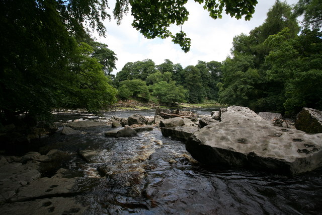
The upper Tees, often called Teesdale, is a landscape of steep-sided gorges, limestone and millstone grit outcrops, upland pastures and scattered heather moor. The river has cut impressive features into the bedrock, including a series of waterfalls. Among the best known is High Force, a dramatic drop where the flow passes through a narrow rocky gorge. The long-distance footpath called the Pennine Way runs close to parts of the headwaters and has made the area popular with walkers and naturalists since it opened in 1965.
Lower reaches and estuary
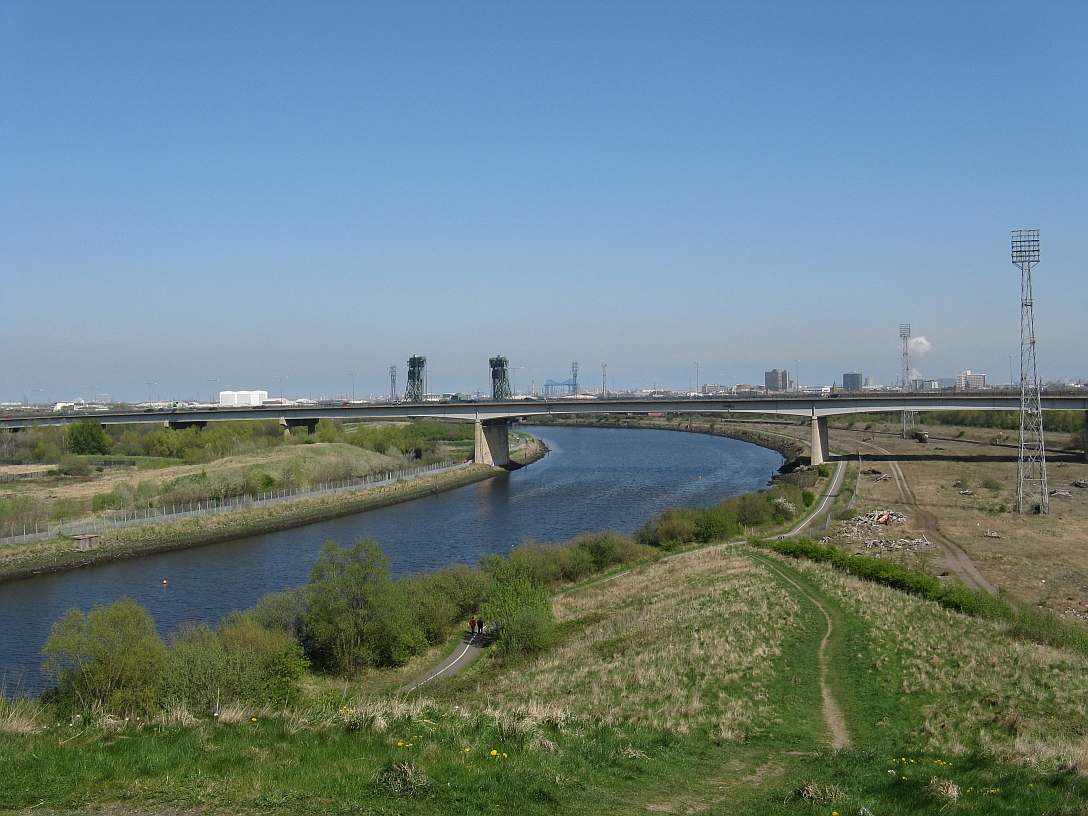
Downstream the Tees widens into a lowland river whose floodplain has supported agriculture, towns and transport links. For much of its lower course the river forms a historic and administrative boundary between North Yorkshire and County Durham. The tidal estuary has significant port facilities and industrial developments; approaches and coastal settlements sit between towns such as Hartlepool and Redcar, and the estuary remains a focus for shipping and regeneration.
Industry, engineering and transport
The Tees valley was central to the industrial growth of north‑east England from the 19th century, supporting iron, steel, chemical works and shipbuilding. Engineering works such as bridges and the Tees Barrage in the Stockton area reflect long-standing attempts to manage tidal influence, navigation and flood risk. The port complex known as Teesport handles a wide range of cargoes and underpins regional trade.
Ecology, recreation and conservation
The river and its estuary support diverse habitats: upland streams, riparian woodlands, fen and floodplain meadows, and extensive tidal mudflats important for wading birds and wintering wildfowl. Fish populations, including migratory salmon and trout in cleaner stretches, make the Tees a valueable angling river. Recreational uses include walking, canoeing, sailing and birdwatching. Conservation work seeks to reconcile the legacy of industrial pollution with habitat restoration, water quality improvements and protection of designated sites.
Access and visitor information
Access to the Tees for visitors is available at popular viewpoints, public footpaths and leisure centres; upland car parks and waymarked trails serve walkers heading into Teesdale. Local authorities and conservation organisations provide information on safe access, tides and seasonal sensitivities for wildlife.
Notable facts
- The Tees rises on the high Pennine plateau and reaches the North Sea after flowing east for about 85 miles.
- High Force is one of the river’s best known waterfalls and an important local attraction.
- The river forms part of the county boundary between North Yorkshire and County Durham in its lower reaches.
- The estuary supports major port facilities and lies between towns such as Hartlepool and Redcar, while the surrounding landscape attracts walkers on routes including the Pennine Way.
See also
- List of rivers in the United Kingdom
Related articles
Author
AlegsaOnline.com River Tees Leandro Alegsa
URL: https://en.alegsaonline.com/art/83131