
River Tamar: Border River of Devon and Cornwall
Overview of the River Tamar in South West England, its course, tributaries, history as a boundary, bridges, the Tamar Valley AONB, and ecological and cultural significance.
The River Tamar is a prominent river in South West England that largely defines the county line between Devon (east) and Cornwall (west). Rising on high ground in north Cornwall, the river runs generally southward for much of its length and empties into a broad estuary—the Hamoaze—before flowing into Plymouth Sound. The Tamar has long formed an important physical and cultural divide while also functioning as a corridor for wildlife, navigation and local industry.
Image gallery
10 Images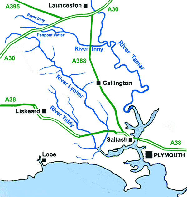


Course and tributaries
The Tamar’s source lies only a few kilometres from the north Cornish coast, yet the main channel turns south and is fed by numerous tributaries along its descent. On the Cornish side, principal feeders include the rivers Inny, Ottery, Kensey and the Lynher (often called the St Germans River). From the Devon side the Deer and the Tavy are notable contributors. These watercourses create a network of valleys and floodplain that broaden into the tidal estuary near Plymouth.
Crossings and infrastructure
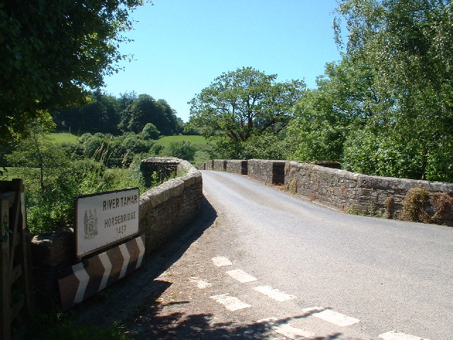
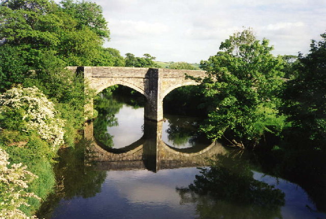
The lower Tamar has relatively few road bridges. Two of the most visible crossings at Saltash connect Cornwall with the city of Plymouth. The historic rail crossing, the Royal Albert Bridge, was completed in 1859 and is widely attributed to the work of Isambard Kingdom Brunel; it carries the mainline into Cornwall. Nearby, a modern road structure, the Tamar Bridge, replaced a long-standing ferry service and now handles vehicular traffic. Both crossings serve the town of Saltash. Upstream there are a mix of older road bridges, footbridges and rural fords.
History and boundary role
The Tamar has a deep-rooted role as a political boundary. In the tenth century the river was acknowledged as a dividing line between Cornwall and the rest of England; later medieval and modern documents continued to treat it as the county separation. Its strategic importance grew as maritime trade and naval facilities developed around Plymouth Sound, while the surrounding valley supported agriculture, settlements and—especially in Cornwall—mining activity that shaped local communities.
Tamar Valley Area of Outstanding Natural Beauty
The lower valley and its tributaries form the Tamar Valley Area of Outstanding Natural Beauty, a protected landscape that embraces a mosaic of riverine habitats, woodlands, farmland and industrial heritage sites. The designated area extends for many square kilometres below Launceston and includes important wildlife corridors, scenic viewpoints and recreational opportunities such as boating, angling and riverside walking. The AONB designation recognises both natural qualities and the distinctive cultural history of the valley.
Ecology, uses and notable facts
Ecologically the Tamar supports estuarine and freshwater species, migratory fish and varied birdlife around its tidal reaches. Historically, parts of the catchment were influenced by metal mining and related industries; their legacy can still be seen in some landscape features and cultural sites. Today the river is valued for leisure, local fisheries, small-scale shipping in the estuary and as a scenic asset for communities along its banks. For readers seeking further information on navigation, conservation activities and local amenities, consult regional resources and guides that specialise in the Tamar’s environmental management and recreational services (river information, regional guides, county pages).
- Major tributaries: Inny, Ottery, Kensey, Lynher (St Germans River), Deer, Tavy.
- Key crossings: Royal Albert Bridge (rail, 1859), Tamar Bridge (road, modern) at Saltash.
- Protected area: Tamar Valley AONB, designated for its landscape and heritage (AONB page).
- Historical note: The river has been treated as a boundary between Cornwall and the rest of England since at least the early medieval period; rulers such as King Athelstan are associated with that demarcation in historical accounts.
Whether approached as a natural feature, historical border, or working landscape, the River Tamar remains a defining element of the south-western English region it traverses. For practical matters—navigation rules, conservation programmes and visitor information—local authorities and conservation organisations provide current guidance and maps.
Questions and answers
Q: Where is the River Tamar located?
A: The River Tamar is located in South West England.
Q: Which counties does the River Tamar form most of the border between?
A: The River Tamar forms most of the border between Devon (to the east) and Cornwall (to the west).
Q: Where is the Tamar's source?
A: The Tamar's source is less than 6 km (4 miles) from the north Cornish coast.
Q: Where does the Tamar flow into?
A: The Tamar flows into the Hamoaze (a wide estuary) before entering Plymouth Sound.
Q: When was the east bank of the River Tamar made the boundary between England and Cornwall?
A: The east bank of the River Tamar was made the boundary between England and Cornwall in the year 936 by King Athelstan of England.
Q: Are there any road bridges over the lower Tamar apart from the modern Tamar Bridge at Saltash?
A: No, there are no road bridges over the lower Tamar apart from the modern Tamar Bridge at Saltash which was built to replace the ferry.
Q: What is the Tamar Valley Area of Outstanding Natural Beauty?
A: The Tamar Valley Area of Outstanding Natural Beauty covers around 195 km² (75 square miles) around the lower Tamar (below Launceston) and its tributaries the Tavy and the Lynher. It was first proposed in 1963, but was not designated until 1995.
Related articles
Author
AlegsaOnline.com River Tamar: Border River of Devon and Cornwall Leandro Alegsa
URL: https://en.alegsaonline.com/art/83127
Sources
- tamarvalley.org.uk : "Tamar Valley Area of Outstanding Natural Beauty"