River source (headwaters)
The river source, or headwaters, is the original place a river or stream begins. Covers types (lake, spring, glacier), definitions, measurement challenges, ecological importance and notable examples.
Overview
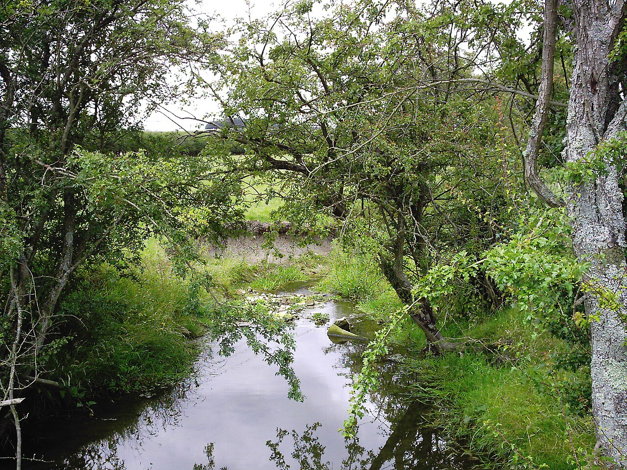
The source of a river or a stream is the location where flowing water first emerges to form a defined channel. It is commonly called the headwater or head-stream. Identifying a source can be straightforward when a single spring or lake clearly feeds the channel, but many rivers begin as networks of small flows and wetlands that combine gradually into a permanent stream.
Image gallery
4 Images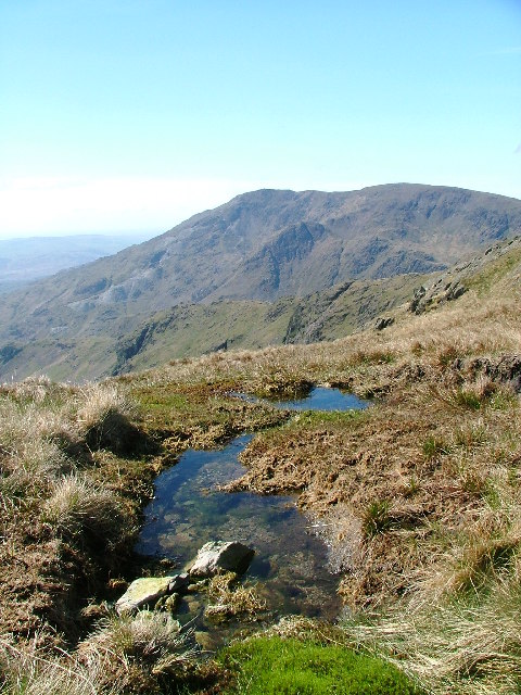

Common types of sources
Sources take several familiar forms and are often described by the landscape that supplies them. Typical types include:
- Lake outlets, where a lake discharges the water that becomes a river.
- Marsh or bogs, where groundwater and rainfall collect and seep into channels.
- Springs, places where groundwater rises to the surface to feed a stream.
- Glacial outlets, where melting ice produces continuous runoff that forms headwaters.
How the source is defined and debated
Hydrologists and geographers use several methods to define a river's source. One common approach names the most distant point in the drainage system measured along the channel network from the river's mouth or estuary. Another considers the highest-altitude flowing point, while some definitions favor the branch with greatest long-term discharge. Because rivers collect many tributaries, there can be legitimate differences about which small stream is the true headwater. Confluences — the joining of two or more streams — complicate matters further; a confluence may mark where a recognizable river name begins.
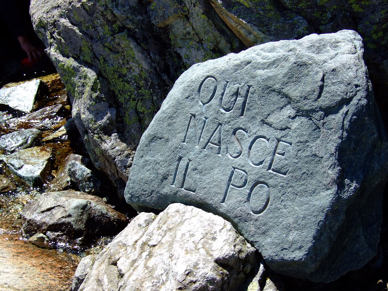
Examples and notable cases
Large rivers sometimes have sources that are lakes fed by multiple inflowing streams. For instance, Lake Victoria is commonly cited as the source of the Nile, although many rivers flow into the lake and different criteria point to different headstreams. In mountainous regions headwaters frequently start at higher elevations where snowmelt and glacier melt supply water; glacial headwaters are important indicators of climate change because shrinking glaciers alter seasonal flows.
Ecology, uses and importance
Headwater areas are ecologically valuable. They provide habitat for specialized plants and animals, act as filters that maintain water quality, and regulate downstream flow by storing and releasing water. Human uses include water supply, small-scale hydropower, and cultural or symbolic significance: a river's source is often a site of historical interest or pilgrimage. Protecting headwaters helps maintain freshwater resources for communities and ecosystems downstream.
Distinctions and practical considerations
Practical mapping and management require clear conventions. Authorities may record a river's mouth and source differently depending on whether the goal is navigation, water management or scientific study. River mouths can form deltas when sediment is deposited at the sea; understanding the full river system — from source to mouth — is essential for flood control, biodiversity conservation and sustainable water use.
Related articles
Author
AlegsaOnline.com River source (headwaters) Leandro Alegsa
URL: https://en.alegsaonline.com/art/83126