
River Severn: Britain's longest river — course, history, features and uses
The River Severn is the longest river in Great Britain. This article describes its course from the Cambrian Mountains to the Bristol Channel, major towns and tributaries, the Severn Estuary, ecology and human uses.
Overview
The River Severn is the longest river in Great Britain, running roughly 354 kilometres (about 220 miles) from its source in mid‑Wales to the sea. It has the largest freshwater flow of any river in England and Wales and drains a wide catchment across central Britain. Along its route the Severn passes through upland moors, rural valleys and several historic market towns before widening into the Severn Estuary and meeting the Bristol Channel.
Image gallery
10 Images




Course and principal places
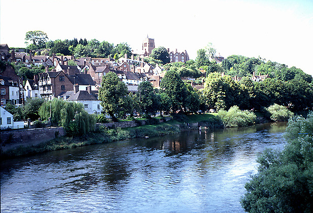
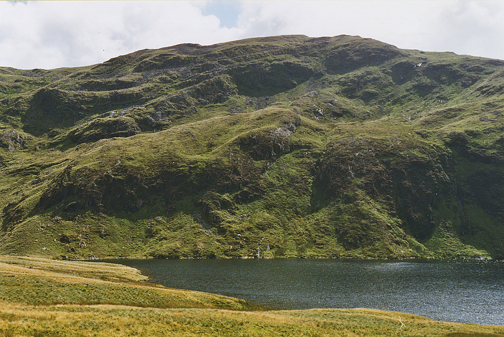
The river rises on the flanks of the Cambrian Mountains in mid‑Wales; its upland origin is often identified with the area of the Cambrian Mountains. From there the Severn flows generally east and then south, traversing counties such as Shropshire, Worcestershire and Gloucestershire. Several county and market towns lie on its banks, notably Shrewsbury, Worcester and Gloucester; these settlements grew historically because of the river’s value for transport, water supply and milling.
Physical characteristics and tributaries
The Severn’s catchment is extensive — its drainage basin covers many thousands of square kilometres and supports a network of tributaries, floodplains and wetlands. Major tributaries and associated waterways contribute to its volume and include rivers and streams that link upland Wales with the lowlands of central England. The wider catchment and estuary together influence tidal behaviour, sediment movement and flood risk across the region. For technical summaries and basin data see the catchment overview at drainage basin resources.
History, navigation and human use
The Severn has been an important corridor for people and goods since prehistoric and medieval times. Navigation, river engineering and canal links were developed to carry cargoes during the industrial era, while improved bridges and crossings altered travel patterns in the 20th century. The river becomes tidal and transitions into the Severn Estuary beyond the major road crossings such as the Second Severn Crossing. The estuary then discharges into the Bristol Channel and ultimately the Atlantic. Human uses today include commercial shipping in the lower reaches, leisure boating, angling and water abstraction for towns and agriculture.
Ecology, tides and notable phenomena
The Severn and its estuary support varied habitats, from upland streams to intertidal mudflats, which are important for fish (including migratory species), birds and other wildlife. The estuary is renowned for its high tidal range — among the largest in Britain — and for the spectacular Severn Bore, a tidal wave that can travel upstream under certain tidal conditions and attracts surfers and spectators. Conservation and flood management are active concerns for communities and agencies working along the river.
Administrative and geographic distinctions
- The river flows through several ceremonial and administrative counties: see links for Shropshire, Worcestershire and Gloucestershire.
- Significant towns on the Severn include Shrewsbury, Worcester and Gloucester, which historically developed because of river access.
- Some rivers flow into the Severn Estuary rather than the main river channel, for example the River Avon.
Why the Severn matters
As Britain’s longest river it has shaped landscapes, economies and communities for centuries. Its changing character — from mountain stream to broad tidal estuary — creates diverse ecological zones and practical challenges for flood defence, navigation and planning. Ongoing management balances habitat conservation, recreational use and the needs of urban and rural populations that rely on the river’s resources. For further regional and technical information consult local authorities and river basin documents such as those referenced at regional pages and specialist sources like upland hydrology guides.
Additional background and resources are available through general overviews and local studies; for further reading see materials on river towns and the estuary at county guides, navigation histories at county waterway records, and environmental assessments at urban and conservation reports. For route maps and visitor information consult summaries for Shrewsbury and Worcester.
See also
- List of rivers in the United Kingdom
Questions and answers
Q: What is the River Severn?
A: The River Severn is the longest river in Great Britain, at about 354 kilometres (220 mi).
Q: Where does the River Severn rise from?
A: The River Severn rises in the Cambrian Mountains of mid Wales.
Q: Which counties does the River Severn flow through?
A: The River Severn flows through Shropshire, Worcestershire, and Gloucestershire.
Q: Which county towns are situated on the banks of the River Severn?
A: The county towns of Shrewsbury, Worcester, and Gloucester are situated on the banks of the River Severn.
Q: Where does the River Severn discharge?
A: The River Severn discharges into the Bristol Channel, which in turn discharges into the Atlantic Ocean.
Q: What is the area of the River Severn's drainage basin?
A: The River Severn's drainage basin area is 11,420 square kilometres (4,409 sq mi), excluding the River Wye and River Avon that flow into the Severn Estuary.
Q: What is the significance of the Second Severn Crossing?
A: The Second Severn Crossing usually marks the point where the River Severn is considered to become the Severn Estuary.
Related articles
Author
AlegsaOnline.com River Severn: Britain's longest river — course, history, features and uses Leandro Alegsa
URL: https://en.alegsaonline.com/art/83123
Sources
- nwl.ac.uk : "National River Flow Archive – 54001 Severn @ Montford"
- environment-agency.gov.uk : "HiFlows-UK"
- seered.co.uk : "Frankwell Flood Alleviation Scheme, Shrewsbury"
- bbc.co.uk : "The River Severn Facts"
- commons.wikimedia.org : River Severn