
River Camel — river in north Cornwall, England
The River Camel rises on the edge of Bodmin Moor and flows about 30 miles through north Cornwall to the Atlantic. Its tidal estuary supports wildlife, recreation (sailing, birdwatching, fishing) and local communities.
Overview
The River Camel runs through northwestern Cornwall in the United Kingdom. It begins on the fringes of Bodmin Moor and, together with a network of tributaries, drains a significant portion of north Cornwall before reaching the sea. The river's course covers roughly thirty miles and terminates at the north coast, where it empties into the Atlantic Ocean. For much of its lower length the river is influenced by tides, creating a mix of freshwater and brackish habitats.
Image gallery
9 Images

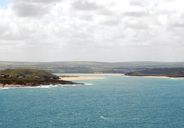


Course and tidal reach
The upper Camel flows from moorland and moor-edge streams across varied countryside, receiving smaller streams and rivers that boost its flow. Its lower valley broadens into an estuary that is tidal as far upstream as the town of Egloshayle, where the interplay of river flow and sea tides shapes mudflats, salt marshes and channels. These shifting features are important for sediment transport and for species that depend on transitional coastal environments.
Ecology and natural features
The river and its estuary support diverse plant and animal communities. Mudflats and marshes provide feeding and resting areas for migratory and wintering birds, while freshwater stretches carry fish populations and aquatic plants adapted to cooler, upland conditions. Riparian woodlands and hedgerows along parts of the corridor offer habitat continuity for mammals, insects and amphibians.
History and human use
Human settlement and activity have long been linked to the Camel. Its valley provided routes for travel, water for agriculture and sites for mills in earlier centuries. The estuary also historically enabled small-scale coastal trade and boat traffic; in more recent times the scenic river corridor has become valued for leisure and tourism, contributing to local economies while raising questions about sustainable use.
Recreation, conservation and notable facts
The River Camel is a popular destination for a range of outdoor activities. Common pursuits include:
- Sailing and small-craft navigation on the tidal estuary
- Birdwatching on mudflats and salt marshes
- Fishing for freshwater and estuarine species
Conservation groups, local authorities and landowners work to balance recreation, agriculture and wildlife protection along the Camel. Efforts typically focus on water quality, habitat restoration and managing the effects of development and extreme weather. The river remains both a natural asset and a cultural landmark in north Cornwall.
Questions and answers
Q: Where is the River Camel located?
A: The River Camel is located in Cornwall, UK.
Q: Where does the River Camel rise from?
A: The River Camel rises on the edge of Bodmin Moor.
Q: What does the River Camel and its tributaries drain?
A: The River Camel and its tributaries drain a considerable part of North Cornwall.
Q: How long is the River Camel?
A: The River Camel covers a distance of approximately 30 miles.
Q: Is the River Camel tidal?
A: Yes, the River Camel is tidal as far upstream as Egloshayle.
Q: What are the popular activities on the River Camel?
A: Sailing, birdwatching, and fishing are popular activities on the River Camel.
Q: Where does the River Camel issue into?
A: The River Camel issues into the Atlantic Ocean after covering a distance of approximately 30 miles.
Related articles
Author
AlegsaOnline.com River Camel — river in north Cornwall, England Leandro Alegsa
URL: https://en.alegsaonline.com/art/83090
Sources
- cornwallwildlifetrust.org.uk : "Killas"
- bgs.ac.uk : "BGS GeoIndex"
- nwl.ac.uk : "Camel at Denby"