Río Negro (Uruguay)
Major river crossing central Uruguay, a left tributary of the Uruguay River that divides the country, supports hydroelectric power, irrigation, transport and diverse freshwater ecosystems.
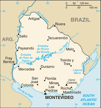
The Río Negro is the principal river of Uruguay and a key tributary of the Uruguay River. It originates in the highlands of southern Brazil and flows generally westward across the full width of Uruguay before joining the Uruguay River. As the largest internal watercourse of the country, the Río Negro plays a central geographic, economic and ecological role, and its valley is an important feature in Uruguay's landscape.
Image gallery
8 Images


Course and characteristics
The river travels from its source on the eastern watershed into a sequence of natural reaches and artificial reservoirs. It is a left-bank tributary of the larger Uruguay River and effectively separates the southern regions of Uruguay from the northern areas. Along its route the Río Negro collects water from many smaller streams and forms wide floodplains and wetlands that support agriculture, grazing and wildlife. Basic geographic references and mapping coordinates are available in authoritative databases: coordinates.
Human use and infrastructure
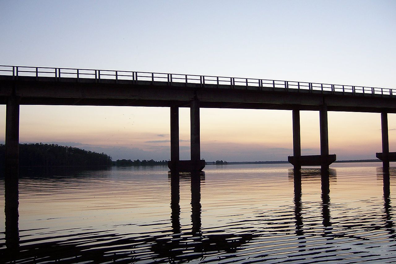
During the 20th century, several large dams and reservoirs were built on the Río Negro to regulate flows and produce hydroelectricity. These installations supply power to much of the country, reduce flood risk in lower reaches, and create lake-like bodies used for fishing and recreation. The river corridor is used for irrigation and supports rural communities dependent on cattle and crop production. Navigation is limited by dams and seasonal flow variation, so commercial transport is modest compared with historical attempts to use inland waterways. For general country context see Uruguay and for river type information see river.
Ecology and environment
The Río Negro basin contains a variety of habitats from upland streams to broad floodplain marshes. These support freshwater fish, waterfowl and riparian vegetation important for biodiversity. Wetlands associated with the Río Negro act as natural water filters and buffer storms, but they are sensitive to changes from damming, irrigation and land use. Conservation and sustainable water management are ongoing concerns among local authorities and environmental groups.
History and significance
Historically the Río Negro has been a landmark in regional geography and settlement patterns. Its valley influenced the placement of roads and towns and served as a natural division within the country. The development of hydroelectric projects on the Río Negro marked a major phase in Uruguay's 20th-century modernization, altering hydrology while providing energy and economic benefits. Regional studies and summaries about the river's development can be found through national and international resources: history, hydrology, Uruguay River, southern Brazil.
Notable facts and distinctions
- The Río Negro is the most important river running entirely across Uruguay, shaping the country's internal drainage.
- It is a left tributary of the Uruguay River and forms a clear geographic division between northern and southern Uruguay.
- Major dams along the river provide hydroelectric power, recreational reservoirs and flood regulation.
Because of its economic and environmental importance, the Río Negro remains the focus of planning for water resources, energy production and habitat protection in Uruguay.
Questions and answers
Q: What are the coordinates of the Río Negro?
A: The coordinates of the Río Negro are 33°25′34″S 58°24′32″W.
Q: What is the Río Negro?
A: The Río Negro is a river in Uruguay.
Q: What kind of river is the Río Negro?
A: The Río Negro is the most important river in Uruguay.
Q: Is the Río Negro the most significant river in Uruguay?
A: Yes, the Río Negro is the most important river in Uruguay.
Q: What kind of river is the Río Negro in France?
A: The text does not mention a Río Negro in France.
Q: Where does the Río Negro start?
A: The Río Negro starts in southern Brazil.
Q: What does the Río Negro effectively divide in Uruguay?
A: The course of the Río Negro across Uruguay effectively divides the south of the country from the north.
Related articles
Author
AlegsaOnline.com Río Negro (Uruguay) Leandro Alegsa
URL: https://en.alegsaonline.com/art/83011
Sources
- commons.wikimedia.org : Río Negro
- grdc.sr.unh.edu : "GRDC - Le Río Negro - Station: Palmar"