Retezat Mountains: peaks, glacial lakes, and Romania's first national park
High massif in Romania's Southern Carpathians known for rugged peaks, numerous glacial lakes (including Lacul Bucura), rich biodiversity and the Retezat National Park.
Overview
The Retezat Mountains are a compact, rugged massif in Romania, forming part of the Southern Carpathians. Locally they are known as Munţii Retezat in Romanian and as Retyezát‑hegység in Hungarian. The range is celebrated for its steep ridges, glacial cirques and a large concentration of high‑altitude lakes. Its highest point is Peleaga, which reaches 2,509 m (8,232 ft).
Image gallery
10 Images


Geography and geology
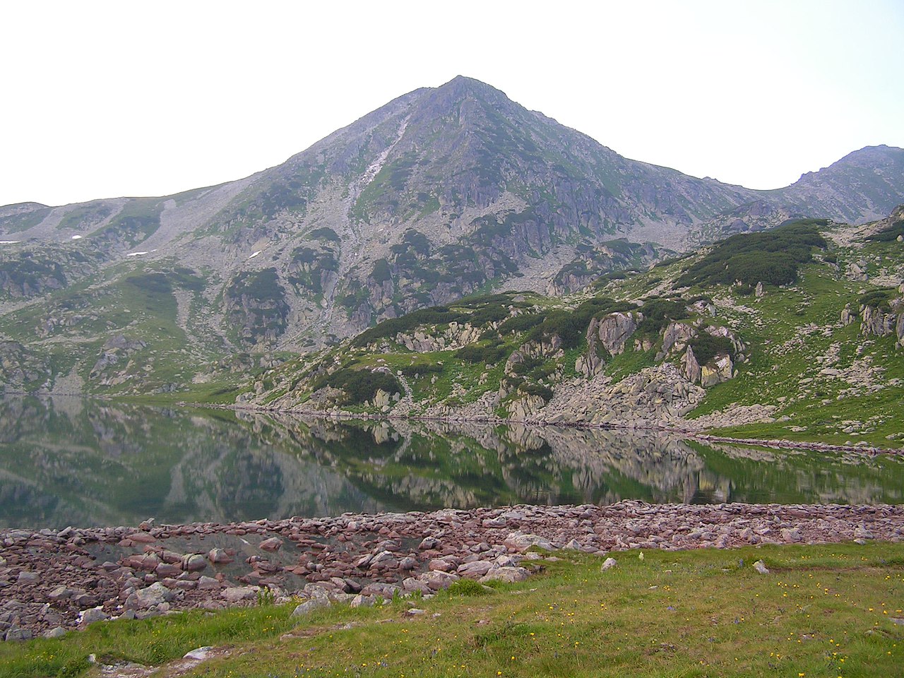
The Retezat are a distinct massif — one of the higher massifs in the country — carved from crystalline rocks and uplifted during the Alpine orogeny. Glacial action during the Pleistocene sculpted deep bowls and sharp ridgelines, leaving behind dozens of small alpine lakes. The relief is dramatic, with narrow valleys and steep scarps that contrast with rolling subalpine meadows.
Peaks and lakes
The range contains several notable summits and many tarns. Key peaks include:
- Peleaga (Vârful Peleaga) — the highest summit.
- Păpuşa (often cited as Vârful Păpuşa in local guides) and the central Retezat Peak.
Glacial lakes are a defining feature. The largest is Lacul Bucura, commonly called Bucura Lake, which covers about 8.9 ha (22.0 acres) and lies at roughly 2,030 m. The area contains scores of other small lakes and ponds formed in cirques and along moraines, making it an important site for hydrology and alpine ecology (lakes).
Flora, fauna and conservation
Because of its elevation range and relatively intact habitats, the massif supports a mix of montane and alpine plant communities, including endemic and relict species. Large mammals such as chamois, bears and wolves use the area, and many bird species breed in the higher zones. Much of the central massif is protected within Retezat National Park, Romania's first national park, established to safeguard these landscapes and species.
Human use, tourism and research
The Retezat Mountains are popular with hikers, backpackers and scientists. Trails cross high passes and access classic glacial basins; refuges and marked routes allow multi‑day circuits. Scientific interest focuses on glacial geomorphology, alpine ecology and conservation management. Visitors are encouraged to follow park regulations to limit erosion and preserve fragile high‑altitude habitats.
Distinctive facts
Notable features include the density of glacial lakes, the presence of Romania's largest glacial lake (Bucura), and the massif's contribution to the country's natural heritage through the national park. For practical information on access, trails and conservation rules, consult regional guides and official park resources (local name, alternate name, massif overview, country context, Carpathian region, peak data, elevation notes, height in feet, other peaks, glacial origins, lake area, acreage, park status).
Geography
The Retezat Mountains form the central massif of the western end of the Southern Carpathians, a final alpine high point from which the mountains slope down to the west and southwest. Towards the east it is separated by a deep incision from the central part of the Southern Carpathians, the Șureanu-Parâng-Lotrului mountain group. Specifically, it is separated from the Munții Șureanu by the valley of the Strei (Strell) to the northeast and from the Munții Parâng by the valley of the Jiu (Schil) to the far east. These valleys form one of the three great breakthroughs or crossings of the Southern Carpathians between Transylvania and Wallachia. To the south, one enters Little Wallachia.
In the south, the valley of Lupeni (pronounced Lupèn), which runs in a west-east direction and drains the Retezat-Godeanu group centrally to the east, divides this mountain group - and the Retezat Mountains from the Munții Vâlcan to the south. This valley branches off to the west from the Valea Jiului (Schiltal) at Petroșani. It is the valley of the western Jiu spring river, Jiul de Vest, which joins there with the eastern tributary - Jiul de Est, which rises between the Șurean and Parâng mountains.
Mountains with more than 2000 m altitude
|
|
Geology
The main massif consists of crystalline schist and granite diorite. Only the so-called "Small Retezat" is a karst massif consisting of limestone.

Tourism
The Retezat Mountains are - in terms of the national park - well developed for tourism, which is evident from the numerous, well-marked hiking trails and the established campsites. Wild camping is prohibited. The paths are partly quite difficult to walk on, as they often only consist of rough boulders.
Camping Opportunities:
- Cabana Pietrele: located in the northern part, many mosquitoes, muddy, makes an overall unkempt impression.
- Lacul Bucura (directly on the lake): magnificent view of the mountain panorama (Bucura, Peleaga, Judele). It can get crowded there, as there is not too much space for the usually high number of visitors.
- Poiana Pelegii: a lot of space, situated in the valley, directly at a small brook.
- La Fete, near Cabana Buta: located directly at the creek; there are some good camping possibilities.


Questions and answers
Q: What are the Retezat Mountains?
A: The Retezat Mountains are one of the highest massifs in Romania and part of the Southern Carpathians.
Q: What is the highest peak in the Retezat Mountains?
A: The highest peak in the Retezat Mountains is Peleaga (Vârful Peleaga), at an altitude of 2,509 meters (8,232 feet).
Q: What are some other important peaks in the Retezat Mountains?
A: Other important peaks in the Retezat Mountains are Păpuşa (Varful Păpuşa) and Retezat Peak (Vârful Retezat).
Q: What are some features of the Retezat Mountains?
A: The Retezat Mountains have many glacial lakes, and the largest glacial lake in Romania, Bucura Lake (lacul Bucura), is located in these mountains. The area also contains Romania's first national park, the Retezat National Park.
Q: Where is Bucura Lake located?
A: Bucura Lake is located in the Retezat Mountains, at an altitude of 2,030 meters (6,660 feet) above sea level.
Q: What is the size of Bucura Lake?
A: Bucura Lake covers 8.9 hectares (22.0 acres).
Q: What is the Retezat National Park?
A: The Retezat National Park is Romania's first national park and is located in the Retezat Mountains.
Related articles
Author
AlegsaOnline.com Retezat Mountains: peaks, glacial lakes, and Romania's first national park Leandro Alegsa
URL: https://en.alegsaonline.com/art/82337