Ratanakiri Province — northeast Cambodia: geography, people and conservation
Ratanakiri is a remote, forested province in northeastern Cambodia. Known for its highlands, indigenous communities, protected parks and Banlung town, it faces development and conservation challenges.
Overview
Ratanakiri is a province in the far northeast of Cambodia characterized by rugged highland terrain, extensive forest cover and a mosaic of indigenous cultures. The provincial capital is Banlung, a small town that serves as the region's administrative and service centre. Ratanakiri is one of Cambodia's least densely populated provinces and has become better known through eco-tourism, conservation projects and media attention on land-use change.
Image gallery
10 Images


Geography and natural features
The province occupies a borderland next to Vietnam and contains part of the Annamite Range to the north and east. Major rivers such as the Tonle San and Tonle Srepok drain the area and support local agriculture and fisheries. Ratanakiri contains significant protected landscapes, including sections of Virachey National Park and the Lomphat Wildlife Sanctuary, which protect forest, wildlife and headwater catchments.
Environment and conservation
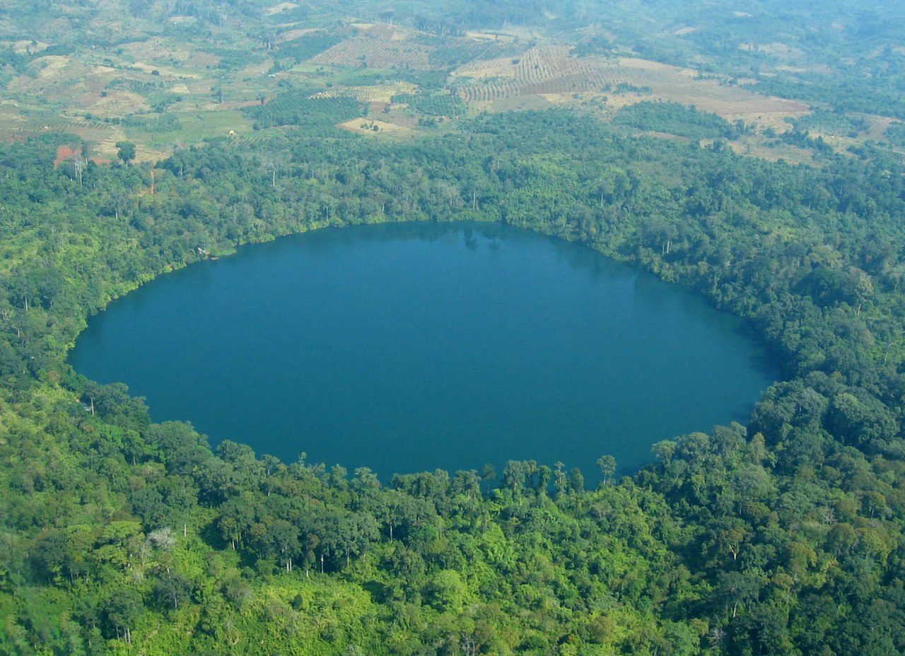
Ratanakiri's forests host a variety of Southeast Asian flora and fauna and are important for regional biodiversity. Conservation efforts focus on preventing deforestation, managing hunting pressure and safeguarding watersheds. At the same time, pressures from commercial logging, agricultural expansion and infrastructure development have been persistent concerns. The province features notable natural attractions such as crater lakes and waterfalls that attract visitors for low-impact tourism.
People, culture and history
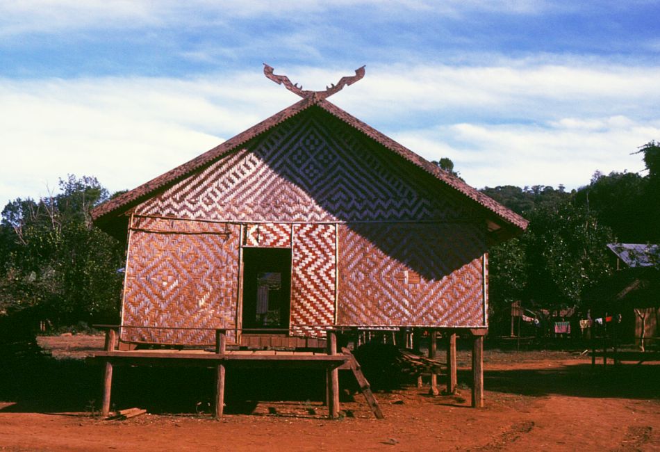
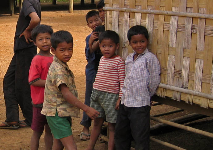
The population includes several indigenous lowland and highland groups—commonly referred to as Jarai, Tampuan and Kreung among others—each with distinct languages, customs and land-use systems. Historically, Ratanakiri was administratively separated from neighbouring provinces in the mid-20th century: it was created in 1959 from the eastern part of Stung Treng Province. Traditional subsistence practices, shifting cultivation and forest-based livelihoods remain important for many communities, even as cash crops and market links expand.
Administration and economy
Administratively, Ratanakiri is divided into eight districts and one municipality; Banlung is the municipality and provincial seat. Local government, customary institutions and non-governmental organizations all play roles in land management and rural development. The economy is a mix of smallholder agriculture, artisanal activities, eco-tourism and limited extractive enterprises. Development initiatives often aim to balance improved access to services with protection of customary land rights.
Visiting and further information
Travelers visit Ratanakiri for trekking, cultural exchanges with indigenous communities, crater lakes and wildlife viewing. Those researching the province can consult official and civil-society resources for administrative details and maps; a useful starting point for administrative listings is the provincial profile and its divisions (administrative divisions), while general information on the province can be found at a regional overview page (Ratanakiri overview).
- Protected areas: Virachey National Park, Lomphat Wildlife Sanctuary and other reserves.
- Notable natural features: Annamite Range, Tonle San and Tonle Srepok rivers, crater lakes and waterfalls.
- Cultural groups: Jarai, Tampuan, Kreung and other indigenous communities.
Questions and answers
Q: Where is Ratanakiri located?
A: Ratanakiri is a province in Cambodia.
Q: What is the capital city of Ratanakiri?
A: The capital city of Ratanakiri is Banlung.
Q: When was Ratanakiri Province created?
A: Ratanakiri Province was created in 1959.
Q: What was the area that became Ratanakiri Province before 1959?
A: The area that became Ratanakiri Province was the eastern area of Stung Treng Province.
Q: What mountains are located in the north of Ratanakiri Province?
A: The Annamite Range of mountains is located in the north of Ratanakiri Province.
Q: What are the names of the rivers in Ratanakiri Province?
A: The names of the rivers in Ratanakiri Province are Tonle San and Tonle Srepok.
Q: What are some of the natural reserves located in Ratanakiri Province?
A: Lomphat Wildlife Sanctuary and Virachey National Park are both natural reserves located in Ratanakiri Province.
Related articles
Author
AlegsaOnline.com Ratanakiri Province — northeast Cambodia: geography, people and conservation Leandro Alegsa
URL: https://en.alegsaonline.com/art/81251
Sources
- ratanakiri.gov.kh : "History of Ratanakiri Province"
- drive.google.com : "General Population Census of the Kingdom of Cambodia 2019"