Rappahannock River
A major river in eastern Virginia that flows from the Blue Ridge to the Chesapeake Bay; notable for its watershed, ecology, colonial and Civil War history, and modern recreational and conservation roles.
The Rappahannock River is a prominent waterway in Virginia, United States, rising in the foothills of the Blue Ridge Mountains and flowing eastward to the Chesapeake Bay. Its course crosses much of the northern portion of the state, covering a mixture of mountainous, piedmont and coastal landscapes. The river and its tributaries drain a predominantly rural and often forested watershed, although development from nearby urban centers has increased in recent decades.
Image gallery
6 Images
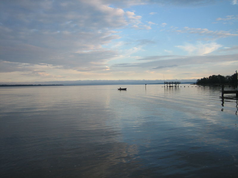


Geography and physical characteristics
The Rappahannock stretches for many miles from its headwaters near the western foothills and receives water from numerous streams and creeks before becoming a tidal estuary near the coast. Historically it formed a natural corridor and barrier; its lower reaches are affected by tides and support brackish marshes and estuarine habitats. The river lies south of the Potomac River and has carved valleys across the piedmont that reflect the region's geology and land use.
Watershed, ecology and resources
The drainage basin supports mixed hardwood forests, wetlands and agricultural land. These habitats sustain fish species, waterfowl and riparian wildlife, and the estuary provides nursery grounds for commercially and recreationally important species. Water quality and habitat restoration have been priorities for local groups and agencies working to balance human uses with conservation. The basin's proximity to the Washington, D.C. metropolitan area has heightened attention to land-use planning and protection of remaining open space.
History and cultural importance
Human presence along the Rappahannock dates to indigenous nations and later early European settlements during the colonial era. The river played a strategic role in the 18th and 19th centuries because its channel and fords influenced travel and military movements. During the American Civil War, the river often marked the boundary between opposing forces and served as an obstacle to north–south campaigns; it figured in operations involving both the Union and the Confederate States. Over time the river corridor supported mills, ferry crossings and small ports that linked inland farms to coastal markets.
Uses, recreation and conservation
Today the Rappahannock is valued for fishing, boating and shoreline recreation as well as sustainable agriculture and forestry in its basin. Local and regional organizations promote riparian buffer restoration, sustainable development practices and monitoring to reduce pollution and protect aquatic habitat. Federal, state and nonprofit partners have supported projects to conserve wetlands, improve fish passage and restore oyster beds in the estuary.
Towns, crossings and notable features
Numerous towns and historic sites lie along the river, connected by bridges, historic ferries and scenic roads. Important crossings and access points serve commercial traffic, commuters and visitors. A sample of river-related features includes:
- Headwater and mountain tributaries that feed the upper Rappahannock.
- Wooded piedmont valleys with farmland and small towns.
- Tidal marshes and estuarine flats near the mouth that support shellfish beds.
Management of the Rappahannock balances cultural heritage, economic uses and ecological health. Continued attention to land use, water quality and habitat restoration seeks to preserve the river's ecological functions and its value to the communities that depend on it.
For broader context on the river's setting and its role in regional history and ecology, see related resources linked here: regional overview, northern Virginia geography, western headwaters, forestland, and project or planning pages at development, settlement history, and conservation portals at Civil War sites and federal resources.
Additional entry points and external materials can provide maps, ecological data and visitor information from academic, state and local organizations: mountain source, bay terminus, neighboring rivers, and civic or historical groups referenced via metropolitan connections, regional history, and other local resource pages.
Questions and answers
Q: What is the Rappahannock River?
A: The Rappahannock River is a river in eastern Virginia, in the United States. It is about 195 miles (314 km) in length and crosses the entire northern part of the state, from the Blue Ridge Mountains in the west, across the Piedmont, to the Chesapeake Bay, south of the Potomac River.
Q: How large is its watershed?
A: The Rappahannock River's watershed covers an area of 2,848 square miles (7,380 km2), which is about 6% of Virginia.
Q: Is it a rural or developed area?
A: Much of the watershed is rural and forested; however it has experienced increased development in recent decades due to its proximity to Washington D.C.'s suburbs.
Q: What role did it play during American history?
A: The Rappahannock was an important river during American history as it was home to early settlements in Virginia Colony and later at center stage for Eastern Theater of American Civil War as a significant obstacle to north-south movements via land. As such it functioned as war's eastern-theatre boundary between Union and Confederate States of America.
Q: Where does it start and end?
A: The Rappahannock River starts at Blue Ridge Mountains located in western part of Virginia and ends at Chesapeake Bay south of Potomac River.
Q: How many miles long is it?
A: The Rappahannock River is approximately 195 miles (314 km) long.
Related articles
Author
AlegsaOnline.com Rappahannock River Leandro Alegsa
URL: https://en.alegsaonline.com/art/81206
Sources
- waterdata.usgs.gov : USGS data
- viewer.nationalmap.gov : The National Map
- talkingproud.us : Rappahannock River
- newrivernotes.com : A History of Orange County, Virginia by W. W. Scott