Queen Mary's Peak — summit of Tristan da Cunha
Queen Mary's Peak is the 2,062 m volcanic summit of Tristan da Cunha in the South Atlantic, noted for its crater lake, remote location, occasional snow and a recorded 1961 eruption that prompted evacuation.
Overview
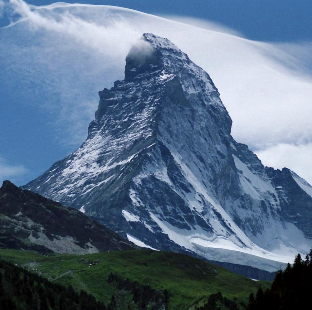
Queen Mary's Peak crowns the volcanic island of Tristan da Cunha and rises to about 2,062 metres above sea level. It is the highest point in the British Overseas Territory of Saint Helena, Ascension and Tristan da Cunha and a prominent landmark in the South Atlantic Ocean. The name honors Mary of Teck, queen consort to King George V.
Image gallery
3 Images

Geology and physical characteristics
The peak is the summit of a large shield volcano that formed the island. The summit contains a roughly 300-metre-wide crater with a distinct heart-shaped lake at its lowest point. The upper flanks and rim show volcanic deposits and layers typical of long-lived oceanic volcanoes, and the upper slopes are often subject to severe winds and, in colder months, patches of snow.
Climate, ecology and the crater lake
Weather at summit level is markedly cooler and wetter than at sea level. The crater lake can freeze in winter and supports limited aquatic life adapted to the cold, isolated conditions. Vegetation on the mountain varies with altitude, from coastal grasses and seabird nesting areas to colder, wind-pruned communities higher up.
History and human significance
Sea captains used the peak as a visual reference while sailing between Europe and the Indian Ocean, and it was an important navigational feature before modern instruments. The island has recorded only one well-documented volcanic outbreak in modern times: an eruption in 1961 from a minor vent on the northern shore forced the temporary evacuation of the islanders.
Uses, access and cultural notes
For the small resident community, the peak is a cultural symbol and a part of local identity. Climbs to the summit are possible but challenging, requiring good fitness and careful weather planning; access is sometimes restricted for safety. Historically it also served mariners as a navigational aid on long ocean passages.
Notable facts
- Queen Mary's Peak marks the highest elevation within its territory and dominates the island's topography.
- The summit crater contains a lake that may freeze seasonally and is relatively small and enclosed within the caldera.
- The 1961 eruption prompted a rare complete evacuation, illustrating how remote communities are vulnerable to volcanic activity.
- Despite isolation, the peak remains a reference point for sailors and a subject of natural-history interest.
Readers seeking further geological or historical detail on the peak and island administration can follow linked resources for official, scientific, and local perspectives: Tristan da Cunha, topographic and elevation notes (elevation data), geological summaries (volcano type), and historical accounts of the 1961 eruption. Additional context on surrounding sea lanes and historical navigation appears in resources tied to the European and Indian Ocean sailing routes.
Questions and answers
Q: What is Queen Mary's Peak?
A: Queen Mary's Peak is the summit of the island of Tristan da Cunha, in the South Atlantic Ocean, and it is the highest point of the British overseas territory of Saint Helena, Ascension and Tristan da Cunha.
Q: How tall is Queen Mary's Peak?
A: The top of Queen Mary's Peak is 2,062 metres (6,765 feet) above sea level.
Q: Why is it called Queen Mary's Peak?
A: Queen Mary's Peak is named after Mary of Teck, the Queen consort of King George V.
Q: What is the peak of Queen Mary's Summit?
A: The mountain is the peak of the large shield volcano which forms the island.
Q: What is the crater at the top of Queen Mary's Summit like?
A: The crater at the top of the Queen Mary's Summit is 300 metres (1,000 feet) wide, with a heart-shaped lake. This lake is normally frozen during the winter, and the upper slopes of the volcano are covered in snow.
Q: Has there been any historical eruption of Queen Mary's Peak?
A: Yes, there was one recorded historical eruption of Queen Mary's Peak, which occurred in 1961 from a small crater on the north shore of the island. The island community had to be evacuated.
Q: Was Queen Mary's Peak ever used as a navigational aid by sailors?
A: Yes, Queen Mary's Peak was used by sailors on the route from Europe to the Indian Ocean and beyond as a navigational aid. In the 17th century the East India Company instructed captains to sail via Tristan.
Related articles
Author
AlegsaOnline.com Queen Mary's Peak — summit of Tristan da Cunha Leandro Alegsa
URL: https://en.alegsaonline.com/art/80460
Sources
- books.google.com : "Some Account of the Island of Tristan da Cunha and of its Natural Productions"
- tristandc.com : "Tristan Peak"