Pyrenees — mountain range between France and Spain
Mountain chain in southwest Europe forming a natural border between France and Spain, stretching from the Bay of Biscay to the Mediterranean; known for high peaks, biodiversity, distinct cultures, and outdoor recreation.
Overview
The Pyrenees are a prominent mountain range in southwest Europe forming a largely continuous natural border between France and Spain. The range separates the Iberian Peninsula from the rest of Europe and extends for about 430 km from the Atlantic Ocean (Bay of Biscay) to the Mediterranean Sea (Cap de Creus). It is known by regional names such as Catalan: Pirineus, French: Pyrénées, Spanish: Pirineos, Occitan: Pirenèus, Aragonese: Perinés and Basque: Pirinioak.
Image gallery
10 Images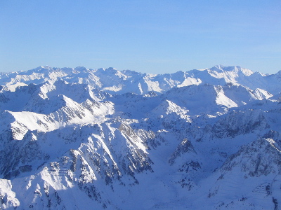


Geography and extent
Running roughly west–east, the chain presents a succession of massifs, deep valleys and plateaus. The western Pyrenees are influenced by Atlantic weather while eastern sectors show Mediterranean features. The central Pyrenees include the highest summits and the microstate of Andorra, located in a high valley between Spain and France. River systems originating in the range feed both northern and southern basins.
Physical characteristics
The range contains numerous high peaks, with the highest summits exceeding 3,000 metres; Aneto in the Maladeta massif is traditionally cited as the tallest, rising to just over 3,400 metres. Glacial relics such as cirques, moraines and small glaciers persist in sheltered areas. Karst limestone is widespread in many sectors, producing caves and sinkholes, while lower slopes host mixed woodlands.
Geology
The Pyrenees formed during the tectonic collisions that affected southwestern Europe, through processes of folding, uplift and subsequent erosion. Over successive ice ages Pleistocene glaciers carved distinctive U-shaped valleys and cirques. Local geology varies from older metamorphic cores to sedimentary cover and extensive calcareous plateaus.
Ecology and protection
Vegetation zones change with elevation and exposure: Atlantic-influenced forests in the west give way to subalpine meadows and high-elevation pastures, while Mediterranean species appear on sun-exposed eastern slopes. The mountains support mammals, birds and plant communities adapted to alpine and montane conditions. Numerous protected areas and parks on both sides of the border conserve landscapes and biodiversity, and cross-border initiatives aim to maintain ecological connectivity.
Human history and culture
Human occupation dates back to prehistoric times; archaeological sites, pastoral routes and medieval fortifications testify to long human use. The Pyrenees are a cultural mosaic with several regional languages and traditions. Traditional activities such as transhumant shepherding coexist with contemporary livelihoods based on tourism, local crafts and mountain agriculture.
Recreation and access
The range is a major destination for hiking, mountaineering, skiing and cycling; many long-distance trails and high passes are popular with visitors. Famous road passes have featured in international cycling races. Visitor management and protected-area planning aim to reconcile recreation with conservation priorities.
Notable peaks and passes
- Aneto — the highest peak of the Pyrenees.
- Monte Perdido — a major massif with striking cliffs and valleys.
- Posets — one of the principal summits in the central sector.
- Col du Tourmalet, Somport and other historic passes used for transport, pilgrimage and sport.
As a physical barrier and a corridor for species and people, the Pyrenees continue to shape the landscapes, cultures and conservation efforts of southwest Europe, offering diverse opportunities for study and outdoor recreation across national frontiers.
Geography
The Pyrenees are divided into the Western or Atlantic Pyrenees, the High or Central Pyrenees and the Eastern Pyrenees, which includes the Pic du Canigou. The High Pyrenees range extends from the Port de Canfranc in the west to the Val d'Aran in the east.
The boundary with the Cantabrian Mountains is fluid, but can be drawn roughly along the line Pamplona - Leitza - Oria River - Donostia-San Sebastián.
The highest mountain is the Pico de Aneto in the Maladeta massif at 3404 metres. There are about two hundred peaks above 3000 m in the Pyrenees. The highest of them are glaciated. Since about the middle of the 19th century there has been a sharp decline in glaciers. The once very impressive Ossoue glacier on the Vignemale has lost much of its former size.
→ Main article: List of mountains in the Pyrenees
Politics, history and economy
Before the settlement of Cro-Magnon men (Homo sapiens), the Spanish foothills of the Pyrenees were already inhabited by Neanderthals, as findings in the cave Cova Gran de Santa Linya prove.
The cromlechs of the Pyrenees bear witness to Stone Age settlement.
The political border between France and Spain runs through the Pyrenees. The small principality of Andorra lies in the eastern Pyrenees. Like the Alpine region, the Pyrenees have a cultural linking function between the three riparian states, which is shown, for example, by the use of the same languages (Catalan, Gascon, Basque).
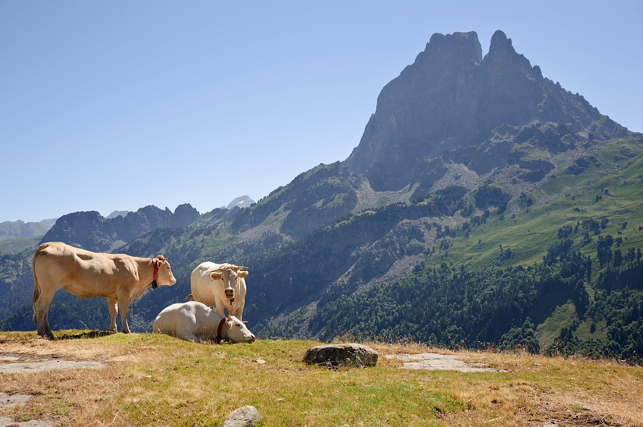
Extensive pasture farming with sheep, cattle and goats is practised, in the summer months also as alpine pasture farming. In the past, transhumance was common, but today it has almost disappeared. Especially in the western Pyrenees different kinds of cheese are produced. In the predominant limestone there are often caves in which the cheese can ripen on the alpine pastures. Cheese is produced from cow's and sheep's milk, often mixed. Well-known varieties are the Ossau-Iraty Brebis-Pyrénées from the Vallée d'Aspe, the Vallée d'Ossau and the bordering Spanish Pyrenees and the Pyrenean cheese with its black wax layer, produced in the Basque Country from cow's milk. Fresh and aged goat's milk is also used to make goat's cheese.
In the foothills, viticulture is practised on both the French (Irouléguy, Jurançon, Corbières) and Spanish sides. Smuggling played an important role until the middle of the 20th century. In the western Pyrenees, the Pottok ponies were used as pack animals, while in the east the Mérens proved their worth as smuggler ponies.
Traffic
Like any high mountain range, the Pyrenees represent a significant obstacle to land-based transport. The most important road and rail links are therefore located in the far east and far west of the mountains - where they are still relatively low. In the west, the motorway between Bordeaux or Toulouse on the one hand, and the Spanish Basque Country and Madrid on the other, passes through the Irún (Behovia) border crossing. To the east, the motorway links Marseille and Barcelona and the other towns on the French and Spanish Mediterranean coasts respectively, crossing the border at the small town of Le Perthus; on the Spanish side, the municipality of La Jonquera lies on the border. These two motorway border crossings carry most of the goods traffic between the Iberian Peninsula and the rest of Europe.
The two most important rail links run from north to south through the Pyrenees, at Irún/Hendaye and Cerbère/Portbou, near the coast respectively, in the far east and far west. They connect France and Spain.
The central link is the line at Cerbère/Portbou from Lyon to Barcelona, Madrid, Seville, which is connected to the European high-speed network and is also built in standard gauge on the Spanish side. The Spanish high-speed network in standard gauge does not yet serve the Spanish Atlantic coast. Train connections of SNCF and Renfe are rare and partly very slow in the border area. It might be a good idea to take the narrow-gauge line of EuskoTren (former Ferrocarriles de Vía Estrecha (FEVE)) from Hendaye (France) to San Sebastian and possibly on to Bilbao, as there is a frequent service here. A trip to Madrid seems to make little sense, so that this route is internationally only limited usable.
Another cross-border rail connection is a line from Portet-Saint-Simon station south of Toulouse via Latour-de-Carol and Puigcerdà to Barcelona. In Latour-de-Carol the change to Spanish broad gauge trains of the Rodalies Barcelona takes place. It runs through the 5414 m long Tunnel ferroviaire du Puymorens.
A previously existing further connection (railway line Pau-Canfranc and railway line Saragossa-Canfranc (broad gauge)) through the Somport tunnel has been interrupted between Bedous and Canfranc since 1970 and has not been repaired (bus as rail replacement service). Both lines are of no importance for international traffic. Cross-border freight traffic is no longer possible because of the change from standard gauge to broad gauge. Corresponding facilities (gauge change or reloading) have been dismantled.
A planned fifth railway line from Lleida in Spain to France ends to this day in La Pobla de Segur in Spain. Further construction to France has never taken place.
The scenic Ligne de Cerdagne has only narrow gauge with side catenary and runs east-west in France. It runs from Latour-de-Carol to Villefranche-de-Conflent with a connection to the standard gauge line to Perpignan. The line serves only tourist purposes and is of no importance for regional or international traffic.
Important rural roads connect the cities of Pau (France) and Jaca or Huesca (Spain) through the Somport tunnel and Foix (France) and Manresa (Spain) via the Bourg-Madame/Puigcerdá border crossing and through the Cadí tunnel. The other roads that cross the Pyrenees are mainly of regional importance. Worth mentioning is the camino frances, the Way of Saint James, the pilgrimage route from France to Santiago de Compostela. Many pilgrims begin it in the small town of Saint-Jean-Pied-de-Port, about 8 kilometres from the Spanish border. Andorra can only be reached by a single road, using either the Envalira tunnel from France or the road over the Envalira pass.
Geology
→ Main article: Geology of the Pyrenees
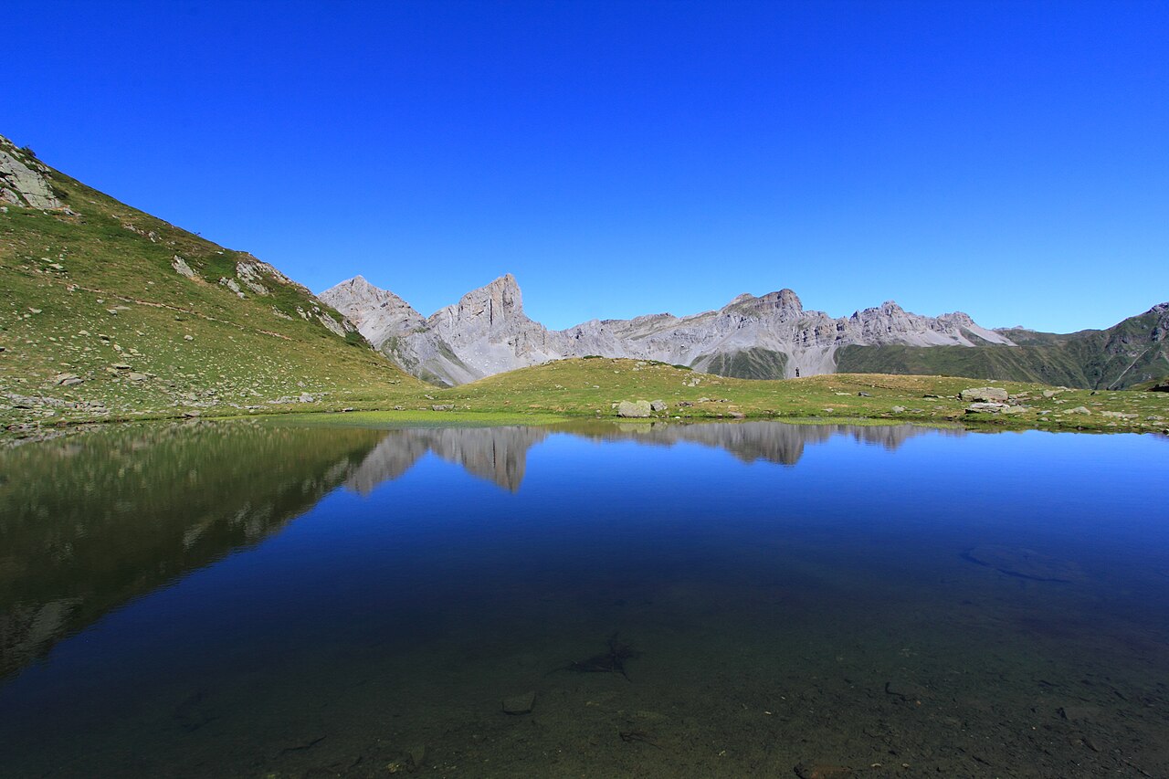
Like the Alps, the Pyrenees were formed around 50 to 100 million years ago during the Tertiary period. The western Pyrenees consist mainly of limestone, whereas in the central Pyrenees various granites dominate. The folded mountains were covered with a closed ice sheet, especially during the Würm Ice Age. The ice age has formed several hanging valleys and many thousands of glacial lakes. Due to these boundary conditions, simultaneous snowmelt and heavy rainfall can lead to widespread devastation, such as the floods in the Pyrenees in 2013.
Fauna
On the French side, some brown bears still live in the large mixed forests up to about 1800 m altitude. In the high alpine areas the pyrenean ibex (French isard, Spanish sarrio or rebeco) is found, but it also occurs in the Cantabrian Mountains and the Abruzzi. Despite conservation measures, the local subspecies pyrenaica of the Iberian ibex finally became extinct in 2000 for unknown reasons. At the western end of the mountain range, the globally critically endangered European mink has its last natural occurrence in Western Europe. Although not originally native, marmots naturalized from the Alps have become very widespread. Rare and endangered is the Pyrenean desman, a species of the mole family. Birds include the golden eagle, the booted eagle, the hawk eagle, the griffon vulture, the Egyptian vulture and the bearded vulture. Other particularly noteworthy breeding bird species, most of which are widely isolated, are the rock ptarmigan, capercaillie, white-backed woodpecker, Mornell's plover, wallcreeper, alpine chough, alder siskin, lemon siskin, ring ouzel and mountain pipit. There are a large number of insects, the most notable of which are the 300 or so species of butterfly, as well as grasshoppers and beetles. Among the endemic species of this mountain range are the Pyrenean mountain newt and the moor butterfly Erebia gorgone.
Flora
The flora contains about 4500 plant species, of which 150 are endemic. They are rudiments of the last great ice ages: during the Pleistocene, many plant species ranged from the cold north to the warmer south, but they could not cross the Pyrenees. However, some of them took refuge in valleys and have become endemic to the area. Examples are the Pyrenean lily and the Pyrenean rock plate.


National Parks
There are three national parks in the Pyrenees. The oldest is the Ordesa y Monte Perdido National Park, created in 1917 on the Spanish side, located south of the Cirque de Gavarnie. It covers an area of about 156 km². Also in Spain, the Aigüestortes i Estany de Sant Maurici National Park covers an area of about 141 km², making it the smallest of the three national parks. On the French side, the area from the mountains south of Lescun in the Vallée d'Aspe in the west to the Néouvielle massif in the east was declared a national park (Parc National des Pyrénées) in 1967. This has an area of 457 km².
Related articles
Author
AlegsaOnline.com Pyrenees — mountain range between France and Spain Leandro Alegsa
URL: https://en.alegsaonline.com/art/80239