
Pomerania: historical Baltic region of Germany and Poland
Pomerania is a coastal region along the Baltic Sea, historically inhabited by West Slavic and Germanic peoples. Today it is divided between Germany and Poland and is known for maritime trade, ports and seaside landscapes.
Overview
Pomerania (in German Pommern and in Polish Pomorze) is a historic region on the southern shore of the Baltic Sea. Its identity derives from a shared coastal geography and a long history of cross-cultural contact. Modern Pomerania is politically split between Germany and Poland, but the name and cultural references persist across borders.
Image gallery
10 Images



Geography and parts
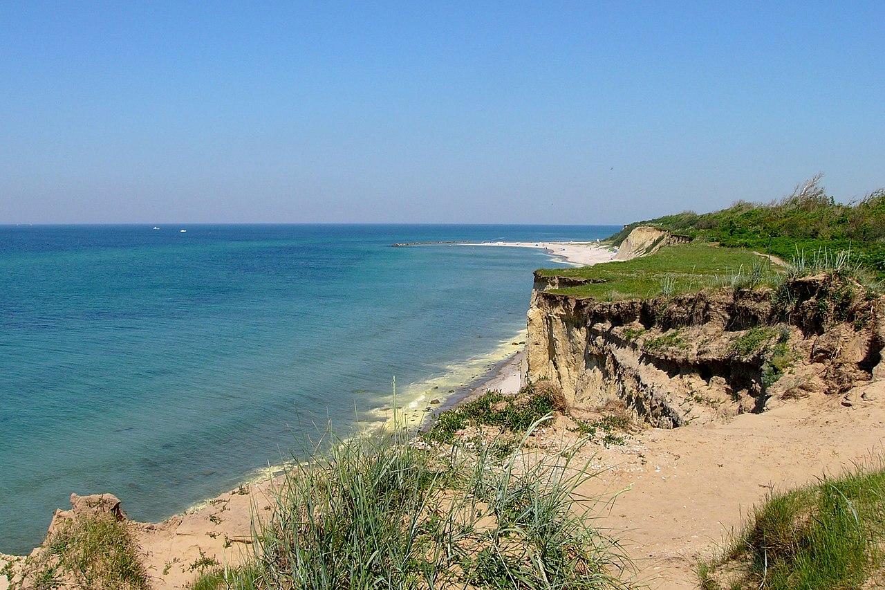
The landscape combines a low-lying coastline, sandy beaches, lagoons and inland lakes, with fertile plains and small wooded areas. Notable subregions include Western Pomerania and Eastern Pomerania (sometimes called Pomerelia). Important urban centers historically and today include Szczecin (Stettin), Stralsund, Greifswald and Koszalin; a number of islands and peninsulas lie off the coast.
History and development
Pomerania’s recorded history spans Slavic settlement, the formation of local duchies, integration into Baltic trade networks and periods of German and Polish rule. From the Middle Ages many towns participated in Hanseatic commerce. Over centuries borders shifted frequently; after the upheavals of the 20th century the region’s political map was substantially redrawn and populations moved accordingly.
Economy, culture and importance
Maritime activities — shipping, fishing, shipbuilding and port trade — have long shaped the region’s economy. Agriculture, forestry and tourism (seaside resorts and natural parks) are also important. Pomerania preserves diverse cultural strands: local dialects, maritime folklore, and minority traditions such as the Kashubian community in the eastern areas.
Notable facts and distinctions
- Name origin: Slavic roots meaning "land by the sea".
- Administrative split: parts belong to German states and Polish voivodeships today.
- Heritage: Hanseatic towns, coastal fortifications and maritime museums testify to its trading past.
Pomerania remains a distinct cultural and natural region whose shoreline and ports continue to link northern Europe. For further reading about languages, historical borders and modern administration, consult region-specific resources and local archives.

Geography
Politically, Pomerania today is divided between the German states of Mecklenburg-Vorpommern and Brandenburg and the Polish voivodeships of West Pomerania with its capital Szczecin, Pomerania with its capital Gdańsk, and Kujawsko-Pomerania with its capitals Bydgoszcz and Toruń.
The Pomeranian Bay and the Szczecin Lagoon, also known as the Oder Lagoon, lie in the region. The largest islands off the Pomeranian coast are Usedom, Wollin (Wolin) and Rügen. The islands of Rügen and Usedom and the Bodden coast of Western Pomerania have a mixture of land cores with a close interlocking of land and sea and spits connecting them (not so called here). The inland of Western Pomerania is characterised by a network of glacial valleys, the bottom of which is only slightly above sea level. Since the Stettiner Haff (Oderhaff) is a sea bay, the three estuary arms of the Oder, i.e. Peenestrom, Swine (Świna) and Dievenow (Dziwna) are not rivers but sea arms. Between Dievenow and Gdansk Bay (Zatoka Gdańska) extends the Pomeranian Compensatory Coast. There, the bays have been closed by currents and now form beach lakes, such as Lake Leba. At the end of the Equalizing Coast, the Hela Peninsula (Polish: Hel) juts into the Bay of Gdansk. The Pomeranian Lake District, formed during the Ice Age, stretches inland from Hinterpommern and Pomerania, the eastern part of which is also called the Kashubian Lake District. The strip between the coast and the lake district is called the Pobrzeże Slowińskie.
Most of Vorpommern lies in the state of Mecklenburg-Vorpommern with the main centres of Stralsund and Greifswald. The southernmost part of Vorpommern lies in the state of Brandenburg and extends south to the Randow and Welse rivers. Most of the communities of Vorpommern in Brandenburg are grouped together in the Amt Gartz (Oder). The villages of Schönow and Jamikow in West Pomerania belong to the municipality of Passow in the Amt Oder-Welse. The Vorpommern villages of Kunow and Kummerow are part of the town of Schwedt/Oder. Part of Western Pomerania, the so-called Stettiner Zipfel with the city of Szczecin itself as well as the easternmost section of the island of Usedom (Uznam) with the former district town of Swinemünde (Świnoujście) and the island of Wollin (Wolin), belongs to the Polish voivodeship of Western Pomerania.


Origin and meaning of the name
The name is derived from the Slavic po more and means "by the sea". Pomerania is originally the land of the Slavic tribe of the Pomorans.
The Latin name Pomerania is written down as the phrase longum mare ('along the sea') in the Dagome Iudex document of c. 1086, a registry of the Curia concerning a donation to the pope made around 990 by "Dagome and Ote" (Mieszko I and Oda of Haldensleben), describing their land as "Schinesge" (early Polish Piast state). The Spanish-Arab-Jewish traveller Ibrahim ibn Jaqub visited - also in the 2nd half of the 10th century - the trading town of Vineta near the mouth of the Oder, which has not been located with certainty to this day, and also mentioned Demmin and the pre-Pomeranian tribe of the Ranen. The first mention of Pomerania is found for the year 1046 about a Zemuzil, Duke of Pomerania ("Zemuzil [dux] Bomeraniorum"). Pomerania is frequently mentioned in the chronicles of Adam of Bremen around 1070 and Gallus Anonymus around 1113.
Related articles
Author
AlegsaOnline.com Pomerania: historical Baltic region of Germany and Poland Leandro Alegsa
URL: https://en.alegsaonline.com/art/77899
Sources
- freepages.history.rootsweb.com : Map of Poland before the fragmentation period.