
Aveyron (river)
River in southern France that flows into the Tarn; gives its name to the Aveyron department and traverses karst plateaus, gorges and agricultural lowlands.
Overview
The Aveyron is a river in southern France known for winding through limestone plateaus and narrow gorges before joining a larger river system. Its name was given to the French administrative area called the Aveyron department. The stream is known locally in Occitan as Avairon.
Image gallery
7 Images
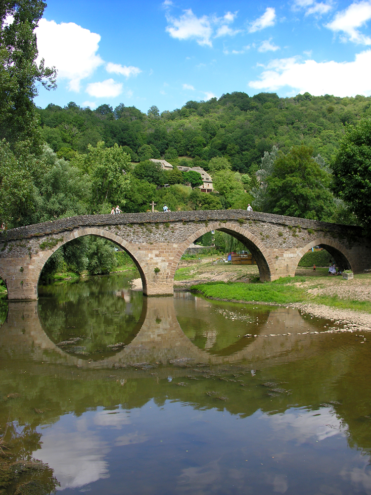


Location and course
The river rises in upland terrain and descends across mixed agricultural and forested country to meet the Tarn. Coordinates for a central point on the river are recorded as 44°05′15″N 1°15′58″E. Along its course the valley alternates between broad alluvial sections used for farming and steeper, rock-walled gorges where the stream has incised the plateaus.
Physical characteristics
- Geology: largely limestone and other sedimentary rocks, which produce karst features such as caves and sinkholes.
- Landscape: a mix of upland moors, river terraces, and confined canyon reaches where erosion has been concentrated.
- Hydrology: seasonal flow variation typical of temperate European rivers, with higher discharge in wet seasons and lower flow in summer.
History, culture and economy
Human settlement has long clustered along the Aveyron because of water supply, fertile floodplain soils and sites for mills. The river valley contains historic villages and transport routes that follow its course. The water has been harnessed in places for small-scale industry and agriculture, and the river helped shape local place names and administrative boundaries, notably lending its name to the department.
Uses, ecology and recreation
The Aveyron supports freshwater habitats for fish and invertebrates and provides resources for irrigation and local communities. Recreational activities include angling, canoeing and riverside walking where access and safety allow. Conservation efforts in river corridors commonly focus on water quality, floodplain habitat preservation and maintaining ecological continuity for migrating species.
Notable facts and distinctions
- Tributary status: the river is a tributary of the Tarn river, itself part of a larger river network that drains toward the Atlantic basin.
- Regional identity: several place names and cultural references in the region derive from the river and its valley.
- Cultural language: the Occitan form Avairon reflects the historical language of the area.
For maps and more detailed geographical data consult regional hydrological resources or local guides; basic coordinates are available at 44°05′15″N 1°15′58″E, and general regional information can be found through resources linked to the broader river network like the Tarn and associated basins.
Questions and answers
Q: What are the coordinates of the Aveyron river?
A: The coordinates of the Aveyron river are 44°05′15″N 1°15′58″E.
Q: Where is the Aveyron river located?
A: The Aveyron river is located in southern France.
Q: What is the Aveyron department named after?
A: The Aveyron department is named after the Aveyron river.
Q: Is the Aveyron river a tributary of the Tarn river?
A: Yes, the Aveyron river is a tributary of the Tarn river.
Q: What language is the name "Aveyron" in?
A: The name "Aveyron" is in the Occitan language.
Q: What is the significance of the Aveyron river in southern France?
A: The Aveyron river is significant in southern France as it is a tributary of the Tarn river and the department of Aveyron is named after it.
Q: Where exactly is the Aveyron river situated?
A: The Aveyron river is situated at a latitude of 44.08750°N and a longitude of 1.26611°E.
Related articles
Author
AlegsaOnline.com Aveyron (river) Leandro Alegsa
URL: https://en.alegsaonline.com/art/7727
Sources
- services.sandre.eaufrance.fr : "L'Aveyron (O5--0250)"
- hydro.eaufrance.fr : "L'Aveyron à Montauban (Loubéjac)"
- geoportail.gouv.fr : "Source de l'Aveyron"
- geoportail.gouv.fr : "Confluence de l'Aveyron"
- services.sandre.eaufrance.fr : "Le Viaur (O5--0290)"
- services.sandre.eaufrance.fr : "Le Cérou (O56-0400)"
- services.sandre.eaufrance.fr : "La Vère (O57-0400)"
- services.sandre.eaufrance.fr : "La Serène de Sanvensa (O52-0430)"
- services.sandre.eaufrance.fr : "L'Alzou (O52-0400)"
- services.sandre.eaufrance.fr : "La Bonnette (O5680500)"
- services.sandre.eaufrance.fr : "Rivière la Lère (O58-0400)"
- services.sandre.eaufrance.fr : "Ruisseau de Serre (O5040500)"