
Piccadilly Circus: central junction and public space in London's West End
Piccadilly Circus is a famous road junction and public space in London's West End, noted for its illuminated advertising, the Shaftesbury Memorial fountain (commonly called Eros) and its role as a transport and meeting hub.
Overview
Piccadilly Circus is a busy and well known public space and traffic interchange in central London, situated in the city's West End within the City of Westminster. The name combines the street name Piccadilly with the Latin-derived term "circus", used in Britain for a circular open space or traffic junction. The Circus functions as a crossroads for retail, entertainment and cultural streets and has long been a popular meeting point for residents and visitors.
Image gallery
10 Images






Layout and principal streets
Several principal streets meet at the Circus. To the west runs Piccadilly, while Regent Street continues northwards from the junction. Other approaches lead to the theatre district on Shaftesbury Avenue, to the Haymarket and along Coventry Street toward Leicester Square. This configuration concentrates vehicle traffic and large numbers of pedestrians, and has shaped successive changes to crossings, lighting and pedestrian areas.
Monuments and sculpture
The central fountain and winged figure is one of the Circus's best known features. The memorial is popularly referred to as "Eros", although it is more accurately associated with Anteros, a companion figure in classical mythology; the distinction appears frequently in local accounts and legend. The fountain and statue form an informal meeting place and a frequent subject for photography and public gatherings.
Advertising, lights and the northern façade
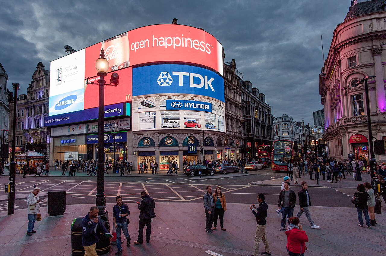
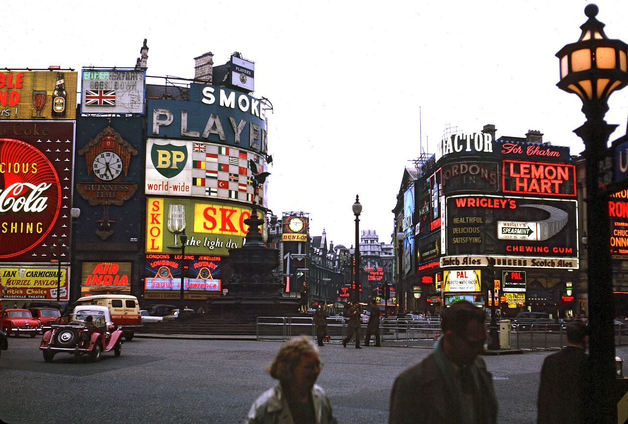
Piccadilly Circus is widely recognised for its illuminated advertising displays mounted on the corner building on the northern side of the junction. The display panels have evolved from early electric and neon signs to modern LED and digital screens that show branded content as well as occasional public information. The illuminated façade contributes to the area's visual identity, especially at night, and makes the Circus a familiar city landmark.
Transport connections
Directly beneath the plaza is Piccadilly Circus tube station, a convenient Underground interchange and an important reason for the site's high footfall. The station links central streets to wider parts of the city and provides onward connections for many visitors. Surface bus routes and pedestrian routes from surrounding streets further increase the area's accessibility.
Cultural role and media
As an iconic urban space the Circus features frequently in films, television and literature, and it is often used as a backdrop for public events, demonstrations and celebrations. Its prominence has made the site a symbol of London’s West End, combining commercial signage, historic architecture and public sculpture in a small but tightly used urban space.
Surrounding buildings and amenities
The Circus is ringed by a mix of theatres, retail premises and historic façades. Nearby venues include the former London Pavilion and the long-running Criterion Theatre, along with restaurants, shops and entertainment venues that serve tourists and local theatre audiences. The combination of theatres and shopping makes the area a gateway to the broader West End leisure district.
Visiting and practical notes
Visitors should expect high pedestrian volumes and busy traffic, especially during evenings and weekends. Parts of the plaza around the fountain have been adapted to give priority to pedestrians, but care is still required when crossing the approaches. For official transport guidance and up-to-date visitor information people commonly consult local authority and transport resources in the City of Westminster or transport operators.
Notable facts
- The site combines civic commemoration, commercial advertising and urban movement in one compact public space.
- The memorial fountain popularly called "Eros" is a frequent meeting point and a subject of local discussion about myth and public art.
- Signage on the northern façade has evolved with technology, from early illuminated signs to today’s digital displays.
- Piccadilly Circus links Piccadilly, Regent Street and routes towards Leicester Square, concentrating both traffic and visitors.
For further orientation, historical background and visitor advice consult official guides and transport information provided by local services or recognised visitor resources. The Circus remains a compact but dynamic piece of London’s urban fabric: a junction of streets, signs, theatres and public life that continues to adapt while remaining instantly recognisable.
Questions and answers
Q: What is Piccadilly Circus?
A: Piccadilly Circus is a road junction and public space located in London's West End in the City of Westminster.
Q: What are some of the places that Piccadilly Circus links to?
A: Piccadilly Circus links to Regent Street, Shaftesbury Avenue, Haymarket, Coventry Street (which leads to Leicester Square), and Glasshouse Street.
Q: Why is Piccadilly Circus considered a busy meeting place?
A: Piccadilly Circus is considered a busy meeting place due to its status as a major traffic intersection.
Q: What is Piccadilly Circus well-known for?
A: Piccadilly Circus is well-known for its neon signs and video display which are mounted on the corner building on the northern side.
Q: What is the name of the statue located at Piccadilly Circus?
A: The statue located at Piccadilly Circus is of Anteros who was the brother of Eros in legend, but it is popularly known as Eros.
Q: What is the name of the tube station underneath Piccadilly Circus?
A: The name of the tube station underneath Piccadilly Circus is Piccadilly Circus tube station which is part of the London Underground system.
Q: What are some notable buildings surrounding Piccadilly Circus?
A: Some notable buildings surrounding Piccadilly Circus include the London Pavilion and the Criterion Theatre.
Related articles
Author
AlegsaOnline.com Piccadilly Circus: central junction and public space in London's West End Leandro Alegsa
URL: https://en.alegsaonline.com/art/76714
Sources
- tools.wmflabs.org : 51°30′36″N 0°8′4″W / 51.51000°N 0.13444°W / 51.51000; -0.13444