Auvergne-Rhône-Alpes — administrative region of France
Auvergne-Rhône-Alpes is a large French region formed in 2016 by merging Auvergne and Rhône‑Alpes. It combines mountains, valleys and cities such as Lyon and Grenoble, with strong industry, agriculture and tourism.
Overview
Auvergne-Rhône-Alpes is an administrative region in east‑central France created on 1 January 2016 by combining the former regions of Auvergne and Rhône‑Alpes. Its administrative capital is based in Lyon, a metropolitan and cultural hub. The region spans a wide range of landscapes from the volcanic plateaus of the Massif Central to the high peaks of the Alps; its location is often referenced by coordinates such as 45°45′35″N 4°50′32″E.
Image gallery
8 Images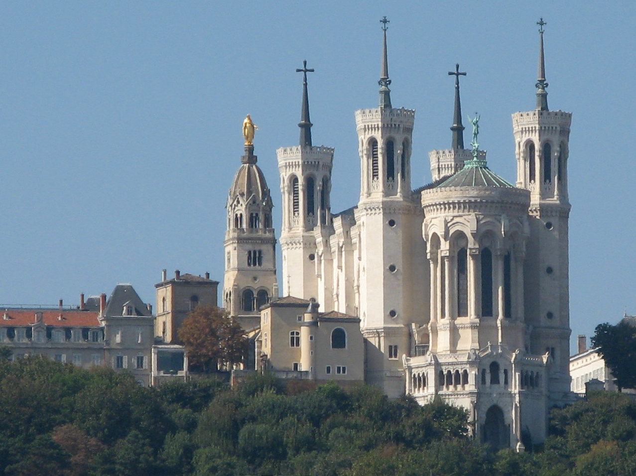


Geography and environment
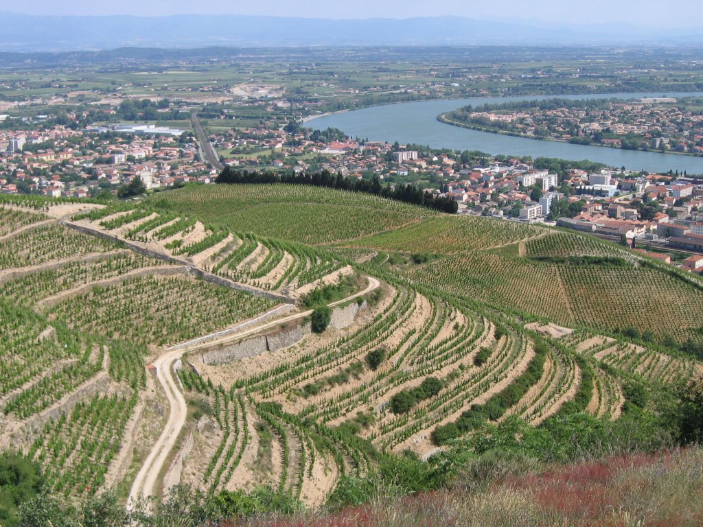
The territory includes major mountain chains (the Alps and parts of the Massif Central), important river valleys—the Rhône and its corridor—and significant freshwater basins. Mont Blanc, Western Europe's highest summit, lies on the region's eastern side. These contrasting environments support diverse ecosystems, protected areas and outdoor activities such as skiing, hiking and mountaineering.
History and identity
The modern region was formed as part of a national territorial reorganization; it brings together distinct historical provinces and linguistic traditions. Regional languages and dialects such as Franco‑Provençal and Occitan are part of local heritage; see a reference to the Occitan form via Occitan. The long urban and rural histories shaped distinctive local cuisines, crafts and festivals centered on cities like Lyon, Grenoble and Clermont‑Ferrand.
Economy and society
Auvergne‑Rhône‑Alpes is one of France's economic powerhouses. Lyon is a major center for banking, biotech, food industries and higher education; Grenoble is known for scientific research and high‑tech clusters. Agriculture remains important in the plains and foothills, producing cheeses, wines and livestock products. Tourism—both alpine winter sports and summer nature tourism—contributes substantially to local incomes.
Administration and transport
The region is governed by a regional council seated in Lyon and coordinates departmental services across urban and rural areas. Transport links include major motorways and rail corridors following the Rhône valley, international airports serving Lyon and other cities, and mountain passes that connect France with neighboring countries.
Notable facts and further reading
Questions and answers
Q: What are the coordinates of Auvergne-Rhône-Alpes?
A: The coordinates of Auvergne-Rhône-Alpes are 45°45′35″N 4°50′32″E.
Q: What is the meaning of the coordinates of Auvergne-Rhône-Alpes?
A: The coordinates of Auvergne-Rhône-Alpes refer to the geographical location of the region in southern France.
Q: What is Auvergne-Rhône-Alpes?
A: Auvergne-Rhône-Alpes is an administrative region of France that was created on 1 January 2016 by merging the former French regions of Auvergne and Rhône-Alpes.
Q: Where is Auvergne-Rhône-Alpes located?
A: Auvergne-Rhône-Alpes is located in the central and eastern parts of southern France.
Q: What is the capital city of Auvergne-Rhône-Alpes?
A: The capital city of Auvergne-Rhône-Alpes is Lyon.
Q: How many former French regions were merged to create Auvergne-Rhône-Alpes?
A: Two former French regions were merged to create Auvergne-Rhône-Alpes.
Q: What are the local languages spoken in Auvergne-Rhône-Alpes?
A: The local languages spoken in Auvergne-Rhône-Alpes are Franco-Provençal and Occitan.
Related articles
Author
AlegsaOnline.com Auvergne-Rhône-Alpes — administrative region of France Leandro Alegsa
URL: https://en.alegsaonline.com/art/7650
Sources
- insee.fr : "Populations légales 2014: Recensement de la population - Population des régions"
- annuaire-mairie.fr : "Ville de Lyon"
- peakbagger.com : "Mont Blanc, France/Italy"
- peakbagger.com : "France Department High Points"
- insee.fr : "Populations légales 2014 des départements et des collectivités d'outre-mer"