Perm Krai: geography, history, economy and culture of a western Ural region
Perm Krai is a federal subject of Russia formed in 2005 around the city of Perm. It spans the western slopes of the Ural Mountains and the eastern East European Plain, centered on the Kama River basin.
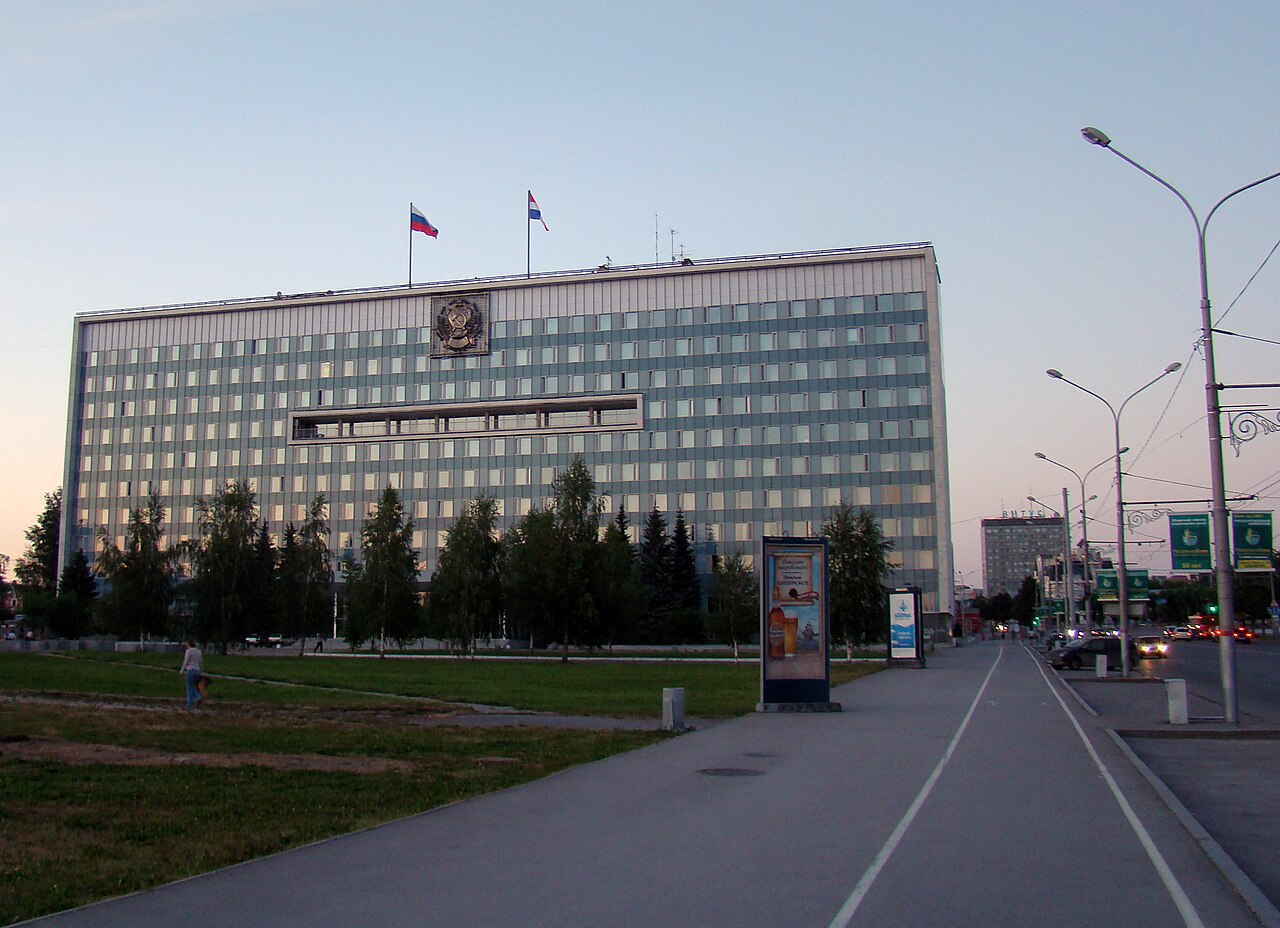
Perm Krai is a federal subject of the Russian Federation created on 1 December 2005 through the merger of Perm Oblast and the Komi–Permyak autonomous area. Its administrative center is the city of Perm. The region occupies a transition zone between the East European Plain and the western side of the Ural mountain system and plays a significant role as an industrial, cultural and transport hub in this part of Russia. It is formally a krai, one of several types of federal subjects of Russia.
Image gallery
10 Images


Geography and natural features
Perm Krai stretches roughly 645 km from north to south and about 417.5 km from west to east. The landscape combines low rolling hills and extensive forested areas on the plain with the rising ridges and uplands of the Ural Mountains in the east. The highest elevation in the krai is Tulysmsky Kamen, rising to nearly 1,500 metres on the northeasterly flank of the Urals.
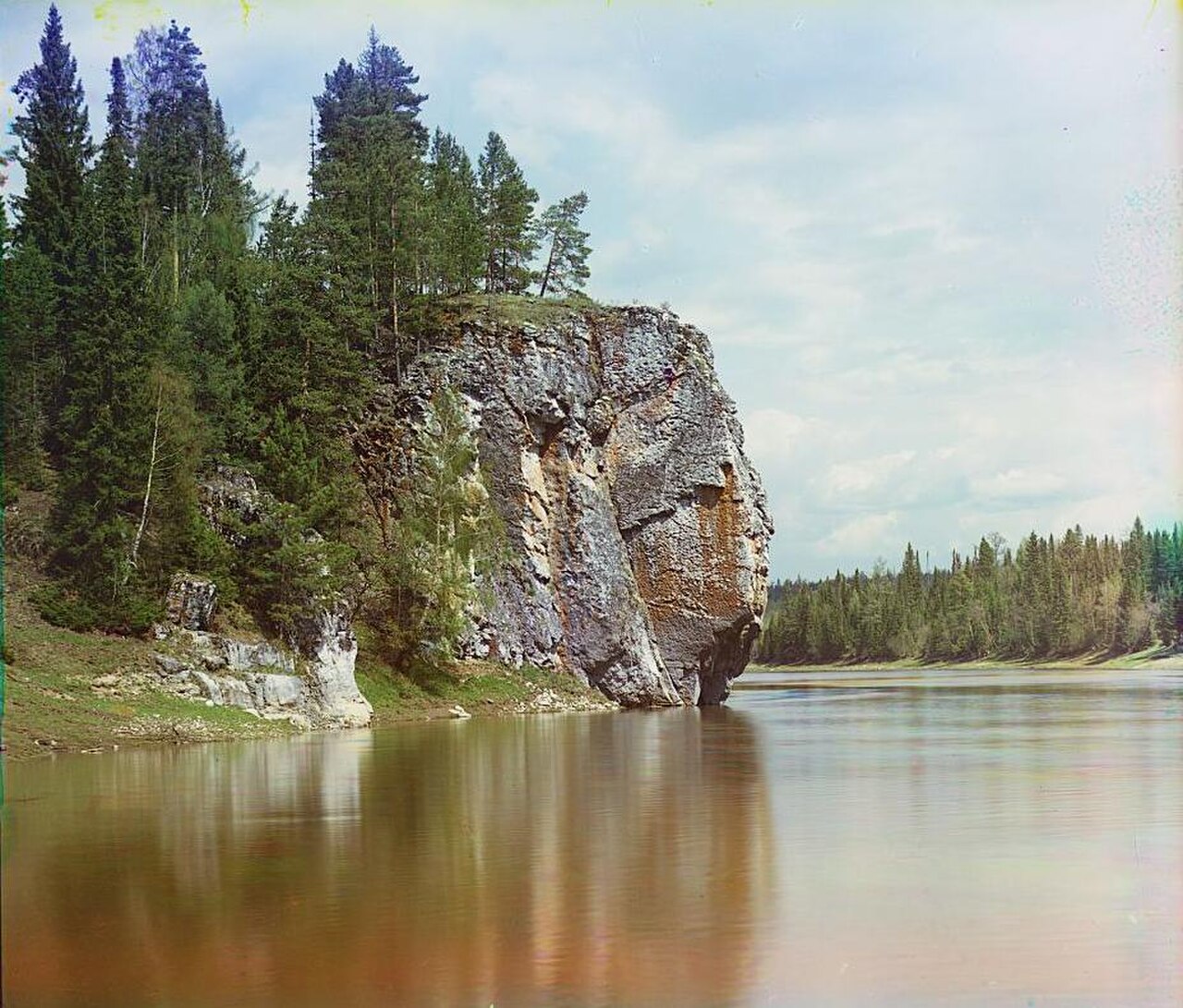
Hydrologically the territory is dominated by the Kama River basin, a major tributary of the Volga. The region contains tens of thousands of smaller streams and rivers—commonly cited as more than 29,000 watercourses with a combined length measured in the tens of thousands of kilometres. Among the longer rivers are the Kama itself and the Chusovaya; the Kama is the region’s principal artery for drainage and historically for navigation.
History and administration
The modern krai is a relatively recent administrative construct, formed after a referendum that combined the former Perm Oblast with the Komi–Permyak self-governing district to create a single federal subject. The merger preserved certain cultural and administrative arrangements for the Komi-Permyak people while streamlining regional governance. Administratively, Perm Krai is divided into districts and urban municipalities; the city of Perm functions as the political and economic center.
Economy, resources and transport
Perm Krai has a diversified economy built on industry, natural resources and transport. The region is known for metallurgy, machine building, chemical production and forestry, and it has deposits of minerals and hydrocarbons typical of the western Urals. The Kama River and a developed rail network provide important freight corridors; Perm city is served by major rail lines and an airport that link the krai to other Russian regions.
Population, culture and institutions
The population is concentrated in urban centers, with the largest being Perm itself; the total population has been measured in the low millions and has experienced demographic change in recent decades. Perm is the region’s cultural heart, hosting theaters, universities and museums and serving as a focal point for regional arts, including classical music and ballet traditions. The Komi-Permyak minority retains distinct linguistic and cultural expressions within the krai.
Environment and notable facts
Large tracts of taiga and mixed forest remain across the krai, supporting biodiversity and traditional industries such as timber. There are several federal and regional protected areas and nature reserves intended to conserve mountain ecosystems, river valleys and forest habitats. The combination of plain and mountain environments, extensive river networks and mineral resources makes Perm Krai both ecologically varied and economically important in the western Urals.
- Created by merger in 2005; administrative center: Perm.
- Dominated by the Kama River basin; contains many thousands of rivers and streams.
- Landscape spans the East European Plain and the western slopes of the Ural Mountains.
- Economy based on industry, natural resources and transport links.
Questions and answers
Q: What is Perm Krai?
A: Perm Krai is a federal territory of Russia.
Q: When did Perm Krai come into existence?
A: Perm Krai came into existence on December 1, 2005.
Q: How did Perm Krai come into existence?
A: Perm Krai came into existence as a result of the 2004 referendum on the merger of Perm Oblast and Komi–Permyak self-governing district.
Q: Where is Perm Krai located?
A: Perm Krai is located in the east of the East European Plain and the western slope of the Middle Ural Mountains.
Q: What is the length from north to south of Perm Krai?
A: The length from north to south of Perm Krai is 645 km (401 mi).
Q: Which are the two rivers that have lengths exceeding 500 km in Perm Krai?
A: The two rivers that have lengths exceeding 500 km in Perm Krai are the Kama (1,120 km or 700 mi) and the Chusovaya (592 km or 368 mi).
Q: What is the highest mountain in Perm Krai and where is it located?
A: The highest mountain in Perm Krai is Tulysmsky Kamen (1,496 m or 4,908 ft) and it is located in the northeast of the territory.
Related articles
Author
AlegsaOnline.com Perm Krai: geography, history, economy and culture of a western Ural region Leandro Alegsa
URL: https://en.alegsaonline.com/art/75861