Aurich: Town and District Capital in East Frisia, Lower Saxony
Aurich is a historic town in East Frisia, Lower Saxony, Germany. It is the administrative center of the district of Aurich and the region's second largest town by population and area, after Emden.
Aurich is a town in the northwest of Germany that serves as the administrative center of the district of Aurich in the federal state of Lower Saxony. Located in the cultural region known as East Frisia, it occupies a role as a regional service and administrative hub and is the second largest town in the area by population (after Emden) and the second largest by land area (after Wittmund).
Image gallery
3 Images


Overview
Aurich functions as a local centre for public administration, education, and commerce for surrounding smaller towns and rural areas. The town combines a modest urban core with agricultural and low-density suburban surroundings. Its setting in the low-lying coastal landscape of northern Germany means the local economy and land use have long been shaped by agriculture, waterways and connections to nearby ports.
Names and language
The name Aurich appears in several regional languages and dialects: in East Frisian Low Saxon as Auerk, in West Frisian as Auwerk, and in Saterland Frisian as Aurk. German is the official language, but local dialects and Frisian linguistic traditions remain part of cultural life and place names across the district.
History and development
Aurich developed from a medieval settlement into a regional administrative centre over several centuries. Like other East Frisian towns, its history reflects maritime trade, land reclamation and shifting political arrangements in northern Europe. Over time Aurich acquired a mix of civic buildings, religious sites and modest manufacturing and services; during the 19th and 20th centuries it modernized transport and public institutions while retaining a compact historic core.
Administration, economy and transport
As capital of the district of Aurich, the town houses district government services and courts that serve a wider rural hinterland. The local economy combines public administration with small and medium-sized enterprises, retail, agriculture and tourism. Aurich is served by regional road and rail links that provide access to larger coastal cities and ports in Germany, making it a practical base for visitors exploring East Frisian towns and the North Sea coast.
Culture, points of interest and notable facts
Aurich is noted for its East Frisian character, including traditional festivals, local museums and community institutions that celebrate regional history and folklore. Visitors and residents alike commonly encounter a mix of historic buildings, civic squares and green spaces. Typical points of interest include municipal museums, churches, and examples of local architecture, while the surrounding countryside offers dikes, polders and opportunities to learn about coastal land management.
- Regional role: administrative centre of the district of Aurich.
- Linguistic note: local East Frisian and Low Saxon names persist alongside German.
- Geography: part of the North Sea coastal plain with agricultural and maritime influences.
- Accessibility: connected by regional roads and rail to nearby coastal cities such as Emden.

Geography
Geographical location
| Table I: Land use | |
| Use | Area in ha |
| Buildings and open spaces | 1683 |
| Operational areas | 348 |
| Recreational areas | 80 |
| Streets and squares | 975 |
| Agricultural land | 14.007 |
| Woods | 2042 |
| Waters | 258 |
| Areas of other use | 332 |
| Total area | 19.725 |
Aurich is located in the middle of the East Frisian Peninsula and has an area of 197.25 square kilometres with a north-south extension of 16 kilometres and an east-west extension of 19 kilometres.
Aurich's catchment area extends far beyond the city. Both the Aurich authorities and the companies employ workers not only from the city and the immediate surrounding communities, but also from further afield. As a shopping location, Aurich also radiates far beyond the city and its immediate neighbouring communities - particularly due to its central location within East Frisia.
Aurich is listed as a middle centre in the regional planning of the state of Lower Saxony. An upgrading to a middle centre with upper-centre sub-functions, as experienced by the neighbouring town of Emden in 2007, was demanded by the council majority and the mayor, but was rejected by the state. The state also rejected the proposal that Aurich, Leer and Emden form a joint middle centre with upper-centre sub-functions.
Geology
Central East Frisia was once more covered by moors than current maps suggest. Between the low moors at the edge of the Geest and the high moors located mainly on the crests of the East Frisian Geest Ridge, sandy Geest outcrops of the ground moraine were used for settlement foundations. The core town of Aurich is located on one of these, about three to nine metres above sea level.
Geest and moor characterise large parts of the city area, almost three quarters of which is used for agriculture. Aurich also has an above-average forest area compared to the rest of East Frisia. A good tenth of the town's area is forested, which makes Aurich the East Frisian municipality with the third highest proportion of woodland in the total area after the joint municipality of Hage and the neighbouring municipality of Friedeburg. In addition to forests, hedgerows make up a good part of the tree population of the city of Aurich. They characterise the landscape in the outer areas of the city on the Geest.
Neighboring communities
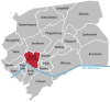
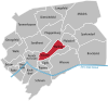
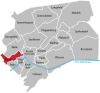
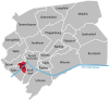
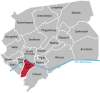
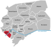
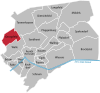
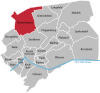
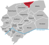
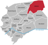
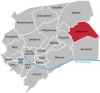
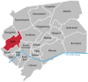
Surrounding municipalities (clockwise, starting in the west) are Südbrookmerland and Großheide (both in the district of Aurich), Eversmeer, Westerholt, Neuschoo and Blomberg (all in the joint municipality of Holtriem in the district of Wittmund), Dunum (joint municipality of Esens in the district of Wittmund), the district town of Wittmund itself and Friedeburg (district of Wittmund) and finally Wiesmoor, Großefehn and Ihlow (again all in the district of Aurich). Aurich is thus the municipality with the most neighbouring municipalities in East Frisia. This is true even if the member municipalities of the aforementioned joint municipalities are not counted individually.
City breakdown
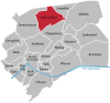
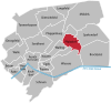
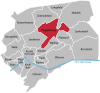
Due to the municipal area reform in 1972, many formerly independent municipalities were incorporated into the city of Aurich. From the resulting 21 districts, 11 localities were formed, in which the local interests are represented by local councils.
The population density in the city of Aurich is - an effect of the municipal reform - extremely unevenly distributed. In the city centre, which was the city of Aurich until 1972, the population density is at a metropolitan level: more than 2,000 inhabitants per square kilometre. At the other end of the scale, the district of Brockzetel, which is characterised by woodland, moorland and agricultural land, has around 20 inhabitants per square kilometre, less than one eleventh of the national average.
| Districts of the city of Aurich | |||||
| Village | District | Area in km² | Inhabitants 31.12.2019 | Inhabitants / km² | Map |
| Core city Aurich (former city of Aurich) | Core city Aurich (former city of Aurich) | 5,83 | 12.399 | 2.124 |
|
| Brockzetel and Wiesens | Brockzetel | 19,25 | 353 | 19 |
|
| Meadows | 16,73 | 1.420 | 86 |
| |
| Egels and Wallinghausen | Leeches | 4,43 | 1.788 | 416 |
|
| Wallinghausen | 5,81 | 3.560 | 579 |
| |
| Extum, Haxtum, Kirchdorf and Rahe | Extum | 4,17 | 2.151 | 427 |
|
| Haxtum | 2,20 | 1.764 | 806 |
| |
| Church Village | 4,77 | 1.444 | 280 |
| |
| Rahe | 4,38 | 523 | 121 |
| |
| Dietrichsfeld, Pfalzdorf and Plaggenburg | Dietrichsfeld | 11,31 | 789 | 70 |
|
| Pfalzdorf | 6,11 | 234 | 37 |
| |
| Plaggenburg | 13,47 | 1.434 | 105 |
| |
| Georgsfeld and Tannenhausen | Georgsfeld | 6,56 | 563 | 86 |
|
| Tannenhausen | 16,92 | 1.929 | 114 |
| |
| Langefeld, Middels and Spekendorf | Langefeld | 4,79 | 416 | 87 |
|
| Middels | 23,01 | 1.222 | 51 |
| |
| Spekendorf | 13,37 | 434 | 31 |
| |
| Popens | Popens | 1,88 | 1.994 | 1.031 |
|
| Schirum | Schirum | 13,19 | 1.411 | 106 |
|
| Sandhorst | Sandhorst | 10,77 | 4.458 | 395 |
|
| Walle | Walle | 8,26 | 2.660 | 317 |
|
Climate
Aurich is located in the temperate climate zone. The city area is mainly under the direct influence of the North Sea. In summer the daytime temperatures are lower, in winter often higher than further inland. The climate is generally characterised by the Central European westerly wind zone. However, climatically special conditions prevail in the high moorland areas, which are mainly located in the east and southeast of the urban area. Because of the subsoil conditions in a rain moor, the temperature differences between day and night are extreme. In the summer, very high temperatures can occur on the ground during the day, causing bog fires. In addition, bog areas are much more foggy than the surrounding area.
According to the climate classification of Köppen, Aurich is in the classification Cfb.
- Climate zone C: Warm-moderate climate
- Climate type Cf: Humid-moderate climate
- Climate subtype b: warm summers
The average annual temperature mean is 8.4 °C. The warmest month is July with a monthly temperature average of 16 °C. The coldest month is January with an average of 1.0 °C.
The amount of precipitation within a year in Aurich is just under 830 mm. The month with the most rain is November with 84.4 mm, the month with the least rain is February with 43.1 mm.
In Aurich, the sun shines for a total of just over 1,455 hours a year, giving an average of just over 121 hours per month. The greatest chance of sunshine is in May. In this month there are 205 hours of sunshine. The opposite is true for December, when the sun shines for only 29 hours.
The values given refer to the long-term average for the years 1961 to 1990.
| Monthly average temperatures and precipitation for Aurich
Source: German Weather Service | |||||||||||||||||||||||||||||||||||||||||||||||||||||||||||||||||||||||||||||||||||||||||||||||||||||||||||||||||||||||||||||||||||||||||||||||||||||||||||||||||||||
Protected areas
Aurich has a large number of nature reserves and landscape conservation areas as well as natural monuments. The Kollrunger Moor nature reserve, which has been protected since 2007 and covers 279 hectares, is located on the territory of the city of Aurich and the neighbouring municipality of Friedeburg (district of Wittmund). It is part of the fauna-flora-habitat area "Kollrunger Moor und Klinge" and includes both residual high moor areas and rewetted areas after peat cutting. The Brockzeteler Moor NSG is 171 hectares in size. It has been under nature conservation since 1986. In the northwest of the city area, Aurich has a share in the 1180-hectare nature reserve "Ewiges Meer und Umgebung". The sea itself lies on the territory of the neighbouring municipality of Eversmeer. It has been under nature conservation since 1990 and is part of the FFH area "Ewiges Meer, Großes Moor bei Aurich" and the EU bird sanctuary "Ewiges Meer". This nature reserve is framed by the Berumerfehner-Meerhusener Moor landscape conservation area (1726 hectares). It has been protected since 1973. The 871-hectare LSG "Egelser Wald und Umgebung" has been protected since 1966. South of the district of Schirum, Aurich has a share in the 833-hectare LSG "Ihlower Forst und Niederung des Krummen Tiefs", which has been protected since 1986. In addition, there are smaller landscape protection areas: Upstalsboom and surroundings (6.4 hectares, since 1965), Wilhelminenholz (3.2 hectares, since 1964), Popenser Gehölz and surroundings (15.6 hectares, since 1972) and Am Forstamt Sandhorst (8.5 hectares, since 1969). Since 1986, a 4.9-hectare amphibian biotope in Brockzetel has been protected as a natural monument. The two oldest natural monuments (protected in 1941) are the Tannenhausen megalithic tomb and the lime tree avenue on the Aurich city wall. The lime and beech avenue on Esenser Straße has been protected as a natural monument since 1969, the beech avenue Moltkebahn since 1983. In addition, there are a number of other solitary trees in the inner city area and in the outer areas of the city.

History
→ Main article: History of the city of Aurich
The history of Aurich can be traced back to the 13th century. The original settlement of Aurechove is first mentioned in a Frisian legal record from 1276, the Brokmerbrief. The oldest trace of settlement in the core town of Aurich (fragments of vessels) dates back to the 9th century and was discovered during excavations in 2009.
It was situated around the Lamberti Church, which was founded by Count Moritz of Oldenburg and dedicated to Saint Lambertus, the bishop of Maastricht who was killed in 703. Its massive steeple, which has appeared in its present form since 1662, is one of the town's landmarks.
In the late Middle Ages followed a period marked by conflicts between several chieftain families, which only ended when the Cirksena, the later count and prince dynasty, prevailed around 1350. They initially resided in Emden, but moved their court to Aurich in 1561 after disputes with representatives of the port city.
After the extinction of the Cirksena, the Prussians took over the rule of East Frisia. On 7 June 1744 Aurich was occupied without resistance by 500 Prussian soldiers and officials. On June 23, the land paid homage to the Prussian crown. Aurich remained the seat of the state authorities, received a War and Domain Chamber and became the government capital of the Prussian province of East Frisia.
During the Napoleonic era, first Dutch, later French soldiers occupied the town. East Frisia was annexed to the French Empire as the "Departement de l'Ems-Oriental" ("East Ems"). Aurich was the seat of the highest French official, the prefect.
After the Congress of Vienna, the city was annexed to the Kingdom of Hanover together with East Frisia, then fell back to Prussia after the German War in 1866. Aurich was able to maintain its status as the administrative centre of East Frisia under the various dominions. However, there was no industrialisation at that time. Economically, the city remained characterized by its position as an important cattle trading center, which it was able to further expand since the 14th century.
In the 20th century, the National Socialists received more and more support from the mid-1920s onwards. In the Reichstag elections of 1932, 44.2% of those eligible to vote in the administrative district of Aurich voted for the NSDAP. The elections of 1932 and 1933 finally sealed the end of the young democracy. Jews, communists and other social groups that were not agreeable to the new rulers were now increasingly excluded, persecuted and murdered. Large sections of the population, on the other hand, welcomed the National Socialists enthusiastically. In the following years there were several large events in Aurich with several thousand enthusiastic listeners.
On the night of November 9-10, 1938, the riots against the Jews ordered by the Reich leadership of the National Socialists, later called "Reichskristallnacht" or November pogroms 1938, also took place in Aurich. Two years later, the city was reported to be free of Jews.
During the Second World War Aurich was spared major air raids. The city was bombed three times. A total of 17 people lost their lives and 24 were injured. The greatest damage occurred on 27 September 1943, when 30 houses were completely destroyed by explosive and incendiary bombs, 180 were seriously damaged and 285 were slightly damaged. On that day alone, 13 people were killed and 18 were injured.
In late 1944, concentration camp prisoners of the provisional concentration camp Engerhafe had to build tank trenches around the town by hand. Twice a day, around 2,000 prisoners, also carrying the bodies of fellow inmates, marched through the middle of the town. Within two months 188 concentration camp prisoners died. The useless fortification was part of what the NSDAP called the Friesenwall.
On 3 May 1945, there was a demonstration in Aurich's market square against the continued defence against the Canadians, who had meanwhile advanced as far as Marcardsmoor. Johann von Essen wanted to raise a white flag on the Aurich castle tower as a sign of surrender, whereupon he was arrested by the Gestapo, but later freed by the angry crowd.
Aurich citizens (whose names are unknown) saved Aurich, whose destruction was guaranteed, after negotiating with the Canadians on May 3 and 4, 1945. The city was to be surrendered to the Canadians without a fight.
After 1945, the city was additionally populated by many refugees. While at the outbreak of the war it counted 7089 inhabitants, by the end of 1945 it had already become 10,350. One problem was the lack of jobs for the population.
The 1990s saw the start of the rise of Enercon, a wind turbine manufacturer founded in 1984, which within two decades of its foundation had grown into an industrial company with a four-digit workforce in Aurich.
Incorporations
On 1 July 1972, the municipalities of Brockzetel, Dietrichsfeld, Egels, Extum, Georgsfeld, Haxtum, Kirchdorf, Langefeld, Middels, Pfalzdorf, Plaggenburg, Popens, Rahe, Sandhorst, Schirum, Spekendorf, Tannenhausen, Walle, Wallinghausen and Wiesens were added to Aurich's urban area as part of the Lower Saxony municipal area reform. The incorporation of large parts of today's city area increased Aurich's population by more than twice its previous size and exceeded the 30,000-inhabitant mark. Since the municipal reform, Aurich is thus the second largest municipality in East Frisia in terms of inhabitants.
Spin-offs
On 1 January 1979 there was a territorial exchange with the neighbouring municipality of Südbrookmerland, in which Aurich lost about 100 inhabitants (according to the population at that time).
Name development
There are various hypotheses about the interpretation of the town's name. Either it is to be assigned to a person (Affo, East Frisian first name) and his property (Reich) or it refers to a waterworks at the fertile, water-rich lowland of the little river Aa (or Ehe), where the town was built. Known are the spellings Aurichove, Aurike, Aurikehove, Auryke, Auwerckhove, Auwerick, Auerk, Auwerck, Auwreke, Awerck, Awreke, Awrik, Auwerich and Aurickeshove.
Population development
Today the city of Aurich has a good 40,000 inhabitants, but around 1900 it was still a manageable city of about 5000 inhabitants. The flight and expulsion of Germans from Central and Eastern Europe in 1945-1950 brought a significant boost in population development when many refugees from the eastern territories of the German Reich were taken in. The population of Aurich was almost 50 percent higher in 1945 than in 1939. A second boost in population development resulted from the incorporation of many small surrounding communities in the course of the territorial reform in Lower Saxony.
The increase in the number of inhabitants since 1990 results on the one hand from people who have moved to Aurich from the New Länder, but even more so from ethnic German immigrants who have found a new home in Aurich. Since the end of the 1990s, Aurich's population has remained fairly constant at just over 40,000. The birth balance has been negative since the beginning of the 21st century, but is balanced out by new arrivals. Retirees from other regions of Germany who want to spend their retirement in East Frisia play an important role.
|
|
|
(in each case on 31 December, 1961 on 6 June, 1970 on 27 May (census results including places subsequently incorporated))


Related articles
Author
AlegsaOnline.com Aurich: Town and District Capital in East Frisia, Lower Saxony Leandro Alegsa
URL: https://en.alegsaonline.com/art/7399
Sources
- destatis.de : "Alle politisch selbständigen Gemeinden mit ausgewählten Merkmalen am 31.12.2018 (4. Quartal)" · web.archive.org
- www1.nls.niedersachsen.de : Landesbetrieb für Statistik und Kommunikationstechnologie Niedersachsen, 102 Bevölkerung - Basis Zensus 2011, Stand 31. Dezember 2015 (Tabelle K1020014)