Aconcagua River — river of central Chile
Aconcagua River flows east–west across Chile's Valparaíso Region from the high Andes to the Pacific, supplying water for cities and agriculture and notable for its name's link to the nearby Aconcagua mountain.
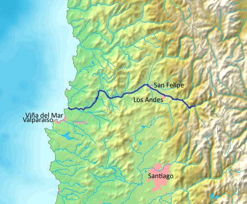
The Aconcagua River is a principal watercourse in north central Chile that runs roughly east to west across the Valparaíso administrative area. Its mouth opens into the Pacific Ocean about 20 km north of the city of Valparaíso. The river and its valley form an important local landscape for settlement, irrigation and transport; its approximate geographic location is indicated by these coordinates.
Image gallery
3 Images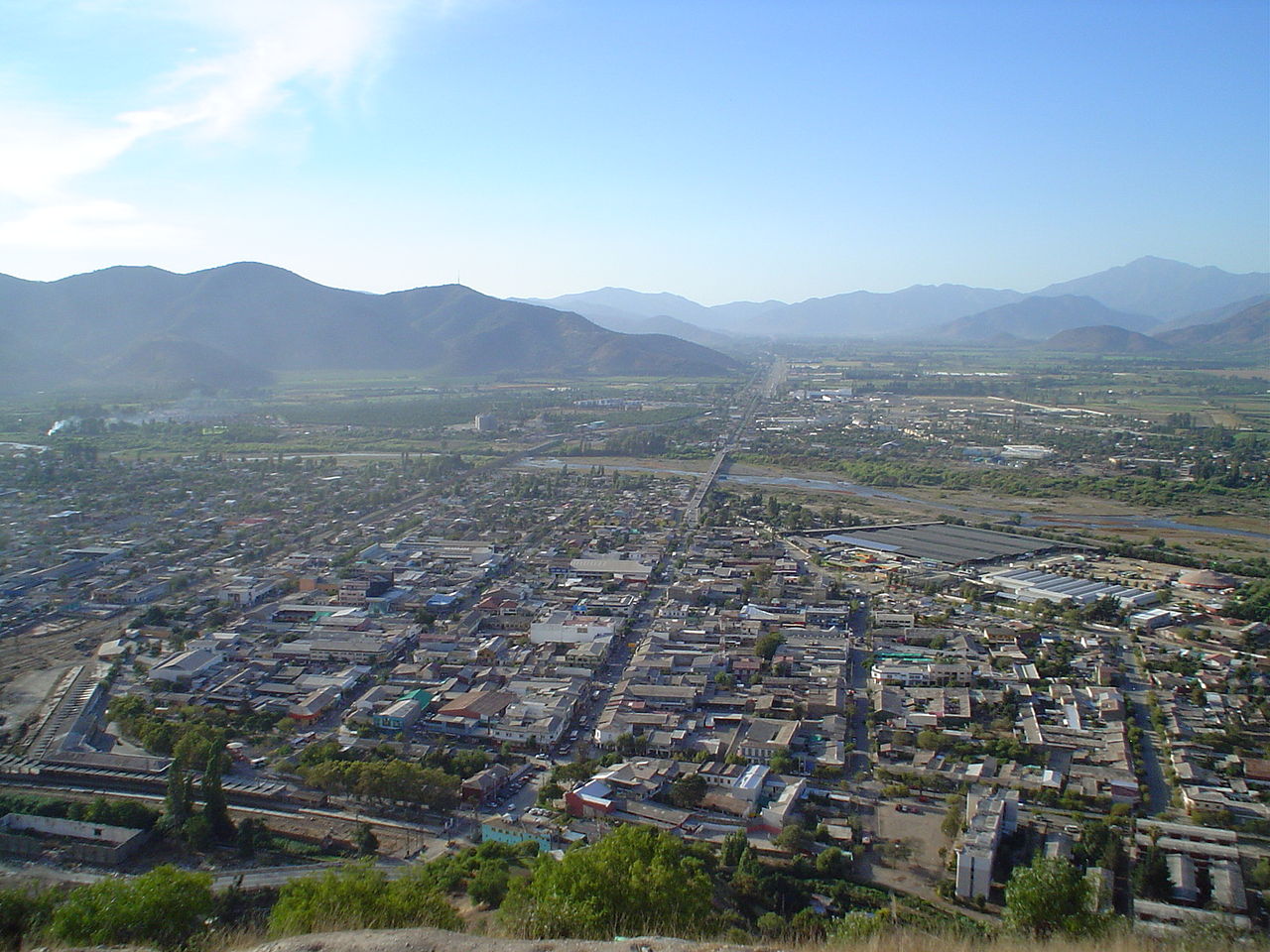

Course and physical characteristics
The river originates on the Chilean side of the high Andes and flows down into lower valleys before reaching the coast. Although commonly associated by name with the mountain Aconcagua, the river does not begin on that mountain's slopes. Aconcagua peak itself lies in Argentina, and is located roughly 20 km from the river's headwaters, across the international border. The Aconcagua basin collects runoff from Andean foothills and transmits it westward to the Pacific Ocean.
Drainage basin, uses and ecology
The river drains a mixed landscape of highland valleys and semi-arid lowlands. Local communities rely on its flow for urban water supply, irrigation of fruit orchards and vineyards, and limited industry. Because precipitation in the region is seasonal and snowmelt from the Andes contributes to flow, water management and allocation are important concerns for agriculture and municipal planners. The river corridor also supports riparian vegetation and habitats used by regional wildlife.
Human context and infrastructure
Towns, roads and agricultural plots have long clustered along the river valley where water and flatter land are available. Infrastructure such as small dams, diversion channels and bridges are commonly found on rivers of this type to regulate irrigation and cross the floodplain. The Aconcagua River has played a role in the social and economic development of the Valparaíso Region and neighboring communities in regional planning documents and maps of Chile.
Name and notable facts
- Name origin: The river shares its name with the famous mountain Aconcagua, but their geographic connection is one of proximity rather than direct hydrological origin; the mountain stands across the border in Argentina while the river rises in Chile.
- Coastal outlet: The river empties into the ocean north of the major port of Valparaíso, contributing freshwater and sediment to the nearby coastal zone.
- References and mapping: For map locations and further geographic detail consult regional sources and mapping tools using the river's coordinates or general entries about the Aconcagua River.
The Aconcagua River remains an important feature of the central Chilean landscape, combining natural, economic and cultural roles. Its valley illustrates how Andean runoff is harnessed for lowland use, and why careful water management is central to communities in the Valparaíso area.
Further reading and specific hydrological data can be found through local hydrology studies, government water agencies and regional planning materials that document the river basin and its seasonal behavior; see related resources on the mountain Aconcagua, national context in Chile, and cross-border geographic notes concerning Argentina. For broader context, consult descriptive entries and maps tied to the river name Aconcagua River and regional guides to the Valparaíso Region.
Questions and answers
Q: What are the coordinates of the Aconcagua River?
A: The coordinates of the Aconcagua River are 32°54′54″S 71°30′30″W / 32.91500°S 71.50833°W / -32.91500; -71.50833.
Q: In which direction does the Aconcagua River flow?
A: The Aconcagua River flows from east to west.
Q: Where does the Aconcagua River flow through?
A: The Aconcagua River flows through the Valparaíso region in north central Chile.
Q: Where does the Aconcagua River flow into?
A: The Aconcagua River flows into the Pacific Ocean 20 km (12 mi) north of Valparaíso.
Q: Does the Aconcagua River start in the slopes of Aconcagua?
A: No, the Aconcagua River does not start in the slopes of Aconcagua.
Q: Where is Aconcagua located?
A: Aconcagua is located in Argentina, about 20 km (12 mi) from the beginning of the Aconcagua River, in Chilean territory.
Q: What is the distance between the mouth of the Aconcagua River and Valparaíso?
A: The distance between the mouth of the Aconcagua River and Valparaíso is 20 km (12 mi).
Related articles
Author
AlegsaOnline.com Aconcagua River — river of central Chile Leandro Alegsa
URL: https://en.alegsaonline.com/art/736
Sources
- sinia.cl : "Cuenca del río Aconcagua"