Augsburg: Roman foundation, Renaissance wealth and Reformation landmark
Augsburg is a historic Bavarian city founded in Roman times, known for Renaissance banking families, the Augsburg Confession, industrial culture and a distinctive water-management heritage.
Overview
Augsburg is a city in southern Germany located in the federal state of Bavaria. It is one of the country’s older urban centres, with a modern population of roughly a quarter of a million residents and a university campus that contributes to local education and research life (University). The name and pronunciation of the city vary slightly in English; examples can be heard in references to the UK pronunciation and the US pronunciation.
Image gallery
10 Images


Origins and historical development
The settlement that became Augsburg began as a Roman foundation, established as a military and market centre known historically as Augusta Vindelicorum; this Roman origin remains important when tracing the city’s urban pattern and ancient remains (Roman). After the fall of Rome, Augsburg continued to grow through the Middle Ages and into the Renaissance, when local families and merchants accrued significant wealth and influence. The late medieval and early modern periods saw Augsburg emerge as a banking and commercial hub largely through the activities of prominent merchant houses.
Renaissance, religion and law
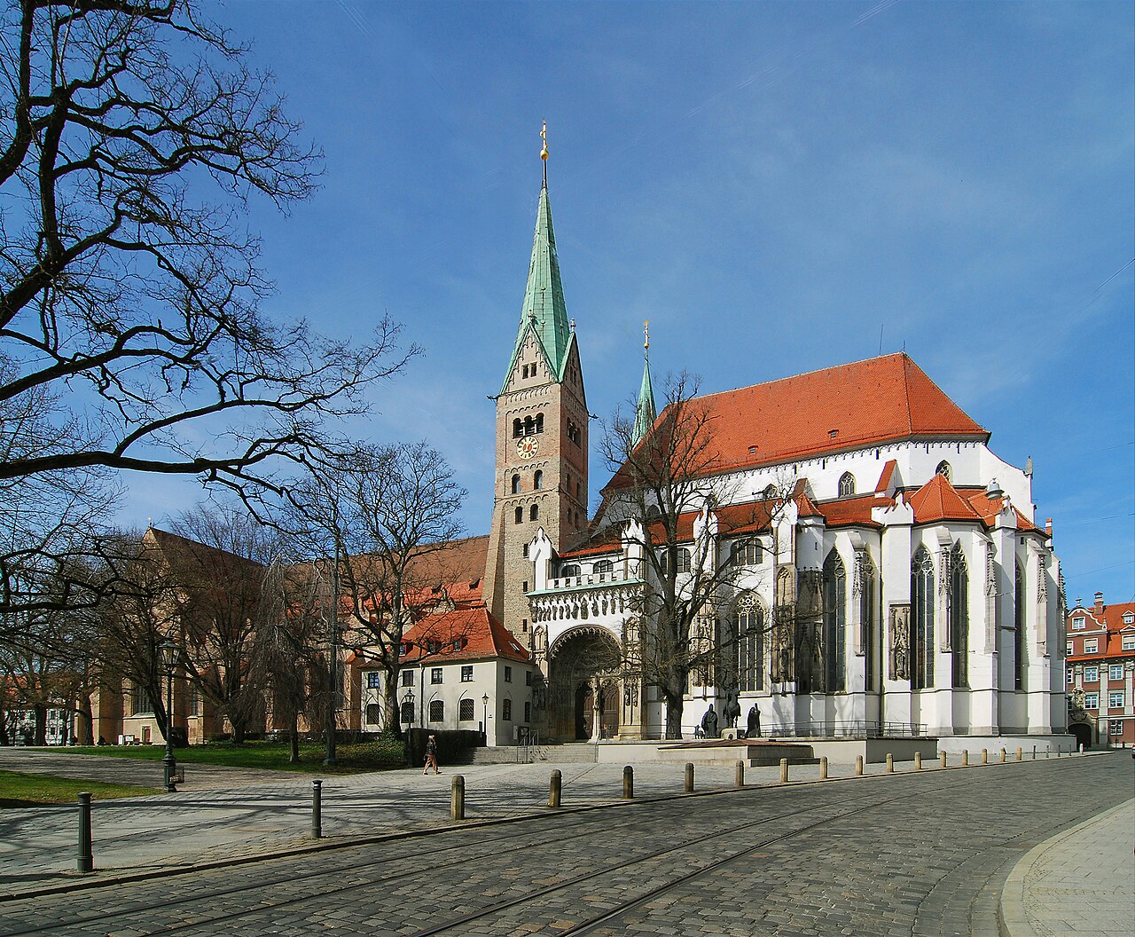
In the Renaissance era Augsburg became influential for both finance and religious affairs. A powerful banking family helped finance trade and imperial projects in the 15th and 16th centuries, and their patronage left a distinct architectural and civic legacy (Renaissance). In the 16th century Augsburg was a centre for the Reformation: the city hosted the presentation of the Lutheran statement of faith now known as the Augsburg Confession in 1530, and two and a half decades later the settlement between Catholic and Protestant princes known as the Peace of Augsburg was concluded there. These events made the city a focal point of religious negotiation in Europe.
City character, institutions and landmarks
Today Augsburg combines historic buildings, civic institutions and industrial sites. Notable features include medieval and Renaissance churches, the historic municipal hall and tower, and the world’s oldest social housing complex still in use. The city retains recognisable quarters that reflect its Roman grid, medieval expansion and later industrial neighbourhoods. Cultural institutions and festivals draw on this layered past, while museums and university faculties interpret local history and arts.
Economy, culture and water heritage
Historically important for trade and finance, Augsburg later developed manufacturing and engineering industries; these sectors continue to play a role alongside services and education. The city is also renowned for its historic water-management works—an extensive network of canals, water towers and fountains that supplied power and drinking water and that have been recognized internationally for their technical and cultural value. Visitors and scholars often point to that hydraulic system as one of Augsburg’s most distinctive legacies.
Climate and practical information
Augsburg has a temperate continental climate with cold winters and warm summers, typically classified in climatology as a humid continental regime under the Köppen climate classification. For travellers and students the city offers transport connections to larger Bavarian centres, local museums, concert venues and green spaces along its rivers and canals. Its long history—from a Roman outpost to a Renaissance commercial centre and a site of Reformation-era diplomacy—gives Augsburg a rich civic identity that remains visible in architecture, institutions and public life.
- Key historical moments: Roman foundation, medieval growth, Renaissance finance and the Reformation.
- Notable sites: cathedral and parish churches, the historic town hall, social-housing complex and the water-management network.
- Institutional note: a modern university and active cultural scene maintain Augsburg’s role as a regional centre.


Geography
The town lies on the rivers Lech, Wertach and Singold. The oldest part of the town as well as the southern quarters are situated on the northern spur of a high terrace, which was formed between the steep hillside of Friedberg in the east and the high Riedeln of the western hillside.
To the south is the Lechfeld, a post-glacial gravel plain between the two major rivers Lech and Wertach, where rare primeval landscapes have been preserved. The Augsburg city forest and the Lech valley heaths are among the most species-rich Central European habitats.
Augsburg is bordered by the Augsburg - Westliche Wälder Nature Park, a large forest area. In addition, however, the city area itself is also heavily greened, which is why the city was the first German city to be awarded the title of greenest and most livable city in the Europe-wide Entente Florale Europe competition in 1997. The city is the largest municipal forest owner in Bavaria and the third largest in Germany.

enlarge and show information about the picture
![]()
Panoramic view of Augsburg, seen from the west
Neighboring communities
The city is surrounded by the district of Aichach-Friedberg in the east and by the district of Augsburg in the west. Due to the elongated north-south direction of the city area, many towns and communities border on Augsburg.
The conurbation is formed by Friedberg (district of Aichach-Friedberg), Königsbrunn, Stadtbergen, Neusäß and Gersthofen (all district of Augsburg), starting in the east and following in a clockwise direction, all of which border directly on the built-up area of Augsburg with their settlement core.
In addition, the municipalities of Rehling, Affing, Kissing, Mering and Merching (all in the district of Aichach-Friedberg) as well as Bobingen, Gessertshausen and Diedorf (all in the district of Augsburg) border on the town (clockwise from the north).
City breakdown
→ Main article: List of planning areas and city districts of Augsburg
The city area consists of 42 boroughs, which form 17 planning areas. This type of city division has existed since 1938. The total area is 147 square kilometres (39th place among large German cities).
The city districts are partly formerly independent municipalities, partly newly founded residential areas. Some districts have spatially separate settlements (Wohnplätze) with their own name. Neighbourhoods not mentioned in the administrative division are the Augsburg Old Town as part of the inner city and the Augsburg Textile Quarter, which is partly in Spickel-Herrenbach, partly in the inner city.
Former U.S. Army barracks and residential areas retained their names after the troop withdrawal in 1998, including Centerville, Cramerton, Reese, Sheridan, Sullivan Heights, and Supply-Center. Many of these barracks are now residential areas.

Planning areas of Augsburg
I: Innenstadt | II: Oberhausen | III: Bärenkeller | IV: Firnhaberau | V: Hammerschmiede | VI: Lechhausen | VII: Kriegshaber | VIII: Pfersee | IX: Hochfeld | X: Antonsviertel | XI: Spickel-Herrenbach | XII: Hochzoll | XIII: Haunstetten-Siebenbrunn | XIV: Göggingen | XV: Inningen | XVI: Bergheim | XVII: Universitätsviertel
Waters
The town lies on three rivers: The Lech is the largest flowing body of water and is widened by the tributary of the Wertach, which flows in north of the Wolfzahnau landscape conservation area. Augsburg's third river, the Singold, rises in Ostallgäu and flows into the city's extensive artificial stream and canal system. Augsburg's numerous canals - most of which flow through the Lech district in the old town - are spanned by 500 bridge structures. They are part of the "Augsburg Water Management System" site, which will be inscribed on the UNESCO World Heritage List on July 6, 2019.
See also: List of fountains in Augsburg
| River | river length in the |
| Lech | 19.9 km |
| Wertach | 13.1 km |
| Singold | 6.2 km |
| 29 Lech canals | 77.7 km |
| 4 Wertach channels | 11.6 km |
| 19 streams | 45.6 km |
| Total length | 174.1 km |
The factory canal, into which the Singold flows, is diverted from the Wertach in Göggingen, flows as the Wertach canal, Holz- or Senkelbach to the north and returns to the Wertach after the Augsburg balloon factory.
At the Hochablass, the Hauptstadtbach and the Neubach are diverted from the Lech, which reunite after a few hundred metres to fork shortly downstream into the north-flowing Herrenbach (downstream Proviantbach with its outlets and inlets Hanreibach and Fichtelbach) and the west-flowing Kaufbach. The Kaufbach feeds the Schäfflerbach and the town ditches and town centre canals, which flow northwards to reunite on the site of the UPM-Kymmene and flow back together with the Proviantbach as the Stadtbach in the western area of the Wolfzahnau to join the Lech a few metres before the mouth of the Wertach. The Mühlbach flows through the Pfersee district.
The Brunnenbach, the Reichskanal and the Lochbach (a Lech canal) flow through the Stadtwald. In the process, they branch off into other small streams to reunite shortly before the city centre.
In the alluvial forest, which the Lech flows through, are the Kuhsee and the smaller Stempflesee. In the north of Augsburg are the Autobahnsee, the Kaisersee and the Europaweiher at the Augsburger Müllberg. In the south of Augsburg are the Wertach reservoir, the Lautersee and the Ilsesee (local recreation area).
The nature reserves in the south of Augsburg serve Augsburg's drinking water supply. The city forest and the Lechau forest near Unterbergen are therefore designated as drinking water protection areas. The water drawn from there with a hardness level of 13.5 °dH (medium hard) supplies the cities of Augsburg, Neusäß, Friedberg and Stadtbergen.
Nature and environment
After the large-scale incorporations of the 1970s, the city is one of the greenest large cities in Germany, with about one third green and wooded areas.
Augsburg's city forest - with about 21.5 square kilometres the largest Bavarian alluvial forest - forms a closed forest area in the south-east and has a high regional value for nature conservation and as a local recreation and leisure area. There are seven landscape protection areas, four FFH areas and two nature conservation areas in the city area (as of May 2016).
The southwest of the city is covered by parts of the Augsburg-Westliche Wälder nature park. This 1,175 square kilometre nature park is the only one in Bavarian Swabia. It is bordered to the north by the Danube, to the east by the slopes of the Wertach and Schmutter rivers and to the west by the Mindel river. In the south it reaches to the edge of the Unterallgäu.
The city is considered a model city for environmentally friendly lighting nationwide. Measures to combat light pollution in the area of public lighting have reduced electricity consumption and thus carbon dioxide emissions by 20 percent, resulting in annual savings of 250,000 euros.
In a 2011 study by the Geers Foundation, Augsburg had the second lowest noise level of all German cities over 250,000 inhabitants after Münster - only 17.0 percent of the city's area was exposed to a daily average of more than 55 decibels.
In November 2013, Augsburg was awarded the German Sustainability Award as the "Most Sustainable Large City 2013".
Climate
The city lies in the transition between the humid Atlantic and the dry continental climate on the plain of the Lechfeld in a slight valley location. Further weather-determining factors are the Alps as a Central European and the Danube as a regional weather divide. Therefore the weather is relatively changeable. In the period 1950-2010, an increase in temperature, a decrease in precipitation and an increase in the occurrence of extreme values were measured for Augsburg.
The weather periods vary between moderate, not too cold winters and warm, not excessively hot summers. Large amounts of snow, which protect the vegetation over the frost periods, usually fall only from January and persist until mid-March. Larger amounts of precipitation are experienced in early summer, largely with westerly winds. Longer dry periods occur in mid-summer and early autumn.
The Föhn brings warm and dry air currents from the foothills of the Alps to Augsburg from a southerly direction all year round. This is associated with good visibility, so that the Bavarian and Allgäu Alps are often clearly visible.
The annual average temperature is about 8.4 degrees Celsius, the annual precipitation about 850 millimeters. In the course of the heatwave summer of 2003, a temperature of 36.0 degrees was measured on August 13, the highest value since the beginning of temperature observations is 37.1 degrees from July 27, 1983. The lowest recorded temperature was -28.2 degrees, measured on February 12, 1929.
Due to its location in the most thunderstorm-intensive state of Bavaria, Augsburg is frequently affected by severe storms, which can lead to enormous flooding of the Lech and Wertach rivers. The strongest impact was in 1999, when a weir on the Wertach broke and entire city districts were under water.
On autumn days it is often foggy in Augsburg due to its location in the Lech and Wertach valleys. After Munich, Augsburg is the snowiest major city in Germany.
| Augsburg | ||||||||||||||||||||||||||||||||||||||||||||||||
| Climate diagram | ||||||||||||||||||||||||||||||||||||||||||||||||
| ||||||||||||||||||||||||||||||||||||||||||||||||
| Monthly average temperatures and precipitation for Augsburg
Source: DWD, data: 2015-2020; weatheronline.de | |||||||||||||||||||||||||||||||||||||||||||||||||||||||||||||||||||||||||||||||||||||||||||||||||||||||||||||||||||||||||||||||||||||||||||||||||||||||||||||||||||||||||||||||||||||||||||||||||||||||||||||||||||||||||||||||||||||||||||||||||||||||||||||||||||||||||||


Politics
On 23 September 2008, the city was awarded the title "Place of Diversity" by the German government.
Municipality
At the head of the city of Augsburg, as chairman of the council, was demonstrably since 1266 the Stadtpfleger, who was occasionally also called mayor, which led to the fact that sometimes both titles were in use at the same time. It was not until 1548 that the title was finally fixed at Stadtpfleger. They held office for several years and were then elected for life, which is why there were also several town governors at the same time.
After the transition to Bavaria, a magistrate with two mayors was established in Augsburg, supported from 1818 by an additional college of municipal commissioners. In 1919, this two-chamber system was abandoned in favour of the establishment of a "city council", which has since been presided over by the "first mayor", who usually holds the title of Lord Mayor (see list of Augsburg's Lord Mayors).
On 16 March 2008, Kurt Gribl (CSU, at the time of the election, however, without party affiliation) won a run-off election against incumbent Paul Wengert (SPD) and took office as Lord Mayor on 2 May 2008. In the municipal election on 16 March 2014, incumbent Gribl again ran as the mayoral candidate for the CSU. He prevailed over his challengers without a run-off with 51.8% and was thus confirmed in office.
On 29 March 2020, Eva Weber (CSU) became the first woman in the city's history to be elected mayor. She won the runoff with 62.3% against Dirk Wurm (SPD), who received 37.7% of the vote.
City Council
City Council Election 2020
as a percentage
%
40
30
20
10
0
32,3
23,4
14,3
6,6
4,5
3,7
2,3
2,2
5,3
gains and losses
compared to 2014
%p
12
10
8
6
4
2
0
-2
-4
-6
-8
-10
−5,4
+11,0
−8,1
+0,7
+0,9
+0,5
+0,7
+0,3
+0,4
Template:Election Chart/Maintenance/New Result not 100%
Template:Election Chart/Maintenance/Old Result Not 100%
→ Main article: Results of the local elections in Augsburg
The city council is composed of 60 city councillors and the mayor.
| Election results of the city council since 1972 in percent | |||||||||||
| Year | SPD | FDP | Green | ÖDP | REP | Pro Augsburg | Other | ||||
| 1972 | 44,9 | 46,5 | 2,3 | - – | - – | 0,7 | - – | 0,9 | - – | - – | 4,7 |
| 1978 | 46,8 | 44,5 | 2,7 | - – | - – | 0,4 | - – | 0,6 | - – | - – | 4,9 |
| 1984 | 32,9 | 44,9 | 1,3 | 4,2 | - – | 0,2 | - – | 0,7 | - – | - – | 15,8 |
| 1990 | 43,1 | 28,4 | 2,5 | 10,8 | - – | - – | 10,0 | - – | - – | - – | 5,2 |
| 1996 | 44,1 | 29,4 | 1,7 | 10,5 | - – | - – | 2,8 | - – | - – | - – | 11,5 |
| 2002 | 43,5 | 36,4 | 3,5 | 8,7 | 1,8 | 1,2 | - – | - – | - – | - – | 4,9 |
| 2008 | 40,1 | 30,1 | 2,7 | 10,3 | 1,5 | 3,5 | - – | - – | 9,4 | - – | 2,4 |
| 2014 | 37,7 | 22,4 | 1,6 | 12,4 | 1,9 | 3,2 | - – | - – | 5,1 | 5,9 | 9,6 |
| Seats | 23 | 13 | 1 | 7 | 1 | 2 | - – | - – | 3 | 4 | 62 |
1 2002 as PDS, until 1984 the DKP is listed. In 2017 Alexander Süßmair resigned from the party, taking his city council mandate with him.
2 Christian Social Centre (CSM): 3, Free Voters: 2, Polit-WG e. V.: 1
Member of the Bundestag
Augsburg is located in the electoral district 252 Augsburg-City, which also includes Königsbrunn in the district of the same name.
In the election to the 17th German Bundestag in September 2009, Christian Ruck of the CSU was directly elected with 42.2 percent of the vote. Miriam Gruß for the FDP, Heinz Paula for the SPD, Alexander Süßmair for the Left Party and Claudia Roth for Bündnis 90/Die Grünen also entered the Bundestag via the state list.
After Christian Ruck and Heinz Paula did not run again in the election for the 18th German Bundestag, only Claudia Roth of Bündnis 90/Die Grünen was re-elected. Volker Ullrich (CSU) won the direct mandate, for the SPD Ulrike Bahr was elected via the state list. Alexander Süßmair and Miriam Gruß were not re-elected.
Citizen referendums
In Bavaria, Article 18a of the Municipal Code allows municipal citizens the right to initiate citizens' petitions within the framework of direct influence at the municipal level. Successful collections of signatures lead to a vote by way of a citizens' referendum. In Augsburg, citizens were called to the ballot box in the following matters:
- In 1995, the building contractor Ignaz Walter intended to build an underground car park under Fuggerstraße close to the city centre. One citizens' petition was in favour of the construction, another was against it. In January 1996, 63 percent of the voters decided to reject the underground car park, a minority of 37 percent wanted the building to be realised. The turnout was 36.3 percent.
- A few months later, the construction of the so-called "Schleifenstraße" (loop road) including the bypass at the Red Gate aroused public opinion. Various citizens' initiatives, which claimed that the traffic would cause noise pollution and affect the residential environment, collected the necessary signatures for a citizens' petition. The Augsburg city council opposed the rejection of the initiatives with the improved concept of a "city-compatible" tangent. It received 80 percent "yes" votes in the referendum in June 1997. 32.5 percent of those eligible to vote went to the ballot on the subsequently realized loop road.
- In 2007, concrete considerations by the Augsburg city administration and the city's public transport company regarding the redesign of Königsplatz became the subject of a citizens' petition. As part of the plans for the Augsburg mobility hub, the central bus stop was to be enlarged and modernised. It was intended to interfere with the adjacent green space, including the clearing of trees. The opponents first demanded an ideas competition on an overall traffic concept before any reconstruction. On 25 November 2007, the referendum on the conversion took place. 53.2 percent of the voting citizens decided in favour of this competition. The turnout was 24.2 percent.
- After the competition, the city government of CSU and Pro Augsburg decided on a car-free Königsplatz, achieved by relocating the main traffic axes. Citizens mobilized against this planning, demanding the construction of a tunnel at Königsplatz. In the referendum on 21 November 2010, eligible voters were able to vote separately on a council petition, the citizens' petition and a run-off question. The city council alternative, which provides for a "relief road" as a precaution in case of need, received the preference of the voters with 73.9 percent "yes" votes. The construction of a tunnel not only failed to meet the required quorum of 19,391 votes, but would have been rejected by a majority of 68.1 percent of the valid votes counted. The turnout was 28.8 percent.
Sometimes local politicians react to opposition from the population even without a referendum, when strong signature support from sympathizers for a project becomes apparent. For example, the construction of the new Augsburg public library was realized in a short time after years of delay for financial reasons, and the intended sale of the old municipal swimming pool was stopped by the citizens' will.
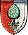
Coat of arms
· 
Coat of arms of the Augsburg library (coloured around 1551-1600)
· 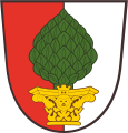
City coat of arms with golden capital from 1811 to 1985
· 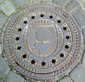
Swiss stone nut on a manhole cover of the city of Augsburg
|
| Blasing: "In a shield split by red and silver a green pine nut on a golden capital." |
| Coat of arms justification: The official heraldic description of Augsburg's coat of arms names a shield split by red and silver, on which is a green pine nut on a capital, also green since 1985. Accordingly, the city colors are red-green-white. The oldest verifiable town seal of Augsburg from the year 1237 shows a two-towered town gate with a battlemented wall and a star above it. In the archway is a tree of life, from 1260 a grape on foot, which probably alludes to the name of the town "Augster", which represents a type of grape. In the 15th century, a green grape is depicted in a red and white shield, which is changed by the discovery of a pine cone (probably the top of a Roman tomb) in 1467: Since then a pine nut is depicted instead of the grape. The head on the capital can be traced back to 1521, the mural crown only to 1811. The meaning of these symbols is not clear. The town colours have been known since 1372. On the occasion of the 2000-year celebration in 1985, the coat of arms was redesigned according to contemporary taste. As a stylized pine cone, the pine nut was the field emblem of the Roman legion of the Roman camp and became the symbol of the later Roman capital of the province of Raetia. Even today, the pine nut can be found on numerous buildings and walls throughout the city as a sign of Augsburg's dignity. The pine nut stands in a red and white split shield, which can be traced back to the banner of the Bishop of Augsburg, which, like the old insignia of the Duchy of Swabia, bore the colours red and white. |

Twinning
Augsburg entered into its first twinning arrangement with Inverness in Scotland in 1956 at the suggestion of the British Consulate General in Munich. After the first reciprocal visits by official representatives in the same year, a cultural exchange took place on a permanent basis; the town twinning was never recorded in a contract.
| The Augsburg Town Twinning | ||||
|
| 1956 |
| ||
|
| Nagahama | 1959 |
| |
|
| Amagasaki | 1959 |
| |
|
| 1964 |
| ||
|
| France | 1967 |
| |
|
| 2001 |
| ||
|
| 2004 |
| ||
The first German-Japanese sister city alliance can be traced back to the initiative of Magokichi Yamaoka, who had studied in Munich before the Second World War and was interested in Rudolf Diesel, which is why he was often present in Augsburg. After the war, Yamaoka had become the head of the Yanmar Diesel Works and donated the Japanese Rudolf Diesel memorial grove in Wittelsbacher Park. He then used his political and private influence to link the cities of Amagasaki and Nagahama, where his company had factories, with Augsburg, resulting in the dual partnership in 1959.
In 1964, the connection to the American city of Dayton (Ohio) was established, which had its origins in the "People to People" project announced by US President Eisenhower in 1956. In addition, the Dayton-based NCR corporation had established its German headquarters in Augsburg.
After the signing of the Élysée Treaty in 1964, the Augsburg city council expressed the wish for a partnership with a city in France. In consultation with the International Union of Mayors, the centrally located town of Bourges was chosen. The partnership agreement was signed in April 1967.
31 years later, on 1 May 2001, another partnership agreement was signed, the origins of which go back to the post-war period: in 1955, the city of Augsburg had taken on the sponsorship of all those displaced from the Czech city of Liberec (Reichenberg), the majority of whom had found a new home in the Fuggerstadt. After the end of the ColdWar, the former displaced persons first established cultural contact, which led to regular exchange programmes.
The last partnership entered into has its roots in the provincial partnership of the Free State of Bavaria with the Chinese province of Shandong in 1987, as a result of which the provincial capital of Jinan was interested in entering into a partnership with a Bavarian city. After initial mutual visits and contacts, the mayors signed the partnership document on 3 September 2004.
Sponsorships
In 1954, at the suggestion of the German Association of Towns, the then market town of Göggingen had taken over a "sponsorship for the district of Neudek" (Sudetenland), which was taken over by the city of Augsburg with the incorporation of the town of Göggingen in 1972 and extended to the "expellees from the town and district of Neudek". For some years there have also been friendly contacts with the town of Nejdek. In the same year, Augsburg itself became godfather over the Swabian town of Illertissen, which was elevated to the status of a city in that year.
Only one year later, the sponsorship of all Germans expelled from the region of Reichenberg (Czech. Liberec), which today belongs to the Czech Republic, was taken over, which finally led to an official town twinning in 2001 after the fall of the Iron Curtain (see: Town Twinning).
The Fuggerstadt is also the godfather of several means of transport. In imperial times, for example, a small cruiser was named SMS Augsburg from 1909, and in the German Navy two frigates have been named Augsburg since 1958, the F 222 and the F 213. In 2018, the Federal Ministry of Defence announced that one of the five planned new corvettes of the 2nd construction lot K130 will bear the name Augsburg. Since 2008, the passenger ship MS Augsburg of the Ammersee fleet has also carried the name of the city. In addition, an ICE 3 of Deutsche Bahn has been running since 2002 and a LINT 41 of Bayerische Regiobahn since 2008. A Lufthansa Airbus A320-211, christened Augsburg in 1990, was decommissioned in June 2020.
Stamps
Events connected with Augsburg were recorded in stamps commemorating the 1000th anniversary of the Battle of the Lechfeld (1955), the Ecumenical Whitsun Meeting (1971), the Olympic competitions on the Augsburg Ice Canal (1972), the 450th anniversary of the Confessio Augustana (1980), the 2000th anniversary of the city (1985) or the 450th anniversary of the Augsburg Religious Peace (2005).
On Stamp Day 1984, a stamp was issued on the Augsburg post office building of the 16th century. At Christmas 1995, motifs from the St. Mary's window of Augsburg Cathedral were issued. In summer 2017, a series with motifs of the Augsburg Puppet Box was issued. The private delivery company Logistic-Mail-Factory, based in Augsburg, issued several stamp series with references to the city, including motifs of the Fugger family, Augsburg Zoo or the Puppet Box.
World Heritage List
The city of Augsburg, as the applicant, has succeeded in having its historically centuries-old, progressive water management system inscribed on the UNESCO World Heritage List. The strict separation between drinking and process water was introduced here as early as 1545.

Related articles
Author
AlegsaOnline.com Augsburg: Roman foundation, Renaissance wealth and Reformation landmark Leandro Alegsa
URL: https://en.alegsaonline.com/art/7286
Sources
- destatis.de : "Alle politisch selbständigen Gemeinden mit ausgewählten Merkmalen am 31.12.2018 (4. Quartal)" · web.archive.org
- destatis.de : destatis.de/DE/ZahlenFakten/LaenderRegionen/Regionales/Gemeindeverzeichnis/Administrativ/…
- statistikdaten.bayern.de : "Fortschreibung des Bevölkerungsstandes"