Omak, Washington: City at the Gateway to the Okanogan Highlands
Overview of Omak, Washington—its geography, history, economy, transportation, culture, and role as a regional service center in north-central Washington State.
Omak is a small city in north‑central Washington State, situated at the southern edge of the Okanogan Highlands. It functions as the largest community in Okanogan County and serves as a regional center for commerce, services and culture in a largely rural part of the state. The city sits along U.S. Route 97 and is linked by state highways to neighboring towns, national forests and recreation areas. Omak’s landscape combines a compact downtown, residential neighborhoods and surrounding agricultural lands; the town also acts as an access point to the Okanogan National Forest and other outdoor destinations.
Image gallery
10 Images


Geography and population
Located in a transition zone between plateau and highlands, Omak occupies a modest land area and is surrounded by irrigated farmland, sagebrush steppe and forested uplands. The local climate is characterized by warm summers and cold winters typical of the inland Pacific Northwest, and seasonal temperature swings influence agricultural schedules and outdoor recreation. The city forms part of a larger urban area that includes nearby Okanogan; together these communities are the primary population center for much of the county. Population counts have varied over time with growth tied to regional irrigation, agriculture and service employment.
History and origins
The Omak area was inhabited for centuries by Native American peoples of the Interior Plateau before Euro‑American settlement began in the 19th and early 20th centuries. The arrival of non‑Indian settlers accelerated with irrigation projects and the expansion of agriculture in the early 1900s. Large public works and regional electrical developments—linked historically to projects such as the Grand Coulee Dam and associated irrigation systems—helped open previously dry land to farming and supported civic development. The name Omak derives from indigenous language roots and is commonly interpreted to reflect notions of abundance or good medicine, a reference to local fertile lands and favorable growing conditions.
Economy and infrastructure
Agriculture has long been central to Omak’s economy; orchards, hay, wheat and other crops are produced in the surrounding valley with irrigation. Forestry and sawmilling also contribute to local employment, and in recent decades the city has seen some diversification into light manufacturing, retail, health care and tourism. As a county service center, Omak contains medical clinics, government offices, and retail that support a broad rural hinterland.
- Transportation: U.S. Route 97 runs through the city, while state routes provide connections north and east to smaller communities and tribal lands.
- Education: The community hosts a campus of Wenatchee Valley College and local public schools serving the area.
- Media: Local news coverage is delivered by a regional weekly newspaper and other local outlets.
Culture, recreation and community life
Omak supports a range of cultural and recreational activities that reflect its rural setting and seasonal rhythms. Outdoor recreation is a major attraction: the surrounding national forests, state parks and miles of trails offer hiking, hunting, fishing and winter activities. The town also hosts community events and fairs that draw visitors from across the county and beyond, celebrating agricultural heritage and regional traditions. Local facilities include parks, community centers and sports fields that serve residents of all ages.
Government, regional role and notable facts
Omak is organized under Washington State municipal law and operates with local elected officials responsible for municipal services, land use and community planning. As the principal city in the region, it functions as a hub for health care, education, government services and retail for a large rural area. The city’s role as gateway to national forests and state parks, combined with its agricultural base, defines much of its economy and identity. Visitors and new residents are often drawn by the combination of small‑town services, outdoor access and a longstanding local community life.
Today Omak remains a small but significant center in north‑central Washington: rooted in agricultural development and regional infrastructure, sustaining local institutions, and providing access to the wide landscapes of the Okanogan Highlands.
History
Beginnings
The Okanogan Valley was the ancestral home of the Syilx (also called Okanogan), whose territory extended north into what is now Canada. The Syilx participated in trade fairs at Kettle Falls and at the mouth of the Fraser River. The trade network gained strength in the mid-18th century after the acquisition of horses.
In 1811 Fort Okanogan was built by the Pacific Fur Company at the confluence of the Okanogan and Columbia Rivers. The fort first became the property of the North West Company, and later of the Hudson's Bay Company. Fort Colvile, located near Kettle Falls, was another important trading outpost. The Okanogan River was used by fur traders to travel between Fort Okanogan and Kamloops. In the late 1850s, this route became known as the Okanagan Trail and was used extensively as a land connection to the Fraser Canyon Gold Rush.
In the 1850s, whites increasingly settled in what is now Omak, establishing settlements and introducing mining, forestry and agriculture. As more and more white settlers arrived, disputes arose between them and the Native Americans over land ownership.
As a result, a treaty was made to establish an Indian reservation on part of the disputed land, while the whites were given the rest of the land. The area of the reservation was later reduced to 20,000 km² (5 million ac). Around 1872, the Colville Reservation was developed during the presidency of Ulysses S. Grant. By the General Allotment Act of 1887, the Confederated Tribes of the Colville Reservation, an Indian tribe recognized by federal law, was formed by an administrative act from 12 separate bands. The United States federal government decided to relocate the Colville Reservation to areas west of the Columbia River and a concurrent reduction of the territory to 11,000 km² (2.8 million ac). There would be continued reductions of this area for the next 60 years.
Around 1886, Alma was parceled out nearby as an Unincorporated Community. In honor of J. I. Pogue, a fruit farmer, Alma was renamed Pogue, and later Okanogan - the present name. J. I. Pogue was upset about the erasure of his name and petitioned explorer, civil engineer, and settler Ben Ross to establish a new town about 4 mi (6.5 km) north. Born in Bureau County, Illinois, Ross worked for the Great Northern Railroad shortly before moving to Okanogan County. He decided to establish a new community at Pogue's proposed site in 1907. It was named Omak. Ross sold various properties in what is now the town and struggled to gain recognition for his town. He built a cabin in 1907 to house his daughter, son and grandchildren - becoming the first white settler in the area.
Progress
The town began to develop after the completion of the Okanogan Irrigation Project, which was designed to support agriculture. At that time, many farmers came to Omak in search of a home. Fruits such as apples, berries, peaches, plums, and watermelons were grown beginning in 1910. Omak served as a Census-designated place (CDP) in 1910 and was recognized as a territorial corporation on February 11, 1911. Omak and Okanogan rivaled each other in high school sports. During the Great Depression of 1933, many Omak residents were forced to work in surrounding cities and towns. In response, the Bureau of Reclamation offered work as part of a development project at Grand Coulee Dam in nearby Coulee Dam, employing an estimated 5,000 workers between 1933 and 1951, when the mega-project was completed. By 1950, there were numerous buildings and facilities in the town, such as St. Mary Mission Church, to serve the needs of residents.
In the 1910s, Omak was selected as the site of a sawmill to expand economic growth. The Omak Fruit Growers controlled the mill and a nearby fruit processing plant. The Biles-Coleman Lumber Company took over the organization and built a sawmill outside the city limits on nearby Omak Mountain in 1924. A second sawmill was built in the Omak area. The company and its mills were purchased in 1975 by Crown Zellerbach, a former San Francisco-based paper and pulp manufacturing conglomerate, and thus acquired by the associated Cavenham Forest Industries. The company eventually went bankrupt; employees bought the mill for $45 million and renamed it Omak Wood Products to save their jobs. Omak Woods Products' workforce dropped to 480 in the early 1990s and later went bankrupt itself, along with Quality Veneer, which owned the properties for US$19 million until 2000. The Confederated Tribes of the Colville Reservation bought the plant for US$6.6 million, but were forced to close in 2009 due to low demand and laid off 130 workers. Since 2013, there have been efforts to reopen the mills during the summer season.


Geography
Topography
The Canada-United States border-with an official border crossing between Osoyoos, British Columbia and Oroville-is about 70 km (45 mi) north of Omak. The Idaho border is about 260 km (160 mi) to the southeast. Washington state's largest city, Seattle, is about 380 km (237 mi) southwest of Omak. The Okanogan River, coming from the city of Riverside, defines the northern boundary of the city, while the southern boundary is formed by the city of Okanogan. The terrain is mountainous and forested.
The nearest Primary Statistical Area, which in the United States is a metropolitan area combined for statistical purposes, is that of Wenatchee-East Wenatchee. A CDP to the northeast of the city was named North Omak because of its neighborhood. Omak is part of two Census County Divisions: Omak (the west half) and Colville Reservation (east half).
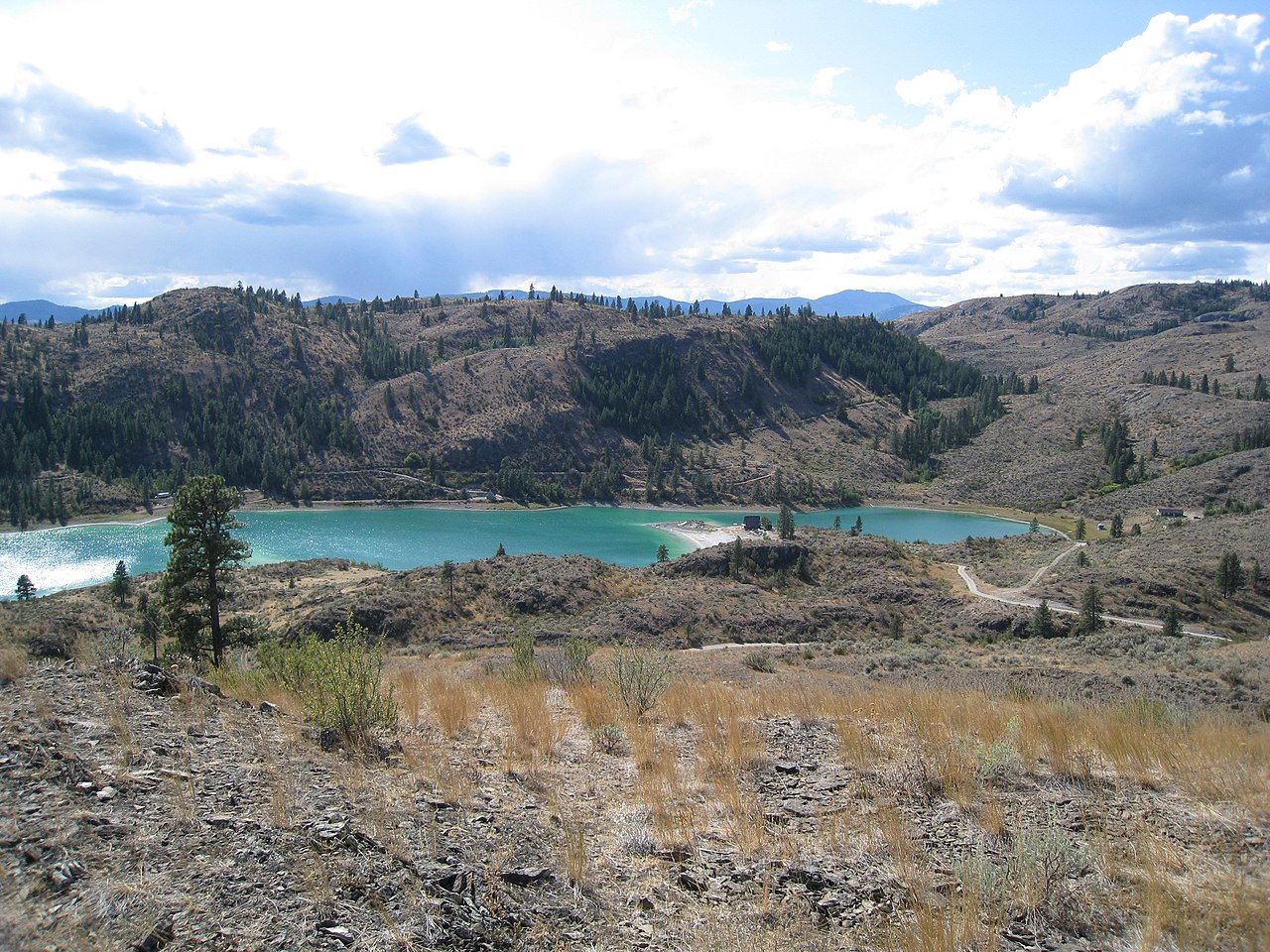
Omak, located at the base of the Okanogan Highlands in central Okanogan County, is part of the Okanogan Country region, which extends into British Columbia where it is called Okanagan Country. Omak is also located in the Inland Northwest, centered in Spokane, and on the Columbia Plateau or Columbia Plateau ecoregion near the Okanogan Drift Hills. The Okanogan River, a 115 mi (185 km) tributary of the Columbia River, flows through the center of the city and picks up Omak Creek from the east just outside the city limits. Known for its "floating" Omak Rock, the 3,244-ac (1,313 ha) Omak Lake-lying 950 ft (290 m) above sea level-is the largest drainless salt lake in Washington state. Crawfish Lake, 80 ac (32 ha) in size, is located about 15 mi (24 km) northeast of Omak on the boundary between the Colville Reservation and the Okanogan National Forest. The over 6,000 km² (about 1.5 million ac) forest combines diverse terrain and several mountain peaks.
Elevations in the area range from 780 ft (240 m) above sea level at the mouth of the Okanogan River to 6,774 ft (2,065 m) at Moses Mountain. The average elevation is 257 m (843 ft) according to the United States Geological Survey (USGS). Moses Mountain and its summit are located east of the city, whereas Little Moses Mountain (1,818 m or 5,963 ft) and Omak Mountain (1,752 m or 5,749 ft) are in Moses Mountain's neighborhood. West of the city is the Northern Cascade Mountains, part of the Cascade Range. Peaks to the west of the Omak area range from 6,000 to 6,000 ft (1,800 to 2,400 m). The summit of Coleman Butte Mountain-1,450 ft (440 m)-is just outside the city limits.
According to the United States Census Bureau, the city occupies a total area of 3.5 sq mi (9.06 km²), including 0.07 sq mi (0.18 km²) of water area, which accounts for 2% of the total area. The area was expanded in April 2010 when 1.5 km² (0.56 sqmi) of the town of Okanogan was incorporated. Omak is the fourth largest settlement in Okanogan County by area after Nespelem Community (60 km²; 23 sqmi), North Omak (29 km²; 11.2 sqmi), and Disautel (9.8 km²; 3.8 sqmi). Omak covers 0.07% of the county's total area. The 12.5 km² (4.83 sqmi) expanded urban area, the Greater Omak Area, includes the City of Okanogan and the North Omak CDP. The surrounding metropolitan area occupies 1,037 sqmi (2,690 km²), but is not officially recognized as a Metropolitan Statistical Area.
Climate
The city is located in an area with a semi-arid climate (according to Köppen & Geiger cold-semiarid (BSk)) with little precipitation, hot summers and cold winters. Average temperatures in Omak range from -8.6 °C in January to 31.6 °C in July. The lowest temperature ever recorded was -32 °C on February 1, 1950, and the highest was 46 °C on July 26, 1928. The annual mean daily temperature is 9.2 °C. Average monthly precipitation ranges from 12 mm in August to 42 mm in December. Notwithstanding its more southerly location, average temperatures in Wenatchee are about the same as in Omak, which is also true of other southern communities.
Four distinct seasons can be observed in Omak. Summers are hot and relatively dry with a daily mean temperature of 22.3 °C in July, while winter is the wettest season with 570 mm of snow between November and February. Spring and autumn are mild seasons with little precipitation. The city is located in "winter hardiness" zone 6a, which is designated by the United States Department of Agriculture (USDA). In July 2012, a severe storm occurred in Omak, bringing heavy rains, gale force winds, and hail, forcing the temporary closure of U.S. Route 97 in Washington and requiring repairs to public roads. Omak was affected by the December 14, 1872 Northern Cascade Range earthquake - the most severe earthquake known in the state. The epicenter was at Omak Lake. The earthquake had a magnitude between 6.5 and 7.0 and was accompanied by aftershocks. Another quake of lesser magnitude struck the city in November 2011.
| Omak, Washington | ||||||||||||||||||||||||||||||||||||||||||||||||
| Climate diagram | ||||||||||||||||||||||||||||||||||||||||||||||||
| ||||||||||||||||||||||||||||||||||||||||||||||||
| Monthly average temperatures and precipitation for Omak, Washington
Source: Western Regional Climate Center, The Weather Channel | |||||||||||||||||||||||||||||||||||||||||||||||||||||||||||||||||||||||||||||||||||||||||||||||||||||||||||||||||||||||||||||||||||||||||||||||||||||||||||||||||||||||||||||||||||||||||||||||||||||||||||||||
Cityscape
Omak is a planned city. During the 20th century, Ross planned what would become the town of Omak. In the year of its incorporation, a central business district was developed with a credit union and a hotel operated by the local agricultural industry. The town was equipped with a post office, formerly known as Epley. Ross established the Omak School District in 1906; soon after, the first school (Omak Schoolhouse) was built. A butcher shop, hardware store, law office, stationery store, and confectionery were built downtown in 1910. A steel bridge was built the following year, but collapsed into the Okanogan River during its dedication. It was rebuilt without further problems.
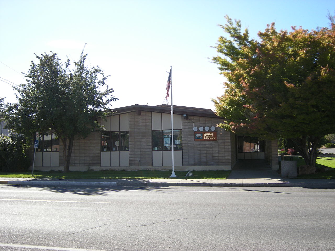
The city consists of a central business district and residential neighborhoods. Downtown Omak, the main business district, is the economic center for Omak and Okanogan County. There are several churches used as such in the city. The post office in Omak - operated by the United States Postal Service (USPS) - is the only property in town listed on the National Register of Historic Places (NRHP). Breadline Cafe is a notable downtown restaurant and music venue. The City of Omak maintains Omak Memorial Cemetery; the cemetery contains 3,747 graves in an area near Washington State Route 215, and was formerly known as Okanoma Cemetery. The 48-acre North Omak Business Park is Omak's commercial district; it is bounded on the east by U.S. Route 97. The city's residential neighborhoods are East Omak and South Omak.


Related articles
Author
AlegsaOnline.com Omak, Washington: City at the Gateway to the Okanogan Highlands Leandro Alegsa
URL: https://en.alegsaonline.com/art/72483