Oecusse (Special Administrative Region of East Timor)
Oecusse is the northwestern exclave of Timor-Leste, a Special Administrative Region centered on Pante Macassar, bordered by Indonesia's Nusa Tenggara Timur and the Savu Sea.
Overview
Oecusse is a Special Administrative Region and exclave of the state of East Timor. Located on the northwestern part of the island of Timor, it is separated from the main territory of the country by Indonesian West Timor. The administrative centre and largest town is Pante Macassar, which serves as the political and economic hub of the region.
Image gallery
10 Images


Geography and population
Oecusse is bounded on most sides by the Indonesian province Nusa Tenggara Timur and faces the Savu Sea to the north. The landscape includes coastal plains, river valleys and inland hills. The climate is tropical with a distinct wet and dry season. Local communities maintain rural livelihoods dominated by agriculture, fishing and small-scale trade.
History and cultural notes
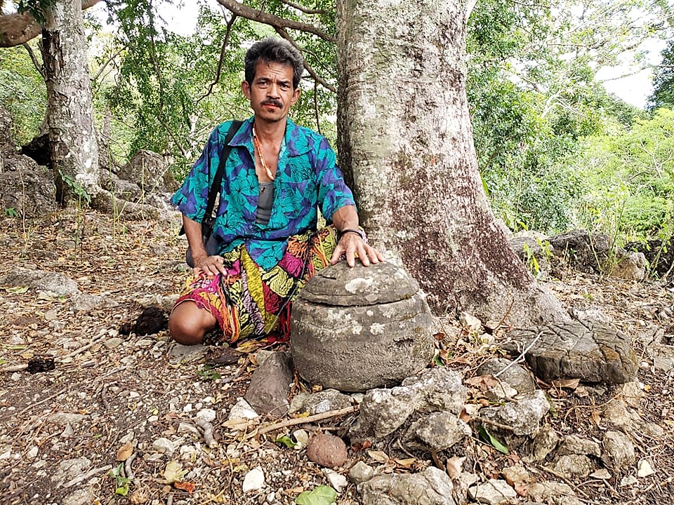
The area has historical importance as one of the earliest points of European contact on the island; Portuguese presence in parts of Oecusse dates back centuries and shaped local administration and culture. Traditional languages and customs persist alongside the national languages of Tetum and Portuguese. Cultural life combines indigenous Austronesian traditions with influences from the colonial period and neighbouring Indonesian islands.
Administration and development
Oecusse holds a special administrative status within Timor-Leste, intended to recognise its geographic separation and to allow tailored governance arrangements. Development efforts in the region have focused on improving transport links, basic services and economic opportunities while respecting local social structures. Pante Macassar functions as the seat of regional authorities.
Key features and significance
- Exclave status makes Oecusse strategically and logistically distinct within Timor-Leste.
- Coastal access provides fishing and maritime connections despite land separation from the capital.
- Historical ties to Portuguese Timor contribute to a distinctive cultural and administrative legacy.
Visitors and researchers interested in border studies, maritime communities or post-colonial administration often cite Oecusse as an instructive case. Its mixture of rural economies, historical depth and contemporary development challenges illustrates how small, geographically separated regions negotiate identity, governance and growth within a larger national framework.
For administrative or travel information consult official East Timorese sources and regional notices; practical access typically involves sea or short flights to Pante Macassar and coordination across international boundaries with the surrounding Indonesian province.
Geography
Overview
Oe-Cusse Ambeno has an area of 813.62 km². The Special Administrative Region is completely surrounded by Indonesian territory except in the north, where it borders the Sawu Sea. The rest of East Timor's territory lies 58 kilometres to the east as the crow flies; by road, the distance is over 70 kilometres. Oecuse's coastline is about 50 kilometers long, and its land border is about 300 kilometers. To the east and south lies the Indonesian governmental district of North Central Timor. In the far west, Oe-Cusse Ambeno extends to the government district of Kupang. Two border areas were still in dispute with Indonesia over affiliation until 2019: the Área Cruz (Passabe administrative district) and the 1069-hectare Citrana Triangle with the village of Naktuka (Nitibe administrative district). In the case of Fatu Sinai Island, 12 km off the coast of the westernmost point of the Special Administrative Region, East Timor has renounced further claims. From Oe-Cusse Ambeno, border crossings lead into West Timor at Bobometo (Oesilo Administrative Office), Sacato (Pante Macassar Administrative Office) and Passabe (Passabe Administrative Office). However, only Bobometo and Sacato are legal crossings.
Oe-Cusse Ambeno is divided into four administrative offices (Posto Administrativo) with a total of 18 Sucos and 63 Aldeias. The administrative offices are Nitibe, Oesilo, Pante Macassar and Passabe. The capital Pante Macassar (Pante Makasar, Oecussi) is located in Suco Costa, classified as urban, and is 281 km west of Dili.
See also: List of localities in the special administrative region of Oe-Cusse Ambeno
The most important river is the Tono. It rises in the administrative district of Oesilo and flows into the Sawu Sea at Lifau. Outside the rainy season, however, the river runs dry. Away from the Tono, the Special Administrative Region consists of a landscape of water-scarce hills 800 to 900 m high. The northeast Oe-Cusse Ambenos forms the youngest and wildest surface structure of the entire island and is of volcanic origin. Here, in the administrative district of Pante Macassar, lies one of the highest points of Oe-Cusse Ambenos, Sapu (Fatu Nipane), at 1259 m. In Passabe, the land rises steadily, reaching the highest point in the Special Administrative Region at 1560 m, Bisae Súnan, at the southwestern tip of the administrative district. Other mountains include Manoleu (1171 m) in the northwest of Nitibe and Puas (1121 m) in Passabe. In Oesilo, south of the village of Saben (Suco Bobometo) are the mud volcanoes of Poto.
Geology
Regionally, the island of Timor is located in the area of the Outer Banda Arc. The banda arc was formed by the collision of the Australian and Eurasian plates. Since the late Miocene distal sediments of the Australian continental margin were pushed southwards onto proximal rock complexes. Individual rock blocks from the subsurface become attached (aggregated) to existing island arc rocks during subduction processes. The complex fold and overthrust belt continues to evolve to the present day as the Australian Plate pushes northward beneath the Eurasian Plate at an average rate of 70 millimeters per year. Numerous earthquakes in this region are an expression of these plate tectonic processes. Tectonostratigraphically, three units can be subdivided in Oe-Cusse Ambeno.
The oldest unit that can be genetically assigned to the Australian continental margin unit is formed in Oe-Cusse Ambeno in the south of the Sucos Naimeco by the Triassic Aitutu Formation. The light to dark grey, carbonate-clay alternating sequence is characterized by fine- to coarse-laminated rocks intercalated with numerous carbonate and chert nodules and numerous fossils. The hard radiolaritic calcilutite, which makes up 80% of the formation, forms rugged cliffs on which only sparse vegetation grows. 15% of the rock of the Aitutu Formation consists of fossil shells and 5% is formed by calcarenites, shaly limestones, quartzarenites, radiolarites and strongly bituminous rocks.
To the east of Nitibe, limestones of the Dartollu Formation, formed in shallow marine waters of the Australian continental slope during the Eocene, are exposed in some areas. The mostly honey-brown biocalcarenites are formed from a mixture of granular, calcareous skeletal fragments in a matrix of micrite. This rock formation is characterized by the occurrence of numerous cave systems resulting from intense karstification.
A large part of Oe-Cusse Ambeno consists of rocks of the so-called Bobonaro complex. These rocks were formed as a result of the collision of the two continental plates. This allochthonous rock formation not only occurs in the nearest East Timorese community of Bobonaro, but is one of the most common rock formations on the entire island. Embedded in a matrix of mudstone are chaotically intercalated, lithologically highly diverse, angular to rounded boulders from older geological formations (Permian to lower Miocene) formed on the Australian continental slope. While the predominantly dark, brown and green clay matrix presents sedimentation in the basin during formation, the boulders, triggered from the continental slope by submarine earthquakes, were emplaced in the soft clay matrix. Different rock types may be very irregularly distributed in the clay matrix during this process. Such formations are genetically called olisthostromes. Violent ground motions and tectonic unrest during the formation of olisthostromes from the late Miocene onwards are indicated by intense scaling of the rocks and the formation of numerous harness strands on the embedded boulders (olistholites). In this context, the much harder olistholites form more than 90% of the rocks in the region. The size of the interbedded foreign rocks ranges from a few millimetres to 500 metres in diameter.
The youngest deposits are found at the mouths of Tono in the centre and Noel Besi on the western boundary, deposited in syn- and postorogenic sedimentary basins since the latest Miocene. These and the Pante Macassar coast are covered with young alluvial soils (alluvium). In the north of Pante Macassar and on the western border, there are still various areas from which there are no datable geological data.
During a raw material prospection in 2002, various minerals and mineral resources were mapped in Oe-Cusse Ambeno. In Usitaco, for example, there are basalt and diorite deposits that are suitable for use as building stones. Various metal deposits are found on the coast: gold in Nipane, iron in Beneufe and copper in various places. The latter was already tested for exploitation by a multinational corporation in the 1980s. Other exploitable raw materials in the Special Administrative Region include gypsum, kaolin, limestone, clay, sand, bentonite, marl and gravel. Sea salt is extracted at Pante Macassar.
Climate
The dry season is between May and November. On the coast, the rains sometimes begin in January. In the rainy season, heavy rains occur, especially in the highlands, causing flooding along the rivers, especially in Citrana and Passabe. Passabe is completely cut off from the outside world during this time. The annual rainfall here ranges from 2000 to 2500 mm. Oesilo and Nitibe receive about 1500 and 2000 mm of rainfall annually, while Pante Macassar receives 1000 to 1500 mm. In the rainy season, the danger from malaria also increases. Already one month after the end of the rainy season the landscape loses its green colour again and dries out. The highest temperatures are measured in November with up to 32.4 °C, the lowest in July with 22.4 °C.
fauna and flora
The native frog world consists mainly of representatives of the rice frogs Fejervarya and a frog that resembles the white-bearded bullfrog (Polypedates cf. leucomystax). Numerous is also the Black-naped Toad (Bufo melanostictus) introduced by man a few years ago. The Timor flying dragon (Draco timorensis), which can sail from tree to tree with its flight skins, is conspicuous. Geckos include the toke (Gekko gecko), Asian house gecko (Hemidactylus frenatus), fringed-tailed house gecko (Hemidactylus platyurus), Roti house gecko (Hemidactylus tenkatei) and an undetermined species of bow-fingered gecko (Cyrtodactylus). From a 2010 scientific expedition, three species of skinks were reported in Oe-Cusse Ambeno: an undetermined species of rainbow skink (Carlia), many-striped skink (Eutropis cf. multifasciata), and Elbert emerald skink (Lamprolepis cf. smaragdina). In addition, the giant snake reticulated python (Malayopython reticulatus) and the sea snake adder flat-tailed (Laticauda colubrina) were found. Possibly there is also the Timor water python (Liasis mackloti).
For waterfowl and shorebirds, two wetlands in Oe-Cusse Ambeno are significant: the mouth of the Tono in Lifau, with 10 hectares, and a marsh at Pante Macassar, with 200 hectares. These are home to various species of ducks, Little Terns (Sterna albifrons), Reef Bullfinch (Esacus giganteus), Malayan Plover (Charadrius peronii) and Royal Spoonbill (Platalea regia).
A total of 30.8% of the Special Administrative Region is covered with forest, which is mostly lowland dry forest. In the west there are last remnants of original coastal forest. The Suco Beneufe, which rises rapidly to a sea level of 300 m, has the greatest diversity of deciduous trees in Oe-Cusse Ambeno due to low population density and poor accessibility. Pterocarpus are the most common here. Gyrocarpus americanus is found in dry places, and Corypha utan near water. Hardwoods, such as teak, are still found in Bobometo (Oesilo Administrative Office). 52% of the forest is classified as threatened due to slash and burn and illegal logging. Eucalyptus alba is widely distributed. The last stands of the sandalwood tree (Santalum album) disappeared during the Indonesian occupation. During this time, the export volume from Oe-Cusse Ambeno increased tenfold compared to that during the Portuguese colonial period.
On the lower reaches of the Tono and a small section on the Noel Besi, the wetlands are used for rice cultivation, the other arable land is mostly in the centre of Oe-Cusse Ambeno. In addition, there are smaller savannah areas, the largest south of the capital Pante Macassar.


Population
For 2015, a population of 68,913 inhabitants is given. In 2011, there were 67,266 inhabitants. They live for the most part on the banks of the Tono. The population density in the special administrative region is 84.70 inhabitants/km². At the beginning of 2014, the population was already estimated at 70,350. By 2025, the population is expected to double. Between 1990 and 2004, the number of inhabitants grew by 1.16% annually, and between 2001 and 2004 by as much as 8.21%. In 2004, each woman in Passabe had an average of 5.54 children, but the number rose to 5.92 in Pante Macassar and 6.76 in Oesilo, and finally to 6.88 children per woman in Nitibe (national average 6.99). Infant mortality in 2002 was 80 deaths per 1000 live births in Passabe (78 in 1996), 115 in Oesilo (133), 119 in Nitibe (137), and 122 in Pante Macassar (119). The national average was 98. Pante Macassar and Passabe are two of 14 then sub-districts where infant mortality increased against the national trend. The average age in Oe-Cusse Ambeno is 18.8 years (2010).
Most of the inhabitants belong to the Atoin Meto (Atoni), the largest ethnic group in West Timor. In the special administrative region, a distinction is made between the inhabitants of the highlands and the lowlands. The relationship between the groups is mostly peaceful, but tensions do surface from time to time. The language spoken is mostly Uab Meto (Dawan), which is also the most common language in the Indonesian part of West Timor. In 2004, 59.7% in Oe-Cusse Ambeno named Baikeno, a dialect of Uab Meto, as their mother tongue. Baikeno speakers form the largest population group in the administrative offices of Pante Macassar and Passabe, while the Atoni dialect predominates in Nitibe and Oesilo. However, it is important to bear in mind in these figures from censuses that many Oe-Cusse Ambeno residents use the terms Uab Meto, Baikeno and Dawan as synonyms and make no distinction between language and dialect. In 2015, the census made no distinction between the different terms, registering 98.1% Baikeno native speakers. Tetum, Indonesian and Portuguese are also widely spoken, but only 1.6% of residents list Tetum as their mother tongue, and native speakers of Bahasa Indonesia and Portuguese are a vanishingly small minority. If second languages are also taken into account, 54.7% spoke Tetum, 34.5% Bahasa Indonesia, 24.2% Portuguese and 9.6% English in 2015.
Anyone wearing European clothes is simply called malai ("foreigner"), which is also common in other parts of Timor. Complicating matters are the terms Kaes muti and Kaes metan. Kaes actually means "stranger" in Uab Meto, but in Oe-Cusse Ambeno it more commonly refers to someone who is different and sometimes highly placed. Thus, a woman may call her husband this, or a villager may call an official or someone from another village. Muti means "white" and metan means "black." Yet definitions of who is white and who is black are generally complex in West Timor. Timorese allied with the Dutch Kaes muti wore white stripes on their clothing, in contrast to the black of Timorese of Portuguese descent. Black was also the color of Wehale, the ancient cultural center of Timor. White is associated with the outside, black with the inside. In rituals, black is considered attractive, white repulsive. For example, waving a black cloth is said to bring rain, a white cloth ends rainfall. In Oe-Cusse Ambeno, colors cannot be used to describe skin color. Kaes muti are called non-Timorese, regardless of skin color. When UN forces from Africa and Oceania were in the country after the Indonesian occupation, they too were called white foreigners.
Kaes metan is the name given in Oe-Cusse Ambeno to the inhabitants of the lowlands (sometimes this is a proper name), while the highlanders consider themselves Atoni. The two groups speak different dialects: Baikeno is spoken on the coast, Atoni in the highlands. The social distinction goes so far that among some families in the highlands, marriage to members of a particular lineage of Kaes metan is forbidden. Due to conflicts in the past, this prohibition has been extended to all Kaes metan. Even when Kaes metan move to the mountains, the cultural distinction remains for generations. Among the Kaes metan, land and other property are traditionally passed down through the female line, favoring the youngest over older children. Men, until the previous generation, always moved in with the woman's family after marriage (matrilocality). In the highlands, the eldest child has precedence, without regard to gender.
The 2010 census found that 99.3% of residents were Catholics and 0.6% were Protestants. There were also 36 Hindus, 21 Muslims, 10 followers of Timorese traditional religion and one Buddhist in Oe-Cusse Ambeno. The 2015 census recorded 99.50% Catholics, 0.39% Protestants, 44 Hindus, 16 Muslims, four Buddhists and no more official adherents of the old faith. 12 people provided other information. A Good Friday procession (Procissão do Ama Senhor Morto) is held annually in Lifau, attended by more than a thousand Christians, including those from Indonesian West Timor. The crucifixion of Jesus is re-enacted in a play.
Unlike the rest of East Timor, there are still cases of leprosy here, partly because residents reject modern treatment methods. In 2003, Oe-Cusse Ambeno had the highest infection rate worldwide, according to the International Leprosy Mission. Other common diseases include malaria and tuberculosis. In contrast to other regions of Timor, dengue has not occurred in Oe-Cusse Ambeno in recent years.
The illiteracy rate in 2015 was 30.3% (women: 31.0%; men: 29.6%), the highest in the country. In 2004, it was 61.9%. Of residents three years of age or older, 34.7% attended school in 2015. 21.8% had dropped out of school. Never attended school 40.8%; the national average is 28.9%. 3.0% of Oe-Cusse Ambenos residents attended only preschool, and just under one-third attended only elementary school. 17.5 % of the inhabitants have completed secondary school. A diploma or degree is held by 3.3%, which is less than half the national average. There are 525 teachers in the Special Administrative Region and 40 people working in the Special Administrative Region School Administration. There are 68 primary schools and four secondary schools. A problem is that most of the teachers do not speak Portuguese. Not many speak Uab Meto either, although there has been a requirement since 2012 that teaching should be in the mother tongue. Most teachers use Tetum or Indonesian.
| Schooling | Graduation | ||||||||||
| at school | School finished | never in any school | Preschool | Elementary School | Pre-Secondary | Secondary | Diploma / University of Applied Sciences | University | No degree | ||
| Women | 33,4 % | 20,7 % | 43,2 % | 2,8 % | 31,0 % | 9,1 % | 8,1 % | 0,4 % | 1,9 % | 0,3 % | |
| Men | 35,9 % | 22,9 % | 38,5 % | 3,2 % | 32,8 % | 8,1 % | 9,7 % | 0,7 % | 3,6 % | 0,2 % | |
| total | 34,7 % | 21,8 % | 40,8 % | 3,0 % | 31,9 % | 8,6 % | 8,9 % | 0,5 % | 2,8 % | 0,3 % | |


Related articles
Author
AlegsaOnline.com Oecusse (Special Administrative Region of East Timor) Leandro Alegsa
URL: https://en.alegsaonline.com/art/71987
Sources
- cia.gov : "Timor-Leste"
- mof.gov.tl : "Oe-Cusse Suco Reports"