Nuremberg (German: Nürnberg) is a historic city in Germany, located in the state of Bavaria. It serves as the principal urban centre of Middle Franconia and is the largest city of Franconia. The old town lies along the river Pegnitz and the modern transport corridor that includes the Rhine–Main–Danube Canal. Nuremberg is situated roughly 170 kilometres north of Munich and had a population in the range of about 530,000 in recent years.
Overview and city character
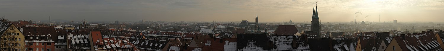
Nuremberg combines a well-preserved medieval centre and defensive walls with post‑war reconstruction, contemporary neighbourhoods and industrial districts. The skyline is defined by the Imperial Castle and by long stretches of ramparts. The old market square, timber-framed houses and narrow lanes form a compact core that draws visitors, while surrounding districts host manufacturing, research and cultural institutions.
History
The town rose to prominence in the Middle Ages as an imperial city of the Holy Roman Empire, an important trading and crafts centre. It became a centre for metalwork, printing and book production; the artist Albrecht Dürer is among its best-known historical figures. In the 19th and 20th centuries Nuremberg developed significant industry and trade fair activity. During the Nazi period the city was associated with large party rallies and discriminatory laws that bear its name; it was heavily damaged by bombing in World War II. In the immediate postwar years the Nuremberg Trials at the Palace of Justice established important precedents in international law.
Landmarks, museums and culture
Key attractions include the Imperial Castle, the main market (which hosts the famous Christkindlesmarkt each winter), the Albrecht Dürer House, and major museums such as the Germanic collections housed in comprehensive cultural institutions. The Toy Museum reflects a long local tradition of toy-making and trade; the city also preserves examples of medieval craftsmanship, municipal architecture and wartime history in its museums and memorials.
Economy, transport and institutions
Today Nuremberg balances industry, trade fairs and services. Its economy features electrical and mechanical engineering, information technology firms, and logistics. The city is linked by long‑distance rail, an international airport and inland waterways via the canal system, making it an important transport hub in northern Bavaria. Cultural life is supported by theatres, galleries, festivals and several universities and research institutes.
Memory and public life
Nuremberg remains known both for its medieval heritage and for its central place in 20th‑century legal and political history. Public sites — from the castle and market squares to the Palace of Justice and memorials — reflect layers of civic, artistic and judicial memory. Visitors seeking current statistics, museum details or event schedules should consult official city resources and institutional guides.
For more detailed information consult local guides, municipal publications and specialist works on urban history and law.


.svg.png)
.svg.png)