
Northwest Highlands (Scotland)
A concise encyclopedic overview of Scotland's Northwest Highlands: geography, geology, ecology, settlements, history, and recreational importance.
Overview
The Northwest Highlands form the northern third of mainland Scotland, a region of rugged mountains, deep glens and sea-fringed coasts. The area lies around the coordinates 58°01′08″N 4°28′26″W and is commonly described in relation to the rest of Scotland. It is separated from the Grampian Mountains by a major geological fault line known as the Great Glen; references to the higher eastern ranges commonly use the name Grampian Mountains while the long linear valley is the Great Glen.
Image gallery
6 Images


Geology and physical characteristics
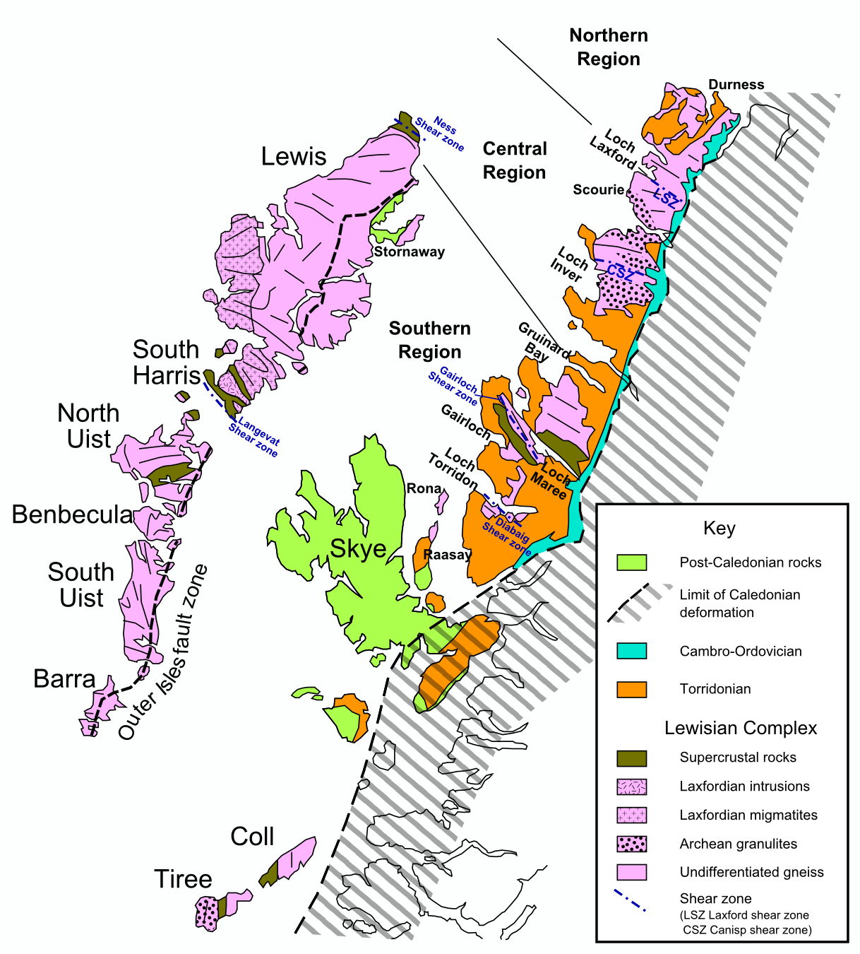
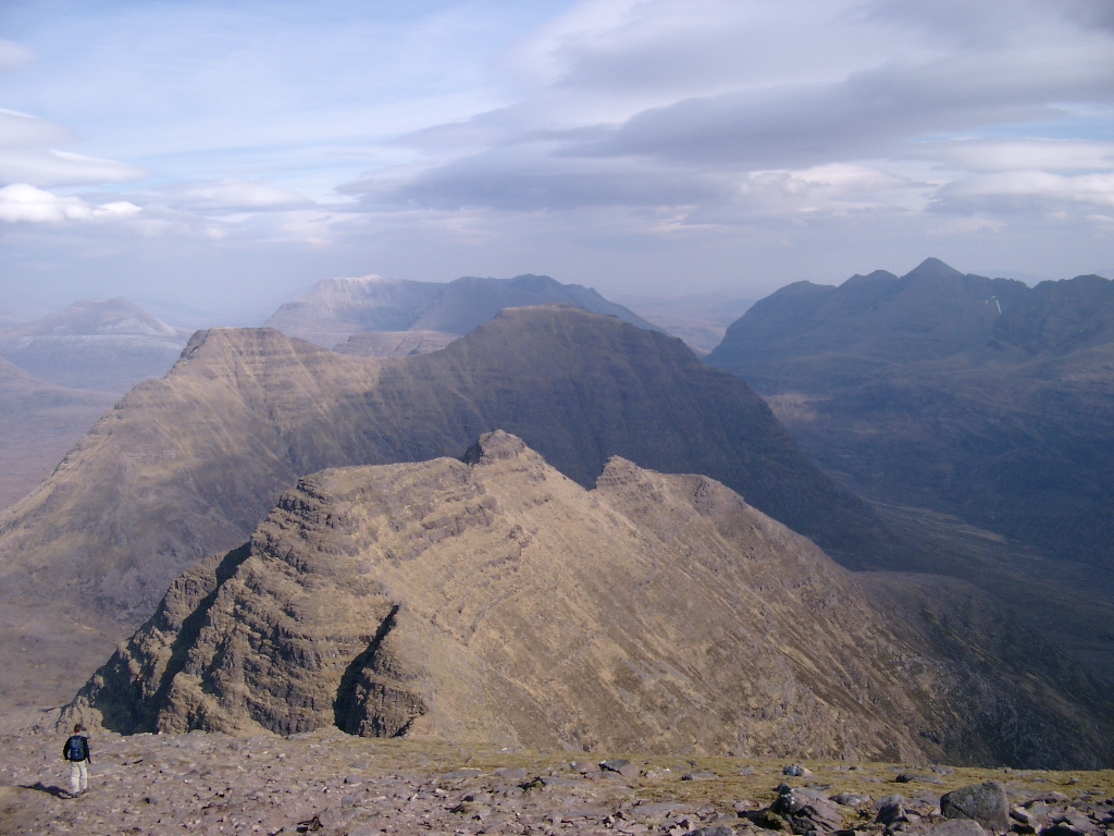
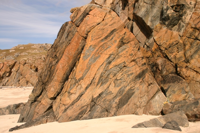
The foundation of the Northwest Highlands is ancient crystalline rock. Much of the bedrock is formed from Lewisian gneiss, some of the oldest exposed rock in the British Isles and a defining element of the region's landscape. Above this basement lie layers of sedimentary and metamorphic rocks: prominent ridges and isolated peaks are often capped by red or grey Torridonian sandstone, and a few summits show pale outcrops of Cambrian quartzite. The geology produces steep faces, occasional mesa-like tors and dramatic coastal cliffs.
Landscape, flora and fauna
Glacial action sculpted deep corries, U-shaped valleys and freshwater lochs. Notable water bodies and channels that traverse or border the area include the Caledonian Canal, which links sea lochs from Loch Linnhe through Loch Ness to the Moray Firth. Vegetation ranges from exposed montane heath and peatlands to sheltered pockets of native woodland. The Highlands support species typical of northern Britain: red deer, golden eagles, grouse and an array of wading birds; many habitats are protected by national and local conservation designations.
Human geography and history
Population is sparse compared with lowland Scotland. The largest settlement and administrative hub for the wider Highland area is Inverness, often called the "Capital of the Highlands." Traditional land uses have included crofting, extensive sheep farming and fishing. Cultural layers include Gaelic-speaking communities, Norse place-names on coastal islands, and vestiges of prehistoric settlement such as brochs and burial cairns. Over centuries the region's difficult terrain shaped distinct patterns of settlement and transport.
Uses, access and recreation
The Northwest Highlands attract hillwalkers, climbers, naturalists and those seeking remote coastal landscapes. Key activities include hillwalking on distinctive peaks, wildlife watching, fishing, and sailing in sheltered sea lochs. Infrastructure is concentrated along a few main roads and rail links; many scenic routes follow old drove roads and military-era tracks. Conservation groups, local authorities and landowners work to balance recreation, biodiversity and rural livelihoods.
Notable facts and distinctions
- The region is geologically notable for the exposure of very old metamorphic rocks and for the juxtaposition of ancient gneiss with younger sedimentary units.
- Its scenery—steep mountains, isolated sea lochs and extensive peatland—differs markedly from the smoother hills of southern Britain.
- Transport corridors such as the Caledonian Canal have historically linked western and eastern coasts; contemporary tourism and conservation emphasize the area's wild character.
For maps, geological descriptions and visitor guidance consult regional resources and official conservation sites. Further reading and authoritative datasets can be found via regional archives and geological surveys (bedrock summaries, Great Glen overview, Grampians relation). Additional reference links and guides are available for travel planning and natural-history study (Torridonian landscapes, sandstone formations, quartzite features, loch corridors, urban services in Inverness).
Questions and answers
Q: What are the coordinates of the Northwest Highlands?
A: The coordinates of the Northwest Highlands are 58°01′08″N 4°28′26″W / 58.019°N 4.474°W / 58.019; -4.474
Q: How is the Northwest Highlands separated from the rest of Scotland?
A: The Northwest Highlands are separated from the rest of Scotland by the Caledonian Canal, which extends from Loch Linnhe in the west, via Loch Ness to the Moray Firth in the north.
Q: What type of rock is found in this area?
A: The Highlands are formed on Lewisian gneiss, which is one of oldest layers of rock in Scotland. There are also impressive rock islands made up of dark red or gray Torridonian sandstone and some peaks topped with light gray or white Cambrian quartzite.
Q: What is Inverness known as?
A: Inverness is known as "The Capital of the Highlands".
Q: What role does Inverness play in this region?
A: Inverness serves as an administrative centre for Highland Council area and it's by far largest settlement in this region.
Q: Where does Loch Linnhe extend to?
A: Loch Linnhe extends from west to Moray Firth in north via Loch Ness.
Related articles
Author
AlegsaOnline.com Northwest Highlands (Scotland) Leandro Alegsa
URL: https://en.alegsaonline.com/art/71083
Sources
- books.google.com : The Geology of Scotland
- sp.lyellcollection.org : Continental Extensional Tectonics