North Macedonia
Template:Infobox State/Maintenance/NAME-German
Northern Macedonia (Macedonian Северна Македонија Severna Makedonija, Albanian Maqedonia e Veriut; officially Republic of Northern Macedonia, Macedonian Република Северна Македонија Republika Severna Makedonija, Albanian Republika e Maqedonisë së Veriut; until 2019: Republic of Macedonia) is a landlocked country in southeastern Europe. It is located in the northwest of the historical region of Macedonia.
Northern Macedonia has been a member of NATO since 27 March 2020 and a candidate for accession to the European Union (EU) since 2005. Northern Macedonia has one of the weakest economies in Europe and is in a process of transformation, both economically and politically. The country is struggling with high unemployment rates and a weak infrastructure as well as a lack of investment.
In addition to Slavic Macedonians, who make up about 64% of the total population, there is a large minority of Albanians (25%). There are also smaller minorities of Turks (3.85 %), Roma (2.66 %), Serbs (1.78 %), Bosniaks (0.84 %) and Aromanians/Meglenorumänen (0.48 %) as well as other ethnic groups (1.04 %). Due to this situation, there have been and still are ethnically motivated conflicts, especially between Macedonians and Albanians. After the civil war-like conditions in 2001 and the peace treaty that was signed afterwards, the overall situation in the country has improved considerably. However, social equality of all ethnic groups has still not been achieved.
Name and international memberships
→ Main article: Dispute over the name Macedonia
The state was founded in 1991 as the Republic of Macedonia in the wake of the disintegration of Yugoslavia from the southernmost constituent republic of socialist Yugoslavia. Due to the name dispute with its southern neighbor Greece, the state was internationally referred to as the Former Yugoslav Republic of Macedonia (FYROM; English former Yugoslav Republic of Macedonia, abbreviated FYROM) to avoid an official name. At NATO and in some other contexts, the three-letter abbreviation FYR Macedonia was used.
The agreement with the Greek government on 12 June 2018 initiated the change of the state name to Република Северна Македонија/Republika Severna Makedonija (German Republic of North Macedonia). In return, Greece agreed to stop blocking northern Macedonia's accession negotiations with the EU and NATO. However, in a referendum on 30 September 2018, which was only advisory, 91% of the votes cast were in favour of NATO membership and the associated name change to "North Macedonia". However, the quorum of 50% was missed with a turnout of 36%, leaving the referendum invalid. However, since the parliaments in Skopje and Athens ratified the agreement, the renaming to North Macedonia became effective anyway. To this end, the constitution was amended in January 2019.
In the vote in the Macedonian parliament on 11 January 2019, a slim two-thirds majority of 81 out of 120 votes were in favour of the amendment. In the vote in the Greek parliament, an absolute majority of 153 out of 300 MPs voted in favour of the agreement with the neighbouring state. The new state name thus became effective on 12 February 2019.
The country has been a member of the United Nations since 8 April 1993 (until the name change registered on 14 February 2019 under the name "the former Yugoslav Republic of Macedonia"), CEFTA, as well as a participating state of the Organization for Security and Cooperation in Europe, the Council of Europe and the Cooperation Council for South-Eastern Europe. North Macedonia is also a member of the World Trade Organization, the International Monetary Fund, the World Bank and NATO.
Geography
Northern Macedonia is a landlocked country centrally located on the Balkan Peninsula. It borders Serbia to the north, Bulgaria to the east, Greece to the south, Albania to the west and Kosovo to the northwest. The longest extension from north to south is 188 km, from west to east 216 km. The country's border with Serbia is 62 km long, that with Bulgaria 148 km, that with Greece 246 km, that with Albania 151 km and that with Kosovo 159 km. Thus, the state border is 766 km long in total.
Only along the larger rivers and in the basin landscapes is the country relatively flat. These uplands and lowlands account for 19.1 percent of the country's area (4,900 square kilometers). Water bodies occupy 2.11 percent (551 square kilometers) of the state's area; the rest of the land (20,262 square kilometers) consists of mountains and hills. The highest mountains are in the west of the country on the border with Albania and Kosovo. The highest peak is Golem Korab (alb. Maja e Korabit) at 2764 m. i. y. , which is also Albania's highest mountain. About 3.8 percent of the national territory is protected by national parks. They are located in the west and southwest of the country.
The Republic of Northern Macedonia occupies part of the geographical region of Macedonia. It shares it mainly with Greece.
See also: List of border localities in North Macedonia and List of protected areas in North Macedonia
Terrain
The western mountains of northern Macedonia are foothills of the Dinaric Mountains, the most important mountain range of the Western Balkans. The highest peaks are the 2764 m high Golem Korab on the border with Albania and the 2747 m high Titov Vrv in the massif of Šar Planina (alb. Malet e Sharrit). Other mountains are the Jablanica Mountains in the southwest of the country, which partly form the border with Albania, the Osogovo Mountains with Bulgaria, the Galičica Massif between Lake Ohrid and Lake Prespa, and the Pelister Massif between Lake Prespa and Bitola.
The largest plateaus and lowlands are formed by the Ovče Pole northwest of Štip, the Pelagonia Plain between Prilep and Bitola, the Skopje and Kumanovo Plains, and the Polog Plain between Tetovo and Gostivar. In addition, the wide river valleys form further arable land.
Waters
The Vardar River rises in Šar Planina and flows through the entire country first to the east and then to Skopje to the southeast before finally flowing into the Thermaic Gulf as the Axiós (Greek Αξιός) through the Greek region of Macedonia. It forms the country's main axis of orientation and has four major tributaries. The Black Drin rises from Lake Ohrid and flows through the southwestern region of the country until it continues into Albania at the town of Debar and empties into the Adriatic Sea.
In the southwest, on the border with Albania, northern Macedonia has a two-thirds share each in Lake Ohrid and Lake Prespa. These lakes (700 m. and 900 m. a.y. respectively) are about 400 square kilometres in size and were formed by tectonics in a geological zone of weakness in the earth's crust. Lake Ohrid has a maximum depth of 287 metres; it is rich in endemic species. Both lakes, the city of Ohrid and the Galičica National Park are UNESCO World Heritage Sites.
Northern Macedonia is located in the Blue Heart of Europe.
Climate
The climate of northern Macedonia is relatively harsh in the mountainous interior. In general, it lies in the transitional area between the Mediterranean and the continental climate. In winter it is usually very rainy and cold, while in summer it is very rainy and warm. The seasons of autumn and spring are weak, i.e. the summers and winters last relatively long.
Flora
Many regions untouched by man and a species-rich flora and fauna characterize the flora and fauna of northern Macedonia. The flora in the country is represented by about 210 families, 920 genera and 3700 plant species. Of these, 3200 species belong to the angiosperms, 350 species to the deciduous mosses and 42 species to the ferns. One third of the country is covered by mixed forests, where beech, oak and chestnut predominate. In the plains, the vegetation consists mainly of maquis and pastures used by agriculture and livestock. Around the larger lakes grow cypress, walnut and fig trees. From 1300 m. a.s.l., mountain pines and firs flourish. And from 2000 m. a.s.l., juniper bushes and plant species adapted to the harsh mountain climate are most common.
According to WWF and the digital map of European ecological regions of the European Environment Agency, the territory of the country can be divided into four ecoregions: Mixed forests of Pindos, Mixed forests of the Balkan Peninsula, Mixed forests of the Rhodope Mountains and Mixed forests with hardwood vegetation of the Aegean Sea.
The Pelister National Park near Bitola is known for the occurrence of the endemic Rumelian pine, as well as for 88 plant species that make up 30 percent of the tree flora in northern Macedonia. The pine forests of Pelister are divided into two groups: Pine forests with ferns and Pine forests with junipers.
The most common deciduous trees are the Macedonian oak, the sycamore maple, the weeping willow, the pollard willow, the alder, poplars, elms and the common ash. Another plant species that characterizes northern Macedonia - especially in Šar Planina and Bistra - is the poppy. Reeds grow on untouched lakeshores.
Fauna
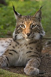
Northern Macedonia has a rich wildlife. Species range from bears, wild boars, badgers, wolves and red foxes to squirrels, martens, chamois and red deer. Red deer are found in the Demir Kapija region, while the rare Balkan lynx (Lynx lynx martinoi) lives almost exclusively in the mountains to the west and north. Only about 40 specimens of this highly endangered subspecies remain in northern Macedonia - especially in the Mavrovo National Park - and in neighbouring Albania. The mountain area around Mavrovo is also home to a large population of chamois, which attract many hunters.
Lake Ohrid is one of the oldest lakes in the world and is known for its Ohrid trout, whitefish, gudgeon, roach and snook. Similar species can only be found in Lake Baikal. The European eel, which is also present in the lake, swims thousands of kilometres from the Sargasso Sea to Lake Ohrid to stay there for ten years and return to its birthplace in the Atlantic Ocean after reaching sexual maturity.
The Šarplaninac (Albanian Deltari Ilir) is the best known sheepdog of the country.
Large parts of northern Macedonia lie in the European Green Belt.

Only about 40 specimens of the Balkan lynx (Lynx lynx balcanicus) remain; pictured is a Eurasian lynx.

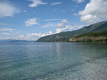
Lake Ohrid is shared by Northern Macedonia and Albania. It is the largest lake in the country, one of the largest in the Balkan Peninsula and one of the oldest on earth.

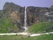
The Korab waterfall is with 139 m height the highest waterfall in Southeast Europe.

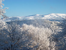
Carev Vrv is one of the highest mountains in the Osogovo range. It is located southeast of the town of Kriva Palanka near the border with Bulgaria.
Questions and Answers
Q: What is the official name of North Macedonia?
A: The official name of North Macedonia is the Republic of North Macedonia.
Q: What currency is used in North Macedonia?
A: The currency used in North Macedonia is the Macedonian denar (MKD).
Q: What is the capital and largest city of North Macedonia?
A: The capital and largest city of North Macedonia is Skopje, with more than 500,000 residents.
Q: How many languages are spoken in North Macedonia?
A: Two languages are spoken in North Macedonia; Macedonian and Albanian (since 2019).
Q: What countries border North Macedonia?
A: Countries that border North Macedonia include Serbia to the north, Albania to the west, Greece to the south, and Bulgaria to the east.
Q: How many mountains are higher than 2000 meters above sea level in North Macedonia?
A: Sixteen mountains are higher than 2000 meters above sea level inNorthMacedonia.
Q: When didNorthMacedoniabecome a member of NATO? A:NorthMacedoniajoined NATO on 30 March 2020.
Search within the encyclopedia