
Nome (ancient Egyptian administrative district)
A nome (Greek: Νομός; Egyptian: sepat) was a territorial and administrative district of ancient Egypt, established before the Dynastic period and used for millennia to organize government, religion and economy.
A nome was a primary territorial and administrative division in ancient Egypt. The Greek term Νομός gives the name commonly used in modern scholarship, while ancient Egyptians called these districts sepat. The system predates the traditional date of unification and was already in place before 3100 BC. Nomes began as largely independent local polities that controlled a town and its surrounding agricultural land; over time they were incorporated into larger, pharaonic states, a process traditionally associated with the early ruler Menes. The nome framework persisted — with variations — for more than three thousand years, surviving changes in dynasties and foreign rule.
Image gallery
10 Images


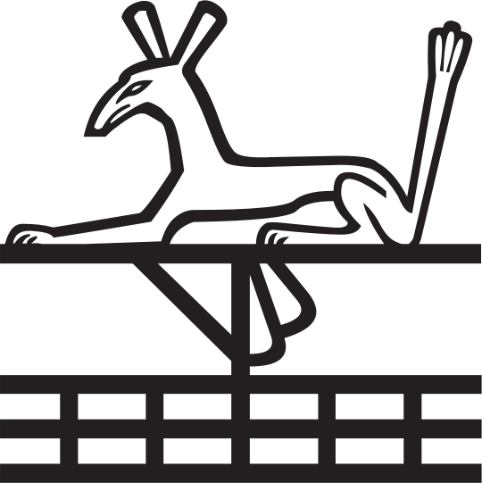
Organization and geography
Nomes were territorial units with recognized borders, local capitals, and administrative centers. The system functioned as an administrative backbone: each nome collected taxes, oversaw irrigation and stored grain, and maintained local cults and temples. Boundaries followed natural features such as the alluvial strip of the Nile and the limits of arable land, producing long, narrow districts in Upper Egypt and broader areas across the delta in Lower Egypt.
Lower Egypt (Delta and Nile floodplain) was divided into about twenty nomes under pharaonic administration. The numbering began in the west and progressed eastward along the delta. The first nome in Lower Egypt included the region of Memphis and the necropolis at Saqqara and Giza, close to modern Cairo. Major coastal or delta cities such as Alexandria (in later times) and ancient Bubastis lay within named nomes and were integrated into this grid of districts.
Upper Egypt was typically split into twenty-two nomes, numbered from south to north along the river. The First Nome was centered on the island of Elephantine, near the border with Nubia at the First Cataract, the region of modern Aswan. Further downstream were important nomes containing the great cult centers: Waset (ancient Thebes, modern Luxor) and, in the mid-valley, sites such as Amarna and Meidum.
Roles, officials and local life
Each nome was headed by a governor often called a nomarch; these officials supervised tax collection, local justice, corvée labor and upkeep of irrigation works. Nomes supported local temples and specific divine patrons, creating a patchwork of cults and regional identities. Economically, nomes were the practical units for organizing sowing, harvest, and storage of grain, and they played a central role in supplying the royal court and armies.
Over centuries the power of nomarchs fluctuated. In times of central strength they acted as provincial agents of the king; in periods of fragmentation they could become semi-independent. The Middle Kingdom saw administrative reforms that at times curtailed hereditary local power, while the Late Period, Persians, Greeks and Romans retained the nome as a useful subdivision — in part explaining why the Greek name survives in our terminology.
Notable features and legacy
- Distinct numbering systems: Lower Egypt’s nomes were numbered west to east across the delta; Upper Egypt’s were counted from south to north along the Nile.
- Civic identity: Many nomes had symbols and emblems used on seals and monuments, and inhabitants often identified with their province as much as with the kingdom.
- Archaeological value: Nome capitals and tombs preserve records of local administration, economy and religion, aiding modern reconstruction of Egypt’s regional history.
- Toponymic survival: Place names and regional boundaries influenced later administrative divisions, and traces of some ancient nome names persist in Coptic and modern Egyptian toponyms.
The study of nomes illuminates how a long-lived civilization organized territory and maintained continuity across millennia. For concise introductions or further details consult works on ancient Egyptian administration and regional archaeology; many museum catalogues and academic surveys arrange material by nome, reflecting their continued usefulness to scholars and the public alike.
References and further reading (examples): Greek term, administrative role, ancient Egypt overview, autonomous origins, Early rulers, Lower Egypt, Old Kingdom context, Memphis, Mediterranean, Saqqara, Giza, Cairo, Nile, Delta, Alexandria, Upper Egypt, Elephantine, Nubia, First Cataract, Aswan, Waset, Luxor, Amarna.
Questions and answers
Q: What is a Nome?
A: A Nome was an administrative part of ancient Egypt. It was also known as a “sepat” in Egyptian, and it was divided into 20 nomes in Lower Egypt and 22 nomes in Upper Egypt.
Q: When did the division of ancient Egypt into nomes happen?
A: The division of ancient Egypt into nomes happened before 3100 BC.
Q: How were the nomes numbered?
A: The nomes were numbered in a more or less orderly fashion starting from west to east through the Nile delta. The numbering started in the west, and continued with higher numbers in the east.
Q: Where was Alexandria located?
A: Alexandria was located in the Third Nome.
Q: Where was Bubastis located?
A: Bubastis was located in the Eighteenth Nome.
Q: Where did Upper Egypt begin?
A: Upper Egypt began at Elephantine close to Egypt's border with Nubia at the First Cataract – which is now modern-day Aswan.
Q: What city was located in the Twenty-First Nome?
A: Meidum was located in the Twenty-First Nome.
Related articles
Author
AlegsaOnline.com Nome (ancient Egyptian administrative district) Leandro Alegsa
URL: https://en.alegsaonline.com/art/70583