Nile Delta — Egypt's Nile River Delta
The Nile Delta is the broad, fertile alluvial plain in northern Egypt where the Nile fans into the Mediterranean; a densely populated agricultural and ecological region facing erosion and sea‑level threats.
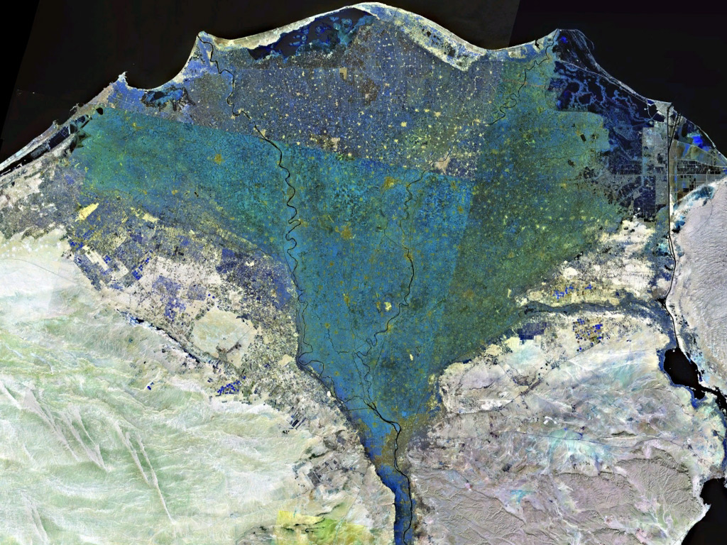
The Nile Delta occupies the northern terminus of the Nile River system, spreading into the Mediterranean Sea and forming one of the world’s largest river deltas. Its approximate central coordinates are given here: 30°54′N 31°7′E. In Arabic the region is known as دلتا النيل. Geographically it marks the transition between modern urban Cairo and the coastal plain, and is often identified with the historic region called Lower Egypt.
Image gallery
8 Images


Physical characteristics
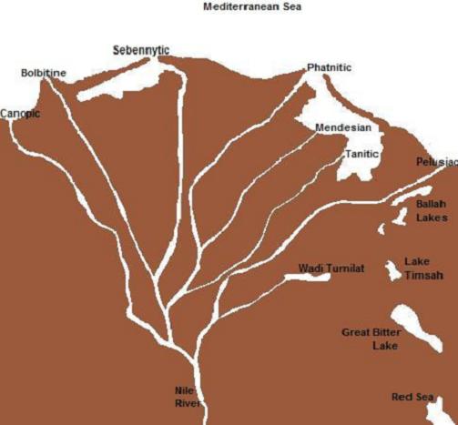
The delta is an alluvial, fan‑shaped plain formed by successive layers of river sediments. From west to east the shoreline extends roughly from Alexandria to Port Said, while the north–south distance from the coast to where the delta begins a little below Cairo is approximately 160 km. Historically the flow split into multiple distributaries that created wetlands, lagoons, and marshy zones before emptying into the Mediterranean Sea.
Formation and historical development
The delta built up over millennia as the Nile delivered suspended sediments (silt) during annual floods, creating fertile soils that supported ancient civilizations. Modern interventions, especially the construction of upstream dams, have altered that natural cycle. The completion of the high dam at Aswan in the 20th century greatly reduced downstream sediment transport, cutting off most of the fresh silt that replenished the delta and contributing to shoreline erosion and subsidence.
Ecology, land use and economy
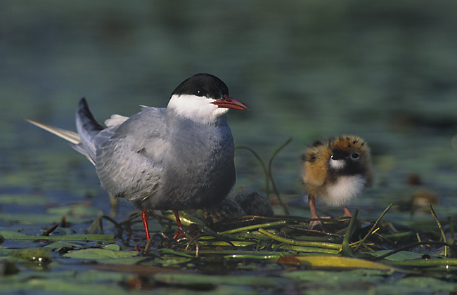
The delta is one of Egypt’s principal agricultural regions: its clay and silty soils support cereals, cotton, rice, vegetables and fodder for livestock. It is also Egypt’s most densely populated area, hosting a patchwork of small farms, towns and major cities. Coastal lagoons and freshwater wetlands provide habitat for migratory birds and fish, while the proximity to the Mediterranean makes parts of the delta important for fisheries and ports.
Contemporary challenges and management
Today the delta faces multiple pressures: reduced sediment supply and tilled soils have accelerated coastal erosion and land subsidence; rising Mediterranean sea levels increase saltwater intrusion into aquifers and farmland; and expanding urbanization brings pollution and habitat loss. Efforts to manage these threats include engineered coastal defenses, changes in agricultural practices, and regional planning to balance development with wetland conservation.
Key points and distinctions
- The Nile Delta is a triangular alluvial plain where the Nile spreads into the Mediterranean.
- It extends along the coast from Alexandria to Port Said.
- Its beginning is located just downstream from Cairo and is part of historical Lower Egypt.
- Construction of the Aswan dams altered flood regimes and stopped much of the natural silt deposition that built the delta.
- Coordinates commonly used for the delta’s center are 30°54′N 31°7′E.
- The delta’s Arabic name is دلتا النيل, and it is sometimes referred to simply as the Nile River Delta (delta).
- As a distinctive region of northern Egypt, the delta combines rich agricultural land with crucial ecological zones.
Understanding the Nile Delta requires both its long human history and the modern environmental dynamics that threaten its future productivity and habitats. Ongoing research and policy action aim to reconcile economic needs with measures that protect soils, manage water and reduce coastal loss.
Questions and answers
Q: What are the coordinates of the Nile Delta?
A: The coordinates of the Nile Delta are 30°54′N 31°7′E.
Q: What is the Nile Delta?
A: The Nile Delta is the delta formed in Northern Egypt (Lower Egypt) where the Nile River spreads out and drains into the Mediterranean Sea.
Q: How large is the Nile Delta?
A: The Nile Delta is one of the world's largest river deltas and covers some 240 km of Mediterranean coastline.
Q: What is the length of the delta from north to south?
A: From north to south, the delta is approximately 160 km in length.
Q: Where does the delta begin?
A: The Delta begins slightly down-river from Cairo.
Q: Why is the delta shrinking?
A: The delta is shrinking because the dams at Aswan farther upstream on the Nile have stopped further addition of the silt that built the delta in past centuries.
Q: What can be found in the Nile Delta?
A: The Nile Delta is a rich agricultural region.
Related articles
Author
AlegsaOnline.com Nile Delta — Egypt's Nile River Delta Leandro Alegsa
URL: https://en.alegsaonline.com/art/70214