Nigeria — overview, history, geography and culture
Nigeria is a populous federal republic in West Africa with about 217 million people, a diverse mix of languages and cultures, a large regional economy, and a history from precolonial states to modern independence.
Overview
Nigeria is a federal republic on the Gulf of Guinea in West Africa. It is the continent's most populous country, home to a diverse population, multiple major ethnic groups and languages, and dynamic cultural industries such as film and music. The country plays a leading role in regional politics and commerce.
Image gallery
10 Images


Geography and population
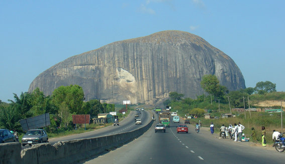
Nigeria occupies a variety of landscapes from coastal mangroves to savanna and plateaus, and is bisected by the Niger River. Located in West Africa, it has a population of roughly 217 million people, making it the largest African country by population. The official capital is Abuja, while Lagos remains the largest city and chief economic hub.
Languages, religion and administrative divisions
English is the official language, used for government and education, but hundreds of indigenous languages are spoken nationwide. Major languages include:
- Hausa
- Yorùbá
- Igbo
The country is organized as a federation of 36 states plus the Federal Capital Territory. Religious adherence is mixed, with large Muslim and Christian communities and numerous traditional beliefs.
History
Long before colonial rule, the territory now called Nigeria hosted a variety of kingdoms and city-states, including Hausa city-states, the Oyo and Benin kingdoms. European contact and British colonial administration reshaped the region, and Nigeria gained independence in 1960. The post‑independence era has included periods of military rule, a civil war in the late 1960s, and a return to civilian government in 1999.
Economy and culture
Nigeria's economy combines oil and gas production with agriculture, services and a growing technology sector. It is one of Africa's largest economies and a major oil producer. Cultural output—especially Nollywood film and contemporary music—has broad influence across the continent and the diaspora. Demographic growth and urbanization continue to shape economic and social policy.
Notable facts and contemporary issues
Nigeria's large population gives it considerable weight in Africa, while challenges include infrastructure, regional disparities and governance issues. The federal capital moved from Lagos to Abuja in 1991 to provide a centrally located administrative center. For current statistics and further reading see demographic and economic sources such as population databases and regional analyses (demographics).
Geography
Nigeria is located in West Africa on the Atlantic Ocean and covers an area of 923,768 square kilometres with an east-west and north-south extension of 1200 and 1100 kilometres respectively. A prominent feature of the country is the southeast-flowing Niger River and its southwest-flowing tributary, the Benue River, which converge in Nigeria and flow into the Gulf of Guinea in the Niger Delta. The Niger Delta is one of the largest river deltas in the world and covers an area of approximately 70,000 km². This corresponds approximately to the size of Bavaria.
The approximately 850 km long coastal strip on the Gulf of Guinea is characterised by lagoons (in the west, for example, the Lagos Lagoon) and mangrove swamps. It reaches its greatest extent in the Niger Delta. The belt of tropical rainforest in the interior, which used to be almost 100 kilometres wide, has been largely cleared and replaced by secondary forest. Further north, a region known as the Middle Belt extends into the wet savannah of the Sudan, followed by the dry savannah of the Sahel. A separate vegetation zone is formed by the Jos Plateau in eastern Nigeria, a highland up to 1829 metres high.
The highest elevation in Nigeria, at 2419 meters, is Mount Chappal Waddi, located in the mountainous country near the border with Cameroon. The only known volcanic area in Nigeria is the Biu Plateau.
Climate
Nigeria is influenced by two climatic zones: tropical humid hot climate in the south with a productive rainy season that lasts from April to October. Humidity is high throughout the year, between 85 and 95 percent. Average temperatures in the southern part of Nigeria are around 30 °C. It usually cools down only slightly at night. Northern Nigeria has a desert climate with higher temperatures and less rainfall than the south. The rainy season of the West African monsoon lasts from June to September and the dry season with periods of drought lasts from November to March; the Harmattan brings dry hot air from the Sahara during this time. Temperatures can rise to 50 degrees in the north. However, the humidity here is much lower and more comfortable. The temperature differences are up to 20 degrees between day and night. The rainy season is less pronounced in northern Nigeria.
Hydrology
Nigeria is divided into two main catchment areas - that of Lake Chad and that of the Niger. The Niger catchment area covers about 63% of the country. The main tributary of the Niger is the Benue, whose tributaries extend beyond Cameroon into Chad and the Sharieinzus region.
The Chad Basin is fed by the northeastern quarter of Nigeria. The Bauchi Plateau forms the watershed between the Niger/Benue and Komadugu Yobe river systems. The flat plains of northeastern Nigeria are geographically part of the Chad Basin, where the course of the El Beid River forms the border with Cameroon, from the Mandara Mountains to Lake Chad. The Komadugu Yobe river system gives rise to the internationally important Hadejia-Nguru wetlands and Ox-bow lakes around Lake Nguru during the rainy season. Other rivers of the northeast are the Ngadda and the Yedseram, both of which flow through the Sambisa swamps, thus forming a river system.
There are also numerous coastal rivers.
Catchment area breakdown of the country in percent
| Catchment area | Square kilometer | Percentage of the country |
| Niger | 584.404 | 63,3 |
| Lake Chad | 179.300 | 19,4 |
| Cross River | 40.300 | 4,4 |
| Ogun | 22.540 | 2,4 |
| Ouémé (Okpara) | 9.700 | 1,1 |
| Imo | 9.100 | 1,0 |
| Osun | 9.014 | 1,0 |
| Other coastal rivers | 69.410 | 7,5 |
| Nigeria | 923.768 | 100 |
See also: List of rivers in Nigeria

Nature
Climate and vegetation zones
Nigeria comprises five different vegetation zones in which a rich flora and fauna could develop. This ranges from the extensive mangrove forests in the coastal regions to the tropical rainforests of the mountain regions and the savannahs of the Sudan and Sahel. This natural wealth is a product of the different climatic conditions, which have given rise to a variety of different ecosystems. Rainfall is highly unevenly distributed and is characterized by a sharp meridional gradient. In the north of the country, rainfall ranges from 400 to 600 mm, during the rainy season of the West African monsoon from June to September. This rainfall supports the development of biomes in the Sahelian zone in the northeast, which occupies about 10% of Nigeria's land area. It is characterized by extensive grass savannahs interspersed with extensive dry forests, whose dominant tree species belong to the Acacia sp. genus. The WWF calls this vegetation zone the Sahel Acacia Savanna ecoregion.
To the south of the Sahel, the savannah landscape of the Sudan follows, where between 600 and 1600 mm of precipitation falls annually. This vegetation zone covers about 70 % of the country's area, this comprises various ecosystems covering large parts of the Nigerian part of the Upper Guinea Threshold up to the highlands of Adamaua. The flora in this vegetation zone is characterized by dispersed and wide-ranging forests interspersed with scrub forests and underlain by an understory of long-necked grasses and broad-leaved herbs. Gallery forests spread along the rivers. This vegetation zone is referred to by WWF as the Western Sudan Savanna ecoregion. The Western Sudan Savannah is home to a large number of different animal species, many of which are endemic to this savannah landscape. Large populations of bushbuck (Tragelaphus scriptus), warthog (Phacochoerus africanus), steppe monitor (Varanus exanthematicus), anubis baboon (Papio anubis) and mantled baboon (Papio hamadryas) live in this ecoregion. The once large populations of African mammals, such as the elephant, survive only in the established protected zones. A transition zone between the savannahs of Sudan and the rainforest areas is the Guinea savannah, characterized by denser tree cover and very tall grass savannahs. It is limited to the states of Ondo, Edo, Anambra, Oyo, Kaduna and Enugu.
South of the savannah landscape of the Sudan and the Guinea savannah are the rainforest areas. Together with the coastal regions, these occupy about 20% of Nigeria's land area. It encompasses the windward side of the Upper Guinea Sill, extending to the coastal regions and averaging about 100 km in width. In this region, rainfall ranges from 1600 to 2500 mm, with over 4000 mm in some coastal and high mountain regions. In the high mountainous regions with high rainfall, a mountain rainforest is formed and thus forms the fourth vegetation zone of Nigeria. However, the extent of primary rainforest has decreased by about 90% in the last 100 years. Untouched rainforest areas can only be found on the Obudu and Mambilla plateau as well as in the Oban hills.
The coastal regions form the fifth vegetation zone of Nigeria and include the Niger Delta and the extensive mangrove forests, various forms of lagoon and coastal landscapes. The mangrove forests in Nigeria cover an area of 11,134 km² (9723 km² according to US-AID) along a 708 km coastline. However, the extent of mangrove forests has declined sharply in the last 50 years, due to large population increases and economic activities such as oil exploration. Nevertheless, the coastal regions of Nigeria are among the most species-rich ecosystems on earth.
Biodiversity
Nigeria is known to have more than 1340 terrestrial vertebrate species, including 274 mammal, 885 bird, 109 amphibian and 135 reptile species. These include Africa's northernmost gorilla species, the critically endangered Cross River gorilla (Gorilla gorilla diehli). Other almost endemic primate species are the Niger Delta stubby ape (Piliocolobus epieni), Nigeria blue-bellied guenon (Cercopithecus sclateri) and the red-bellied guenon (Cercopithecus erythrogaster). Furthermore, about 20,000 species of insects (including over 1000 species of butterflies in both sectors of the Cross River National Park alone), 77 species of molluscs and five species of echinoderms are also known to occur in Nigeria. About 247 fish species have been documented in the inland waters of Nigeria and 648 fish species in the marine oceanic coastal waters.
The flora of Nigeria is naturally more diverse, with 848 species of algae and 5103 species of vascular plants documented. Of these, however, only a fraction are endemic to Nigeria. Seed crops native to Nigeria include sorghum millet (Sorghum bicolor), cowpea (Vigna unguiculata), West African rice Oryza sativa, Bambara groundnut (Vigna subterranea), common bean (Macrotyloma geocarpum) and African yam bean (Sphenostylis stenocarpa). The 1992 biodiversity study further lists 3423 fungal, 500 viral and 55 bacterial species, but little is known about this aspect of biodiversity.
Nature reserves
The size of protected areas in Nigeria is equivalent to about 3.22 percent of the country's land area, the core zones of which are the eight national conservation areas of Chad Basin National Park, Cross River National Park, Gashaka-Gumti National Park, Kainji National Park, Kamuku National Park, Okomu National Park, Old Oyo National Park and Yankari National Park. Other classifications of protected areas form Game Reserves (hunting reserves), Forest Reserves and Sacred Coves. Three transboundary biosphere corridors could be created together with Cameroon, these link Afi Mountain Wildlife Sanctuary and Mbe Mountains Community Wildlife Sanctuary with Okwangwo sector of Cross River National Park and Takamanda National Park, and Oban sector of Nigerian National Park with Korup National Park. The third biosphere corridor links the Chad Basin National Park with the Waza National Park. Nigeria has been a signatory to the Ramsar Convention since 2001. A total of eleven protected areas of wetlands of international importance were designated in 2008, these are: Apoi Creek Forest Reserve, Baturiya Wetlands Game Reserve, Dagona Sanctuary Lake, Foge Islands, Lake Chad Wetlands in Nigeria, Lower Kaduna-Middle Niger Floodplain, Lake Maladumba, Nguru Lake (and Marma Channel) complex, Lake Oguta, Pandam and Wase Lakes Wildlife Park and the Upper Orashi Forest Reserve.
Environmental issues
The most severe damage has been caused in the Niger Delta by oil production, which has been going on for more than 50 years. Water, air and food are contaminated. According to a study published in August 2011 by the United Nations Environment Programme (UNEP), up to one million people are threatened by the serious environmental pollution. A clean-up of the contaminated areas in the settlement area of the Ogoni ethnic group alone will take up to 30 years and cause costs of one billion US dollars in the first five years of the proposed clean-up operation alone.
Oil pipeline explosions have repeatedly killed large numbers of people in recent years. A pipeline explosion near Abule Egba on 26 December 2006 killed about 500 people, and an Iljegun pipeline explosion on 16 May 2008 claimed about 40 lives. In May 2010, over 3,000 barrels of oil leaked from a pipeline in Akwa Ibom within seven days, destroying one of the world's largest mangrove forests.
See also: Movement for the Survival of the Ogoni People

Related articles
Author
AlegsaOnline.com Nigeria — overview, history, geography and culture Leandro Alegsa
URL: https://en.alegsaonline.com/art/70114
Sources
- ethnologue.com : "Languages of Nigeria"
- esa.un.org : "United Nations world population prospects"
- imf.org : "Nigeria"
- data.worldbank.org : "Gini Index"
- hdr.undp.org : "2015 Human Development Report Statistical Annex"
- data.worldbank.org : Population Total
- aljazeera.com : "Nigeria becomes Africa's largest economy"
- cia.gov : "Rank Order – Area"
- cia.gov : "Africa :: Nigeria"
- africabasket.com : "Nigerian Basketball"
- commons.wikimedia.org : Nigeria
- thecommonwealth.org : Commonwealth Secretariat - Member States