Nagercoil: southern Tamil Nadu city — history, geography, and life
Overview of Nagercoil, the administrative centre of Kanyakumari district: location, history, demographics, economy, culture, and notable features near India's southern tip.
Overview
Nagercoil is the administrative headquarters of Kanyakumari District in the extreme south of the Indian state of Tamil Nadu. The town sits close to the southernmost point of the Indian peninsula and is set between the low coastal plain to the east and the rising slopes of the Western Ghats to the west. Its name is commonly associated with a traditional serpent shrine and is often rendered in English as the "Temple of the Nāgas"; the town is also linked historically to the older regional name Nanjilnadu. Nagercoil functions as a regional hub for administration, education, healthcare and commerce within the district.
Image gallery
10 Images


Geography and environment
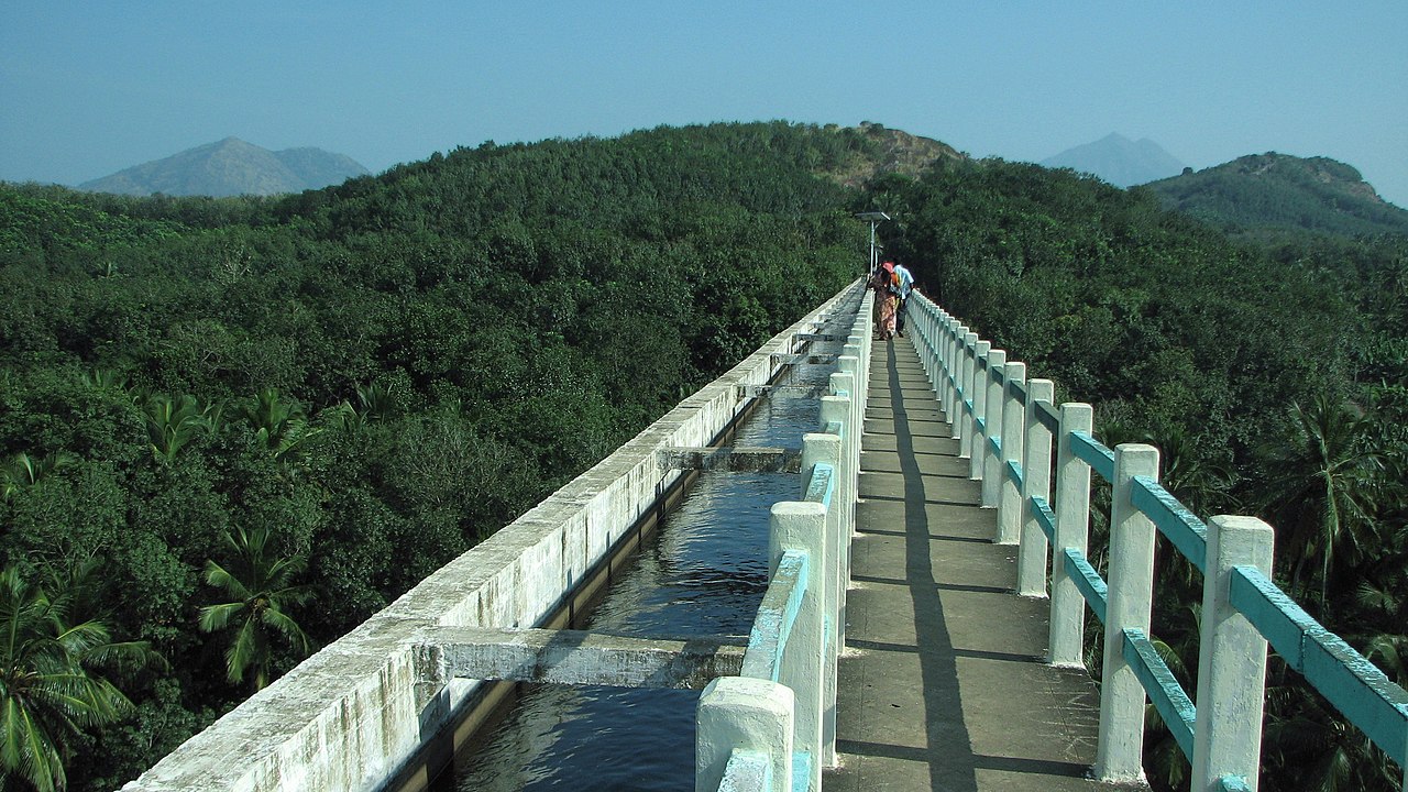
The landscape around Nagercoil is a mix of gently undulating hills, paddy fields and coconut groves. The Western Ghats form a forested backdrop that influences local rainfall patterns and produces a generally humid tropical climate with substantial monsoon precipitation. Agricultural land is concentrated on the eastern side of the municipality and along the coastal belt of the district, while the western highlands are more sparsely populated and heavily wooded. Local soils and coastal sands have supported the extraction of heavy minerals such as ilmenite and monazite in the broader region.
History and administration
Nagercoil has a layered history shaped by South Indian kingdoms and by its period within the Travancore state. After Indian independence, political and linguistic reorganisations in the 1950s led to the town and much of the surrounding district becoming part of Tamil Nadu. Its civic status today is that of a municipality and it serves as the principal administrative centre for district-level government offices and services.
Population and society
According to the 2011 national census, Nagercoil had a population of roughly 225,000 residents. Demographic highlights from that count include a relatively high female-to-male ratio, above many national averages, and a notably high literacy rate. The urban population contains diverse religious communities: a Hindu majority alongside substantial Christian and Muslim minorities, with smaller numbers of adherents to other faiths. Occupationally, the workforce is a combination of formal employees, workers in family and household industries, agricultural labourers, and people employed in services and trade.
Economy, agriculture and industry
The local economy blends agriculture, small-scale industry and service-sector activity. The lowland areas are fertile and support paddy cultivation, banana varieties and coconut production; traditional farming remains important to many households. Urban Nagercoil hosts educational institutions, hospitals and government offices that provide employment and attract daily commuters. Mineral sands with ilmenite and monazite occur in parts of the coastal region, and some mineral extraction and processing have been part of the wider district economy. Small enterprises include textile and handicraft workshops, food processing units and repair services that serve both local and regional markets.
Culture, education and notable places
Cultural life in Nagercoil reflects the mix of Tamil customs and the influence of nearby Kerala traditions, a legacy of its historical connections. The town and its neighbourhood are known for temples and churches that attract local worshippers and visitors. Among well-known sites in and near the town are the ancient serpent shrine and the local Nagaraja traditions; other historic or architectural attractions nearby include royal-era palaces and coastal pilgrimage spots. Education is a significant local asset: the town supports a range of schools, colleges and professional institutions that serve the district's students.
Transport and connections
Nagercoil is connected by road and rail to other urban centers in Tamil Nadu and to neighbouring Kerala. The transport network supports daily commuting, regional trade and travel to nearby tourist and pilgrimage destinations at the southern tip of the peninsula. For longer-distance air connections, residents commonly use the nearest major airport located in the adjacent state capital region.
Quick facts and further reading
- Administrative role: headquarters of Kanyakumari District; municipal governance and district services.
- Historic link: once part of the Travancore kingdom and later integrated with Tamil Nadu.
- Agriculture: paddy, bananas and coconuts are locally important crops.
- Minerals: mineral sands including ilmenite and monazite are found in the coastal zone of the district.
For focused information on local institutions, heritage sites and travel guidance, consult administrative sources and regional travel or cultural guides. Relevant starting points include pages on the town's historical shrines such as the Nagaraja shrine, general information about the state of Tamil Nadu, the district administration at Kanyakumari District, municipal services via Nagercoil Municipality, and demographic summaries or census resources at official statistics.
Climate table
| Monthly average temperatures for Nagercoil
Source: ww.myweather2.com | |||||||||||||||||||||||||||||||||||||||||||||||||||||||||||||||||||||||||||||||||||||||||||||||||||||||||||||||||||||||||||||||||||||||||||||||||||||||||||||||||||||||||||||||||||||||||||||||||||||||||||||||||||||||||||||||||||||||||||||
Images
· 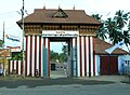
Entrance to the Nagaraja Temple
· 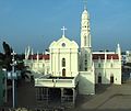
Church of St Xavier in Nagercoil
Questions and answers
Q: What is Nagercoil?
A: Nagercoil is a town in the southernmost Indian state of Tamil Nadu and a municipality and administrative headquarters of Kanyakumari District.
Q: When was it part of Travancore?
A: It was briefly part of the erstwhile Travancore state, till almost a decade after India's Independence from Britain in 1947.
Q: What are some activities that take place in Nagercoil?
A: Nagercoil holds a number of educational institutions, hospitals, offices and industries. It is also the hub of industrial and commercial activity in the district, and a fertile agricultural area that produces paddy. The minerals ilmenite and monazite are mined there.
Q: What is the population size according to 2011 census?
A: According to 2011 census, Nagercoil had a population of 224,849 with a sex-ratio of 1,050 females for every 1,000 males.
Q: What percentage of people belong to Scheduled Castes or Scheduled Tribes?
A: Scheduled Castes and Scheduled Tribes accounted for 4.19% and .17% of the population respectively.
Q: What is the average literacy rate in Nagercoil?
A: The average literacy rate in Nagercoil was 95.35%.
Q: Where is most concentration located within the city/district?
A: The largest concentration of population within both the town and district is along the coastal belt on its eastern side while areas on its western side (along Western Ghats) are sparsely populated.
Related articles
Author
AlegsaOnline.com Nagercoil: southern Tamil Nadu city — history, geography, and life Leandro Alegsa
URL: https://en.alegsaonline.com/art/68101
Sources
- nagercoil.co.in : Nagercoil
- global.britannica.com : "Nagercoil"
- thehindu.com : "Time to ensure scientific disposal of garbage"
- censusindia.gov.in : "Census Info 2011 Final population totals"
- censusindia.gov.in : "Census Info 2011 Final population totals - Nagercoil"
- censusindia.gov.in : "Population By Religious Community - Tamil Nadu"