
Mumbai: India's Financial, Cultural, and Maritime Hub
Mumbai, formerly Bombay, is the capital of Maharashtra and a major Indian port and metropolis. It is India's financial center, home to Bollywood, diverse communities, and a long history as a reclaimed island city.
Overview
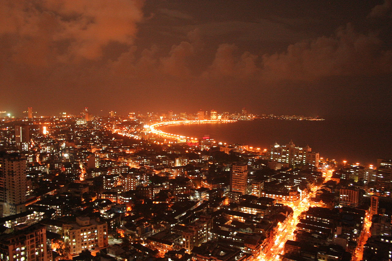
Mumbai (formerly Bombay) is a major port city on the west coast of India and the administrative capital city of the state of Maharashtra. It is one of the country’s largest and most densely populated urban areas. The metropolis combines a natural deep-water harbour with extensive land reclaimed over centuries to form a continuous urban expanse, and serves as a focal point for commerce, entertainment and migration.
Image gallery
10 Images




Geography and urban form
Mumbai developed on a cluster of islands that were gradually joined by reclamation and engineering works to create the present landmass. The shoreline, mangroves and backwaters influence the city’s layout, while the high-rise business districts stand near older residential and industrial neighborhoods. Monsoon rains and coastal tides shape the city’s environment and infrastructure resilience concerns.
History and origins
The area has a long history of settlement and maritime trade, later becoming an important outpost under colonial rule. Over time the city grew into a commercial hub as port activity, manufacturing and finance expanded. In the late 20th century the official name changed from Bombay to Mumbai, reflecting local language and cultural identity associated with the goddess Mumbādevī.
Economy, culture and society
Mumbai is a national financial center: it hosts major stock exchanges, banking institutions and corporate headquarters, and acts as a gateway for international trade. It is also the heart of India’s Hindi-language film industry (popularly called Bollywood) and supports a large creative sector. The city is culturally diverse, with many languages, religions and cuisines coexisting across varied neighborhoods.
Transport, infrastructure and landmarks
The city’s transport network includes one of the busiest suburban rail systems in the world, extensive bus services, a major international airport, and a commercial port. Notable landmarks and public spaces — from colonial-era piers and promenades to modern business districts — reflect its layered history and civic role.
Challenges and notable facts
- Rapid growth has created pressures on housing, public services and the environment.
- Income inequality and informal settlements are visible alongside affluent districts.
- Its harbour and location continue to make it strategically important for trade and finance.
Today Mumbai remains a dynamic, complex metropolis: a center of opportunity, culture and commerce whose past as a natural harbour and reclaimed island continues to shape its future.

The name of the city
From the beginning of colonization in the early 16th century, the city became known as Bombay. The name Bombay is said to derive from the Portuguese term bom baía (sic; grammatically correct would be boa baía "good bay",) or bom baim ("good little bay"). The name Mumbai has been used by the local population for just as long (1507: Manbai) and is said to be a compound of Mumba or Maha-Amba, the name of the regional Hindu goddess Mumbadevi, and Aai, which means "mother" in Marathi.
On 12 August 1996, the Municipal Council passed Corporation Resolution No. 512. (Maharashtra Act No. XXV of 1996) to change the English name Bombay to Mumbai. The "Restoration of name "Mumbai" for "Bombay" Act" received the assent of the Governor of Maharashtra on September 1, 1996 and was first published in the "Maharashtra Government Gazette" on September 4, 1996. Confirmation of the name change was given by the Indian Parliament in New Delhi in 1997. European Union countries use Mumbai as the official name of the city.
Indians of different native languages in Mumbai, who often communicate in English anyway, use Mumbai and Bombay side by side. Some public institutions, such as the Stock Exchange, the Court of Justice and the IIT Technical University, continue to use Bombay in their names, while others, such as the city's largest university, have dropped the old name.

Geography
Geographical position
Mumbai is located on the coast of the Arabian Sea in western India at 18.56 degrees north latitude and 72.49 degrees east longitude and an average of eleven meters above sea level.
The administrative city area has a surface area of 603.40 square kilometers and stretches along the west coast of the Maharashtra offshore island of Salsette. The city center of Mumbai is located on an elongated peninsula in the south of the 619 square kilometer island. The outskirts of Mumbai and the city of Thane are located in the northern part of Salsette Island.
Apart from some steep elevations of up to 496 meters, Salsette is very flat, parts in the south of the island are below sea level. There are three large lakes in the urban area: Tulsi Lake, Vihar Lake and Powai Lake. The first two lakes are in the Sanjay Gandhi National Park (formerly Borivili National Park). The two small rivers Oshiwara River in the northern part and Mithi River in the southern part of the urban area flow into the Arabian Sea.
To the east stretches the Konkan, a flat stretch of coastline up to 80 kilometres long, behind which is the high plateau of the West Ghats (also Sahyadri), 1,600 metres above the lowlands. The connection to the east is complicated by the very steep ascents of the plateau.
The Mumbai Metropolitan Region (MMR) has an area of 4,355 square kilometers and extends north to the Tansa River, south to the Patalganga River, west to the Arabian Sea and east to the Western Ghats. In addition to Mumbai, the metropolitan region includes other major cities: Thane, Kalyan-Dombivli, Navi Mumbai, Mira-Bhayandar, Bhiwandi-Nizampur and Ulhasnagar.
City breakdown
Mumbai is divided into six zones. These are divided into 24 city districts (Wards). The zones were assigned numbers and the districts letters. The city districts are further divided into 227 electoral wards. The following table shows the individual zones with the corresponding districts.
| Zone 1 | Zone 2 | Zone 3 | Zone 4 | Zone 5 | Zone 6 |
| Ward A | Ward F/North | Ward H/East | Ward P/North | Ward L | Ward N |
| Ward B | Ward F/South | Ward H/West | Ward P/South | Ward M/East | Ward S |
| Ward C | Ward G/North | Ward K/East | Ward R/North | Ward M/West | Ward T |
| Ward D | Ward G/South | Ward K/West | Ward R/South |
|
|
| Ward E |
|
| Ward R/Central |
|
|
See also: List of Mumbai municipalities
The city consists of two urban districts Mumbai City and Mumbai Suburban.
Climate
The city of Mumbai is located in the tropical climate zone. The average annual temperature is 26.7 degrees Celsius. The temperatures are balanced due to the proximity to the sea and are not subject to large fluctuations. The coolest month is January with an average of 23.9 degrees Celsius, and the hottest is May with a monthly average of 29.7 degrees Celsius.
The heavy rain of the summer monsoon affects the climate more than the temperature. It usually lasts from the beginning of June to the end of September. An average of 1,700 millimeters, or 95 percent of the annual rainfall, falls during this period. In July 2005, heavy monsoon rains caused the worst flooding in Mumbai in about 100 years. A daily rainfall record of 944 millimetres was set for the state of Maharashtra on 26 July 2005. 447 people drowned or died in other related accidents (electrocutions, landslides). Infrastructure, including road and drinking water systems, was damaged. The airport, schools and universities had to be closed for several days. Many businesses stopped working and sent their employees home. The city was temporarily cut off from the outside world.
The months of October and November are similarly hot as those at the time of the summer monsoon, but predominantly free of precipitation. With daily maxima of about 28 degrees Celsius, the months of December to February are dry and somewhat less hot than the months of March to May, when daily maxima of 33 degrees Celsius and more are reached with increasing humidity.
| Mumbai | ||||||||||||||||||||||||||||||||||||||||||||||||
| Climate diagram | ||||||||||||||||||||||||||||||||||||||||||||||||
| ||||||||||||||||||||||||||||||||||||||||||||||||
| Monthly average temperatures and precipitation for Mumbai
Source: WMO; wetterkontor.de | ||||||||||||||||||||||||||||||||||||||||||||||||||||||||||||||||||||||||||||||||||||||||||||||||||||||||||||||||||||||||||||||||||||||||||||||||||||||||||||||||||||||||||||||||||||||||||||||||||||||||||||||||||||||||||||||||||||||||||||||||||||||||||||||||||||||||||||||||||||||||||
Environmental issues
Among the city's major environmental problems are inadequate disposal and treatment capacities for sewage, exhaust gases and waste. Although the water supply situation for households has improved since the early 1980s, only a few households have a sewage disposal system. More than half of Mumbai's residents live in slums, without water connections or sewage systems. Polluted and contaminated water contribute significantly to the emergence and spread of infectious diseases.
The annual monsoon causes problems. After eight months of drought, there are regular floods during the four-month monsoon. The rain repeatedly washes garbage into the drains and leads to their blockage. A partial breakdown of the sewage system and a mixing of drinking and waste water are the result. This also leads to the outbreak of infectious diseases.
The air pollution in the Indian metropolis is alarming. The high content of fine dust is the biggest problem. The causes lie in the numerous factories and power plants as well as in traffic and private households. Mumbai has a well-developed railway network compared to other Indian cities. However, public buses, autorickshaws and private passenger vehicles continue to contribute to air pollution. Carbon dioxide emissions are increasing rapidly as a result of ongoing industrialization and an ever-increasing volume of traffic and energy consumption. The consequences of air pollution are respiratory and skin diseases among Mumbai's population. The inadequate technical facilities in the factories repeatedly lead to impairments.
The largest leopard population in India today lives in Mumbai. The predatory cats feed mainly on the livestock of slum dwellers and street dogs. There have also been attacks on humans.


Related articles
Author
AlegsaOnline.com Mumbai: India's Financial, Cultural, and Maritime Hub Leandro Alegsa
URL: https://en.alegsaonline.com/art/67500
Sources
- world-gazetteer.com : "World: largest cities and towns and statistics of their population (2009)"
- esa.un.org : "Population of urban agglomerations with 750,000 inhabitants or more in 2007 (thousands) 1950-2025 (India)"
- bl.uk : "Bombay: History of a City"
- mmrdamumbai.org : "Mumbai Urban Infrastructure Project"
- img214.imageshack.us : "Navi Mumbai International Airport"